ATL: FIONA - Post-Tropical - Discussion
Moderator: S2k Moderators

Re: ATL: FIONA - Tropical Storm - Discussion
I'm still a bit foggy-eyed this a.m. but my first impression is that Fiona is slowing down and that a new LLC within the whole convective mass will soon become evident. Outflow certainly appears to have improved. My concern for hurricane force conditions for Puerto Rico just jumped a few notches.
3 likes
Andy D
(For official information, please refer to the NHC and NWS products.)
(For official information, please refer to the NHC and NWS products.)

Re: ATL: FIONA - Tropical Storm - Discussion
wxman57 wrote:Curious that none of the northern Lesser Antilles reported any sustained wind over 30 kts overnight. Guadeloupe (TFFF) reported 30kts gusting 50kts at 06Z, but 20 kts or less after that report. You can use the link below and go back to yesterday, or you can type in a stations 4-letter ICAO and check the obs over the past 24 hrs or more.
https://aviationweather.gov/metar
Well I would think St John's Island to the north of Guadeloupe probably had higher sustained winds but they stopped reporting after 9 PM.
2 likes
Re: ATL: FIONA - Tropical Storm - Discussion
Convection re-firing near where the AF recon fixed the CoC.

6 likes
-
Blown Away

- S2K Supporter

- Posts: 10253
- Joined: Wed May 26, 2004 6:17 am
Re: ATL: FIONA - Tropical Storm - Discussion
The blob hasn’t moved much in past few hours.
NHC 5am 16.3/64.3 moving W at 13 and 8am was 16.1/64.4. If you factor Fiona should have moved @39 miles W since 5am and the S adjustment, that is a near @50 mile adjustment to the ESE.
0 likes
Hurricane Eye Experience: David 79, Irene 99, Frances 04, Jeanne 04, Wilma 05… Hurricane Brush Experience: Andrew 92, Erin 95, Floyd 99, Matthew 16, Irma 17, Ian 22, Nicole 22…
-
wxman57

- Moderator-Pro Met

- Posts: 23175
- Age: 68
- Joined: Sat Jun 21, 2003 8:06 pm
- Location: Houston, TX (southwest)
Re: ATL: FIONA - Tropical Storm - Discussion
Recon indicates Fiona's winds are closer to 40 kts than 50 kts. Lack of any TS winds across the Antilles as Fiona passed supports 40 kts or less.
1 likes
-
skyline385

- Category 5

- Posts: 2728
- Age: 35
- Joined: Wed Aug 26, 2020 11:15 pm
- Location: Houston TX
Re: ATL: FIONA - Tropical Storm - Discussion
ColdMiser123 wrote:NDG wrote:Then comes the AF recon and fixes a center further north, the nice LLC it had last night fell apart, but it still has a closed circulation, but broad with multiple centers.
https://i.imgur.com/HqEVDz1.png
AF is flying at ~850 mb, NOAA2 is flying at ~700 mb, appears from recon that at least one of the 700 mb centers is about a degree latitude south of the 850 mb center AF just found at ~16.1 degrees N.
Evidence that this is still a significantly tilted system, which is also likely the reason why recon hasn't found anything overly impressive, despite all the convection currently.
The AF drop at the fix also probably supports this, winds go from 3 kts at FL to 28 kts at surface

0 likes
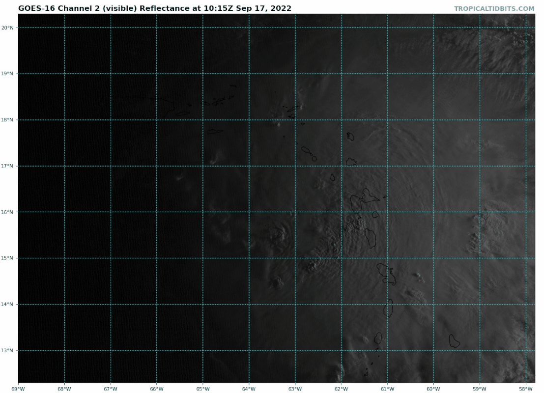
Re: ATL: FIONA - Tropical Storm - Discussion
Blown Away wrote:[url]https://i.postimg.cc/g2457bC0/goes16-vis-07-L-202209171015.gif [/url]
The blob hasn’t moved much in past few hours.
NHC 5am 16.3/64.3 moving W at 13 and 8am was 16.1/64.4. If you factor Fiona should have moved @39 miles W since 5am and the S adjustment, that is a near @50 mile adjustment to the ESE.
Which means the track will inch closer to PR as the day goes by.
0 likes
-
InfernoFlameCat

- Category 5
- Posts: 2127
- Age: 22
- Joined: Mon Dec 14, 2020 10:52 am
- Location: Buford, GA
Re: ATL: FIONA - Tropical Storm - Discussion
Looking at visible, there appears to be no low level center at the moment. The clouds are at a standstill on the west of the supposed center.
0 likes
I am by no means a professional. DO NOT look at my forecasts for official information or make decisions based on what I post.
Goal: to become a registered expert over tropical and subtropical cyclones.
Goal: to become a registered expert over tropical and subtropical cyclones.
Re: ATL: FIONA - Tropical Storm - Discussion
wxman57 wrote:Recon indicates Fiona's winds are closer to 40 kts than 50 kts. Lack of any TS winds across the Antilles as Fiona passed supports 40 kts or less.
Yeah, definitely not a 50 knot storm.
Unflagged strongest winds so far in red:
54 knots
(~ 62.1 mph) 43 knots
(~ 49.5 mph) 3 mm/hr
(~ 0.12 in/hr)
0 likes
-
MJGarrison
- Tropical Storm

- Posts: 146
- Joined: Wed Aug 30, 2017 7:26 pm
Re: ATL: FIONA - Tropical Storm - Discussion
So we’ve talked about the track implications of a stronger/weaker storm. Are we continuing to consider it “stronger because of the additional thunderstorm activity and less sheared appearance, or weaker because of the reduced max winds and not so low pressure?
Sent from my iPad using Tapatalk
Sent from my iPad using Tapatalk
0 likes
-
InfernoFlameCat
- Category 5
- Posts: 2127
- Age: 22
- Joined: Mon Dec 14, 2020 10:52 am
- Location: Buford, GA
Re: ATL: FIONA - Tropical Storm - Discussion
MJGarrison wrote:So we’ve talked about the track implications of a stronger/weaker storm. Are we continuing to consider it “stronger because of the additional thunderstorm activity and less sheared appearance, or weaker because of the reduced max winds and not so low pressure?
Sent from my iPad using Tapatalk
Weaker. Thunderstorms can be as intense as they want. Without a defined low, they will be less inclined to move in accordance to a ridge.
1 likes
I am by no means a professional. DO NOT look at my forecasts for official information or make decisions based on what I post.
Goal: to become a registered expert over tropical and subtropical cyclones.
Goal: to become a registered expert over tropical and subtropical cyclones.
Re: ATL: FIONA - Tropical Storm - Discussion
Am I missing something here? Weaker is supposed to be more Westward.
0 likes
-
tropicwatch

- Category 5
- Posts: 3426
- Age: 62
- Joined: Sat Jun 02, 2007 10:01 am
- Location: The Villages, Florida
- Contact:
Re: ATL: FIONA - Tropical Storm - Discussion
MJGarrison wrote:So we’ve talked about the track implications of a stronger/weaker storm. Are we continuing to consider it “stronger because of the additional thunderstorm activity and less sheared appearance, or weaker because of the reduced max winds and not so low pressure?
Sent from my iPad using Tapatalk
I was wondering the same thing. I'm not sold on the sharp turn northward.
3 likes
Tropicwatch
Agnes 72', Eloise 75, Elena 85', Kate 85', Charley 86', Florence 88', Beryl 94', Dean 95', Erin 95', Opal 95', Earl 98', Georges 98', Ivan 2004', Arlene 2005', Dennis 2005', Ida 2009' Debby 2012' Irma 2017' Michael 2018'
Agnes 72', Eloise 75, Elena 85', Kate 85', Charley 86', Florence 88', Beryl 94', Dean 95', Erin 95', Opal 95', Earl 98', Georges 98', Ivan 2004', Arlene 2005', Dennis 2005', Ida 2009' Debby 2012' Irma 2017' Michael 2018'
-
cheezyWXguy

- Category 5
- Posts: 6282
- Joined: Mon Feb 13, 2006 12:29 am
- Location: Dallas, TX
Re: ATL: FIONA - Tropical Storm - Discussion
Fiona was hardly more than a low level swirl as it passed Guadeloupe, pretty clear the island did a number on it. However, wind shear appears to have quickly backed off since yesterday, and it’s a good sign for Fiona that bursting continues over the center. If this continues through the day, I suspect it will have its current issues worked out by tonight
0 likes
Re: ATL: FIONA - Tropical Storm - Discussion
I think next pass by the AF recon should find a better defined CoC and lower SLP as convection continues to re-fire right near it.

0 likes
-
InfernoFlameCat
- Category 5
- Posts: 2127
- Age: 22
- Joined: Mon Dec 14, 2020 10:52 am
- Location: Buford, GA
Re: ATL: FIONA - Tropical Storm - Discussion
InfernoFlameCat wrote:MJGarrison wrote:So we’ve talked about the track implications of a stronger/weaker storm. Are we continuing to consider it “stronger because of the additional thunderstorm activity and less sheared appearance, or weaker because of the reduced max winds and not so low pressure?
Sent from my iPad using Tapatalk
Weaker. Thunderstorms can be as intense as they want. Without a defined low, they will be less inclined to move in accordance to a ridge.
Aka more west. past the ridge.
0 likes
I am by no means a professional. DO NOT look at my forecasts for official information or make decisions based on what I post.
Goal: to become a registered expert over tropical and subtropical cyclones.
Goal: to become a registered expert over tropical and subtropical cyclones.
Re: ATL: FIONA - Tropical Storm - Discussion
I dont see how Puerto Rico would get direct impacts. Looks to me like it would have to move NW now.
0 likes
Re: ATL: FIONA - Tropical Storm - Discussion
caneman wrote:I dont see how Puerto Rico would get direct impacts. Looks to me like it would have to move NW now.
12z TVCN is now right over the SW tip of PR.
0 likes
Re: ATL: FIONA - Tropical Storm - Discussion
NDG wrote:caneman wrote:I dont see how Puerto Rico would get direct impacts. Looks to me like it would have to move NW now.
12z TVCN is now right over the SW tip of PR.
I understand that but I'm looking at current conditions. Strength of storm, etc.. Looks to me it will be more like D.R. It would need to move NW now.
0 likes
-
Cachondo23
- Tropical Storm
- Posts: 131
- Joined: Wed May 25, 2022 5:56 am
Re: ATL: FIONA - Tropical Storm - Discussion mi
NDG wrote:wxman57 wrote:Curious that none of the northern Lesser Antilles reported any sustained wind over 30 kts overnight. Guadeloupe (TFFF) reported 30kts gusting 50kts at 06Z, but 20 kts or less after that report. You can use the link below and go back to yesterday, or you can type in a stations 4-letter ICAO and check the obs over the past 24 hrs or more.
https://aviationweather.gov/metar
Well I would think St John's Island to the north of Guadeloupe probably had higher sustained winds but they stopped reporting after 9 PM.
You mean St John’s the capital of Antigua?
0 likes
Who is online
Users browsing this forum: No registered users and 19 guests