Hurricane Blas Discussion Number 7
NWS National Hurricane Center Miami FL EP022022
400 PM CDT Wed Jun 15 2022
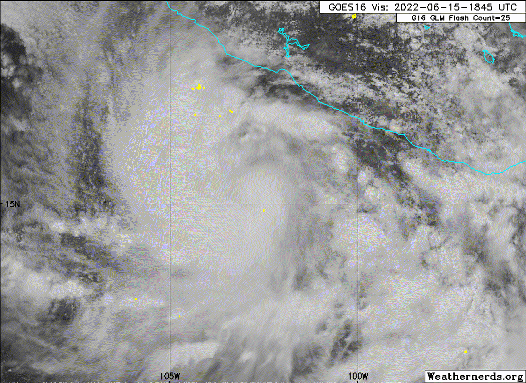
The satellite presentation of Blas this afternoon remains quite
healthy, with deep cold cloud tops below -80 C near the center and a
well-defined curved band wrapping 3/4ths around the western side of
the cyclone. A late arriving AMSR2 pass at 1854 UTC still showed a
mid-level eye feature on 89-GHz, though it remains a bit open to
the east on the 37-GHz channel. Subjective Dvorak estimates from
1800 UTC were up to T4.5/77 kt from both TAFB and SAB, while the
latest UW-CIMSS ADT estimate has been holding steady at T4.4/75 kt.
These data support an initial intensity of 75 kt for this advisory.
Blas has maintained a general west-northwestward heading today,
currently estimated at 290/5 kt. The track philosophy has also not
changed much today, as a deep-layer ridge building westward to the
north of Blas is expected to maintain the cyclone on its current
heading with a bit of acceleration over the next couple of days.
Afterwards, Blas is likely to become increasingly steered by the
lower-level flow as it becomes vertically shallow, leading to a
slowdown and bend in the track to the west and west-southwest at the
end of the forecast period. There was a modest increase in forward
motion from the guidance suite this cycle, so the track forecast was
also nudged a bit faster, but is still very close to the previous
forecast track and near the reliable consensus aids.
Blas has intensified 30-kt in the last 24 hours, which qualifies as
rapid intensification. Whether of not this rate of intensification
continues likely hinges on the impact of moderate (20-30 kt)
easterly vertical wind shear which both the GFS and ECMWF suggest is
already impinging on the cyclone. The latest intensity forecast
still shows a peak of 85 kt in 24 h, but slows the rate of
intensification relative to the prior advisory. This forecast is on
the high side of the guidance envelope and is closest to the latest
SHIPS and LGEM runs. After 36 h, sea-surface temperatures begin to
rapidly decrease underneath Blas as it also moves towards an
increasingly dry and stable environment, as seen by the widespread
stratocumulus field to the northwest of the system on visible
satellite. Weakening is forecast to commence by Friday, with the
global model guidance now suggesting Blas could become a remnant low
by the end of the forecast period as convection ceases.
While Blas is expected to remain off the coast of Mexico, its
associated swells are beginning to affect portions of the coast of
southwestern Mexico and are likely continue through the end
of the week.
FORECAST POSITIONS AND MAX WINDS
INIT 15/2100Z 15.1N 103.1W 75 KT 85 MPH
12H 16/0600Z 15.5N 104.0W 80 KT 90 MPH
24H 16/1800Z 16.1N 105.5W 85 KT 100 MPH
36H 17/0600Z 16.7N 107.4W 80 KT 90 MPH
48H 17/1800Z 17.4N 109.3W 75 KT 85 MPH
60H 18/0600Z 18.0N 111.1W 65 KT 75 MPH
72H 18/1800Z 18.3N 112.3W 55 KT 65 MPH
96H 19/1800Z 18.8N 114.9W 35 KT 40 MPH
120H 20/1800Z 18.5N 116.6W 25 KT 30 MPH...POST-TROP/REMNT LOW
$$
Forecaster Papin
Visit the Caribbean-Central America Weather Thread where you can find at first post web cams,radars
and observations from Caribbean basin members
Click Here


