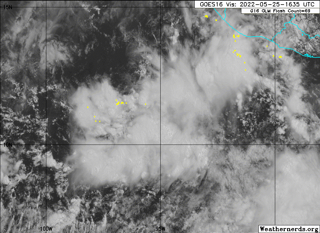
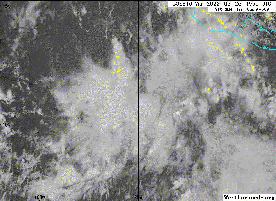
https://ftp.nhc.noaa.gov/atcf/btk/bep912022.dat
EPAC: AGATHA - Remnants
Moderator: S2k Moderators
- cycloneye
- Admin
- Posts: 139764
- Age: 67
- Joined: Thu Oct 10, 2002 10:54 am
- Location: San Juan, Puerto Rico
EPAC: AGATHA - Remnants
EP, 91, 2022052518, , BEST, 0, 110N, 950W, 25, 1009, DB, 34, NEQ, 0, 0, 0, 0, 1011, 180, 130, 0, 0, E, 0, , 0, 0, INVEST, S, 0, , 0, 0, 0, 0, genesis-num, 003, SPAWNINVEST, ep732022 to ep912022,
https://ftp.nhc.noaa.gov/atcf/btk/bep912022.dat
0 likes
Visit the Caribbean-Central America Weather Thread where you can find at first post web cams,radars
and observations from Caribbean basin members Click Here
- galaxy401
- Category 5
- Posts: 2302
- Age: 29
- Joined: Sat Aug 25, 2012 9:04 pm
- Location: Casa Grande, Arizona
Re: EPAC: INVEST 91E
Probably be one of those May systems that dump a lot of rain at landfall.
0 likes
Got my eyes on moving right into Hurricane Alley: Florida.
- cycloneye
- Admin
- Posts: 139764
- Age: 67
- Joined: Thu Oct 10, 2002 10:54 am
- Location: San Juan, Puerto Rico
Re: EPAC: INVEST 91E
The first run of HWRF will be very interesting to see how far in intensity it will go.
0 likes
Visit the Caribbean-Central America Weather Thread where you can find at first post web cams,radars
and observations from Caribbean basin members Click Here
-
- Category 5
- Posts: 7353
- Age: 38
- Joined: Thu Jul 06, 2017 1:51 am
Re: EPAC: INVEST 91E
0 likes
-
- Tropical Storm
- Posts: 108
- Age: 31
- Joined: Mon Jul 05, 2021 2:54 pm
- Contact:
Re: EPAC: INVEST 91E
Im expecting a strong Category 2/3 hurricane from this system.
Last edited by Hurricane2021 on Wed May 25, 2022 4:43 pm, edited 2 times in total.
1 likes
- Kingarabian
- S2K Supporter
- Posts: 15462
- Joined: Sat Aug 08, 2009 3:06 am
- Location: Honolulu, Hawaii
-
- Category 2
- Posts: 747
- Age: 25
- Joined: Sat Aug 25, 2018 10:34 pm
- Location: Monterrey, N.L, México
Re: EPAC: INVEST 91E
Watching closely where this will make landfall and at what intensity, South Mexico it's a very vulnerable region for tropical cyclones and this has the potential to be a powerful hurricane
0 likes
-
- Tropical Low
- Posts: 32
- Age: 54
- Joined: Sun May 22, 2022 9:26 am
- Location: New Port Richey, Florida
Re: EPAC: INVEST 91E
Be safe and be prepared and keep us postedAstromanía wrote:Watching closely where this will make landfall and at what intensity, South Mexico it's a very vulnerable region for tropical cyclones and this has the potential to be a powerful hurricane
0 likes
- DorkyMcDorkface
- Category 2
- Posts: 745
- Age: 26
- Joined: Mon Sep 30, 2019 1:32 pm
- Location: Mid-Atlantic
Re: EPAC: INVEST 91E
Well if there's ever a time for an EPAC major this year (which may be hard to come by due to La Niña and -PDO) it's now. This should be over some of the warmest waters in the basin as it develops, and will also have a pristine upper level environment to aid it.
2 likes
Floyd 1999 | Isabel 2003 | Hanna 2008 | Irene 2011 | Sandy 2012 | Isaias 2020
- cycloneye
- Admin
- Posts: 139764
- Age: 67
- Joined: Thu Oct 10, 2002 10:54 am
- Location: San Juan, Puerto Rico
Re: EPAC: INVEST 91E
...SPECIAL FEATURES...
A surface trough is located south of the Gulf of Tehuantepec.
Scattered moderate and isolated strong convection is in the
vicinity of this trough. Environmental conditions are forecast to
be conducive for gradual development, and a tropical depression
is likely to form late this week or this weekend while the system
moves west- northwestward or northwestward at around 5 to 10 kt.
There is a medium probability of this disturbance developing
into a tropical cyclone in the next 48 hours and a high
probability of development in the next 5 days. This developing
area of low pressure will bring an increase in winds and seas to
southern Mexico starting late this week into the weekend.
0 likes
Visit the Caribbean-Central America Weather Thread where you can find at first post web cams,radars
and observations from Caribbean basin members Click Here
-
- Category 2
- Posts: 747
- Age: 25
- Joined: Sat Aug 25, 2018 10:34 pm
- Location: Monterrey, N.L, México
Re: EPAC: INVEST 91E
DorkyMcDorkface wrote:Well if there's ever a time for an EPAC major this year (which may be hard to come by due to La Niña and -PDO) it's now. This should be over some of the warmest waters in the basin as it develops, and will also have a pristine upper level environment to aid it.
If I'm not wrong there have been just one recorded season in EPAC with zero majors, even when conditions are not favorable EPAC usually can produce 1-2 majors in a season or even more, we need to see how this season goes, I can see the EPAC taking advantage until August where activity would move to the Atlantic until end of the season
1 likes
Re: EPAC: INVEST 91E
DorkyMcDorkface wrote:Well if there's ever a time for an EPAC major this year (which may be hard to come by due to La Niña and -PDO) it's now. This should be over some of the warmest waters in the basin as it develops, and will also have a pristine upper level environment to aid it.
The EPac starting with a major in a triple dip La Niña sure would be something. Like I suspected months ago, this feels like a continuation of late 2021 — everything fails to develop in the Atlantic when it seems like it would be favored, while the EPac produces Mexico hurricane landfalls in times of the year when you wouldn’t expect it thanks to the Nina.
2 likes
Irene '11 Sandy '12 Hermine '16 5/15/2018 Derecho Fay '20 Isaias '20 Elsa '21 Henri '21 Ida '21
I am only a meteorology enthusiast who knows a decent amount about tropical cyclones. Look to the professional mets, the NHC, or your local weather office for the best information.
-
- Category 5
- Posts: 7353
- Age: 38
- Joined: Thu Jul 06, 2017 1:51 am
Re: EPAC: INVEST 91E
0 likes
- Yellow Evan
- Professional-Met
- Posts: 15960
- Age: 25
- Joined: Fri Jul 15, 2011 12:48 pm
- Location: Henderson, Nevada/Honolulu, HI
- Contact:
Re: EPAC: INVEST 91E
aspen wrote:DorkyMcDorkface wrote:Well if there's ever a time for an EPAC major this year (which may be hard to come by due to La Niña and -PDO) it's now. This should be over some of the warmest waters in the basin as it develops, and will also have a pristine upper level environment to aid it.
The EPac starting with a major in a triple dip La Niña sure would be something. Like I suspected months ago, this feels like a continuation of late 2021 — everything fails to develop in the Atlantic when it seems like it would be favored, while the EPac produces Mexico hurricane landfalls in times of the year when you wouldn’t expect it thanks to the Nina.
Eh, historically it's not impossible to get a major in a La Nina in June. There's seven in -ENSO years since the most recent +AMO and I definitely don't think this is indicative of a quiet hurricane season in the Atlantic. The real indicator (almost as much of an indicator as early season MDR activity is of a hyperactive Atlantic season) of a hyperactive season, regardless of ENSO state, is multiple major hurricanes forming prior to July 1.
2 likes
- Yellow Evan
- Professional-Met
- Posts: 15960
- Age: 25
- Joined: Fri Jul 15, 2011 12:48 pm
- Location: Henderson, Nevada/Honolulu, HI
- Contact:
Re: EPAC: INVEST 91E
South of the Gulf of Tehuantepec:
Showers and thunderstorms are beginning to show some signs of
organization in association with a surface trough located a few
hundred miles south of the Gulf of Tehuantepec. Environmental
conditions are forecast to be conducive for gradual development, and
a tropical depression is likely to form late this week or this
weekend while the system moves west-northwestward or northwestward
at 5 to 10 mph. Interests in southern Mexico should monitor the
progress of this system.
* Formation chance through 48 hours...medium...40 percent.
* Formation chance through 5 days...high...80 percent.
0 likes
- Yellow Evan
- Professional-Met
- Posts: 15960
- Age: 25
- Joined: Fri Jul 15, 2011 12:48 pm
- Location: Henderson, Nevada/Honolulu, HI
- Contact:
Re: EPAC: INVEST 91E
* GFS version *
* EAST PACIFIC 2021 SHIPS INTENSITY FORECAST *
* IR SAT DATA AVAILABLE, OHC AVAILABLE *
* INVEST EP912022 05/25/22 18 UTC *
TIME (HR) 0 6 12 18 24 36 48 60 72 84 96 108 120 132 144 156 168
V (KT) NO LAND 25 28 30 33 36 41 49 56 61 63 63 64 66 68 65 61 59
V (KT) LAND 25 28 30 33 36 41 49 56 61 63 63 64 66 56 37 30 28
V (KT) LGEM 25 26 27 28 29 30 31 32 34 35 35 35 35 32 28 27 27
Storm Type TROP TROP TROP TROP TROP TROP TROP TROP TROP TROP TROP TROP TROP TROP TROP TROP TROP
SHEAR (KT) 13 10 10 11 9 5 5 9 18 15 19 14 2 4 12 19 15
SHEAR ADJ (KT) -6 -5 -7 -5 -3 1 1 -2 -1 0 4 4 5 0 -1 2 0
SHEAR DIR 115 133 121 139 167 149 110 85 49 10 351 354 345 131 222 238 235
SST (C) 30.0 30.1 30.1 30.1 30.1 30.1 30.0 29.9 29.7 29.8 30.1 30.1 29.7 28.3 26.3 25.9 26.4
POT. INT. (KT) 162 162 162 163 164 164 162 160 158 160 165 166 162 147 126 119 126
200 MB T (C) -53.2 -53.0 -53.3 -53.6 -53.4 -53.4 -53.1 -53.1 -52.8 -52.7 -52.5 -52.8 -52.4 -52.7 -52.5 -52.8 -52.6
200 MB VXT (C) 0.0 0.0 0.0 0.0 0.0 0.0 0.0 0.0 0.0 0.0 0.0 0.0 0.0 0.0 0.0 0.0 0.0
TH_E DEV (C) 7 7 6 6 7 5 5 4 3 3 4 4 6 7 8 6 7
700-500 MB RH 70 71 72 72 71 73 76 78 80 81 79 76 72 73 70 73 70
MODEL VTX (KT) 0 LOST LOST LOST LOST LOST LOST LOST LOST LOST LOST LOST LOST LOST LOST LOST LOST
850 MB ENV VOR 37 36 36 20 17 12 9 -2 0 0 17 44 65 95 94 116 111
200 MB DIV 73 80 93 81 65 46 44 117 153 204 199 130 171 48 90 120 105
700-850 TADV 0 0 0 2 1 0 0 0 0 0 -1 4 -2 -4 -1 -1 -3
LAND (KM) 490 480 487 504 512 570 626 684 713 663 550 376 182 -35 -170 -143 -241
LAT (DEG N) 11.0 11.2 11.3 11.2 11.1 10.6 10.2 9.7 9.4 9.8 10.8 12.4 14.2 xx.x xx.x xx.x xx.x
LONG(DEG W) 95.0 95.1 95.3 95.6 96.0 96.8 97.5 97.7 97.5 97.1 96.9 97.0 97.2 xxx.x xxx.x xxx.x xxx.x
STM SPEED (KT) 3 2 2 4 4 4 3 3 1 3 7 9 10 9 8 3 6
HEAT CONTENT 24 26 27 28 29 33 39 37 32 31 35 40 25 9 0 0 0
FORECAST TRACK FROM TABM INITIAL HEADING/SPEED (DEG/KT):345/ 4 CX,CY: 0/ 4
T-12 MAX WIND: 15 PRESSURE OF STEERING LEVEL (MB): 488 (MEAN=587)
GOES IR BRIGHTNESS TEMP. STD DEV. 50-200 KM RAD: 12.4 (MEAN=14.5)
% GOES IR PIXELS WITH T < -20 C 50-200 KM RAD: 98.0 (MEAN=65.0)
PRELIM RI PROB (DV .GE. 35 KT IN 36 HR): 22.5
INDIVIDUAL CONTRIBUTIONS TO INTENSITY CHANGE
6 12 18 24 36 48 60 72 84 96 108 120 132 144 156 168
------------------------------------------------------------------------------
SAMPLE MEAN CHANGE 0. 0. 1. 1. 1. 2. 1. 1. 0. -0. -1. -2. -2. -3. -4. -4.
SST POTENTIAL -0. -1. -1. -0. 4. 12. 19. 26. 31. 34. 38. 41. 44. 46. 46. 48.
VERTICAL SHEAR MAG 1. 1. 2. 3. 4. 4. 4. 3. 2. 1. 1. 2. 4. 5. 3. 2.
VERTICAL SHEAR ADJ 0. 1. 2. 2. 2. 2. 2. 1. 1. 0. 0. 0. 0. 0. 0. 0.
VERTICAL SHEAR DIR 0. 1. 1. 1. 1. 2. 4. 6. 6. 6. 5. 4. 4. 2. 2. 1.
PERSISTENCE -0. -0. -0. -1. -1. -1. -0. -0. -0. -0. -0. -0. -0. -0. -0. -0.
200/250 MB TEMP. 0. 0. -0. -0. -0. -1. -2. -3. -4. -4. -4. -4. -4. -4. -4. -4.
THETA_E EXCESS 0. 0. 0. 0. -0. -0. -1. -2. -3. -4. -4. -4. -4. -3. -3. -4.
700-500 MB RH 0. 0. 0. 0. 1. 1. 1. 1. 1. 2. 2. 2. 2. 3. 4. 6.
MODEL VTX TENDENCY 0. 0. 0. 0. -0. -0. -0. -0. -0. -0. -0. -0. -0. -0. -0. -0.
850 MB ENV VORTICITY 0. 0. 0. 0. -0. 0. 0. 0. 0. 0. 0. 0. 0. -0. -0. -0.
200 MB DIVERGENCE 0. 0. 1. 1. 1. 1. 2. 4. 6. 8. 8. 7. 4. 1. -1. -3.
850-700 T ADVEC -0. -0. -0. -0. -0. 0. 0. 0. 0. 0. 0. 0. 0. 0. 0. 0.
ZONAL STORM MOTION -0. -0. -1. -1. -2. -3. -3. -3. -2. -2. -2. -2. -2. -1. -1. 0.
STEERING LEVEL PRES -0. -0. -1. -1. -1. -1. -1. -1. -2. -2. -2. -2. -2. -1. -1. -0.
DAYS FROM CLIM. PEAK -0. -0. -0. -0. -0. -0. -1. -1. -2. -2. -2. -2. -3. -3. -4. -5.
GOES PREDICTORS 1. 3. 3. 3. 3. 3. 3. 3. 2. 2. 3. 3. 2. 2. 1. 0.
OCEAN HEAT CONTENT 0. 0. 0. 0. 0. 1. 1. 1. 0. 0. -0. -1. -1. -2. -2. -3.
RI POTENTIAL 0. 1. 2. 3. 4. 3. 2. 0. -0. -1. -1. -1. -1. -1. -1. -1.
------------------------------------------------------------------------------
TOTAL CHANGE 3. 5. 8. 11. 16. 24. 31. 36. 38. 38. 39. 41. 43. 40. 36. 34.
CURRENT MAX WIND (KT): 25. LAT, LON: 11.0 95.0
** 2021 E. Pacific RI INDEX EP912022 INVEST 05/25/22 18 UTC **
(SHIPS-RII PREDICTOR TABLE for 30 KT OR MORE MAXIMUM WIND INCREASE IN NEXT 24-h)
Predictor Value RI Predictor Range Scaled Value(0-1) % Contribution
POT = MPI-VMAX (KT) : 137.6 40.5 to 149.3 0.89 6.9
12 HR PERSISTENCE (KT) : 0.0 -22.0 to 44.0 0.33 3.0
D200 (10**7s-1) : 78.4 -33.0 to 159.5 0.58 4.2
850-200 MB SHEAR (KT) : 10.4 19.6 to 1.3 0.50 3.5
MAXIMUM WIND (KT) : 25.0 22.5 to 132.0 0.07 0.4
STD DEV OF IR BR TEMP : 12.4 37.8 to 2.1 0.71 3.5
BL DRY-AIR FLUX (W/M2) : 48.4 800.8 to -82.5 0.85 -4.7
HEAT CONTENT (KJ/CM2) : 26.8 2.7 to 106.7 0.23 1.0
%area of TPW <45 mm upshear : 0.0 56.6 to 0.0 1.00 1.5
2nd PC OF IR BR TEMP : 0.4 2.2 to -2.3 0.40 0.4
SHIPS Prob RI for 20kt/ 12hr RI threshold= 0% is 0.0 times climatological mean ( 6.3%)
SHIPS Prob RI for 25kt/ 24hr RI threshold= 24% is 1.9 times climatological mean (12.5%)
SHIPS Prob RI for 30kt/ 24hr RI threshold= 20% is 2.3 times climatological mean ( 8.6%)
SHIPS Prob RI for 35kt/ 24hr RI threshold= 0% is 0.0 times climatological mean ( 6.2%)
SHIPS Prob RI for 40kt/ 24hr RI threshold= 0% is 0.0 times climatological mean ( 4.2%)
SHIPS Prob RI for 45kt/ 36hr RI threshold= 19% is 2.9 times climatological mean ( 6.7%)
SHIPS Prob RI for 55kt/ 48hr RI threshold= 23% is 3.9 times climatological mean ( 5.9%)
SHIPS Prob RI for 65kt/ 72hr RI threshold= 0% is 0.0 times climatological mean ( 4.7%)
Matrix of RI probabilities
------------------------------------------------------------------------------
RI (kt / h) | 20/12 | 25/24 | 30/24 | 35/24 | 40/24 | 45/36 | 55/48 |65/72
------------------------------------------------------------------------------
SHIPS-RII: 0.0% 24.1% 19.6% 0.0% 0.0% 19.4% 23.0% 0.0%
Logistic: 9.4% 49.1% 32.9% 19.7% 24.1% 36.7% 63.2% 76.3%
Bayesian: 1.5% 11.8% 4.9% 1.9% 0.6% 7.2% 11.5% 2.7%
Consensus: 3.6% 28.3% 19.1% 7.2% 8.2% 21.1% 32.5% 26.3%
DTOPS: 999.0% 999.0% 999.0% 999.0% 999.0% 999.0% 999.0% 999.0%
## ANNULAR HURRICANE INDEX (AHI) EP912022 INVEST 05/25/22 18 UTC ##
## STORM NOT ANNULAR, SCREENING STEP FAILED, NPASS=4 NFAIL=3 ##
## AHI= 0 (AHI OF 100 IS BEST FIT TO ANN. STRUC., 1 IS MARGINAL, 0 IS NOT ANNULAR) ##
0 likes
- tropicwatch
- Category 5
- Posts: 3208
- Age: 60
- Joined: Sat Jun 02, 2007 10:01 am
- Location: Panama City Florida
- Contact:
Re: EPAC: INVEST 91E
Is this the system that forecast models indicate could emerge in the Bay of Campeche?
0 likes
Tropicwatch
Agnes 72', Eloise 75, Elena 85', Kate 85', Charley 86', Florence 88', Beryl 94', Dean 95', Erin 95', Opal 95', Earl 98', Georges 98', Ivan 2004', Arlene 2005', Dennis 2005', Ida 2009' Debby 2012' Irma 2017' Michael 2018'
- cycloneye
- Admin
- Posts: 139764
- Age: 67
- Joined: Thu Oct 10, 2002 10:54 am
- Location: San Juan, Puerto Rico
Re: EPAC: INVEST 91E
00z Best Track:
SHIP more bullish than first run.
EP, 91, 2022052600, , BEST, 0, 120N, 940W, 25, 1009, DB
SHIP more bullish than first run.
* GFS version *
* EAST PACIFIC 2021 SHIPS INTENSITY FORECAST *
* IR SAT DATA AVAILABLE, OHC AVAILABLE *
* INVEST EP912022 05/26/22 00 UTC *
TIME (HR) 0 6 12 18 24 36 48 60 72 84 96 108 120 132 144 156 168
V (KT) NO LAND 25 27 29 33 38 48 62 75 89 91 87 80 75 72 67 65 62
V (KT) LAND 25 27 29 33 38 48 62 75 89 91 87 80 75 46 33 29 28
V (KT) LGEM 25 26 27 28 30 34 41 50 61 68 67 64 63 42 32 29 27
Storm Type TROP TROP TROP TROP TROP TROP TROP TROP TROP TROP TROP TROP TROP TROP TROP TROP TROP
SHEAR (KT) 6 6 9 10 5 2 4 5 2 3 6 6 10 11 11 20 24
SHEAR ADJ (KT) -3 -4 -5 -5 0 -1 -3 -1 -1 2 5 3 -5 -3 0 -1 -1
SHEAR DIR 119 121 156 181 167 96 110 69 29 62 62 99 212 231 246 246 228
SST (C) 30.7 30.7 30.7 30.6 30.5 30.2 30.2 30.2 30.2 30.2 30.5 29.8 29.8 28.0 28.0 28.2 28.3
POT. INT. (KT) 169 169 169 169 169 165 163 162 163 165 169 162 162 142 140 142 144
200 MB T (C) -52.9 -53.2 -53.5 -53.2 -52.9 -53.2 -52.7 -53.0 -52.1 -53.0 -52.0 -52.8 -52.1 -53.2 -52.5 -53.0 -52.5
200 MB VXT (C) -0.1 -0.1 -0.1 -0.1 -0.1 -0.1 0.0 0.1 0.1 0.2 0.2 0.3 0.3 0.3 0.2 0.0 0.0
TH_E DEV (C) 7 7 6 7 7 5 5 4 4 4 5 4 6 5 6 4 5
700-500 MB RH 72 74 73 73 74 77 79 79 80 81 78 77 79 80 81 83 80
MODEL VTX (KT) 6 5 6 7 8 9 14 17 21 20 17 12 8 8 6 LOST LOST
850 MB ENV VOR 57 57 47 36 31 21 16 11 19 26 51 69 91 72 101 121 129
200 MB DIV 87 123 113 70 80 54 129 176 200 171 176 123 114 85 136 125 140
700-850 TADV -1 -1 0 0 -3 -1 0 0 -1 -4 -2 -4 -1 2 1 -1 -1
LAND (KM) 335 324 354 392 404 449 480 515 487 426 311 168 29 -112 -64 -61 -103
LAT (DEG N) 12.0 12.4 12.4 12.3 12.1 11.7 11.5 11.2 11.4 11.9 12.9 14.3 15.8 xx.x xx.x xx.x xx.x
LONG(DEG W) 94.0 94.3 94.7 95.1 95.7 96.8 97.3 97.4 97.1 96.7 96.2 95.6 94.8 xxx.x xxx.x xxx.x xxx.x
STM SPEED (KT) 6 4 4 5 6 5 2 0 2 5 6 8 8 6 2 2 3
HEAT CONTENT 31 33 35 36 35 38 43 44 40 37 39 18 19 6 9 11 11
FORECAST TRACK FROM TABM INITIAL HEADING/SPEED (DEG/KT):345/ 6 CX,CY: -1/ 6
T-12 MAX WIND: 25 PRESSURE OF STEERING LEVEL (MB): 559 (MEAN=587)
GOES IR BRIGHTNESS TEMP. STD DEV. 50-200 KM RAD: 10.9 (MEAN=14.5)
% GOES IR PIXELS WITH T < -20 C 50-200 KM RAD: 61.0 (MEAN=65.0)
PRELIM RI PROB (DV .GE. 35 KT IN 36 HR): 34.1
INDIVIDUAL CONTRIBUTIONS TO INTENSITY CHANGE
6 12 18 24 36 48 60 72 84 96 108 120 132 144 156 168
------------------------------------------------------------------------------
SAMPLE MEAN CHANGE 0. 0. 1. 1. 1. 2. 1. 1. 0. -0. -1. -2. -2. -3. -4. -4.
SST POTENTIAL -1. -2. -2. -2. 4. 11. 20. 27. 32. 35. 39. 42. 45. 48. 49. 52.
VERTICAL SHEAR MAG 1. 2. 2. 3. 5. 6. 7. 8. 9. 10. 10. 11. 10. 10. 8. 6.
VERTICAL SHEAR ADJ 0. 1. 1. 1. 2. 2. 2. 1. 1. 0. 0. 0. 0. 0. 0. 1.
VERTICAL SHEAR DIR 0. 0. 0. -0. 1. 3. 5. 6. 7. 7. 7. 6. 4. 3. 2. 1.
PERSISTENCE -0. -0. -0. -1. -1. -1. -0. -0. -0. -0. -0. -0. -0. -0. -0. -0.
200/250 MB TEMP. 0. 0. -0. -0. -1. -1. -2. -3. -4. -4. -4. -4. -3. -2. -2. -2.
THETA_E EXCESS 0. 0. 0. 0. 0. -0. -1. -2. -2. -3. -3. -3. -3. -3. -4. -4.
700-500 MB RH 0. 0. 0. 0. 1. 1. 1. 1. 2. 2. 2. 2. 3. 4. 5. 7.
MODEL VTX TENDENCY -0. -0. 1. 2. 3. 8. 14. 21. 20. 15. 7. 3. 2. 0. 1. 1.
850 MB ENV VORTICITY 0. 0. 0. 0. 0. -0. -0. 0. 0. -0. -0. -0. -0. -1. -1. -1.
200 MB DIVERGENCE 0. 1. 1. 1. 1. 2. 4. 7. 9. 10. 10. 8. 5. 2. -1. -3.
850-700 T ADVEC 0. -0. -0. 0. 0. -0. -0. -0. -0. -0. -0. -0. -0. -0. -0. -0.
ZONAL STORM MOTION -0. -0. -1. -1. -2. -2. -3. -3. -2. -2. -2. -2. -2. -1. -1. 0.
STEERING LEVEL PRES -0. -0. -0. -0. -0. -0. -0. -0. -0. -0. -0. -0. -0. -0. -0. -0.
DAYS FROM CLIM. PEAK -0. -0. -0. -0. -0. -0. -1. -1. -2. -2. -2. -2. -3. -3. -4. -5.
GOES PREDICTORS 1. 1. 2. 2. 1. -1. -1. -2. -3. -3. -4. -4. -4. -4. -4. -4.
OCEAN HEAT CONTENT 0. 0. 0. 0. 0. 1. 2. 1. 1. 0. -0. -1. -2. -2. -3. -4.
RI POTENTIAL 1. 2. 4. 5. 8. 7. 4. 1. -1. -2. -3. -4. -4. -4. -4. -3.
------------------------------------------------------------------------------
TOTAL CHANGE 2. 4. 8. 13. 23. 37. 50. 64. 66. 62. 55. 50. 47. 42. 40. 37.
CURRENT MAX WIND (KT): 25. LAT, LON: 12.0 94.0
** 2021 E. Pacific RI INDEX EP912022 INVEST 05/26/22 00 UTC **
(SHIPS-RII PREDICTOR TABLE for 30 KT OR MORE MAXIMUM WIND INCREASE IN NEXT 24-h)
Predictor Value RI Predictor Range Scaled Value(0-1) % Contribution
POT = MPI-VMAX (KT) : 143.9 40.5 to 149.3 0.95 8.9
12 HR PERSISTENCE (KT) : 0.0 -22.0 to 44.0 0.33 3.6
D200 (10**7s-1) : 94.6 -33.0 to 159.5 0.66 5.8
850-200 MB SHEAR (KT) : 7.3 19.6 to 1.3 0.67 5.6
MAXIMUM WIND (KT) : 25.0 22.5 to 132.0 0.07 0.5
STD DEV OF IR BR TEMP : 10.9 37.8 to 2.1 0.75 4.5
BL DRY-AIR FLUX (W/M2) : 46.4 800.8 to -82.5 0.85 -5.6
HEAT CONTENT (KJ/CM2) : 34.0 2.7 to 106.7 0.30 1.5
%area of TPW <45 mm upshear : 0.0 56.6 to 0.0 1.00 1.9
2nd PC OF IR BR TEMP : 0.2 2.2 to -2.3 0.45 0.5
SHIPS Prob RI for 20kt/ 12hr RI threshold= 0% is 0.0 times climatological mean ( 6.3%)
SHIPS Prob RI for 25kt/ 24hr RI threshold= 45% is 3.6 times climatological mean (12.5%)
SHIPS Prob RI for 30kt/ 24hr RI threshold= 27% is 3.1 times climatological mean ( 8.6%)
SHIPS Prob RI for 35kt/ 24hr RI threshold= 0% is 0.0 times climatological mean ( 6.2%)
SHIPS Prob RI for 40kt/ 24hr RI threshold= 0% is 0.0 times climatological mean ( 4.2%)
SHIPS Prob RI for 45kt/ 36hr RI threshold= 37% is 5.6 times climatological mean ( 6.7%)
SHIPS Prob RI for 55kt/ 48hr RI threshold= 54% is 9.2 times climatological mean ( 5.9%)
SHIPS Prob RI for 65kt/ 72hr RI threshold= 0% is 0.0 times climatological mean ( 4.7%)
Matrix of RI probabilities
------------------------------------------------------------------------------
RI (kt / h) | 20/12 | 25/24 | 30/24 | 35/24 | 40/24 | 45/36 | 55/48 |65/72
------------------------------------------------------------------------------
SHIPS-RII: 0.0% 45.3% 27.0% 0.0% 0.0% 37.3% 54.3% 0.0%
Logistic: 3.8% 31.9% 22.4% 13.0% 8.0% 44.6% 71.6% 70.4%
Bayesian: 0.0% 1.5% 0.6% 0.1% 0.1% 0.1% 0.4% 9.0%
Consensus: 1.3% 26.2% 16.7% 4.4% 2.7% 27.3% 42.1% 26.5%
DTOPS: 999.0% 999.0% 999.0% 999.0% 999.0% 999.0% 999.0% 999.0%
## ANNULAR HURRICANE INDEX (AHI) EP912022 INVEST 05/26/22 00 UTC ##
## STORM NOT ANNULAR, SCREENING STEP FAILED, NPASS=4 NFAIL=3 ##
## AHI= 0 (AHI OF 100 IS BEST FIT TO ANN. STRUC., 1 IS MARGINAL, 0 IS NOT ANNULAR) ##
EP, 91, 2022052600, , BEST, 0, 120N, 940W, 25, 1009, DB
0 likes
Visit the Caribbean-Central America Weather Thread where you can find at first post web cams,radars
and observations from Caribbean basin members Click Here
- cycloneye
- Admin
- Posts: 139764
- Age: 67
- Joined: Thu Oct 10, 2002 10:54 am
- Location: San Juan, Puerto Rico
Re: EPAC: INVEST 91E
DorkyMcDorkface wrote:Well if there's ever a time for an EPAC major this year (which may be hard to come by due to La Niña and -PDO) it's now. This should be over some of the warmest waters in the basin as it develops, and will also have a pristine upper level environment to aid it.
Indeed.
3 likes
Visit the Caribbean-Central America Weather Thread where you can find at first post web cams,radars
and observations from Caribbean basin members Click Here
- InfernoFlameCat
- Category 5
- Posts: 1966
- Age: 21
- Joined: Mon Dec 14, 2020 10:52 am
- Location: Buford, GA
Re: EPAC: INVEST 91E
Cat 4 may major? in a triple dip La Nina? that crosses into the GOM and makes two A names occur in the Atlantic? Nah that will never happen
1 likes
I am by no means a professional. DO NOT look at my forecasts for official information or make decisions based on what I post.
Goal: to become a registered expert over tropical and subtropical cyclones.
Who is online
Users browsing this forum: No registered users and 3 guests