Haris wrote:ICON has a hell of a snowstorm
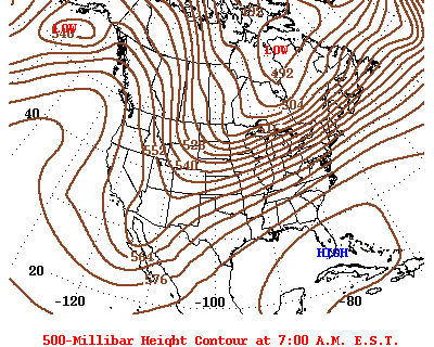
Was just coming to post that both the 18z 12k NAM and ICON look really good at H5.
And for fun, the ICON. Dropping the hammer over DFW.
Moderator: S2k Moderators


Haris wrote:ICON has a hell of a snowstorm
Haris wrote:HockeyTx82 wrote:Haris wrote:ICON has a hell of a snowstorm
Where and when? Texas is a big state
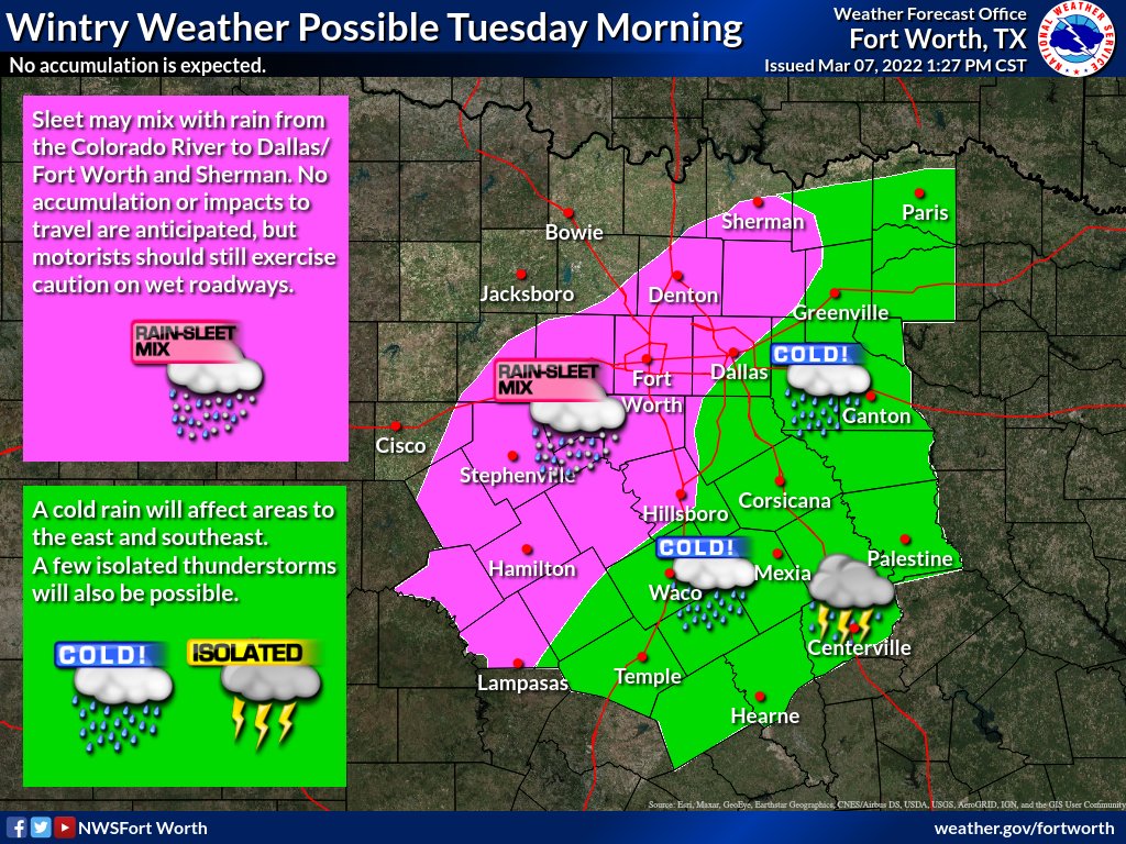
[url]https://i.ibb.co/X7Fczyb/764-DDA9-D-8-D72-4-DB6-84-A2-787-DE04-D3-D21.png [/url]
Ignore the dark green. Icon can’t show mix. It’s all below freezing


bubba hotep wrote:Happy Hour GFS
https://m1o.pivotalweather.com/maps/models/gfs/2022030718/105/sn10_acc.us_sc.png

Haris wrote:HockeyTx82 wrote:Haris wrote:ICON has a hell of a snowstorm
Where and when? Texas is a big state
[url]https://i.ibb.co/X7Fczyb/764-DDA9-D-8-D72-4-DB6-84-A2-787-DE04-D3-D21.png [/url]
Ignore the dark green. Icon can’t show mix. It’s all below freezing

bubba hotep wrote:Happy Hour GFS
https://m1o.pivotalweather.com/maps/models/gfs/2022030718/105/sn10_acc.us_sc.png

 but then again that up here in NTX and we know how he hates the North
 orangeblood wrote:bubba hotep wrote:Happy Hour GFS
https://m1o.pivotalweather.com/maps/models/gfs/2022030718/105/sn10_acc.us_sc.png
H5 looks similar to snowmaggedon!! Doesn't mean we have the same PWAT values but upper levels look really good

CaptinCrunch wrote:GFS and EURO both have been extremely poor handling temps with these deep arctic air masses. I would watch the ICON temp profiles since the ICON has done very well with the last 2 Arctic events. I expect GFS and EURO to be 3-7 degrees to warm on both ends of the temperature range.


orangeblood wrote:bubba hotep wrote:Happy Hour GFS
https://m1o.pivotalweather.com/maps/models/gfs/2022030718/105/sn10_acc.us_sc.png
H5 looks similar to snowmaggedon!! Doesn't mean we have the same PWAT values but upper levels look really good
cheezyWXguy wrote:orangeblood wrote:bubba hotep wrote:Happy Hour GFS
https://m1o.pivotalweather.com/maps/models/gfs/2022030718/105/sn10_acc.us_sc.png
H5 looks similar to snowmaggedon!! Doesn't mean we have the same PWAT values but upper levels look really good
Interesting you bring that up, because this event reminds me a lot of the March snow event a month or so later that dropped 6+” of snow on me when I lived in Plano. Do you know how this event compares to that one?

orangeblood wrote:cheezyWXguy wrote:orangeblood wrote:
H5 looks similar to snowmaggedon!! Doesn't mean we have the same PWAT values but upper levels look really good
Interesting you bring that up, because this event reminds me a lot of the March snow event a month or so later that dropped 6+” of snow on me when I lived in Plano. Do you know how this event compares to that one?
Doesn't look like it...a decent analog looks like early March 2015
March 4, 2015
This Friday March 11, 2022 forecast

Return to “USA & Caribbean Weather”
Users browsing this forum: mmmmsnouts, Stratton23, wxman22 and 117 guests


