Floater back
https://weather.cod.edu/satrad/?parms=meso-meso1-13-24-0-100-1&checked=map&colorbar=undefined
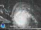
ATL: SAM - Remnants - Discussion
Moderator: S2k Moderators
-
tolakram
- Admin

- Posts: 20186
- Age: 62
- Joined: Sun Aug 27, 2006 8:23 pm
- Location: Florence, KY (name is Mark)
Re: ATL: SAM - Hurricane - Discussion
0 likes
M a r k
- - - - -
Join us in chat: Storm2K Chatroom Invite. Android and IOS apps also available.
The posts in this forum are NOT official forecasts and should not be used as such. Posts are NOT endorsed by any professional institution or STORM2K.org. For official information and forecasts, please refer to NHC and NWS products.
-
Yellow Evan

- Professional-Met

- Posts: 16242
- Age: 27
- Joined: Fri Jul 15, 2011 12:48 pm
- Location: Henderson, Nevada/Honolulu, HI
- Contact:
-
galaxy401

- Category 5

- Posts: 2446
- Age: 30
- Joined: Sat Aug 25, 2012 9:04 pm
- Location: Casa Grande, Arizona
Re: ATL: SAM - Hurricane - Discussion
Think this is around 130 kts now. 
1 likes
Got my eyes on moving right into Hurricane Alley: Florida.
-
CrazyC83
- Professional-Met
- Posts: 34315
- Joined: Tue Mar 07, 2006 11:57 pm
- Location: Deep South, for the first time!
Re: ATL: SAM - Hurricane - Discussion
I agree with 130 kt and I'd put out a Tropical Cyclone Update with that intensity.
4 likes

Re: ATL: SAM - Hurricane - Discussion
SFMR matches FL this time. Maybe 135 kt? 130 kt is the most likely though.
It would be nice to have another pass but I doubt Miss Piggy will do another. They’ve got quite a long flight back to base.
It would be nice to have another pass but I doubt Miss Piggy will do another. They’ve got quite a long flight back to base.
1 likes
Irene '11 Sandy '12 Hermine '16 5/15/2018 Derecho Fay '20 Isaias '20 Elsa '21 Henri '21 Ida '21
I am only a meteorology enthusiast who knows a decent amount about tropical cyclones. Look to the professional mets, the NHC, or your local weather office for the best information.
I am only a meteorology enthusiast who knows a decent amount about tropical cyclones. Look to the professional mets, the NHC, or your local weather office for the best information.

-
supercane4867
- Category 5
- Posts: 4966
- Joined: Wed Nov 14, 2012 10:43 am
Re: ATL: SAM - Hurricane - Discussion
Dropsonde wind profile suggests very efficient downward mixing of intense winds aloft. Those SFMR readings are probably legitimate for assessment. I’d put it at 135kt right now and soon to be CAT5 if we get more pass from recon
2 likes
-
InfernoFlameCat

- Category 5
- Posts: 2127
- Age: 22
- Joined: Mon Dec 14, 2020 10:52 am
- Location: Buford, GA
Re: ATL: SAM - Hurricane - Discussion
They might do a flight refuel.
1 likes
I am by no means a professional. DO NOT look at my forecasts for official information or make decisions based on what I post.
Goal: to become a registered expert over tropical and subtropical cyclones.
Goal: to become a registered expert over tropical and subtropical cyclones.
-
Hypercane_Kyle

- Category 5
- Posts: 3465
- Joined: Sat Mar 07, 2015 7:58 pm
- Location: Cape Canaveral, FL
Re: ATL: SAM - Hurricane - Discussion
Sam ranking very highly up there with other powerful MDR storms this evening. My 135 knot, MSLP 945mb guess is looking good.
0 likes
My posts are my own personal opinion, defer to the National Hurricane Center (NHC) and other NOAA products for decision making during hurricane season.
-
Stormybajan

- Category 1

- Posts: 453
- Joined: Thu May 20, 2021 3:21 pm
- Location: Windward Islands
Re: ATL: SAM - Hurricane - Discussion
Imo based on the NE pass using a blend its probably 130 knots right now and on the edge of 135 knots if those flight level winds increase a bit through this recon mission
0 likes
Sad West Indies and Manchester United fan ⚽️
-
supercane4867
- Category 5
- Posts: 4966
- Joined: Wed Nov 14, 2012 10:43 am
Re: ATL: SAM - Hurricane - Discussion
FWIW the highest SFMR reading recorded in Jose was 142kt but the max FL wind in the same recon mission was only 132kt. SFMR readings from Sam appear to be less inflated than those from Jose
Last edited by supercane4867 on Sat Sep 25, 2021 6:17 pm, edited 2 times in total.
2 likes
-
Iceresistance

- Category 5
- Posts: 9601
- Age: 22
- Joined: Sat Oct 10, 2020 9:45 am
- Location: Tecumseh, OK/Norman, OK
Re: ATL: SAM - Hurricane - Discussion
Extrapolated pressure about the same as it was in the first pass . . . (942 MB)
1 likes
Bill 2015 & Beta 2020
Winter 2020-2021
All observations are in Tecumseh, OK unless otherwise noted.
Winter posts are focused mainly for Oklahoma & Texas.
Take any of my forecasts with a grain of salt, refer to the NWS, SPC, and NHC for official information
Never say Never with weather! Because ANYTHING is possible!
Winter 2020-2021
All observations are in Tecumseh, OK unless otherwise noted.
Winter posts are focused mainly for Oklahoma & Texas.
Take any of my forecasts with a grain of salt, refer to the NWS, SPC, and NHC for official information
Never say Never with weather! Because ANYTHING is possible!


Re: ATL: SAM - Hurricane - Discussion
Hypercane_Kyle wrote:Sam ranking very highly up there with other powerful MDR storms this evening. My 135 knot, MSLP 945mb guess is looking good.
Like which ones you reckon?
0 likes
blonde stacey (xe/xem/xir)

Re: ATL: SAM - Hurricane - Discussion
supercane4867 wrote:Dropsonde wind profile suggests very efficient downward mixing of intense winds aloft. Those SFMR readings are probably legitimate for assessment. I’d put it at 135kt right now and soon to be CAT5 if we get more pass from recon
How long is the plane expected to be out there?
0 likes
The above post is not official and should not be used as such. It is the opinion of the poster and may or may not be backed by sound meteorological data. It is not endorsed by any professional institution or storm2k.org. For official information, please refer to the NHC and NWS products.
-
Yellow Evan
- Professional-Met
- Posts: 16242
- Age: 27
- Joined: Fri Jul 15, 2011 12:48 pm
- Location: Henderson, Nevada/Honolulu, HI
- Contact:
Re: ATL: SAM - Hurricane - Discussion
Ok storm seems to be becoming less symmetrical and cloud top warmth is now persisting. A weakening trend is now imminent though not sure what’s causing it.
2 likes
-
skyline385

- Category 5
- Posts: 2728
- Age: 35
- Joined: Wed Aug 26, 2020 11:15 pm
- Location: Houston TX
Re: ATL: SAM - Hurricane - Discussion
CrazyC83 wrote:I agree with 130 kt and I'd put out a Tropical Cyclone Update with that intensity.
Would they do it for an OTS system? I think they might just update it to 130kt at the 11PM update.
Last edited by skyline385 on Sat Sep 25, 2021 6:38 pm, edited 1 time in total.
2 likes
-
InfernoFlameCat
- Category 5
- Posts: 2127
- Age: 22
- Joined: Mon Dec 14, 2020 10:52 am
- Location: Buford, GA
Re: ATL: SAM - Hurricane - Discussion
I see a 180knot gust in the 16 dropsonde!
1 likes
I am by no means a professional. DO NOT look at my forecasts for official information or make decisions based on what I post.
Goal: to become a registered expert over tropical and subtropical cyclones.
Goal: to become a registered expert over tropical and subtropical cyclones.
Re: ATL: SAM - Hurricane - Discussion
Yellow Evan wrote:Ok storm seems to be becoming less symmetrical and cloud top warmth is now persisting. A weakening trend is now imminent though not sure what’s causing it.
Someone on Twitter pointed out the possibility of an eyewall meld, so maybe that’s what’s happening. Or it’s a bit of mid-level shear.
2 likes
Irene '11 Sandy '12 Hermine '16 5/15/2018 Derecho Fay '20 Isaias '20 Elsa '21 Henri '21 Ida '21
I am only a meteorology enthusiast who knows a decent amount about tropical cyclones. Look to the professional mets, the NHC, or your local weather office for the best information.
I am only a meteorology enthusiast who knows a decent amount about tropical cyclones. Look to the professional mets, the NHC, or your local weather office for the best information.
Re: ATL: SAM - Hurricane - Discussion
Yellow Evan wrote:Ok storm seems to be becoming less symmetrical and cloud top warmth is now persisting. A weakening trend is now imminent though not sure what’s causing it.
I smell an eye wall replacement cycle. Weakening for sure. Will have to see if it can finish this eye wall replacement cycle without pulling a Larry. Actually, does anyone know where the best place to access microwave scans of storm structure are?
1 likes
-
MarioProtVI
- Category 5
- Posts: 1034
- Age: 24
- Joined: Sun Sep 29, 2019 7:33 pm
- Location: New Jersey
Re: ATL: SAM - Hurricane - Discussion
supercane4867 wrote:FWIW the highest SFMR reading recorded in Jose was 142kt but the max FL wind in the same recon mission was only 132kt. SFMR readings from Sam appear to be less inflated than those from Jose
NHC uses blending so it’s more likely 130 kt.
0 likes
Who is online
Users browsing this forum: No registered users and 28 guests