ATL: SAM - Models
Moderator: S2k Moderators
-
AutoPenalti
- Category 5

- Posts: 4091
- Age: 29
- Joined: Mon Aug 17, 2015 4:16 pm
- Location: Ft. Lauderdale, Florida
Re: ATL: INVEST 98L - Models
Euro starting to cave to the GFS perhaps?
1 likes
The posts in this forum are NOT official forecasts and should not be used as such. They are just the opinion of the poster and may or may not be backed by sound meteorological data. They are NOT endorsed by any professional institution or STORM2K. For official information, please refer to products from the NHC and NWS.
Model Runs Cheat Sheet:
GFS (5:30 AM/PM, 11:30 AM/PM)
HWRF, GFDL, UKMET, NAVGEM (6:30-8:00 AM/PM, 12:30-2:00 AM/PM)
ECMWF (1:45 AM/PM)
TCVN is a weighted averaged
-
gatorcane

- S2K Supporter

- Posts: 23708
- Age: 48
- Joined: Sun Mar 13, 2005 3:54 pm
- Location: Boca Raton, FL
Re: ATL: INVEST 98L - Models
AutoPenalti wrote:Euro starting to cave to the GFS perhaps?
Looks that way to me, north shift:
0 likes
-
KirbyDude25

- Tropical Storm

- Posts: 161
- Age: 21
- Joined: Mon Sep 20, 2021 8:03 am
- Location: Westfield, New Jersey
Re: ATL: INVEST 98L - Models
The 12Z CMC just released, and it does what's mostly been expected of 98L (this run passes it slightly north of the Antilles). However, it shows two more storms coming off of Africa, rather than the 0 or 1 I've seen from other models.
0 likes
New Jersey, Rutgers '27
Irene 2011 | Sandy 2012 | Fay 2020 | Isaias 2020 | Ida 2021
Irene 2011 | Sandy 2012 | Fay 2020 | Isaias 2020 | Ida 2021
-
supercane4867
- Category 5
- Posts: 4966
- Joined: Wed Nov 14, 2012 10:43 am
-
AutoPenalti
- Category 5
- Posts: 4091
- Age: 29
- Joined: Mon Aug 17, 2015 4:16 pm
- Location: Ft. Lauderdale, Florida
Re: ATL: INVEST 98L - Models
Massive shift E on the Euro.
0 likes
The posts in this forum are NOT official forecasts and should not be used as such. They are just the opinion of the poster and may or may not be backed by sound meteorological data. They are NOT endorsed by any professional institution or STORM2K. For official information, please refer to products from the NHC and NWS.
Model Runs Cheat Sheet:
GFS (5:30 AM/PM, 11:30 AM/PM)
HWRF, GFDL, UKMET, NAVGEM (6:30-8:00 AM/PM, 12:30-2:00 AM/PM)
ECMWF (1:45 AM/PM)
TCVN is a weighted averaged
-
gatorcane
- S2K Supporter
- Posts: 23708
- Age: 48
- Joined: Sun Mar 13, 2005 3:54 pm
- Location: Boca Raton, FL
Re: ATL: INVEST 98L - Models
12Z Euro 96-216 hour big shift north. Could be a Bermuda threat:
0 likes
-
chris_fit

- Category 5
- Posts: 3261
- Age: 43
- Joined: Wed Sep 10, 2003 11:58 pm
- Location: Tampa Bay Area, FL
Re: ATL: INVEST 98L - Models
Easily OTS on the 12Z Euro - Massive shift N @ the 200+hr mark
Let's see if the ENS follow
Let's see if the ENS follow
0 likes
-
AutoPenalti
- Category 5
- Posts: 4091
- Age: 29
- Joined: Mon Aug 17, 2015 4:16 pm
- Location: Ft. Lauderdale, Florida
Re: ATL: INVEST 98L - Models
Ridge is quickly building back in...may not be OTS-ish at 240.
1 likes
The posts in this forum are NOT official forecasts and should not be used as such. They are just the opinion of the poster and may or may not be backed by sound meteorological data. They are NOT endorsed by any professional institution or STORM2K. For official information, please refer to products from the NHC and NWS.
Model Runs Cheat Sheet:
GFS (5:30 AM/PM, 11:30 AM/PM)
HWRF, GFDL, UKMET, NAVGEM (6:30-8:00 AM/PM, 12:30-2:00 AM/PM)
ECMWF (1:45 AM/PM)
TCVN is a weighted averaged
-
grapealcoholic
- Category 2

- Posts: 703
- Joined: Tue Aug 10, 2021 3:26 pm
Re: ATL: INVEST 98L - Models
Yikes.. euro basically splits the difference with GFS; keeps the cutoff but now with a lot more atlantic ridging. This setup could easily result in a new england landfall
This is literally the only setup that even supports a landfall I think. Would be the worst case scenario

This is literally the only setup that even supports a landfall I think. Would be the worst case scenario
2 likes

Re: ATL: INVEST 98L - Models
gatorcane wrote:12Z Euro 96-216 hour big shift north. Could be a Bermuda threat:
https://i.postimg.cc/MTXc5CQX/ecmwf-z500a-Norm-watl-fh96-216.gif
The latest frame looks to be heading for a direct Cat 3 Bermuda landfall.
0 likes
Irene '11 Sandy '12 Hermine '16 5/15/2018 Derecho Fay '20 Isaias '20 Elsa '21 Henri '21 Ida '21
I am only a meteorology enthusiast who knows a decent amount about tropical cyclones. Look to the professional mets, the NHC, or your local weather office for the best information.
I am only a meteorology enthusiast who knows a decent amount about tropical cyclones. Look to the professional mets, the NHC, or your local weather office for the best information.
-
AutoPenalti
- Category 5
- Posts: 4091
- Age: 29
- Joined: Mon Aug 17, 2015 4:16 pm
- Location: Ft. Lauderdale, Florida
Re: ATL: INVEST 98L - Models
That's assuming the low will be at that exact position by hour 240.
0 likes
The posts in this forum are NOT official forecasts and should not be used as such. They are just the opinion of the poster and may or may not be backed by sound meteorological data. They are NOT endorsed by any professional institution or STORM2K. For official information, please refer to products from the NHC and NWS.
Model Runs Cheat Sheet:
GFS (5:30 AM/PM, 11:30 AM/PM)
HWRF, GFDL, UKMET, NAVGEM (6:30-8:00 AM/PM, 12:30-2:00 AM/PM)
ECMWF (1:45 AM/PM)
TCVN is a weighted averaged
-
Shell Mound
- Category 5
- Posts: 2432
- Age: 33
- Joined: Thu Sep 07, 2017 3:39 pm
- Location: St. Petersburg, FL → Scandinavia
Re: ATL: INVEST 98L - Models
grapealcoholic wrote:Yikes...Euro basically splits the difference with GFS; keeps the cutoff but now with a lot more atlantic ridging. This setup could easily result in a new england landfall
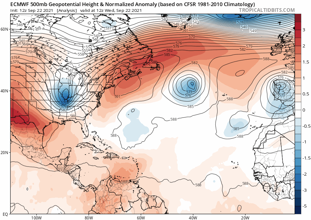
https://www.tropicaltidbits.com/analysis/models/ecmwf/2021092212/ecmwf_z500aNorm_atl_10.png
The setup depicts an Omega block over the Great Lakes with largely zonal flow downstream of the positively tilted, cutoff trough-axis. The overall orientation and retrogression would still suggest that 98L would curve sharply eastward, OTS, once past Bermuda. Climatology would also indicate that a well-developed system in its projected location would be most likely to curve OTS, simply based on seasonal wavelengths. Bermuda has experienced plenty of hurricanes during October, including CV-type systems such as storms in 1862, 1895, 1908, and 2014 (Gonzalo). Nicole (2016) also passed over Bermuda as a 105-kt Category-3 hurricane in October.
1 likes
CVW / MiamiensisWx / Shell Mound
The posts in this forum are NOT official forecasts and should not be used as such. They are just the opinion of the poster and may or may not be backed by sound meteorological data. They are NOT endorsed by any professional institution or STORM2K. For official information, please refer to products from the NHC and NWS.
-
grapealcoholic
- Category 2
- Posts: 703
- Joined: Tue Aug 10, 2021 3:26 pm
Re: ATL: INVEST 98L - Models
Shell Mound wrote:grapealcoholic wrote:Yikes...Euro basically splits the difference with GFS; keeps the cutoff but now with a lot more atlantic ridging. This setup could easily result in a new england landfall
https://www.tropicaltidbits.com/analysis/models/ecmwf/2021092212/ecmwf_z500aNorm_atl_10.png
The setup depicts an Omega block over the Great Lakes with largely zonal flow downstream of the positively tilted, cutoff trough-axis. The overall orientation and retrogression would still suggest that 98L would curve sharply eastward, OTS, once past Bermuda. Climatology would also indicate that a well-developed system in its projected location would be most likely to curve OTS, simply based on seasonal wavelengths. Bermuda has experienced plenty of hurricanes during October, including CV-type systems such as storms in 1862, 1895, 1908, and 2014 (Gonzalo). Nicole (2016) also passed over Bermuda as a 105-kt Category-3 hurricane in October.
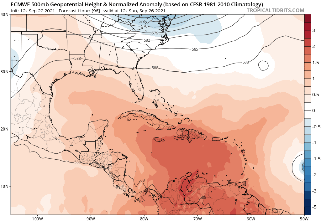
The cutoff is negatively tilted at +240
Last edited by grapealcoholic on Wed Sep 22, 2021 2:14 pm, edited 1 time in total.
0 likes
-
skyline385

- Category 5
- Posts: 2728
- Age: 35
- Joined: Wed Aug 26, 2020 11:15 pm
- Location: Houston TX
Re: ATL: INVEST 98L - Models
So here's something i don't get, why are the models showing 98L recurving into a ridge building and not into the cut off low itself? Shouldnt physics dictate a movement towards the cut off low first?
3 likes
-
grapealcoholic
- Category 2
- Posts: 703
- Joined: Tue Aug 10, 2021 3:26 pm
Re: ATL: INVEST 98L - Models
skyline385 wrote:So here's something i don't get, why are the models showing 98L recurving into a ridge building and not into the cut off low itself? Shouldnt physics dictate a movement towards the cut off low first?
You need a very strong negatively tilted trough. Wasn't quite there in this run
0 likes
Re: ATL: INVEST 98L - Models
skyline385 wrote:So here's something i don't get, why are the models showing 98L recurving into a ridge building and not into the cut off low itself? Shouldnt physics dictate a movement towards the cut off low first?
Keep in mind the counterclockwise steering flow around the upper low.
2 likes
Personal Forecast Disclaimer:
The posts in this forum are NOT official forecasts and should not be used as such. They are just the opinion of the poster and may or may not be backed by sound meteorological data. They are NOT endorsed by any professional institution or storm2k.org. For official information, please refer to the NHC and NWS products.
The posts in this forum are NOT official forecasts and should not be used as such. They are just the opinion of the poster and may or may not be backed by sound meteorological data. They are NOT endorsed by any professional institution or storm2k.org. For official information, please refer to the NHC and NWS products.

Re: ATL: INVEST 98L - Models
Although the 12Z Euro is much less threatening to the US, the 12Z EPS is slightly less unthreatening than the tame 0Z EPS, which had almost no threats from the 51 members anywhere near the SE. This new run is back to a few threats/close calls with ~10% like that (NC, FL).
0 likes
Personal Forecast Disclaimer:
The posts in this forum are NOT official forecasts and should not be used as such. They are just the opinion of the poster and may or may not be backed by sound meteorological data. They are NOT endorsed by any professional institution or storm2k.org. For official information, please refer to the NHC and NWS products.
The posts in this forum are NOT official forecasts and should not be used as such. They are just the opinion of the poster and may or may not be backed by sound meteorological data. They are NOT endorsed by any professional institution or storm2k.org. For official information, please refer to the NHC and NWS products.

Who is online
Users browsing this forum: No registered users and 5 guests