ATL: LARRY - Post-Tropical - Discussion
Moderator: S2k Moderators

Re: ATL: LARRY - Hurricane - Discussion
Based on visible imagery and microwave, I think the original small eyewall from yesterday has dissolved, and a larger one is forming just like the HWRF was insisting. The question is how large that eye will be, and whether or not it’ll become annular. However, since it’ll be a large eye, it’ll take a while to fully form and begin clearing, and we probably won’t see a ton of intensification until it finally solidified.
0 likes
Irene '11 Sandy '12 Hermine '16 5/15/2018 Derecho Fay '20 Isaias '20 Elsa '21 Henri '21 Ida '21
I am only a meteorology enthusiast who knows a decent amount about tropical cyclones. Look to the professional mets, the NHC, or your local weather office for the best information.
I am only a meteorology enthusiast who knows a decent amount about tropical cyclones. Look to the professional mets, the NHC, or your local weather office for the best information.
-
cycloneye

- Admin

- Posts: 149555
- Age: 69
- Joined: Thu Oct 10, 2002 10:54 am
- Location: San Juan, Puerto Rico
Re: ATL: LARRY - Hurricane - Discussion
New intensity peak is 120 kt.
FORECAST VALID 05/1200Z 19.2N 49.7W
MAX WIND 120 KT...GUSTS 145 KT.
FORECAST VALID 05/1200Z 19.2N 49.7W
MAX WIND 120 KT...GUSTS 145 KT.
6 likes
Visit the Caribbean-Central America Weather Thread where you can find at first post web cams,radars
and observations from Caribbean basin members Click Here
and observations from Caribbean basin members Click Here
Re: ATL: LARRY - Hurricane - Discussion
The NHC talks about how the ECMWF-based SHIPS forecasts increased shear and dry air after 84 hours. Under normal circumstances, this would weaken Larry, but it could be annular at this time and almost impossible to kill. Also, they mention that the GFS-based SHIPS does not show that hostile shear. If the environment around Larry is favorable in the 96-144hr range, it will likely either maintain its intensity or become stronger, as it’ll be moving through a region of much higher OHC — up to 5 times more than what it’s currently going through.

Last edited by aspen on Thu Sep 02, 2021 10:22 am, edited 1 time in total.
1 likes
Irene '11 Sandy '12 Hermine '16 5/15/2018 Derecho Fay '20 Isaias '20 Elsa '21 Henri '21 Ida '21
I am only a meteorology enthusiast who knows a decent amount about tropical cyclones. Look to the professional mets, the NHC, or your local weather office for the best information.
I am only a meteorology enthusiast who knows a decent amount about tropical cyclones. Look to the professional mets, the NHC, or your local weather office for the best information.
-
Blown Away

- S2K Supporter

- Posts: 10253
- Joined: Wed May 26, 2004 6:17 am
Re: ATL: LARRY - Hurricane - Discussion

10 likes
Hurricane Eye Experience: David 79, Irene 99, Frances 04, Jeanne 04, Wilma 05… Hurricane Brush Experience: Andrew 92, Erin 95, Floyd 99, Matthew 16, Irma 17, Ian 22, Nicole 22…

Re: ATL: LARRY - Hurricane - Discussion
Blown Away wrote:https://i.imgur.com/MA19z0O.gif
Larry's starting to come together. Wouldn't be surprised if ADT skyrockets tomorrow or so once an eye pops out.
3 likes

Re: ATL: LARRY - Hurricane - Discussion
Forecast Disco Excerpt:
Larry's environmental conditions appear very favorable for
additional intensification over the next 60-72 hours. In fact, the
primarily forecast challenge relates to how Larry's core structure
evolves over the next several days. Right now, the inner-core and
hurricane-force wind radii are very small relative to the expanding
tropical-storm-force wind field around the storm. Thus, it appears
likely that Larry will undergo some form of an eyewall replacement
cycle (ERC) in the next 12 to 24 hours, which may slow down the
short term intensification rate. However, once this cycle is
complete, very light easterly vertical wind shear between 2-8 kt,
abundant mid-level moisture, and sufficently warm sea-surface
temperatures between 27-28 C should favor steady to rapid
intensification. The latest NHC intensity forecast now calls for a
peak intensity of 120 kt in roughly 72 hours, which is a faster and
slightly higher peak than the prior forecast.
3 likes
-
Iceresistance

- Category 5

- Posts: 9598
- Age: 22
- Joined: Sat Oct 10, 2020 9:45 am
- Location: Tecumseh, OK/Norman, OK
Re: ATL: LARRY - Hurricane - Discussion
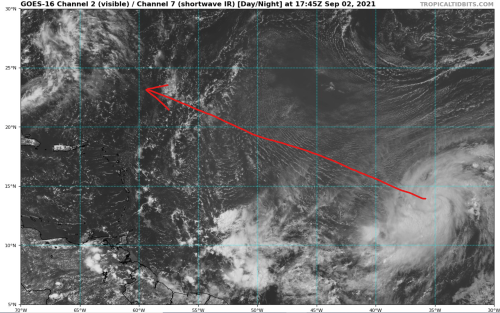
Larry is at the far right of the image, there is good outflow developing from the system . . .

Steering profiles is showing a due west motion within Larry towards the Lesser Antilles
200-700 MB

700-850 MB

Steering profiles is showing a due west motion within Larry towards the Lesser Antilles
200-700 MB
700-850 MB
1 likes
Bill 2015 & Beta 2020
Winter 2020-2021
All observations are in Tecumseh, OK unless otherwise noted.
Winter posts are focused mainly for Oklahoma & Texas.
Take any of my forecasts with a grain of salt, refer to the NWS, SPC, and NHC for official information
Never say Never with weather! Because ANYTHING is possible!
Winter 2020-2021
All observations are in Tecumseh, OK unless otherwise noted.
Winter posts are focused mainly for Oklahoma & Texas.
Take any of my forecasts with a grain of salt, refer to the NWS, SPC, and NHC for official information
Never say Never with weather! Because ANYTHING is possible!
-
InfernoFlameCat

- Category 5
- Posts: 2127
- Age: 22
- Joined: Mon Dec 14, 2020 10:52 am
- Location: Buford, GA
Re: ATL: LARRY - Hurricane - Discussion
Going to bet Larry becomes a Cat 5. Call me bullish but I see massive potential.
3 likes
I am by no means a professional. DO NOT look at my forecasts for official information or make decisions based on what I post.
Goal: to become a registered expert over tropical and subtropical cyclones.
Goal: to become a registered expert over tropical and subtropical cyclones.

Re: ATL: LARRY - Hurricane - Discussion
Iceresistance wrote:Larry is at the far right of the image, there is good outflow developing from the system . . .
https://s9.gifyu.com/images/wg8shr.gif
Steering profiles is showing a due west motion within Larry towards the Lesser Antilles
200-700 MB
https://s9.gifyu.com/images/wg8dlm6.gif
700-850 MB
https://s9.gifyu.com/images/wg8dlm1.gif
Is that wall of shear to the north and south induced by Larry or has it always been there?
0 likes
TC naming lists: retirements and intensity
Most aggressive Advisory #1's in North Atlantic (cr. kevin for starting the list)
Most aggressive Advisory #1's in North Atlantic (cr. kevin for starting the list)
-
Iceresistance
- Category 5
- Posts: 9598
- Age: 22
- Joined: Sat Oct 10, 2020 9:45 am
- Location: Tecumseh, OK/Norman, OK
Re: ATL: LARRY - Hurricane - Discussion
Teban54 wrote:Iceresistance wrote:Larry is at the far right of the image, there is good outflow developing from the system . . .
https://s9.gifyu.com/images/wg8shr.gif
Steering profiles is showing a due west motion within Larry towards the Lesser Antilles
200-700 MB
https://s9.gifyu.com/images/wg8dlm6.gif
700-850 MB
https://s9.gifyu.com/images/wg8dlm1.gif
Is that wall of shear to the north and south induced by Larry or has it always been there?
I think Larry induced some of the wind shear, there is outflow developing from the center of the system . . .
0 likes
Bill 2015 & Beta 2020
Winter 2020-2021
All observations are in Tecumseh, OK unless otherwise noted.
Winter posts are focused mainly for Oklahoma & Texas.
Take any of my forecasts with a grain of salt, refer to the NWS, SPC, and NHC for official information
Never say Never with weather! Because ANYTHING is possible!
Winter 2020-2021
All observations are in Tecumseh, OK unless otherwise noted.
Winter posts are focused mainly for Oklahoma & Texas.
Take any of my forecasts with a grain of salt, refer to the NWS, SPC, and NHC for official information
Never say Never with weather! Because ANYTHING is possible!
-
weeniepatrol

- Category 5
- Posts: 1343
- Joined: Sat Aug 22, 2020 5:30 pm
- Location: WA State
-
Shell Mound
- Category 5
- Posts: 2432
- Age: 33
- Joined: Thu Sep 07, 2017 3:39 pm
- Location: St. Petersburg, FL → Scandinavia
Re: ATL: LARRY - Hurricane - Discussion
Given the current rate of westward shifts, three more model cycles could bring Larry rather close to Hebert Box #1. Leewards and Bermuda should keep watch.
At this point, the significant westward shifts for days on end are starting to be a bit reminiscent of Irma’s (2017). If trends continue for three more cycles, well...
At this point, the significant westward shifts for days on end are starting to be a bit reminiscent of Irma’s (2017). If trends continue for three more cycles, well...
Last edited by Shell Mound on Thu Sep 02, 2021 12:16 pm, edited 1 time in total.
0 likes
CVW / MiamiensisWx / Shell Mound
The posts in this forum are NOT official forecasts and should not be used as such. They are just the opinion of the poster and may or may not be backed by sound meteorological data. They are NOT endorsed by any professional institution or STORM2K. For official information, please refer to products from the NHC and NWS.
-
cheezyWXguy

- Category 5
- Posts: 6282
- Joined: Mon Feb 13, 2006 12:29 am
- Location: Dallas, TX
Re: ATL: LARRY - Hurricane - Discussion
Large eye clearly trying to form, this is going to be a very different looking storm this time tomorrow.
0 likes

Re: ATL: LARRY - Hurricane - Discussion
Shell Mound wrote:Given the current rate of westward shifts, three more model cycles could bring Larry rather close to Hebert Box #1. Leewards and Bermuda should keep watch.
Most of the westward shifts stopped yesterday. If anything most of the models have drifted east over the last couple runs.
4 likes
-
AutoPenalti
- Category 5
- Posts: 4091
- Age: 29
- Joined: Mon Aug 17, 2015 4:16 pm
- Location: Ft. Lauderdale, Florida
Re: ATL: LARRY - Hurricane - Discussion
Shell Mound wrote:Given the current rate of westward shifts, three more model cycles could bring Larry rather close to Hebert Box #1. Leewards and Bermuda should keep watch.
At this point, the significant westward shifts for days on end are starting to be a bit reminiscent of Irma’s (2017). If trends continue for three more cycles, well...
GFS 12z shifted back SW from 06z but still east enough to miss Bermuda.
0 likes
The posts in this forum are NOT official forecasts and should not be used as such. They are just the opinion of the poster and may or may not be backed by sound meteorological data. They are NOT endorsed by any professional institution or STORM2K. For official information, please refer to products from the NHC and NWS.
Model Runs Cheat Sheet:
GFS (5:30 AM/PM, 11:30 AM/PM)
HWRF, GFDL, UKMET, NAVGEM (6:30-8:00 AM/PM, 12:30-2:00 AM/PM)
ECMWF (1:45 AM/PM)
TCVN is a weighted averaged
-
RevanTheJedi96
- Tropical Storm

- Posts: 106
- Joined: Wed Sep 01, 2021 10:40 am
Re: ATL: LARRY - Hurricane - Discussion
Shell Mound wrote:Given the current rate of westward shifts, three more model cycles could bring Larry rather close to Hebert Box #1. Leewards and Bermuda should keep watch.
At this point, the significant westward shifts for days on end are starting to be a bit reminiscent of Irma’s (2017). If trends continue for three more cycles, well...
Well if this were to be Irma then the recurring models keeping show has to drop by Sunday at the latest. And I just don't see that happening. Certainly some worrying trends but the recurve is very strong here and that's a good indicator.
Bermuda should watch this but I'm more and more confidence Larry isn't approaching the US.
0 likes
-
Sciencerocks
- Category 5
- Posts: 10186
- Age: 40
- Joined: Thu Jul 06, 2017 1:51 am


-
Stormybajan

- Category 1

- Posts: 453
- Joined: Thu May 20, 2021 3:21 pm
- Location: Windward Islands
Re: ATL: LARRY - Hurricane - Discussion
Even if Hurricane Larry takes a more WNW track, I dont think this is something the NE leewards should have to worry about. I think the biggest concern for impacts is Bermuda 100%
1 likes
Sad West Indies and Manchester United fan ⚽️
-
cycloneye
- Admin
- Posts: 149555
- Age: 69
- Joined: Thu Oct 10, 2002 10:54 am
- Location: San Juan, Puerto Rico
Re: ATL: LARRY - Hurricane - Discussion
Stormybajan wrote:https://i.postimg.cc/JhMw8wK4/Hurricane-Larry-Sep221-A.png
Even if Hurricane Larry takes a more WNW track, I dont think this is something the NE leewards should have to worry about. I think the biggest concern for impacts is Bermuda 100%
Big waves will go to the Leewards, Virgin Islands and Puerto Rico next week.
3 likes
Visit the Caribbean-Central America Weather Thread where you can find at first post web cams,radars
and observations from Caribbean basin members Click Here
and observations from Caribbean basin members Click Here
Who is online
Users browsing this forum: No registered users and 31 guests