Hurricane Nora Discussion Number 12
NWS National Hurricane Center Miami FL EP142021
1000 AM CDT Sat Aug 28 2021
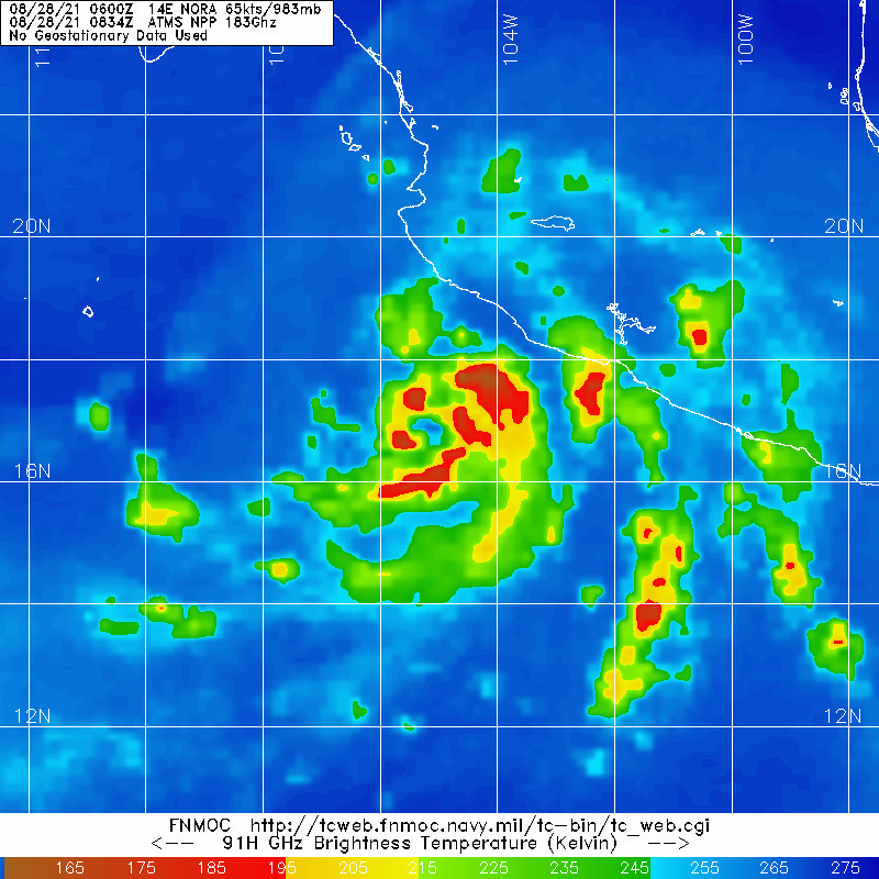
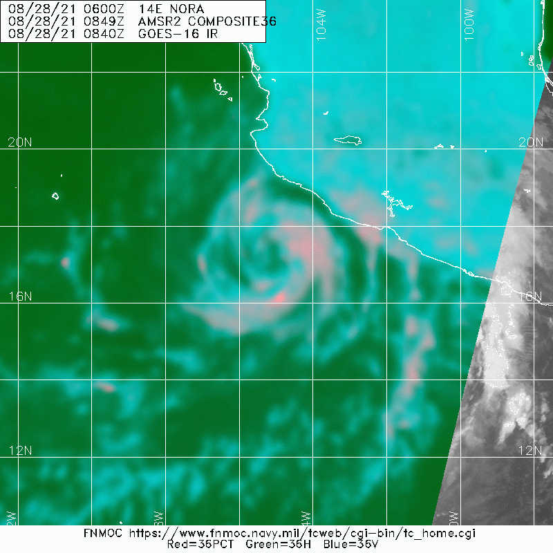
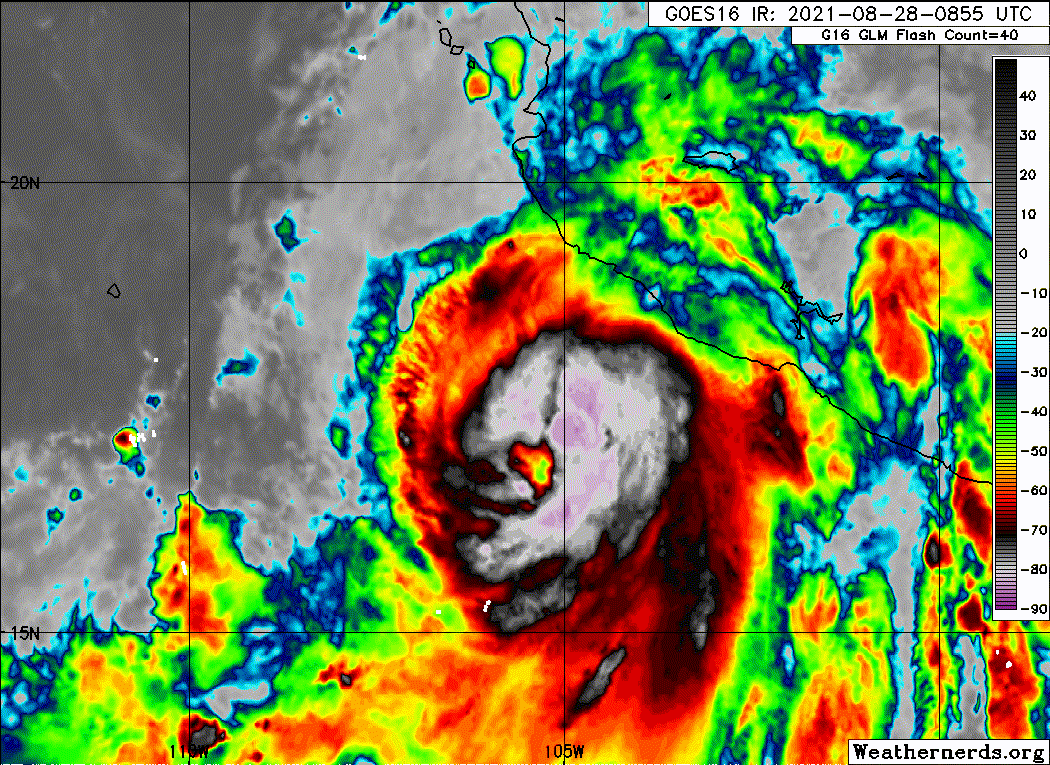
Nora continues to show signs of strengthening with the center
embedded beneath a Central Dense Overcast, where clouds tops are
now as cold as -85 degrees Celsius. Dvorak fixes from TAFB and SAB
are T4.0/65 kt and T4.5/77 kt, and the most recent objective
numbers are near 75 kt. Nora's initial intensity is conservatively
estimated to be 70 kt, but an Air Force Reserve Hurricane Hunter
aircraft should help us verify the maximum winds later this
afternoon.
The latest fixes indicate that Nora is moving west of due north, or
350/10 kt. A shortwave trough over the northern Rockies has created
a weakness in the subtropical ridge over the southwestern U.S.,
which should allow Nora to continue moving northward or
north-northwestward through tonight. This motion will take Nora's
center and hurricane-force winds very close to or over portions of
Jalisco, Mexico, later today and this evening. On Sunday, the track
guidance suggests that Nora will make a turn back toward the
northwest, bringing the center over the Gulf of California by Monday
at a much slower forward speed. The track guidance is in good
agreement on this scenario, but the narrow width of the Gulf of
California means that hazards away from the center could affect both
the coast of mainland Mexico and the east coast of Baja California
Sur. Due to this uncertainty, new watches and warnings have been
extended northward along both coasts. The track guidance--and the
NHC official forecast--suggest that Nora's center could move inland
over Sonora, Mexico, in 4 to 5 days.
Assuming Nora's center remains over water, low shear and warm waters
should allow for additional strengthening during the next 24-36
hours. After that time, possible land interaction, influences of
nearby topography, and potential ingestion of dry air from the
Mexican plateau could all conspire to cause at least gradual
weakening while Nora begins to move into the Gulf of California.
That said, there is still a lot of uncertainty in the intensity
prediction, and Nora is forecast to remain as a hurricane through
early Tuesday, a scenario supported by the ECMWF model. One thing
the models do agree on is that Nora's wind field should contract
after it passes Cabo Corrientes and heads into the Gulf of
California, and this is reflected in the NHC forecast.
Key Messages:
1. Nora is forecast strengthen through tonight as it moves near the
coasts of the Mexican states of Colima, Jalisco, Nayarit, and
southern Sinaloa, and hurricane warnings are in effect for portions
of that coastline. Interests in these areas and points farther
north should closely monitor the progress of Nora and subsequent
updates to the forecast.
2. Heavy rain associated with Nora is expected across the west coast
of Mexico from the Mexican states of Guerrero, northward to southern
Sonora, including Baja California Sur. This rain will likely
result in life-threatening flash flooding and mudslides across these
regions. Rainfall from Nora may spread into the southwestern U.S.
and central Rockies during the middle to latter portion of next
week.
3. Nora is forecast to move over the Gulf of California as a
hurricane by Monday, bringing a risk of wind impacts to portions of
the Mexican states of Baja California Sur, Sinaloa, and Sonora.
Given the above-average uncertainty in the forecast intensity,
confidence is not high enough to determine the magnitude and
location of these potential impacts.
FORECAST POSITIONS AND MAX WINDS
INIT 28/1500Z 18.4N 105.4W 70 KT 80 MPH
12H 29/0000Z 20.1N 105.8W 75 KT 85 MPH
24H 29/1200Z 22.0N 106.5W 80 KT 90 MPH
36H 30/0000Z 23.1N 107.3W 80 KT 90 MPH
48H 30/1200Z 23.8N 108.0W 75 KT 85 MPH
60H 31/0000Z 24.5N 108.9W 70 KT 80 MPH
72H 31/1200Z 25.2N 109.6W 65 KT 75 MPH
96H 01/1200Z 26.9N 110.5W 60 KT 70 MPH
120H 02/1200Z 29.3N 111.0W 40 KT 45 MPH...INLAND
$$
Forecaster Berg