

ATL: IDA - Remnants - Discussion
Moderator: S2k Moderators
-
TheDreamTraveler

- Category 2

- Posts: 645
- Joined: Sun Aug 22, 2010 3:10 am
- Location: PA
Re: ATL: IDA - Hurricane - Discussion
Stormybajan wrote:Quite strange to see literally no intensification from overnight, the IR presentation is rapidly improving right now however so im thinking in about 2 hours once the convective bursts fully wrap around winds should pick up and the pressure should decrease at faster rates
Cuba disrupted the core a bit so it's not too surprising that it's taking time to get stronger. If the land wasn't there it'd be way stronger by now
1 likes

Re: ATL: IDA - Hurricane - Discussion
Anyone whop has been around a while should be well aware Ida has got that textbook look of a cane that is about to blow. Probably going to see some big time RI soon.
2 likes
Personal Forecast Disclaimer:
The posts in this forum are NOT official forecast and should not be used as such. They are just the opinion of the poster and may or may not be backed by sound meteorological data. They are NOT endorsed by any professional institution or storm2k.org. For official information, please refer to the NHC and NWS products
The posts in this forum are NOT official forecast and should not be used as such. They are just the opinion of the poster and may or may not be backed by sound meteorological data. They are NOT endorsed by any professional institution or storm2k.org. For official information, please refer to the NHC and NWS products
-
tropicwatch

- Category 5

- Posts: 3426
- Age: 62
- Joined: Sat Jun 02, 2007 10:01 am
- Location: The Villages, Florida
- Contact:
Re: ATL: IDA - Hurricane - Discussion
Good to see and love it when people ignore the politicians.
12 likes
Tropicwatch
Agnes 72', Eloise 75, Elena 85', Kate 85', Charley 86', Florence 88', Beryl 94', Dean 95', Erin 95', Opal 95', Earl 98', Georges 98', Ivan 2004', Arlene 2005', Dennis 2005', Ida 2009' Debby 2012' Irma 2017' Michael 2018'
Agnes 72', Eloise 75, Elena 85', Kate 85', Charley 86', Florence 88', Beryl 94', Dean 95', Erin 95', Opal 95', Earl 98', Georges 98', Ivan 2004', Arlene 2005', Dennis 2005', Ida 2009' Debby 2012' Irma 2017' Michael 2018'

Re: ATL: IDA - Hurricane - Discussion
At least the interaction with Cuba lowered the ceiling a bit…
1 likes
Irene '11 Sandy '12 Hermine '16 5/15/2018 Derecho Fay '20 Isaias '20 Elsa '21 Henri '21 Ida '21
I am only a meteorology enthusiast who knows a decent amount about tropical cyclones. Look to the professional mets, the NHC, or your local weather office for the best information.
I am only a meteorology enthusiast who knows a decent amount about tropical cyclones. Look to the professional mets, the NHC, or your local weather office for the best information.

Re: ATL: IDA - Hurricane - Discussion
1 likes
I'm a busy grad student, not a professional forecaster. Please refer to the NHC and NWS for official forecasts.
-
Iceresistance

- Category 5
- Posts: 9602
- Age: 22
- Joined: Sat Oct 10, 2020 9:45 am
- Location: Tecumseh, OK/Norman, OK
Re: ATL: IDA - Hurricane - Discussion
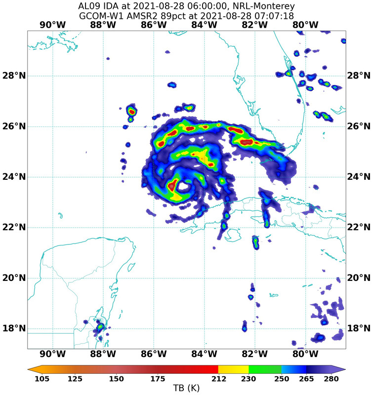
There is a stubborn Dry slot at the inner core right now, I don't see it lasting long though . . .

0 likes
Bill 2015 & Beta 2020
Winter 2020-2021
All observations are in Tecumseh, OK unless otherwise noted.
Winter posts are focused mainly for Oklahoma & Texas.
Take any of my forecasts with a grain of salt, refer to the NWS, SPC, and NHC for official information
Never say Never with weather! Because ANYTHING is possible!
Winter 2020-2021
All observations are in Tecumseh, OK unless otherwise noted.
Winter posts are focused mainly for Oklahoma & Texas.
Take any of my forecasts with a grain of salt, refer to the NWS, SPC, and NHC for official information
Never say Never with weather! Because ANYTHING is possible!

-
gatorcane

- S2K Supporter

- Posts: 23708
- Age: 48
- Joined: Sun Mar 13, 2005 3:54 pm
- Location: Boca Raton, FL
Re: ATL: IDA - Hurricane - Discussion
KWT wrote:Anyone whop has been around a while should be well aware Ida has got that textbook look of a cane that is about to blow. Probably going to see some big time RI soon.
Agreed, also would say it should be a major by this afternoon or evening, probably sooner than the NHC shows:

Last edited by gatorcane on Sat Aug 28, 2021 7:11 am, edited 3 times in total.
2 likes

Re: ATL: IDA - Hurricane - Discussion
Iceresistance wrote:There is a stubborn Dry slot at the inner core right now, I don't see it lasting long though . . .
https://s9.gifyu.com/images/GOES16_1km_ir_202108281155_19.75_28.25_-92.25_-78.25_ir1_ltng16_hgwy_warn_latlon_weathernerds.png
Don't think that's dry air -- just an area where the convection hasn't wrapped yet.
3 likes
-
Category5Kaiju

- Category 5
- Posts: 4341
- Joined: Thu Dec 24, 2020 12:45 pm
- Location: Seattle during the summer, Phoenix during the winter
Re: ATL: IDA - Hurricane - Discussion
aspen wrote:At least the interaction with Cuba lowered the ceiling a bit…
I suppose, although it most likely had a negligible (in the grand scheme of things) impact on such ceiling since a solid Cat 4 is still pretty darn horrific.
1 likes
Unless explicitly stated, all information in my posts is based on my own opinions and observations. Tropical storms and hurricanes can be extremely dangerous. Refer to an accredited weather research agency or meteorologist if you need to make serious decisions regarding an approaching storm.
-
ElectricStorm

- Category 5
- Posts: 5148
- Age: 25
- Joined: Tue Aug 13, 2019 11:23 pm
- Location: Norman, OK
Re: ATL: IDA - Hurricane - Discussion
It's good to see it at least took some time to get going again after Cuba, I'm guessing it took a bit longer since it developed a core before it got there so it got disrupted a bit more. Unfortunately it looks like it's gonna bomb soon. I don't really think Cuba lowered the ceiling and I still expect a 130-140kt storm at peak. I think the only thing Cuba did was prevent an ERC before landfall. With less time, I'm thinking Ida intensifies all the way to landfall now, where if it got going earlier overnight, it could have peaked earlier, and then undergo an ERC before landfall, which arguably would be worse bringing in more surge. Lose-lose situation all around here.
Last edited by ElectricStorm on Sat Aug 28, 2021 7:16 am, edited 1 time in total.
2 likes
B.S Meteorology, University of Oklahoma '25
Please refer to the NHC, NWS, or SPC for official information.
Please refer to the NHC, NWS, or SPC for official information.


Re: ATL: IDA - Hurricane - Discussion
gatorcane wrote:KWT wrote:Anyone whop has been around a while should be well aware Ida has got that textbook look of a cane that is about to blow. Probably going to see some big time RI soon.
Agreed, also would say it should be a major by this afternoon or evening, probably sooner than the NHC shows:
https://i.postimg.cc/yYvFrkr5/goes16-ir-09-L-202108281047.gif
Agree we saw how fast it got it's act together yesterday morning into the afternoon, could see that happen in the next few hours IMO, also maybe my eyes but last couple of frames look mor NNW then a NW mvmt, tracking the angle to 90W will mean everything for impacts E of current cone.
0 likes
Once I see the REDS and GREENS Converge on a Base Velocity. ... I'm There!!
This is NOT an Official Forecast....Just my Opinion. For official information, please refer to the NHC and NWS products.
HIGHLIGHTS : '13 El Reno Tornado : 2013 Storm Chaser Tour, Joaquin; SC flood event, Matthew '16, Lowcountry Snow storm Jan '18
This is NOT an Official Forecast....Just my Opinion. For official information, please refer to the NHC and NWS products.
HIGHLIGHTS : '13 El Reno Tornado : 2013 Storm Chaser Tour, Joaquin; SC flood event, Matthew '16, Lowcountry Snow storm Jan '18

Re: ATL: IDA - Hurricane - Discussion
psyclone wrote:Blinhart wrote:Clearcloudz wrote:https://twitter.com/DerekOrtt/status/1431454835946266627
Will be interesting to see the models tomorrow to see if the models are shifting East or they will shift back a little each way up until landfall. As of right now I'm breathing a lot better than I was this morning. Even though that Spaghetti Model from the 1800Z tonight has me a little worried, but going by the NHC cone, I'm barely in it now.
You should be using wind probability, surge and rainfall estimates to assess your risk. Being in or out of the cone doesn't denote risk. as the storm draws closer the cone will narrow...but the extent of the weather hazards won't. the net effect here is there will be an increasing area in a hurricane and or storm surge warning outside of the cone. good luck to you and everyone else up that way.
I'm sorry if I made you guys not understand what is going on in my head, I was very tired when I wrote that. I understand what happens with the Cone, and I do look at all the other products to figure everything up, I have just gotten up and just started reading this and will be looking at all the products while I'm waking up and getting my game plan together and deciding if I should go up to Monroe and then across to Columbus, Ga.
3 likes
Personal Forecast Disclaimer:
The posts in this forum are NOT official forecast and should not be used as such. They are just the opinion of the poster and may or may not be backed by sound meteorological data. They are NOT endorsed by any professional institution or storm2k.org. For official information, please refer to the NHC and NWS products.
The posts in this forum are NOT official forecast and should not be used as such. They are just the opinion of the poster and may or may not be backed by sound meteorological data. They are NOT endorsed by any professional institution or storm2k.org. For official information, please refer to the NHC and NWS products.

Re: ATL: IDA - Hurricane - Discussion
Weather Dude wrote:It's good to see it at least took some time to get going again after Cuba, I'm guessing it took a bit longer since it developed a core before it got there so it got disrupted a bit more. Unfortunately it looks like it's gonna bomb soon. I don't really think Cuba lowered the ceiling and I still expect a 130kts+. I think the only thing Cuba did was prevent an ERC before landfall. With less time, I'm thinking Ida intensifies all the way to landfall now, where if it got going earlier overnight, it could have peaked earlier, and then undergo an ERC before landfall, which arguably would be worse bringing in more surge. Lose-lose situation all around here.
Yes. With the lack of ERC and larger wind field, it creates serious implications for landfall damage potential.
0 likes
Very useful information on the Dvorak Technique --
https://severe.worldweather.wmo.int/TCF ... kBeven.pdf
https://severe.worldweather.wmo.int/TCF ... kBeven.pdf
-
Shell Mound
- Category 5
- Posts: 2432
- Age: 33
- Joined: Thu Sep 07, 2017 3:39 pm
- Location: St. Petersburg, FL → Scandinavia
Re: ATL: IDA - Hurricane - Discussion
ThetaE wrote:The 00z HWRF thought Ida would have a central pressure of 986 mb immediately after Cuba, so in some sense the impact of land was understated.
On the other hand, the 00z HWRF thought pressure would *rise 1 mb* a few hours after landfall with Cuba, and sit around 985 mb at 09z. Thus a pressure of 986 mb at 09:40z is actually a lot of recovery put in!
That covers past and present. For the future: that HWRF model run has pressure down to 983 at 12z. If we fall below that in any way we’d be ahead of the HWRF’s schedule (which makes landfall as a 940 mb storm).
The recovery pace post-Cuba has been neither faster than expected nor slower than expected. It has been, with a few deviations, as long as expected.
Yesterday’s 18Z HWRF showed Ida reaching 976 mb as of 12:00 UTC (current time) today. The actual MSLP has ended up being ~10 mb higher.
0 likes
CVW / MiamiensisWx / Shell Mound
The posts in this forum are NOT official forecasts and should not be used as such. They are just the opinion of the poster and may or may not be backed by sound meteorological data. They are NOT endorsed by any professional institution or STORM2K. For official information, please refer to products from the NHC and NWS.
-
otowntiger
- Category 5
- Posts: 1932
- Joined: Tue Aug 31, 2004 7:06 pm
Re: ATL: IDA - Hurricane - Discussion
aspen wrote:At least the interaction with Cuba lowered the ceiling a bit…
I think there is reason for hope- I think there are starting to be some signs that the intensity may not be as off the charts as previously expected. The fact that the rapid intensification has not started yet, models depicting slightly lower intensity and the indications from the NHC about wind shear and dry air at the time of landfall point to some reason to believe this won’t be a ‘worst case scenario’. But we’ll see. Maybe I’m just being too optimistic.
1 likes

Re: ATL: IDA - Hurricane - Discussion
Extrap. Sfc. Press: 991.5 mb (29.28 inHg) from Miss Piggy
0 likes
Personal Forecast Disclaimer:
The posts in this forum are NOT official forecast and should not be used as such. They are just the opinion of the poster and may or may not be backed by sound meteorological data. They are NOT endorsed by any professional institution or storm2k.org. For official information, please refer to the NHC and NWS products.
The posts in this forum are NOT official forecast and should not be used as such. They are just the opinion of the poster and may or may not be backed by sound meteorological data. They are NOT endorsed by any professional institution or storm2k.org. For official information, please refer to the NHC and NWS products.
Who is online
Users browsing this forum: No registered users and 14 guests