
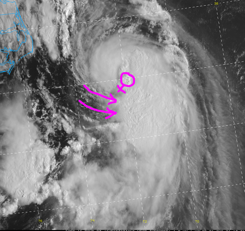
Looks like MLC getting closer to the LLC.
Moderator: S2k Moderators


wxman57 wrote:The NHC didn't mention it, but they shifted their track about 25 miles east on Long Island. It now perfectly matches consensus (TVCN).
The new NHC track forecast is a little to the east of the previous one and very near the best-performing models, the consensus aids.
aspen wrote:Looks like I’ll be spared from Henri’s strongest winds. Henri will pass to the east of my location, so I’ll be getting the weaker west side of the storm. Models are suggesting 2-4 inches of rain, and the ground is already rather saturated from the remnants of Fred — not that much, but it won’t be able to hold the additional rain from Henri.
The 11am discussion seems rather aggressive with the potential for Henri to strengthen even more. They mention how the GFS and HWRF indicate Henri’s pressure could drop by as much as 15+ mb between now and early Sunday while it’s still over the Gulf Stream. If it does have a small phase of rapid intensification — getting up to an 80-85 kt C1/2 and wrapping more of the strongest winds around the whole center — then I’m screwed.
AdamFirst wrote:hohnywx wrote:
His post is based on a surge model that takes in account wind direction piling water up in the sound and the tidal phases of the moon. An interesting take but seems like a worst case scenario to me. Hopefully it doesn't come to pass

wxman57 wrote:The NHC didn't mention it, but they shifted their track about 25 miles east on Long Island. It now perfectly matches consensus (TVCN).
Users browsing this forum: No registered users and 144 guests


