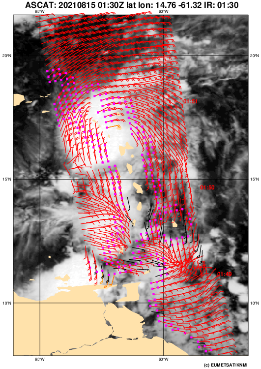
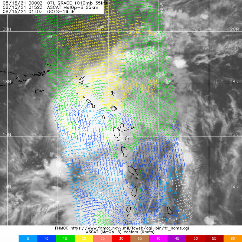
T&T had an interesting afternoon yesterday. Even though we weren't directly affected by Grace, its presence in the region caused our winds to slow down to 10 km/h or less and come in from the south, rather than E/ENE/ESE as they normally would. With the intense daytime heating and near-calm conditions, not to mention all the equatorial moisture being pulled up from South America, strong thunderstorms exploded over northwestern Trinidad close to the capital. Bolts of lightning were coming down all around me.
I managed to catch some of them using the 960 fps mode on my phone. The thunder was phenomenal and storms kept popping up for hours, one after the other.


Cloud tops in these thunderstorms were near or below -80°C, which is rather cold for afternoon thunderstorms here. But it didn't surprise me at all given how downright intense they were. Whenever low pressure systems pass north of us and tamper with our winds, the thunderstorms in T&T (especially Trinidad) tend to be a lot more sinister, even though we're hundreds of kilometres from the systems themselves. It's amazing when you think of how far-reaching the peripheral impacts of tropical cyclones can be. Thankfully, there were no reports of damage from this burst of wild weather but the same pattern is expected to be in place tomorrow so I'll be watching it
very closely. Stay safe, everyone!


