Current Intensity Analysis
UW - CIMSS
ADVANCED DVORAK TECHNIQUE
ADT-Version 9.0
Tropical Cyclone Intensity Algorithm
----- Current Analysis -----
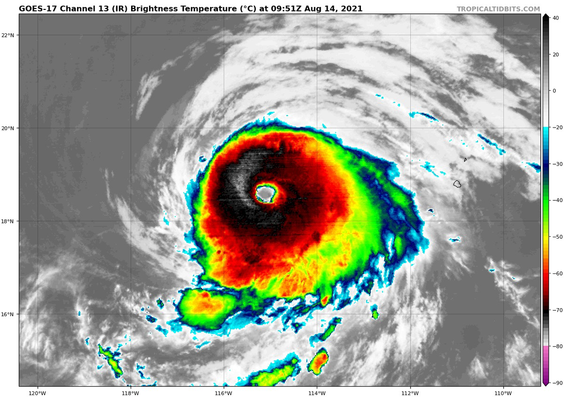
Date : 14 AUG 2021 Time : 094536 UTC
Lat : 18:35:24 N Lon : 115:04:11 W
CI# /Pressure/ Vmax
6.1 / 946.1mb/117.4kt
Final T# Adj T# Raw T#
6.1 6.4 6.6
Estimated radius of max. wind based on IR : 22 km
Center Temp : +15.4C Cloud Region Temp : -69.8C
Scene Type : EYE
Subtropical Adjustment : OFF
Extratropical Adjustment : OFF
Positioning Method : ARCHER POSITIONING
Ocean Basin : EAST PACIFIC
Dvorak CI > MSLP Conversion Used : CKZ Method
Tno/CI Rules : Constraint Limits : 1.3T/6hr
Weakening Flag : OFF
Rapid Dissipation Flag : OFF
C/K/Z MSLP Estimate Inputs :
- Average 34 knot radii : 92nmi
- Environmental MSLP : 1011mb
Satellite Name : GOES17
Satellite Viewing Angle : 33.3 degrees
Even the times when recon found EPAC systems weaker than Dvorak estimated, Dvorak would only be off by 10-15mph. So If this is not 125-130kts, then it's at least the NHC estimate.