Moderator: S2k Moderators


Spacecoast wrote:[url]https://i.ibb.co/3B1JXC0/ecmea.jpg [/url]
[url]https://i.ibb.co/nwkQv8f/ecmeb.jpg [/url]


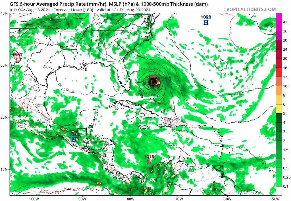
Hypercane_Kyle wrote:12z GFS coming in weaker, less consolidated approaching the islands.

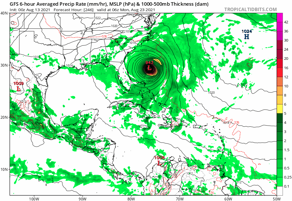
tolakram wrote:I swear the GFS has some strong clockwise outflow from superstorm Fred imparting shear over SEVEN.

mitchell wrote:tolakram wrote:I swear the GFS has some strong clockwise outflow from superstorm Fred imparting shear over SEVEN.
Superstorm?
Users browsing this forum: No registered users and 17 guests