The AFD is still kind of meh but it's coming around considering they didn't even mention snow til yesterday
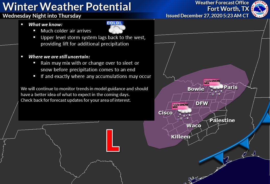
The models are in good agreement in wrapping precipitation around
the back side of this low across much of North and Central Texas
on Thursday, and have included high end chance PoPs in most areas.
MOS guidance from both the GFS and Euro actually depict
likely/categorical PoPs, and may have gone too low with
precipitation chances for Thursday. Uncertainty with the exact
track of the upper low is what held me back from going higher. Of
greater concern is the precipitation type. Kept mention of a
rain/snow mix across the western and northern counties for
Thursday, though believe (at this point anyway) that surface
temperatures will be too warm for accumulations. In leaning toward
the colder Euro solution, expanded the mention of snow into some
of our northeast, east central and southern zones as well on
Thursday. This may have been a bit aggressive this early, but
given the deepening trend of the Euro solution felt there was at
least some appreciable chance of a mix in these counties Thursday
morning.
If the NBM guidance is to be believed, by afternoon, the
low level thermal profile may be a tad too warm in many places for
any snow to occur. Needless to say, there is still tremendous
uncertainty with the evolution of this portion of the forecast,
and how the upper low develops over us will play a key role.
 The posts in this forum are NOT official forecast and should not be used as such. They are just the opinion of the poster and may or may not be backed by sound meteorological data. They are NOT endorsed by any professional institution or


