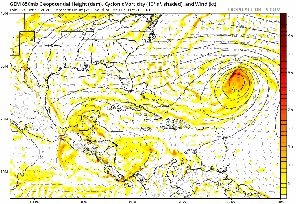
Yeah, I see that. This part of the run doesn’t add up. That trough should have no problem catching it.
Sent from my iPhone using Tapatalk
Trough of low pressure in Western Caribbean (Is Invest 95L)
Moderator: S2k Moderators
Forum rules

The posts in this forum are NOT official forecasts and should not be used as such. They are just the opinion of the poster and may or may not be backed by sound meteorological data. They are NOT endorsed by any professional institution or STORM2K. For official information, please refer to products from the National Hurricane Center and National Weather Service.
-
SouthFLTropics

- Category 5

- Posts: 4258
- Age: 50
- Joined: Thu Aug 14, 2003 8:04 am
- Location: Port St. Lucie, Florida
Re: Possible SW Caribbean Development
0 likes
Fourth Generation Florida Native
Personal Storm History: David 79, Andrew 92, Erin 95, Floyd 99, Irene 99, Frances 04, Jeanne 04, Wilma 05, Matthew 16, Irma 17, Ian 22, Nicole 22, Milton 24
Personal Storm History: David 79, Andrew 92, Erin 95, Floyd 99, Irene 99, Frances 04, Jeanne 04, Wilma 05, Matthew 16, Irma 17, Ian 22, Nicole 22, Milton 24
-
SouthFLTropics
- Category 5
- Posts: 4258
- Age: 50
- Joined: Thu Aug 14, 2003 8:04 am
- Location: Port St. Lucie, Florida
Re: Possible SW Caribbean Development
It’s doing a loop...still think it heads NE.
Sent from my iPhone using Tapatalk
Sent from my iPhone using Tapatalk
0 likes
Fourth Generation Florida Native
Personal Storm History: David 79, Andrew 92, Erin 95, Floyd 99, Irene 99, Frances 04, Jeanne 04, Wilma 05, Matthew 16, Irma 17, Ian 22, Nicole 22, Milton 24
Personal Storm History: David 79, Andrew 92, Erin 95, Floyd 99, Irene 99, Frances 04, Jeanne 04, Wilma 05, Matthew 16, Irma 17, Ian 22, Nicole 22, Milton 24

Re: Possible SW Caribbean Development
What a weird genesis and track. The GFS keeps trying to reform the system to the NE before it eventually crosses Cuba as a sloppy TS, but with Epsilon leaving the picture, the ridge rebuilds and traps Zeta in the Bahamas, where it becomes a hurricane.


After 9-10 days, the GFS smokes all of the drugs once again and has a Gulf major.
After 9-10 days, the GFS smokes all of the drugs once again and has a Gulf major.
3 likes
Irene '11 Sandy '12 Hermine '16 5/15/2018 Derecho Fay '20 Isaias '20 Elsa '21 Henri '21 Ida '21
I am only a meteorology enthusiast who knows a decent amount about tropical cyclones. Look to the professional mets, the NHC, or your local weather office for the best information.
I am only a meteorology enthusiast who knows a decent amount about tropical cyclones. Look to the professional mets, the NHC, or your local weather office for the best information.

-
SouthFLTropics
- Category 5
- Posts: 4258
- Age: 50
- Joined: Thu Aug 14, 2003 8:04 am
- Location: Port St. Lucie, Florida
Re: Possible SW Caribbean Development
This GFS run is not as bizarre as it looks when you review all of the variables in play. It actually makes sense. The only thing suspect to me is how strong the ridge is that turns it west. I think that turn would be more gradual and not as drastic. I don’t buy the WSW motion back towards Cuba.
Sent from my iPhone using Tapatalk
Sent from my iPhone using Tapatalk
2 likes
Fourth Generation Florida Native
Personal Storm History: David 79, Andrew 92, Erin 95, Floyd 99, Irene 99, Frances 04, Jeanne 04, Wilma 05, Matthew 16, Irma 17, Ian 22, Nicole 22, Milton 24
Personal Storm History: David 79, Andrew 92, Erin 95, Floyd 99, Irene 99, Frances 04, Jeanne 04, Wilma 05, Matthew 16, Irma 17, Ian 22, Nicole 22, Milton 24
-
ElectricStorm

- Category 5
- Posts: 5157
- Age: 25
- Joined: Tue Aug 13, 2019 11:23 pm
- Location: Norman, OK
Re: Possible SW Caribbean Development
Lol at the 12z GFS run... Talk about wild changes every single run lol
0 likes
B.S Meteorology, University of Oklahoma '25
Please refer to the NHC, NWS, or SPC for official information.
Please refer to the NHC, NWS, or SPC for official information.
Re: Possible SW Caribbean Development
The crazy tracks start 10 days out and beyond and of course that means it's all subject to change. My guess - the Atlantic system is large and large systems leave large troughs. That and the active west to east pattern at the mid latitudes means it's very likely whatever will form in the Caribbean will follow the Atlantic system NE ahead of the next cold front.
Of course until then the computer models are having fun with our imagination (more hash for lunch)...
Of course until then the computer models are having fun with our imagination (more hash for lunch)...
Last edited by Frank2 on Sat Oct 17, 2020 12:06 pm, edited 3 times in total.
1 likes
-
SouthFLTropics
- Category 5
- Posts: 4258
- Age: 50
- Joined: Thu Aug 14, 2003 8:04 am
- Location: Port St. Lucie, Florida
Re: Possible SW Caribbean Development
I think we may start seeing the Euro get onboard shortly. Today was the first time Icon has really latched on. Let’s see what the peasant has to say later (he’s no longer the King  ).
).
Sent from my iPhone using Tapatalk
).Sent from my iPhone using Tapatalk
0 likes
Fourth Generation Florida Native
Personal Storm History: David 79, Andrew 92, Erin 95, Floyd 99, Irene 99, Frances 04, Jeanne 04, Wilma 05, Matthew 16, Irma 17, Ian 22, Nicole 22, Milton 24
Personal Storm History: David 79, Andrew 92, Erin 95, Floyd 99, Irene 99, Frances 04, Jeanne 04, Wilma 05, Matthew 16, Irma 17, Ian 22, Nicole 22, Milton 24
-
SFLcane

- S2K Supporter

- Posts: 10281
- Age: 48
- Joined: Sat Jun 05, 2010 1:44 pm
- Location: Lake Worth Florida
Re: Possible SW Caribbean Development
Major hurricane into Fort Myers obviously fantasy range.
0 likes
-
gatorcane

- S2K Supporter
- Posts: 23708
- Age: 48
- Joined: Sun Mar 13, 2005 3:54 pm
- Location: Boca Raton, FL
Re: Possible SW Caribbean Development
The CMC like the Euro seems pretty locked on to an ejection NE with the CMC being stronger:
0 likes
-
gatorcane
- S2K Supporter
- Posts: 23708
- Age: 48
- Joined: Sun Mar 13, 2005 3:54 pm
- Location: Boca Raton, FL
Re: Possible SW Caribbean Development
SFLcane wrote:Major hurricane into Fort Myers obviously fantasy range.
The GFS is typically threatening Florida in the fantasy range. Wake me up when it shows something under 168 hours
2 likes
-
gfsperpendicular

- Category 1

- Posts: 383
- Age: 21
- Joined: Mon Jun 19, 2017 3:04 pm
- Location: Northern Virginia
Re: Possible SW Caribbean Development
This is approaching yesterday's 18z run in terms of craziness, it looks like it missed the trough and is turning back into the gulf

0 likes
I'm not sleeping, I'm waiting for the 0900 UTC advisory!
#1 CMC stan
#1 CMC stan
-
TheStormExpert
Re: Possible SW Caribbean Development
12z GFS pulling a GFS-P with the movement from east to west then back east towards Florida in early November.
0 likes

Re: Possible SW Caribbean Development
I think the key here regarding anything that forms in the Caribbean is the size of the Atlantic system - probably the largest this season and that means it will leave a large footprint of low pressure...
1 likes
-
TheStormExpert
Re: Possible SW Caribbean Development
We need to see what future-Epsilon does before we get any idea on what potential future-Zeta does. The trend from the GFS has been our friend here in Florida for a few runs before showing a crazy run like this once or twice a day.
0 likes
Re: Possible SW Caribbean Development
It’ll be crazy and totally 2020 if we’re tracking this thing until early November lol.
Then again, we were tracking Paulette and its precursor and remnants from late August until early October...
Then again, we were tracking Paulette and its precursor and remnants from late August until early October...
2 likes
Irene '11 Sandy '12 Hermine '16 5/15/2018 Derecho Fay '20 Isaias '20 Elsa '21 Henri '21 Ida '21
I am only a meteorology enthusiast who knows a decent amount about tropical cyclones. Look to the professional mets, the NHC, or your local weather office for the best information.
I am only a meteorology enthusiast who knows a decent amount about tropical cyclones. Look to the professional mets, the NHC, or your local weather office for the best information.
-
TheStormExpert
Re: Possible SW Caribbean Development
Frank2 wrote:I think the key here regarding anything that forms in the Caribbean is the size of the Atlantic system - probably the largest this season and that means it will leave a large footprint of low pressure...
The quicker Epsilon leaves the quicker a ridge can rebuild.
0 likes
Who is online
Users browsing this forum: NotSparta and 148 guests