#344 Postby SouthFLTropics » Wed Sep 30, 2020 6:10 am
SconnieCane wrote:robbielyn wrote:GFs buries 1st one into mexico after crossing yucatan, 2nd now hits oct 12th just east of panama city again at 967mb.
Of all the monster hurricane scenarios, can we *not* do a Michael redux, please?

Peninsula force field in effect...
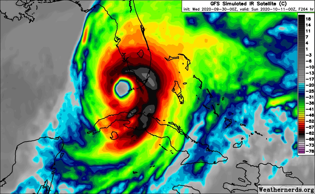
Overnight we had the Wilma sequel at 00z and then the Michael sequel at 06z. Long way to go with these solutions. Not too long ago the models had the first system impacting Florida and now they are burying it into the YP. Many variables to play out. But the general consensus is that the Western Caribbean is coming to life and is putting out warning signs.
5 likes
Fourth Generation Florida Native
Personal Storm History: David 79, Andrew 92, Erin 95, Floyd 99, Irene 99, Frances 04, Jeanne 04, Wilma 05, Matthew 16, Irma 17, Ian 22, Nicole 22, Milton 24


