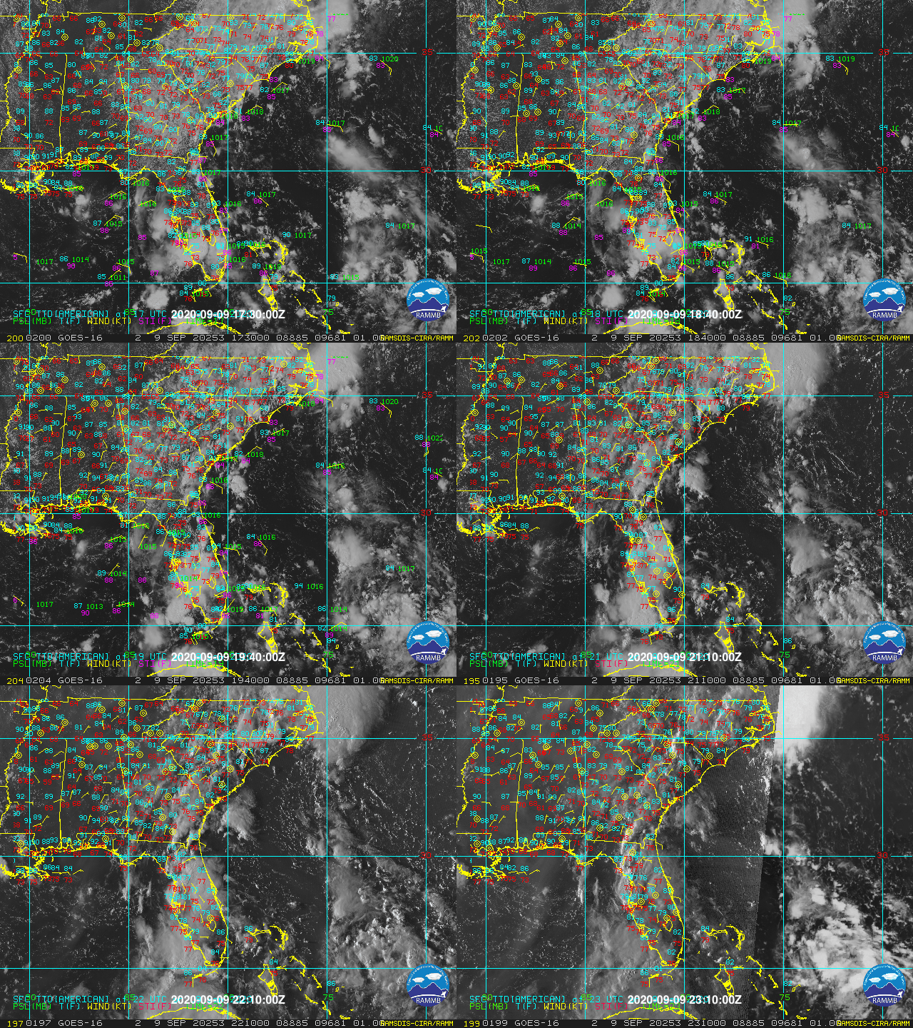
Disturbance over The Bahamas (Is Invest 96L)

This is the general tropical discussion area. Anyone can take their shot at predicting a storms path.

Moderator: S2k Moderators

Forum rules

The posts in this forum are NOT official forecasts and should not be used as such. They are just the opinion of the poster and may or may not be backed by sound meteorological data. They are NOT endorsed by any professional institution or STORM2K. For official information, please refer to products from the National Hurricane Center and National Weather Service.

Help Support Storm2K
Message
Author
User avatar
cycloneye
Admin
Admin
Posts: 145306
Age: 68
Joined: Thu Oct 10, 2002 10:54 am
Location: San Juan, Puerto Rico

Re: Mid Level Disturbance to the S of 94L

#21 Postby cycloneye » Wed Sep 09, 2020 6:29 pm

A large area of disorganized showers and thunderstorm is centered a
couple of hundred miles northeast of the Central Bahamas. This
system is forecast to drift westward and will likely be in the
vicinity of the Florida peninsula on Friday. Afterward, upper-level
conditions could become conducive for some development this weekend
while the system drifts west-northwestward over the eastern Gulf of
Mexico.
* Formation chance through 48 hours...low...near 0 percent.
* Formation chance through 5 days...low...20 percent.


Image
1 likes   
Visit the Caribbean-Central America Weather Thread where you can find at first post web cams,radars
and observations from Caribbean basin members Click Here

User avatar
AnnularCane
S2K Supporter
S2K Supporter
Posts: 2862
Joined: Thu Jun 08, 2006 9:18 am
Location: Wytheville, VA

Re: Mid Level Disturbance to the S of 94L

#22 Postby AnnularCane » Wed Sep 09, 2020 6:41 pm

Wow, you guys are good at this kind of thing. I was really not sure this would actually get a circle. :roflmao:
Last edited by AnnularCane on Wed Sep 09, 2020 6:46 pm, edited 1 time in total.
0 likes   

User avatar
toad strangler
S2K Supporter
S2K Supporter
Posts: 4543
Joined: Sun Jul 28, 2013 3:09 pm
Location: Earth
Contact:

Re: Mid Level Disturbance to the S of 94L

#23 Postby toad strangler » Wed Sep 09, 2020 6:41 pm

Homegrown Lemon
2 likes   

User avatar
gatorcane
S2K Supporter
S2K Supporter
Posts: 23691
Age: 47
Joined: Sun Mar 13, 2005 3:54 pm
Location: Boca Raton, FL

Re: Mid Level Disturbance to the S of 94L

#24 Postby gatorcane » Wed Sep 09, 2020 6:50 pm

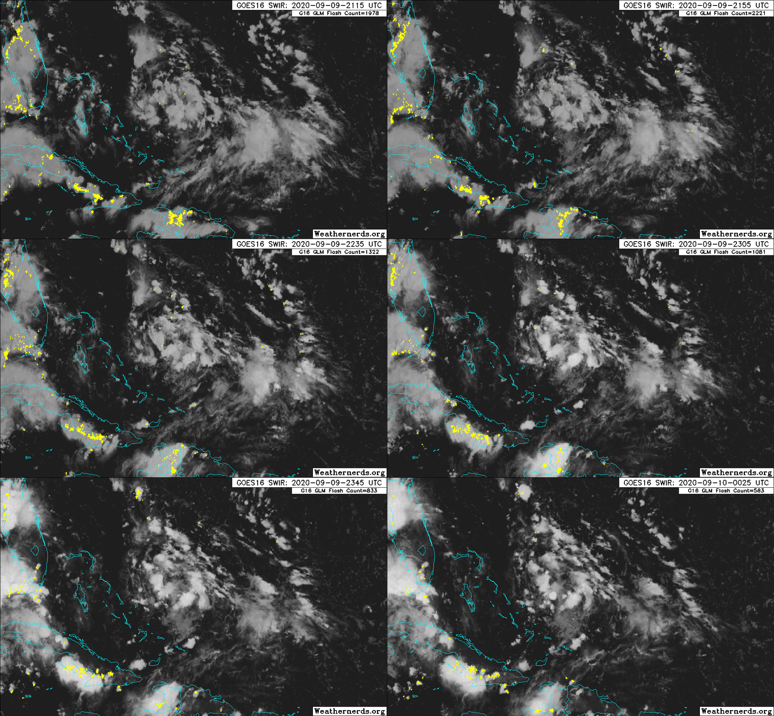
Saved loop:

Image
1 likes   

User avatar
HurricaneAndre2008
Category 1
Category 1
Posts: 334
Age: 27
Joined: Wed Jul 31, 2019 9:51 pm
Contact:

Gulf Area

#25 Postby HurricaneAndre2008 » Wed Sep 09, 2020 7:11 pm

This is about the 0/20 Gulf AOI.
0 likes   
Cindy(2005), Katrina(2005), Rita(2005), Erin(2007), Isaac(2012)

User avatar
SFLcane
S2K Supporter
S2K Supporter
Posts: 10163
Age: 47
Joined: Sat Jun 05, 2010 1:44 pm
Location: Lake Worth Florida

Re: Mid Level Disturbance to the S of 94L

#26 Postby SFLcane » Wed Sep 09, 2020 7:24 pm


I could see a TS before FL. Very low shear
0 likes   

User avatar
northjaxpro
S2K Supporter
S2K Supporter
Posts: 8900
Joined: Mon Sep 27, 2010 11:21 am
Location: Jacksonville, FL

Re: Mid Level Disturbance to the S of 94L

#27 Postby northjaxpro » Wed Sep 09, 2020 7:33 pm

Looking a bit better this evening. It would not take much convection to get this feature to manifest a surface reflection. The Mid-Level spin very evident near 26 N 73 W, Conditions are quite conducive with this feature being in a very moist environment and low wind shear.

This has the makings of a decent homegrown TC in the coming days as it drifts west.
1 likes   
NEVER, EVER SAY NEVER in the tropics and weather in general, and most importantly, with life itself!!

________________________________________________________________________________________

Fay 2008 Beryl 2012 Debby 2012 Colin 2016 Hermine 2016 Julia 2016 Matthew 2016 Irma 2017 Dorian 2019

User avatar
SFLcane
S2K Supporter
S2K Supporter
Posts: 10163
Age: 47
Joined: Sat Jun 05, 2010 1:44 pm
Location: Lake Worth Florida

Re: Mid Level Disturbance to the S of 94L

#28 Postby SFLcane » Wed Sep 09, 2020 7:40 pm

Image
2 likes   

SconnieCane
Category 4
Category 4
Posts: 998
Joined: Thu Aug 02, 2018 5:29 pm
Location: Madison, WI

Re: Mid Level Disturbance to the S of 94L

#29 Postby SconnieCane » Wed Sep 09, 2020 7:54 pm

That much-discussed AEW better hurry up and organize upon splashdown if it wants to be Sally.
0 likes   

jlauderdal
S2K Supporter
S2K Supporter
Posts: 7182
Joined: Wed May 19, 2004 5:46 am
Location: NE Fort Lauderdale
Contact:

Re: RE: Re: Mid Level Disturbance to the S of 94L

#30 Postby jlauderdal » Wed Sep 09, 2020 7:59 pm

SFLcane wrote:


I could see a TS before FL. Very low shear
Getting gas for the genny tomorrow
0 likes   

User avatar
boca
Category 5
Category 5
Posts: 6367
Age: 60
Joined: Mon Dec 15, 2003 8:49 am
Location: Boca Raton,FL

Re: Mid Level Disturbance to the S of 94L

#31 Postby boca » Wed Sep 09, 2020 8:03 pm

Good move jlauderdale but I don’t think this system will develop until after it crosses Florida but it’s good to be cautious since it has that circular look.
0 likes   

User avatar
northjaxpro
S2K Supporter
S2K Supporter
Posts: 8900
Joined: Mon Sep 27, 2010 11:21 am
Location: Jacksonville, FL

Re: Mid Level Disturbance to the S of 94L

#32 Postby northjaxpro » Wed Sep 09, 2020 8:11 pm

boca wrote:Good move jlauderdale but I don’t think this system will develop until after it crosses Florida but it’s good to be cautious since it has that circular look.


There is always a possibility that this system , given decent conditions, which this has right now, could spin up quickly as it drifts toward the Gulf Stream by Friday. There are very warm ssts over the Florida Straits and off the Southeast Florida Coast.

I too think it will be better positioned once in the Eastern Gulf, but hey, this is 2020. Anything goes this season seemingly.
Last edited by northjaxpro on Wed Sep 09, 2020 8:16 pm, edited 2 times in total.
1 likes   
NEVER, EVER SAY NEVER in the tropics and weather in general, and most importantly, with life itself!!

________________________________________________________________________________________

Fay 2008 Beryl 2012 Debby 2012 Colin 2016 Hermine 2016 Julia 2016 Matthew 2016 Irma 2017 Dorian 2019

User avatar
ElectricStorm
Category 5
Category 5
Posts: 5044
Age: 24
Joined: Tue Aug 13, 2019 11:23 pm
Location: Skiatook, OK / Norman, OK

Re: Mid Level Disturbance to the S of 94L

#33 Postby ElectricStorm » Wed Sep 09, 2020 8:15 pm

How good are conditions expected to be in the gulf? We don't need another storm RIing in there
0 likes   
B.S Meteorology, University of Oklahoma '25

Please refer to the NHC, NWS, or SPC for official information.

User avatar
aspen
Category 5
Category 5
Posts: 8818
Joined: Sat Oct 12, 2019 7:10 pm
Location: Connecticut, USA

Re: Mid Level Disturbance to the S of 94L

#34 Postby aspen » Wed Sep 09, 2020 8:17 pm

I see a semi-decent AOI approaching Florida and set to go into the Gulf, and all I think of is Hanna. I have a bit of a suspicion this could be another significant Gulf storm that the global models miss and have to play catch-up on. Is this expected to turn into the NE Gulf coast, or will it traverse across the Gulf like Hanna, or is it too early to tell?
3 likes   
Irene '11 Sandy '12 Hermine '16 5/15/2018 Derecho Fay '20 Isaias '20 Elsa '21 Henri '21 Ida '21

I am only a meteorology enthusiast who knows a decent amount about tropical cyclones. Look to the professional mets, the NHC, or your local weather office for the best information.

User avatar
boca
Category 5
Category 5
Posts: 6367
Age: 60
Joined: Mon Dec 15, 2003 8:49 am
Location: Boca Raton,FL

Re: Mid Level Disturbance to the S of 94L

#35 Postby boca » Wed Sep 09, 2020 8:18 pm

northjaxpro wrote:
boca wrote:Good move jlauderdale but I don’t think this system will develop until after it crosses Florida but it’s good to be cautious since it has that circular look.


There is always a possibility that this system , given decent conditions, which this has right now, could spin up quickly as it drifts toward the Gulf Stream by Friday. There are very warm ssts over the Florida Straits and off the Southeast Florida Coast.

I too think it will be better positioned once in the Eastern Gulf, but hey, this is 2020. Anything goes this season seemingly.


I agree on a side note Denver it snowed today and was 101 two days ago that’s bipolar weather.
0 likes   

ClarCari
Category 2
Category 2
Posts: 579
Joined: Thu Aug 13, 2020 11:02 am

Re: Mid Level Disturbance to the S of 94L

#36 Postby ClarCari » Wed Sep 09, 2020 8:21 pm

Weather Dude wrote:How good are conditions expected to be in the gulf? We don't need another storm RIing in there


Besides only moderate/weak shear thru next few days in the Western Gulf by lower Texas,...Pretty Good I’m afraid :/

The shear in the Eastern Mid-Atlantic looks like it’s easing up too some. This next week could be crazy..
0 likes   

User avatar
GeneratorPower
S2K Supporter
S2K Supporter
Posts: 1648
Age: 45
Joined: Sun Dec 18, 2005 11:48 pm
Location: Huntsville, AL

Re: Mid Level Disturbance to the S of 94L

#37 Postby GeneratorPower » Wed Sep 09, 2020 8:27 pm

The tracking of this disturbance over the Florida peninsula might bring a lot of rain to FL. Before Irma we had a lot of rain for several weeks beforehand. I’d be curious to know if previous disturbances tracking over an area indicates general steering flow, or otherwise changes the atmosphere to make future storms more likely to follow the same path. A la Francis and Jeanne 2004, Katrina and Rita 2005, etc.
0 likes   

User avatar
northjaxpro
S2K Supporter
S2K Supporter
Posts: 8900
Joined: Mon Sep 27, 2010 11:21 am
Location: Jacksonville, FL

Re: Mid Level Disturbance to the S of 94L

#38 Postby northjaxpro » Wed Sep 09, 2020 8:28 pm

aspen wrote:I see a semi-decent AOI approaching Florida and set to go into the Gulf, and all I think of is Hanna. I have a bit of a suspicion this could be another significant Gulf storm that the global models miss and have to play catch-up on. Is this expected to turn into the NE Gulf coast, or will it traverse across the Gulf like Hanna, or is it too early to tell?


The early guidance like EURO anf ICON, slowly drifted the mid-level feature across Florida and into the Eastern GOM this weekend , some others like the GFS Para drifted this up into North Florida.

I am looking forward to the next model run cycles coming up for sure
0 likes   
NEVER, EVER SAY NEVER in the tropics and weather in general, and most importantly, with life itself!!

________________________________________________________________________________________

Fay 2008 Beryl 2012 Debby 2012 Colin 2016 Hermine 2016 Julia 2016 Matthew 2016 Irma 2017 Dorian 2019

User avatar
northjaxpro
S2K Supporter
S2K Supporter
Posts: 8900
Joined: Mon Sep 27, 2010 11:21 am
Location: Jacksonville, FL

Re: Mid Level Disturbance to the S of 94L

#39 Postby northjaxpro » Wed Sep 09, 2020 8:32 pm

boca wrote:
northjaxpro wrote:
boca wrote:Good move jlauderdale but I don’t think this system will develop until after it crosses Florida but it’s good to be cautious since it has that circular look.


There is always a possibility that this system , given decent conditions, which this has right now, could spin up quickly as it drifts toward the Gulf Stream by Friday. There are very warm ssts over the Florida Straits and off the Southeast Florida Coast.

I too think it will be better positioned once in the Eastern Gulf, but hey, this is 2020. Anything goes this season seemingly.


I agree on a side note Denver it snowed today and was 101 two days ago that’s bipolar weather.


Exactly my point. 2020 hss been beyond unusual!
0 likes   
NEVER, EVER SAY NEVER in the tropics and weather in general, and most importantly, with life itself!!

________________________________________________________________________________________

Fay 2008 Beryl 2012 Debby 2012 Colin 2016 Hermine 2016 Julia 2016 Matthew 2016 Irma 2017 Dorian 2019

User avatar
ElectricStorm
Category 5
Category 5
Posts: 5044
Age: 24
Joined: Tue Aug 13, 2019 11:23 pm
Location: Skiatook, OK / Norman, OK

Re: Mid Level Disturbance to the S of 94L

#40 Postby ElectricStorm » Wed Sep 09, 2020 8:34 pm

ClarCari wrote:
Weather Dude wrote:How good are conditions expected to be in the gulf? We don't need another storm RIing in there


Besides only moderate/weak shear thru next few days in the Western Gulf by lower Texas,...Pretty Good I’m afraid :/

The shear in the Eastern Mid-Atlantic looks like it’s easing up too some. This next week could be crazy..

Not good... Welcome to September 2020 :double:
2 likes   
B.S Meteorology, University of Oklahoma '25

Please refer to the NHC, NWS, or SPC for official information.


Return to “Talkin' Tropics”

Who is online

Users browsing this forum: BobHarlem, facemane, nativefloridian, SFLcane, StormWeather, TomballEd and 48 guests