Concerns about a stronger/prolonged SE Ridge ... or a
Moderator: S2k Moderators
Forum rules
 The posts in this forum are NOT official forecast and should not be used as such. They are just the opinion of the poster and may or may not be backed by sound meteorological data. They are NOT endorsed by any professional institution or STORM2K.
 The posts in this forum are NOT official forecast and should not be used as such. They are just the opinion of the poster and may or may not be backed by sound meteorological data. They are NOT endorsed by any professional institution or STORM2K.
- Stormsfury
- Category 5

- Posts: 10549
- Age: 53
- Joined: Wed Feb 05, 2003 6:27 pm
- Location: Summerville, SC
Concerns about a stronger/prolonged SE Ridge ... or a
return to the Southeastern Ridge for the beginning of December ... based on the RSM ... basing just solely on some of this longer range model output (RSM) - Basing on some of the recent progs of a pattern change in mid/late November and seeing the RSM/GSM outputs leads me to believe otherwise (just a tempoary rest bit from the ridge then a reemergance of the ridge towards the end of November/beginning of December).


0 likes
- Stormsfury
- Category 5

- Posts: 10549
- Age: 53
- Joined: Wed Feb 05, 2003 6:27 pm
- Location: Summerville, SC
- Stormsfury
- Category 5

- Posts: 10549
- Age: 53
- Joined: Wed Feb 05, 2003 6:27 pm
- Location: Summerville, SC
Stormsfury wrote:Seems to me that the long range progs are calling for quite changeable patterns in the next 6 weeks to come (IMO, a more progressive overall but very changeable pattern) but hopefully when the cold comes, the timing will be right on time for winter (and some well placed moisture timing as well) ...
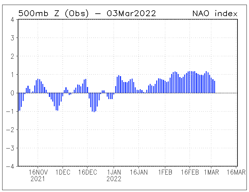
Just looking at some NAO forecasts - well, surprise, surprise, surprise...
The NAO is slightly NEG right now ... but looking at the mean ensemble forecasts ... the overall consensus ... NAO looks to tank NEG in the coming days ...
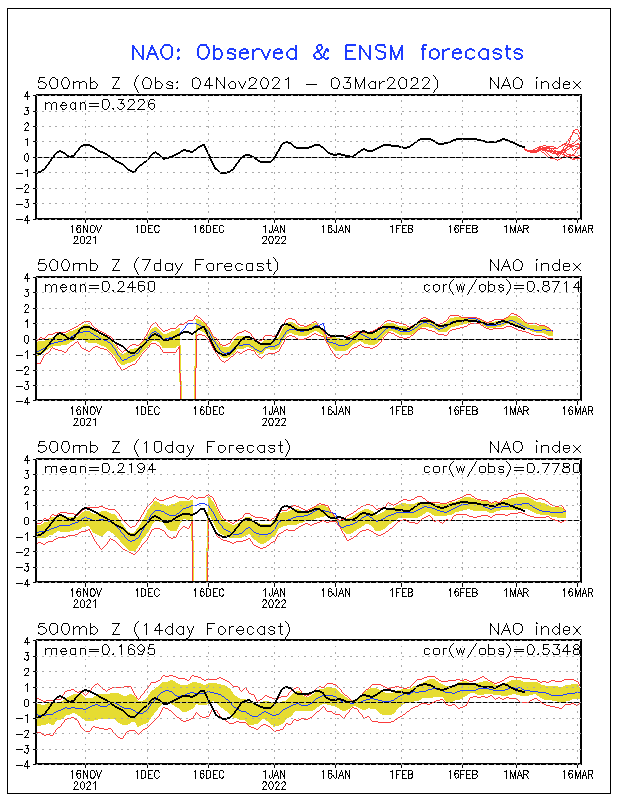
0 likes
- Stormsfury
- Category 5

- Posts: 10549
- Age: 53
- Joined: Wed Feb 05, 2003 6:27 pm
- Location: Summerville, SC
-
Guest
I dont know SF..................I think that ridge is gonna take a hard beating begining next week..............The question is "How strong will it be when (Or IF) it does reappear"?.................I do agree with the changeable pattern for the winter (Especially in the Eastern Areas of the US) Which means imo the storm track wont be far behind?????? See my snowfall and other updates thread)..................I think November is gonna be a wild month(As far as temps/precip/sorminess goes for most of the USA)..........
0 likes
- Stormsfury
- Category 5

- Posts: 10549
- Age: 53
- Joined: Wed Feb 05, 2003 6:27 pm
- Location: Summerville, SC
- Stormsfury
- Category 5

- Posts: 10549
- Age: 53
- Joined: Wed Feb 05, 2003 6:27 pm
- Location: Summerville, SC
-
donsutherland1
- S2K Analyst

- Posts: 2718
- Joined: Mon Sep 15, 2003 8:49 pm
- Location: New York
Re: Concerns about a stronger/prolonged SE Ridge ... or a
Stormsfury,
The RSM is not exactly the highest reliability model. While the beginning of December is far off, I believe the ridge is as likely to be centered somewhere between 55W and 65W (December 1-10 period) as it is to be where the RSM places it. This is not a high confidence idea, either given the timeframe involved.
Overall, I do believe that this winter will see significant variability, so episodes of ridging followed by troughing are likely in the East and certainly more so than last winter.
0 likes
- Stormsfury
- Category 5

- Posts: 10549
- Age: 53
- Joined: Wed Feb 05, 2003 6:27 pm
- Location: Summerville, SC
Re: Concerns about a stronger/prolonged SE Ridge ... or a
donsutherland1 wrote:Stormsfury,
The RSM is not exactly the highest reliability model. While the beginning of December is far off, I believe the ridge is as likely to be centered somewhere between 55W and 65W (December 1-10 period) as it is to be where the RSM places it. This is not a high confidence idea, either given the timeframe involved.
Overall, I do believe that this winter will see significant variability, so episodes of ridging followed by troughing are likely in the East and certainly more so than last winter.
Thanks Don for your input. Long range forecasting (outside of the tropics) isn't exactly something that I can specialize in ... just hoping for some input from the more knowledgable long range specialists. (I'm not afraid to say that this is an area that I want to learn more about).
SF
0 likes
- Stormsfury
- Category 5

- Posts: 10549
- Age: 53
- Joined: Wed Feb 05, 2003 6:27 pm
- Location: Summerville, SC
-
donsutherland1
- S2K Analyst

- Posts: 2718
- Joined: Mon Sep 15, 2003 8:49 pm
- Location: New York
Re: Concerns about a stronger/prolonged SE Ridge ... or a
The RSM forecasts can fluctuate wildly from week to week, as can those of its sister tool, the GSM. Bear in mind that, in part, this is a function of the time range involved. Overall, I wouldn't place high confidence in those outlooks; just consider it one of a number of factors. One should look for some kind of agreement with the other models that are available (if such agreement is strong, then somewhat higher confidence is warranted). Teleconnection indices, MJO, ENSO, even analogs (picking good analogs is almost an art in itself) etc., can all help refine such forecasts.
For example, the October 18 run depicted among the following temperature anomalies for the November 15-22 period:
Northeast: +4C to more than +8C
Middle Atlantic: Above +0C to just over +4C
Southeast: Below -4C to just above +0C
<img src="http://ecpc.ucsd.edu/imagedata/NSMD/RSM96/007d/T2MUSA60/a_t2musa2003101800.week_05.gif">
The October 25 run depicted among the following temperature anomalies for the November 15-22 period:
Northeast: Below -4C to near +0C
Middle Atlantic: Below -2C to near +0C
Southeast: Below -4C to just above +0C
<img src="http://ecpc.ucsd.edu/imagedata/NSMD/RSM96/007d/T2MUSA60/a_t2musa2003102500.week_04.gif">
0 likes
-
donsutherland1
- S2K Analyst

- Posts: 2718
- Joined: Mon Sep 15, 2003 8:49 pm
- Location: New York
Longer-Range Tools
A number of the other tools you might want to examine include:
<b>The Climate Prediction Center:</b>
Canonical Correlation Tool
Optimal Climate Normals
Coupled Ocean Atmosphere Model
Soil Moisture Regression Analysis
Probability of Exceedence
Brief Explanations
<b>International Research Institute for Climate Prediction:</b>
500 mb heights
Temperatures
Precipitation
<b>NCEP Climate Modeling Branch:</b>
Atmospheric General Circulation Model
0 likes
- LehighValleyForcaster
- Tropical Depression

- Posts: 56
- Joined: Tue Oct 21, 2003 4:28 am
- Location: The Greater Lehigh Valley, Penna. (Allentown, Bethlehem and Easton area)
After looking at several models, it still looks like the ridge will stay with us here in the Valley region and most parts of the North Eastern part of the state of Pa.
It does show though that there may be a brake to the ridge that will bring cooler temps about mid November.
Some of the models have changed from a much colder front to more of a milder conditions then earlier indications.
It is still yet difficult to really point out the accuracy of what will be coming our way.
We may just end up being in this strong ridge for at least the next month or two with some brakes and possible cold snaps that probably will not last that long.
I have seen these patterns before and we ended up with a late start winter and a very spring arrival.
This happens once in awhile but not often enough to get excited about.
I would like some winter type weather at least a couple times this year just to brake up the atmosphere around here.
All we can do is wait and watch the changes take place and then maybe we can be more accurate with our forecasting for the Northeast.
0 likes
-
Anonymous
The SE ridge is so strong that it is slowing the southeastward progression of the cold front and it has allowed a low to form along the front which will hold up the progression of the cold air long enough for the cold air to become significantly modified.
Already our northern Virginia forecasts concerning temps for the next couple of days are being modified toward milder readings.
We are now expected to hit 79 tomorrow. It was going to be 62 tomorrow.
Well, I love the SE ridge because it is bringing me more of my beloved OBX weather.
-Nags Head JEB
Already our northern Virginia forecasts concerning temps for the next couple of days are being modified toward milder readings.
We are now expected to hit 79 tomorrow. It was going to be 62 tomorrow.
Well, I love the SE ridge because it is bringing me more of my beloved OBX weather.
-Nags Head JEB
0 likes
-
LMolineux
- Category 1

- Posts: 297
- Joined: Sat Jun 14, 2003 7:25 pm
- Location: Outside of Philadelphia Delaware County Villanova Bryn Mawr Elevation 391'
- Contact:
Stormsfury wrote:Stormsfury wrote:Seems to me that the long range progs are calling for quite changeable patterns in the next 6 weeks to come (IMO, a more progressive overall but very changeable pattern) but hopefully when the cold comes, the timing will be right on time for winter (and some well placed moisture timing as well) ...
Just looking at some NAO forecasts - well, surprise, surprise, surprise...
The NAO is slightly NEG right now ... but looking at the mean ensemble forecasts ... the overall consensus ... NAO looks to tank NEG in the coming days ...
OK SF i got somethign for you to chew on.
The GFS hinting at something really odd after 200 hours out. Is it hinting at the same thign the NAO pattern si taking as well or is this not factored in yet?
Like here

0 likes
-
LMolineux
- Category 1

- Posts: 297
- Joined: Sat Jun 14, 2003 7:25 pm
- Location: Outside of Philadelphia Delaware County Villanova Bryn Mawr Elevation 391'
- Contact:
LMolineux wrote:Stormsfury wrote:Stormsfury wrote:Seems to me that the long range progs are calling for quite changeable patterns in the next 6 weeks to come (IMO, a more progressive overall but very changeable pattern) but hopefully when the cold comes, the timing will be right on time for winter (and some well placed moisture timing as well) ...
Just looking at some NAO forecasts - well, surprise, surprise, surprise...
The NAO is slightly NEG right now ... but looking at the mean ensemble forecasts ... the overall consensus ... NAO looks to tank NEG in the coming days ...
OK SF i got somethign for you to chew on.
The GFS hinting at something really odd after 200 hours out. Is it hinting at the same thign the NAO pattern si taking as well or is this not factored in yet?
Like here
Ok to add to the fire/snow. LOL
http://www.nco.ncep.noaa.gov/pmb/nwprod/analysis/namer//gfs/00/gfs_slp144162_m.shtml
and here.
to match the NAO goign negative forecast towards the 15th
http://www.nco.ncep.noaa.gov/pmb/nwprod/analysis/namer//gfs/00/gfs_slp168192_m.shtml
Take a quick lookie. And Tell me what ya think?
0 likes
Who is online
Users browsing this forum: No registered users and 177 guests


