ATL: LAURA - Post-Tropical - Discussion

Moderator: S2k Moderators

Message
Author
User avatar
sponger
S2K Supporter
S2K Supporter
Posts: 1622
Joined: Thu Jul 22, 2004 11:26 am
Location: St Augustine

Re: ATL: LAURA - Tropical Storm - Discussion

#2641 Postby sponger » Sun Aug 23, 2020 11:22 am

galvestontx wrote:Just booked 5 nights in San Antonio Hilton starting Thursday.


Seems a bit late to miss storm, but may allow you to miss a extended power outage. Tuesday looks best now but predicted arrival time of hurricanes is still stuck in the 19th century.
1 likes   
The following post is NOT an official forecast and should not be used as such. It is just the opinion of the poster and may or may not be backed by sound meteorological data. It is NOT endorsed by any professional institution including storm2k.org For Official Information please refer to the NHC and NWS products.

User avatar
eastcoastFL
Category 5
Category 5
Posts: 3923
Age: 43
Joined: Thu Apr 12, 2007 12:29 pm
Location: Palm City, FL

Re: ATL: LAURA - Tropical Storm - Discussion

#2642 Postby eastcoastFL » Sun Aug 23, 2020 11:25 am

Now that we have a good amount of Louisiana folks on the board what effects would a land falling cat 3/4 west of NOLA have on the city? I just keep thinking of how awful evacuations were with Katrina and how in the world they would handle this with Covid. I guess you can’t exactly squeeze everyone into the Saints stadium this time around. Do they have contingency plans in place already?
0 likes   
Personal Forecast Disclaimer:
The posts in this forum are NOT official forecast and should not be used as such. They are just the opinion of the poster and may or may not be backed by sound meteorological data. They are NOT endorsed by any professional institution or storm2k.org. For official information, please refer to the NHC and NWS products.

User avatar
EnnisTx
S2K Supporter
S2K Supporter
Posts: 896
Joined: Sat Dec 26, 2015 4:06 pm
Location: Albany, Texas
Contact:

Re: ATL: LAURA - Tropical Storm - Discussion

#2643 Postby EnnisTx » Sun Aug 23, 2020 11:27 am

tarheelprogrammer wrote:
toad strangler wrote:
stormlover2013 wrote:

It’s late August, water 90, this will be cat 3/4 mark it down


If I had to stick my neck out and make a prediction, which I really hate doing because it's always just a crapshoot, I'd bet on a Cat 4 through the Gulf and landfalling as a Cat 3


I am going with a strong cat 4 into east-central LA coast.


I don't see Laura going into East Central Louisiana at this point I wouldn't be surprised if it's more towards Galveston in the end. What strength? Who knows it could get ugly though.
0 likes   

User avatar
Kazmit
Category 5
Category 5
Posts: 2131
Age: 22
Joined: Mon Jul 25, 2016 8:49 am
Location: Bermuda

Re: ATL: LAURA - Tropical Storm - Discussion

#2644 Postby Kazmit » Sun Aug 23, 2020 11:28 am

TheAustinMan wrote:While the storms are different and headed on their own unique paths, the scene in the western Atlantic this morning is remarkably reminiscent of a similar scene in August 2004, with storms at similar intensities.

4.8 MB. Source: Bonnie/Charley image from the now defunct website Operational Significant Event Imagery. RGB composite of Marco and Laura made using data from NASA MSFC.
https://i.imgur.com/gigRAcu.png

Wow, nice use of the exact same satellite imagery. I couldn't even tell one was from 2004 and the other from 2020.
3 likes   
Igor 2010, Sandy 2012, Fay 2014, Gonzalo 2014, Joaquin 2015, Nicole 2016, Humberto 2019

I am only a tropical weather enthusiast. My predictions are not official and may or may not be backed by sound meteorological data. For official information, please refer to the NHC and NWS products.

Aric Dunn
Category 5
Category 5
Posts: 21238
Age: 42
Joined: Sun Sep 19, 2004 9:58 pm
Location: Ready for the Chase.
Contact:

Re: ATL: LAURA - Tropical Storm - Discussion

#2645 Postby Aric Dunn » Sun Aug 23, 2020 11:28 am

Image
5 likes   
Note: If I make a post that is brief. Please refer back to previous posts for the analysis or reasoning. I do not re-write/qoute what my initial post said each time.
If there is nothing before... then just ask :)

Space & Atmospheric Physicist, Embry-Riddle Aeronautical University,
I believe the sky is falling...

User avatar
PTrackerLA
Category 5
Category 5
Posts: 5277
Age: 41
Joined: Thu Oct 10, 2002 8:40 pm
Location: Lafayette, LA

Re: ATL: LAURA - Tropical Storm - Discussion

#2646 Postby PTrackerLA » Sun Aug 23, 2020 11:30 am

Laura has me concerned in Lafayette. Went to the store yesterday and will try to wrap up preps outside during the breezes from Marco tomorrow :lol: . This is probably the greatest threat to SE TX and SW/SC LA since 2008.
3 likes   

User avatar
eastcoastFL
Category 5
Category 5
Posts: 3923
Age: 43
Joined: Thu Apr 12, 2007 12:29 pm
Location: Palm City, FL

Re: ATL: LAURA - Tropical Storm - Discussion

#2647 Postby eastcoastFL » Sun Aug 23, 2020 11:30 am

Looking favorable up above

Image

And down below

Image
1 likes   
Personal Forecast Disclaimer:
The posts in this forum are NOT official forecast and should not be used as such. They are just the opinion of the poster and may or may not be backed by sound meteorological data. They are NOT endorsed by any professional institution or storm2k.org. For official information, please refer to the NHC and NWS products.

User avatar
ronjon
Category 5
Category 5
Posts: 4837
Joined: Fri Aug 19, 2005 5:17 pm
Location: Hernando Beach, FL

Re: ATL: LAURA - Tropical Storm - Discussion

#2648 Postby ronjon » Sun Aug 23, 2020 11:32 am

Michele B wrote:
sponger wrote:
SoupBone wrote:
Right, and I guess that's my point. Following in Marco's weakness, at least mostly, would still lend itself to a Central Louisiana solution unless the ridge builds back in faster than expected behind Marco. So Marco's timing and placement will be key to Laura's ultimate arrival track.


"unless the ridge builds back in"
That is exactly what the Euro is forecasting. It seems to have a better grasp than the GPS on the more Southern track over Cuba and may end up nailing the expanding ridge as well.


“Unless the ridge builds back in...”

Will Marco “push” the ridge?
Will he “punch” through it?

I don’t understand how that happens. I don’t remember hearing about this phenomenon before.

I thought a hurricane has to “run around” and was “steered”. By a HP ridge.

I thought a ridge builds or recedes based on jet stream movement?

Can someone enlighten me what this means and how it works?


Strong ridges do steer tropical systems, even the most intense. Physics makes tropical cyclones always want to go poleward (north) once they reach mid-latitude westerlies (higher atmospheric winds that move most systems from west to east). Strong ridging can prevent that northward path. The discussion with this storm is that other tropical systems near the pathway of Laura could be strong enough (up into the midlevels of the atmosphere) to temporarily weaken the western edge of the Atlantic ridge...enough to cause Laura to feel that weakness and move into it...at least for a short period of time. Its temporary though as the other system is moving or can weaken, which would allow the western extension of the ridge to build back in.
1 likes   

User avatar
Nimbus
Category 5
Category 5
Posts: 5341
Joined: Mon Jul 19, 2004 10:54 am

Re: ATL: LAURA - Tropical Storm - Discussion

#2649 Postby Nimbus » Sun Aug 23, 2020 11:33 am

Visioen wrote:I'm thinking about a worst case scenario where the LLC smashes itself against the hight terrain on the eastern side of Cuba, after which a new one forms under the convection of the MLC and the system goes just south of Cuba over the extremely warm waters there. Not saying this will happen, just a hypothetical scenario that seems possible to me.


Macaya mountain range looks like it has tightened up the center just a few miles north off the coast.
That *might* mean a track a little further south of Cuban coastline with more time to strengthen next update.
Laura probably isn't in the mood for a rapid spin up after trekking over the mountains but if she were stronger she might take a slightly more poleward wobble earlier.
A lot to watch, recon has been a huge help finding these vorts!
3 likes   

Aric Dunn
Category 5
Category 5
Posts: 21238
Age: 42
Joined: Sun Sep 19, 2004 9:58 pm
Location: Ready for the Chase.
Contact:

Re: ATL: LAURA - Tropical Storm - Discussion

#2650 Postby Aric Dunn » Sun Aug 23, 2020 11:36 am

West it is.. and wrapping up fast.. if it does not start moving north of west it will just clip the SW portion of the mountains..


Image
4 likes   
Note: If I make a post that is brief. Please refer back to previous posts for the analysis or reasoning. I do not re-write/qoute what my initial post said each time.
If there is nothing before... then just ask :)

Space & Atmospheric Physicist, Embry-Riddle Aeronautical University,
I believe the sky is falling...

St0rmTh0r
Category 1
Category 1
Posts: 369
Joined: Tue Jul 14, 2020 8:04 pm

Re: ATL: LAURA - Tropical Storm - Discussion

#2651 Postby St0rmTh0r » Sun Aug 23, 2020 11:39 am

This year will be one for the books. Laura taking path of least resistance. Cant believe it managed to organize over land now it's over water. If I lived in the path of this I'd leave.
1 likes   

shah83
Category 1
Category 1
Posts: 302
Joined: Sun Jul 31, 2016 4:55 pm

Re: ATL: LAURA - Tropical Storm - Discussion

#2652 Postby shah83 » Sun Aug 23, 2020 11:41 am

And that close to the radar tower probably means we are looking at the low level center.
1 likes   

User avatar
ronjon
Category 5
Category 5
Posts: 4837
Joined: Fri Aug 19, 2005 5:17 pm
Location: Hernando Beach, FL

Re: ATL: LAURA - Tropical Storm - Discussion

#2653 Postby ronjon » Sun Aug 23, 2020 11:42 am

I think since Laura is relatively weak shes getting pushed hard by strengthening ridge to the north. Ridge is probably pretty strong at both low and midlevels. She'll probably remain pretty blob-like until reemergence off the NW tip of Cuba.
0 likes   

St0rmTh0r
Category 1
Category 1
Posts: 369
Joined: Tue Jul 14, 2020 8:04 pm

Re: ATL: LAURA - Tropical Storm - Discussion

#2654 Postby St0rmTh0r » Sun Aug 23, 2020 11:43 am

Nimbus wrote:
Visioen wrote:I'm thinking about a worst case scenario where the LLC smashes itself against the hight terrain on the eastern side of Cuba, after which a new one forms under the convection of the MLC and the system goes just south of Cuba over the extremely warm waters there. Not saying this will happen, just a hypothetical scenario that seems possible to me.


Macaya mountain range looks like it has tightened up the center just a few miles north off the coast.
That *might* mean a track a little further south of Cuban coastline with more time to strengthen next update.
Laura probably isn't in the mood for a rapid spin up after trekking over the mountains but if she were stronger she might take a slightly more poleward wobble earlier.
A lot to watch, recon has been a huge help finding these vorts!

How do the mountains tighten up the center? Can someone explain how this process works? I always see people mentioning this
0 likes   

User avatar
Tireman4
S2K Supporter
S2K Supporter
Posts: 5853
Age: 59
Joined: Fri Jun 30, 2006 1:08 pm
Location: Humble, Texas
Contact:

Re: ATL: LAURA - Tropical Storm - Discussion

#2655 Postby Tireman4 » Sun Aug 23, 2020 11:43 am

eastcoastFL wrote:
TheStormExpert wrote:A developing and organizing TC over Hispaniola!? :eek: 2020 never ceases to surprise! And to think a few days ago I was starting to write this storm off due to its very crappy appearance.

All in all it looks like a major hurricane landfall is becoming more and more likely for someone along the U.S. Gulf Coast mid-week.
:double:

https://s7.gifyu.com/images/goes16_vis_13L_202008231132.gif


I don’t think I’ll be writing off any storms until they actually dissipate. Anything is possible during peak season


Indeed. Dr. Neil Frank has said this over and over and over!!
3 likes   

Nederlander
S2K Supporter
S2K Supporter
Posts: 1251
Joined: Sat Jul 19, 2008 4:28 pm
Location: Conroe, TX

Re: ATL: LAURA - Tropical Storm - Discussion

#2656 Postby Nederlander » Sun Aug 23, 2020 11:45 am

St0rmTh0r wrote:
Nimbus wrote:
Visioen wrote:I'm thinking about a worst case scenario where the LLC smashes itself against the hight terrain on the eastern side of Cuba, after which a new one forms under the convection of the MLC and the system goes just south of Cuba over the extremely warm waters there. Not saying this will happen, just a hypothetical scenario that seems possible to me.


Macaya mountain range looks like it has tightened up the center just a few miles north off the coast.
That *might* mean a track a little further south of Cuban coastline with more time to strengthen next update.
Laura probably isn't in the mood for a rapid spin up after trekking over the mountains but if she were stronger she might take a slightly more poleward wobble earlier.
A lot to watch, recon has been a huge help finding these vorts!

How do the mountains tighten up the center? Can someone explain how this process works? I always see people mentioning this

Friction. Same thing happens when a storm makes landfall, even in flat areas. You can often see the eye contract as it nears the coast, like it’s being squeezed.
Last edited by Nederlander on Sun Aug 23, 2020 11:46 am, edited 1 time in total.
1 likes   

NevadaFan18
Tropical Depression
Tropical Depression
Posts: 51
Joined: Fri Aug 21, 2020 1:51 pm

Re: ATL: LAURA - Tropical Storm - Discussion

#2657 Postby NevadaFan18 » Sun Aug 23, 2020 11:45 am

0 likes   

User avatar
Nimbus
Category 5
Category 5
Posts: 5341
Joined: Mon Jul 19, 2004 10:54 am

Re: ATL: LAURA - Tropical Storm - Discussion

#2658 Postby Nimbus » Sun Aug 23, 2020 11:46 am

St0rmTh0r wrote:
Nimbus wrote:
Visioen wrote:I'm thinking about a worst case scenario where the LLC smashes itself against the hight terrain on the eastern side of Cuba, after which a new one forms under the convection of the MLC and the system goes just south of Cuba over the extremely warm waters there. Not saying this will happen, just a hypothetical scenario that seems possible to me.


Macaya mountain range looks like it has tightened up the center just a few miles north off the coast.
That *might* mean a track a little further south of Cuban coastline with more time to strengthen next update.
Laura probably isn't in the mood for a rapid spin up after trekking over the mountains but if she were stronger she might take a slightly more poleward wobble earlier.


A lot to watch, recon has been a huge help finding these vorts!
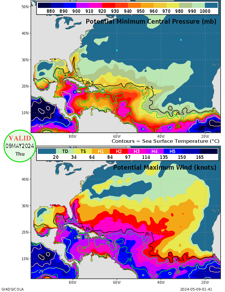
How do the mountains tighten up the center? Can someone explain how this process works? I always see people mentioning this


The 8000 foot mountains create a sort of wind tunnel for those winds on the south side of the circulation in this case increasing the spin rate of the core winds.
1 likes   

Visioen
S2K Supporter
S2K Supporter
Posts: 286
Joined: Sat Sep 02, 2017 2:08 pm
Location: Belgium, Europe

Re: ATL: LAURA - Tropical Storm - Discussion

#2659 Postby Visioen » Sun Aug 23, 2020 11:47 am

St0rmTh0r wrote:
Nimbus wrote:
Visioen wrote:I'm thinking about a worst case scenario where the LLC smashes itself against the hight terrain on the eastern side of Cuba, after which a new one forms under the convection of the MLC and the system goes just south of Cuba over the extremely warm waters there. Not saying this will happen, just a hypothetical scenario that seems possible to me.


Macaya mountain range looks like it has tightened up the center just a few miles north off the coast.
That *might* mean a track a little further south of Cuban coastline with more time to strengthen next update.
Laura probably isn't in the mood for a rapid spin up after trekking over the mountains but if she were stronger she might take a slightly more poleward wobble earlier.
A lot to watch, recon has been a huge help finding these vorts!

How do the mountains tighten up the center? Can someone explain how this process works? I always see people mentioning this

I believe it is because of frictional convergence. http://glossary.ametsoc.org/wiki/Frictional_convergence
0 likes   

Michele B
S2K Supporter
S2K Supporter
Posts: 1115
Joined: Thu Aug 25, 2016 8:08 am
Location: SWFL

Re: ATL: LAURA - Tropical Storm - Discussion

#2660 Postby Michele B » Sun Aug 23, 2020 12:21 pm

ronjon wrote:
Michele B wrote:
sponger wrote:
"unless the ridge builds back in"
That is exactly what the Euro is forecasting. It seems to have a better grasp than the GPS on the more Southern track over Cuba and may end up nailing the expanding ridge as well.


“Unless the ridge builds back in...”

Will Marco “push” the ridge?
Will he “punch” through it?

I don’t understand how that happens. I don’t remember hearing about this phenomenon before.

I thought a hurricane has to “run around” and was “steered”. By a HP ridge.

I thought a ridge builds or recedes based on jet stream movement?

Can someone enlighten me what this means and how it works?


Strong ridges do steer tropical systems, even the most intense. Physics makes tropical cyclones always want to go poleward (north) once they reach mid-latitude westerlies (higher atmospheric winds that move most systems from west to east). Strong ridging can prevent that northward path. The discussion with this storm is that other tropical systems near the pathway of Laura could be strong enough (up into the midlevels of the atmosphere) to temporarily weaken the western edge of the Atlantic ridge...enough to cause Laura to feel that weakness and move into it...at least for a short period of time. Its temporary though as the other system is moving or can weaken, which would allow the western extension of the ridge to build back in.


That makes sense!

Thanks. ron!!!

:wink:
0 likes   
Cleo - 1964, Betsy - 1965, David - 1979, Andrew - 1992, Charlie (Francis, Ivan, Jeanne) - 2004, Irma - 2017, Ian - 2022


Return to “2020”

Who is online

Users browsing this forum: No registered users and 29 guests