what you trying show?stormwatcher95 wrote:https://i.imgur.com/56PrFDS.jpg
ATL: LAURA - Post-Tropical - Discussion
Moderator: S2k Moderators
-
floridasun78
- Category 5

- Posts: 3755
- Joined: Sun May 17, 2009 10:16 pm
- Location: miami fl
Re: ATL: LAURA - Tropical Storm - Discussion
0 likes

Re: ATL: LAURA - Tropical Storm - Discussion
wicked_wx_watcher wrote:What is the probability, if any, of Laura making a westward jog back for a Texas landfall?
This story is far from being over, lots of variables left in play. SETX is still very much still in play at this point.
3 likes
Personal Forecast Disclaimer:
The posts in this forum are NOT official forecast and should not be used as such. They are just the opinion of the poster and may or may not be backed by sound meteorological data. They are NOT endorsed by any professional institution or storm2k.org. For official information, please refer to the NHC and NWS products.
The posts in this forum are NOT official forecast and should not be used as such. They are just the opinion of the poster and may or may not be backed by sound meteorological data. They are NOT endorsed by any professional institution or storm2k.org. For official information, please refer to the NHC and NWS products.
-
Nederlander
- S2K Supporter

- Posts: 1252
- Joined: Sat Jul 19, 2008 4:28 pm
- Location: Conroe, TX
Re: ATL: LAURA - Tropical Storm - Discussion
wicked_wx_watcher wrote:What is the probability, if any, of Laura making a westward jog back for a Texas landfall?
Very much still in play depending on the strength of the ridge building back in
4 likes
-
stormwatcher95
- Tropical Low

- Posts: 27
- Joined: Tue Sep 10, 2019 1:01 pm
Re: ATL: LAURA - Tropical Storm - Discussion
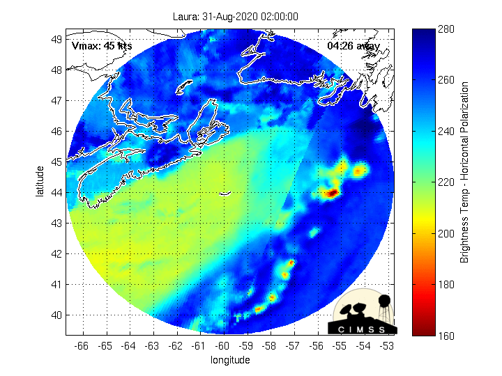
floridasun78 wrote:what you trying show?stormwatcher95 wrote:https://i.imgur.com/56PrFDS.jpg
Just updating on the current microwave presentation. Some of the mets here add thoughts.
Last edited by stormwatcher95 on Sat Aug 22, 2020 6:23 pm, edited 2 times in total.
0 likes
-
Keldeo1997
- Category 2

- Posts: 688
- Joined: Fri Oct 11, 2019 11:35 pm


-
sphelps8681
- Category 2
- Posts: 785
- Joined: Thu Aug 16, 2007 5:37 pm
- Location: Somewhere over the rainbow
Re: ATL: LAURA - Tropical Storm - Discussion
It seems that tracks are going more east. But for Laura I am a little hesitant to think it will be Louisiana track as so many now are forecasting. One local met in my area says we are in the clear another says just the opposite. The NWS Lake Charles says we won't know until tomorrow or Monday. Kinda of confusing and may put people a little lax in if it will come their way. We are still in the cone and it seems like weather channels are like this is all Louisiana. I know all this can change by morning but it seems they should say we don't know all things instead of all things are going to have a certain outcome. Not sure if I should still be prepared or go to the beach and do a little fishing. UGH!!
0 likes

Re: ATL: LAURA - Tropical Storm - Discussion
Based on the final visible frames for today, the overall wave envelope is offset a little to the north, and the mean center is around the NE tip of the DR.
0 likes
Irene '11 Sandy '12 Hermine '16 5/15/2018 Derecho Fay '20 Isaias '20 Elsa '21 Henri '21 Ida '21
I am only a meteorology enthusiast who knows a decent amount about tropical cyclones. Look to the professional mets, the NHC, or your local weather office for the best information.
I am only a meteorology enthusiast who knows a decent amount about tropical cyclones. Look to the professional mets, the NHC, or your local weather office for the best information.
-
eastcoastFL

- Category 5
- Posts: 3996
- Age: 44
- Joined: Thu Apr 12, 2007 12:29 pm
- Location: Palm City, FL
Re: ATL: LAURA - Tropical Storm - Discussion
It’s hard to find the center but it looks like it’s heading on shore at the NE edge of DR but I could be very wrong
I’m using Arics tool
https://realearth.ssec.wisc.edu/?produc ... imate=true
I’m using Arics tool
https://realearth.ssec.wisc.edu/?produc ... imate=true
3 likes
Personal Forecast Disclaimer:
The posts in this forum are NOT official forecast and should not be used as such. They are just the opinion of the poster and may or may not be backed by sound meteorological data. They are NOT endorsed by any professional institution or storm2k.org. For official information, please refer to the NHC and NWS products.
The posts in this forum are NOT official forecast and should not be used as such. They are just the opinion of the poster and may or may not be backed by sound meteorological data. They are NOT endorsed by any professional institution or storm2k.org. For official information, please refer to the NHC and NWS products.
-
eastcoastFL
- Category 5
- Posts: 3996
- Age: 44
- Joined: Thu Apr 12, 2007 12:29 pm
- Location: Palm City, FL
Re: ATL: LAURA - Tropical Storm - Discussion
stormwatcher95 wrote:floridasun78 wrote:what you trying show?stormwatcher95 wrote:https://i.imgur.com/56PrFDS.jpg
Just updating on the current microwave presentation. Some of the mets here add thoughts.
You can really see how it’s structure shaped up quick over the last 24hrs
5 likes
Personal Forecast Disclaimer:
The posts in this forum are NOT official forecast and should not be used as such. They are just the opinion of the poster and may or may not be backed by sound meteorological data. They are NOT endorsed by any professional institution or storm2k.org. For official information, please refer to the NHC and NWS products.
The posts in this forum are NOT official forecast and should not be used as such. They are just the opinion of the poster and may or may not be backed by sound meteorological data. They are NOT endorsed by any professional institution or storm2k.org. For official information, please refer to the NHC and NWS products.
-
eastcoastFL
- Category 5
- Posts: 3996
- Age: 44
- Joined: Thu Apr 12, 2007 12:29 pm
- Location: Palm City, FL
Re: ATL: LAURA - Tropical Storm - Discussion
aspen wrote:Based on the final visible frames for today, the overall wave envelope is offset a little to the north, and the mean center is around the NE tip of the DR.
I was just saying the same thing. But I wasn’t sure. It was hard to identify
0 likes
Personal Forecast Disclaimer:
The posts in this forum are NOT official forecast and should not be used as such. They are just the opinion of the poster and may or may not be backed by sound meteorological data. They are NOT endorsed by any professional institution or storm2k.org. For official information, please refer to the NHC and NWS products.
The posts in this forum are NOT official forecast and should not be used as such. They are just the opinion of the poster and may or may not be backed by sound meteorological data. They are NOT endorsed by any professional institution or storm2k.org. For official information, please refer to the NHC and NWS products.
-
ConvergenceZone
.gif)
- Category 5
- Posts: 5241
- Joined: Fri Jul 29, 2005 1:40 am
- Location: Northern California
Re: ATL: LAURA - Tropical Storm - Discussion
ObsessedMiami wrote:ConvergenceZone wrote:
Hopefully the keys won't have to worry about a hurricane this season. They know they don't need to worry about Laura being a hurricane in that area, but there's still quite a bit of hurricane season left though.. Hopefully if the Keys get tropical storm winds from laura,it won't be too bad.
They know? No one can be certain. Not until it passes your location. If I lived in the Keys, I would be watching carefully the next 24 hours
Oh, I think tropical storm winds are definitely possible in the keys....They even mentioned that on the weather channel
0 likes

Re: ATL: LAURA - Tropical Storm - Discussion
wicked_wx_watcher wrote:What is the probability, if any, of Laura making a westward jog back for a Texas landfall?
A fair amount of the 12z EPS member show the Texas landfall scenario very much on the table.
0 likes
Very useful information on the Dvorak Technique --
https://severe.worldweather.wmo.int/TCF ... kBeven.pdf
https://severe.worldweather.wmo.int/TCF ... kBeven.pdf

Re: ATL: LAURA - Tropical Storm - Discussion
sphelps8681 wrote:It seems that tracks are going more east. But for Laura I am a little hesitant to think it will be Louisiana track as so many now are forecasting. One local met in my area says we are in the clear another says just the opposite. The NWS Lake Charles says we won't know until tomorrow or Monday. Kinda of confusing and may put people a little lax in if it will come their way. We are still in the cone and it seems like weather channels are like this is all Louisiana. I know all this can change by morning but it seems they should say we don't know all things instead of all things are going to have a certain outcome. Not sure if I should still be prepared or go to the beach and do a little fishing. UGH!!
It seems to me like things will continue to be very uncertain until we see how Laura gets through the islands, which unfortunately will take a couple days to play out.
Here in the Houston metro lots of people seem to think the threat is over. I know for myself I’m still very concerned about Laura and moderately concerned about Marco in terms of flooding.
3 likes
-
eastcoastFL
- Category 5
- Posts: 3996
- Age: 44
- Joined: Thu Apr 12, 2007 12:29 pm
- Location: Palm City, FL
Re: ATL: LAURA - Tropical Storm - Discussion
So the nhc is putting the center on the SE tip of DR?
SUMMARY OF 800 PM AST...0000 UTC...INFORMATION
----------------------------------------------
LOCATION...18.1N 68.7W
ABOUT 85 MI...135 KM ESE OF SANTO DOMINGO DOMINICAN REPUBLIC
MAXIMUM SUSTAINED WINDS...50 MPH...85 KM/H
PRESENT MOVEMENT...W OR 280 DEGREES AT 18 MPH...30 KM/H
MINIMUM CENTRAL PRESSURE...1004 MB...29.65 INCHES
0 likes
Personal Forecast Disclaimer:
The posts in this forum are NOT official forecast and should not be used as such. They are just the opinion of the poster and may or may not be backed by sound meteorological data. They are NOT endorsed by any professional institution or storm2k.org. For official information, please refer to the NHC and NWS products.
The posts in this forum are NOT official forecast and should not be used as such. They are just the opinion of the poster and may or may not be backed by sound meteorological data. They are NOT endorsed by any professional institution or storm2k.org. For official information, please refer to the NHC and NWS products.
-
MississippiWx

- S2K Supporter
- Posts: 1705
- Joined: Sat Aug 14, 2010 1:44 pm
- Location: Hattiesburg, Mississippi
Re: ATL: LAURA - Tropical Storm - Discussion
eastcoastFL wrote:MississippiWx wrote:eastcoastFL wrote:
Recon is heading that way now from Florida
https://www.tropicaltidbits.com/recon/recon_NOAA3-0613A-LAURA_dropsondes.png
That’s another upper level dropsonde mission.
Recon is on the ground until tomorrow.
I think it’s a regular recon mission. It says surface to 10000
FLIGHT TWO - NOAA 43
A. 22/2330Z
B. NOAA3 0713A LAURA
C. 22/2100Z
D. 19.5N
E. 22/2300Z TO 23/0400Z
F. SFC TO 10,000 FT
Yeah, that’s my fault.
I read a tweet from a hurricane hunter earlier today. Think he was just referring to his individual crew being grounded for the rest of the day, not all flights. Oops!
1 likes
This post is not an official forecast and should not be used as such. It is just the opinion of MississippiWx and may or may not be backed by sound meteorological data. It is not endorsed by any professional institution including storm2k.org. For Official Information please refer to the NHC and NWS products.

Re: ATL: LAURA - Tropical Storm - Discussion
Recon mission number 6 has been flying down into the Mona passage, 45 knot winds just north of Hispaniola.
They might spot that mesovort or confirm the NHC location further south.
They might spot that mesovort or confirm the NHC location further south.
0 likes
-
Keldeo1997
- Category 2
- Posts: 688
- Joined: Fri Oct 11, 2019 11:35 pm


Re: ATL: LAURA - Tropical Storm - Discussion
eastcoastFL wrote:So the nhc is putting the center on the SE tip of DR?
SUMMARY OF 800 PM AST...0000 UTC...INFORMATION
----------------------------------------------
LOCATION...18.1N 68.7W
ABOUT 85 MI...135 KM ESE OF SANTO DOMINGO DOMINICAN REPUBLIC
MAXIMUM SUSTAINED WINDS...50 MPH...85 KM/H
PRESENT MOVEMENT...W OR 280 DEGREES AT 18 MPH...30 KM/H
MINIMUM CENTRAL PRESSURE...1004 MB...29.65 INCHES
They always go with continuity when the plane is out there en route until it's confirmed otherwise. Same reason we'll see strengthening hurricanes just seemingly stop and then jump quite a bit when the plane arrives.
0 likes
The above post is not official and should not be used as such. It is the opinion of the poster and may or may not be backed by sound meteorological data. It is not endorsed by any professional institution or storm2k.org. For official information, please refer to the NHC and NWS products.

Re: ATL: LAURA - Tropical Storm - Discussion
Recon finding impressive winds, but they may be enhanced by the Mona passage.
0 likes
Igor 2010, Sandy 2012, Fay 2014, Gonzalo 2014, Joaquin 2015, Nicole 2016, Humberto 2019, Imelda 2025
I am only a tropical weather enthusiast. My predictions are not official and may or may not be backed by sound meteorological data. For official information, please refer to the NHC and NWS products.
I am only a tropical weather enthusiast. My predictions are not official and may or may not be backed by sound meteorological data. For official information, please refer to the NHC and NWS products.
-
TheStormExpert
Re: ATL: LAURA - Tropical Storm - Discussion
Let’s all hope Laura struggles with dry air and shear like Marco is when it enters the Gulf or else it could be a significant storm.
4 likes
Who is online
Users browsing this forum: No registered users and 24 guests