ATL: GONZALO - Remnants - Discussion

Moderator: S2k Moderators

Message
Author
User avatar
TheProfessor
Professional-Met
Professional-Met
Posts: 3506
Age: 28
Joined: Tue Dec 03, 2013 10:56 am
Location: Wichita, Kansas

Re: ATL: GONZALO - Tropical Storm- Discussion

#701 Postby TheProfessor » Wed Jul 22, 2020 8:22 pm

gatorcane wrote:The Euro continues to show pretty steady weakening over the next couple of days. I wouldn’t discount the Euro here. It could be right looking at the state of struggling Gonzalo this evening. May not make it to a hurricane.


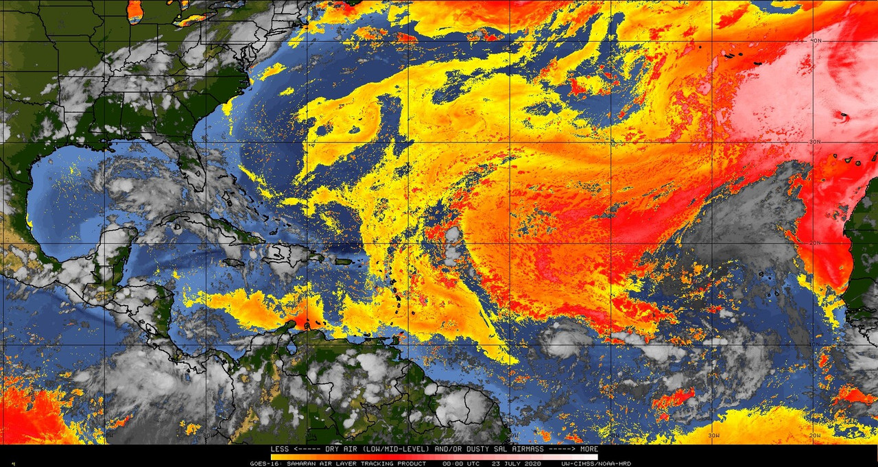
The Euro might be right, but it's sort of for the wrong reasons. It's continuously had to play catch up with this storm and had underestimated it's current intensity as well. Due to this it's seeing a weaker system in a more hostile environment and likely correctly weakening it in that case. But because of that the Euro is riding a fine line since if Gonzalo is able to fight this bout of dry air and become a hurricane, then the Euro will be completely wrong.
8 likes   
An alumnus of The Ohio State University.

Your local National Weather Service office is your best source for weather information.

AutoPenalti
Category 5
Category 5
Posts: 4030
Age: 29
Joined: Mon Aug 17, 2015 4:16 pm
Location: Ft. Lauderdale, Florida

Re: ATL: GONZALO - Tropical Storm- Discussion

#702 Postby AutoPenalti » Wed Jul 22, 2020 8:26 pm

Gonzalo shrunk in size but it’s definitely trying to stay alive.
0 likes   
The posts in this forum are NOT official forecasts and should not be used as such. They are just the opinion of the poster and may or may not be backed by sound meteorological data. They are NOT endorsed by any professional institution or STORM2K. For official information, please refer to products from the NHC and NWS.


Model Runs Cheat Sheet:
GFS (5:30 AM/PM, 11:30 AM/PM)
HWRF, GFDL, UKMET, NAVGEM (6:30-8:00 AM/PM, 12:30-2:00 AM/PM)
ECMWF (1:45 AM/PM)

TCVN
is a weighted averaged

Aric Dunn
Category 5
Category 5
Posts: 21238
Age: 42
Joined: Sun Sep 19, 2004 9:58 pm
Location: Ready for the Chase.
Contact:

Re: ATL: GONZALO - Tropical Storm- Discussion

#703 Postby Aric Dunn » Wed Jul 22, 2020 8:28 pm

Hammy wrote:Anybody else notice the massive rush of air outward away from Gonzalo to the west? It's starting to take on the look of a highly sheared fast mover that's more typical of this time of the year.


it also went north and east and south earlier..

I believe it was some mid level pressure wave from the sustained convection earlier.
1 likes   
Note: If I make a post that is brief. Please refer back to previous posts for the analysis or reasoning. I do not re-write/qoute what my initial post said each time.
If there is nothing before... then just ask :)

Space & Atmospheric Physicist, Embry-Riddle Aeronautical University,
I believe the sky is falling...

User avatar
NDG
S2K Supporter
S2K Supporter
Posts: 15446
Joined: Sun Jul 09, 2006 10:14 pm
Location: Orlando, FL

Re: ATL: GONZALO - Tropical Storm- Discussion

#704 Postby NDG » Wed Jul 22, 2020 8:30 pm

Aric Dunn wrote:
Hammy wrote:Anybody else notice the massive rush of air outward away from Gonzalo to the west? It's starting to take on the look of a highly sheared fast mover that's more typical of this time of the year.


it also went north and east and south earlier..

I believe it was some mid level pressure wave from the sustained convection earlier.


Yes, is not at the surface.
1 likes   

User avatar
Ivanhater
Storm2k Moderator
Storm2k Moderator
Posts: 11161
Age: 38
Joined: Fri Jul 01, 2005 8:25 am
Location: Pensacola

Re: ATL: GONZALO - Tropical Storm- Discussion

#705 Postby Ivanhater » Wed Jul 22, 2020 8:38 pm

Are we sure this doesn't fizzle overnight? It is shrinking more and more
0 likes   
Michael

User avatar
cycloneye
Admin
Admin
Posts: 145303
Age: 68
Joined: Thu Oct 10, 2002 10:54 am
Location: San Juan, Puerto Rico

Re: ATL: GONZALO - Tropical Storm- Discussion

#706 Postby cycloneye » Wed Jul 22, 2020 8:38 pm

3.5 dvorak T numbers.

A. 07L (GONZALO)

B. 22/2330Z

C. 9.9N

D. 44.8W

E. THREE/GOES-E

F. T3.5/3.5

G. IR/EIR/SWIR

H. REMARKS...9/10 BANDING REUSLTS IN A DT OF 3.5. MET AND PT ARE 3.5
BASED ON RAPID 24 HOUR DEVELOPMENT. FT IS BASED ON DT.

I. ADDL POSITIONS

NIL


...CLARK
0 likes   
Visit the Caribbean-Central America Weather Thread where you can find at first post web cams,radars
and observations from Caribbean basin members Click Here

User avatar
Hammy
Category 5
Category 5
Posts: 5849
Age: 41
Joined: Fri May 25, 2012 5:25 pm
Contact:

Re: ATL: GONZALO - Tropical Storm- Discussion

#707 Postby Hammy » Wed Jul 22, 2020 8:39 pm

Center is west of the convection.

Image
0 likes   
The above post is not official and should not be used as such. It is the opinion of the poster and may or may not be backed by sound meteorological data. It is not endorsed by any professional institution or storm2k.org. For official information, please refer to the NHC and NWS products.

Keldeo1997
Category 2
Category 2
Posts: 637
Joined: Fri Oct 11, 2019 11:35 pm

Re: ATL: GONZALO - Tropical Storm- Discussion

#708 Postby Keldeo1997 » Wed Jul 22, 2020 8:42 pm


Uhhh a lot of intensity models are favoring A major or close to one.

 https://twitter.com/TheZodiac13/status/1286107215976431621


Edit: Wow this is even more bullish
Last edited by Keldeo1997 on Wed Jul 22, 2020 8:45 pm, edited 1 time in total.
0 likes   

User avatar
NDG
S2K Supporter
S2K Supporter
Posts: 15446
Joined: Sun Jul 09, 2006 10:14 pm
Location: Orlando, FL

Re: ATL: GONZALO - Tropical Storm- Discussion

#709 Postby NDG » Wed Jul 22, 2020 8:44 pm

18z GFS did a good job of forecasting the convection to diminish this evening, it shows convection returning after midnight into the morning and making a run for hurricane tomorrow evening.
3 likes   

User avatar
EquusStorm
Category 5
Category 5
Posts: 1649
Age: 34
Joined: Thu Nov 07, 2013 1:04 pm
Location: Jasper, AL
Contact:

Re: ATL: GONZALO - Tropical Storm- Discussion

#710 Postby EquusStorm » Wed Jul 22, 2020 8:46 pm

Gonna have some work to do at DMax. These tiny storms can explosively ramp up AND down... really hoping it hasn't decided to do the latter so soon, just gimme a MDR July hurricane real quick for the stats lol

Still has some time but we see time and time again storms that look really good struggling with dry air long enough that they just can't recover fully, probably will be able to mix it out and intensify again but won't know til it happens I guess
Last edited by EquusStorm on Wed Jul 22, 2020 8:48 pm, edited 1 time in total.
0 likes   
Colors of lost purpose on the canvas of irrelevance

Not a meteorologist, in fact more of an idiot than anything. You should probably check with the NHC or a local NWS office for official information.

AutoPenalti
Category 5
Category 5
Posts: 4030
Age: 29
Joined: Mon Aug 17, 2015 4:16 pm
Location: Ft. Lauderdale, Florida

Re: ATL: GONZALO - Tropical Storm- Discussion

#711 Postby AutoPenalti » Wed Jul 22, 2020 8:46 pm

Are my sleepy eyes deceiving me or is it starting to look convection free?
0 likes   
The posts in this forum are NOT official forecasts and should not be used as such. They are just the opinion of the poster and may or may not be backed by sound meteorological data. They are NOT endorsed by any professional institution or STORM2K. For official information, please refer to products from the NHC and NWS.


Model Runs Cheat Sheet:
GFS (5:30 AM/PM, 11:30 AM/PM)
HWRF, GFDL, UKMET, NAVGEM (6:30-8:00 AM/PM, 12:30-2:00 AM/PM)
ECMWF (1:45 AM/PM)

TCVN
is a weighted averaged

User avatar
aspen
Category 5
Category 5
Posts: 8818
Joined: Sat Oct 12, 2019 7:10 pm
Location: Connecticut, USA

Re: ATL: GONZALO - Tropical Storm- Discussion

#712 Postby aspen » Wed Jul 22, 2020 8:51 pm

AutoPenalti wrote:Are my sleepy eyes deceiving me or is it starting to look convection free?

Just sleepy eyes. Gonzalo is tiny and doesn’t have the best convection at the moment, but it should start popping some new hot towers within the next few hours.
0 likes   
Irene '11 Sandy '12 Hermine '16 5/15/2018 Derecho Fay '20 Isaias '20 Elsa '21 Henri '21 Ida '21

I am only a meteorology enthusiast who knows a decent amount about tropical cyclones. Look to the professional mets, the NHC, or your local weather office for the best information.

User avatar
gatorcane
S2K Supporter
S2K Supporter
Posts: 23691
Age: 47
Joined: Sun Mar 13, 2005 3:54 pm
Location: Boca Raton, FL

Re: ATL: GONZALO - Tropical Storm- Discussion

#713 Postby gatorcane » Wed Jul 22, 2020 8:54 pm

There is the tongue of dry mid-level air ahead of Gonzalo. Tough road ahead for this tiny storm:

Image
0 likes   

shiny-pebble
Category 1
Category 1
Posts: 299
Joined: Thu Jul 05, 2018 1:38 pm

Re: RE: Re: ATL: GONZALO - Tropical Storm- Discussion

#714 Postby shiny-pebble » Wed Jul 22, 2020 8:55 pm

Keldeo1997 wrote:


Uhhh a lot of intensity models are favoring A major or close to one.

 https://twitter.com/TheZodiac13/status/1286107215976431621


Edit: Wow this is even more bullish
Woahhh.... Is something wrong??? That cant be right, right???

Sent from my SM-G970U using Tapatalk
1 likes   
Not an meteorologist! Just someone who is interested in weather. Please refer to the NHC and local weather officials to make decisions.
-Jack 8-)

User avatar
MississippiWx
S2K Supporter
S2K Supporter
Posts: 1699
Joined: Sat Aug 14, 2010 1:44 pm
Location: Hattiesburg, Mississippi

Re: ATL: GONZALO - Tropical Storm- Discussion

#715 Postby MississippiWx » Wed Jul 22, 2020 8:55 pm

Hammy wrote:Anybody else notice the massive rush of air outward away from Gonzalo to the west? It's starting to take on the look of a highly sheared fast mover that's more typical of this time of the year.


That appeared to be a gravity wave caused by the collapse in convection from earlier. It went in all directions. Just a theory.
0 likes   
This post is not an official forecast and should not be used as such. It is just the opinion of MississippiWx and may or may not be backed by sound meteorological data. It is not endorsed by any professional institution including storm2k.org. For Official Information please refer to the NHC and NWS products.

User avatar
MississippiWx
S2K Supporter
S2K Supporter
Posts: 1699
Joined: Sat Aug 14, 2010 1:44 pm
Location: Hattiesburg, Mississippi

Re: ATL: GONZALO - Tropical Storm- Discussion

#716 Postby MississippiWx » Wed Jul 22, 2020 8:58 pm

gatorcane wrote:There is the tongue of dry mid-level air ahead of Gonzalo. Tough road ahead for this tiny storm:

https://i.postimg.cc/BvWcD7wP/g16split.jpg


The atmosphere is fluid. Much like a current shear map doesn’t indicate future shear, this SAL product doesn’t indicate dry air in its path. Now, there will be dry air in the vicinity of Gonzalo at all times, but it won’t be that area in front of it that’s the culprit. It will be the area to the north.
1 likes   
This post is not an official forecast and should not be used as such. It is just the opinion of MississippiWx and may or may not be backed by sound meteorological data. It is not endorsed by any professional institution including storm2k.org. For Official Information please refer to the NHC and NWS products.

User avatar
aspen
Category 5
Category 5
Posts: 8818
Joined: Sat Oct 12, 2019 7:10 pm
Location: Connecticut, USA

Re: RE: Re: ATL: GONZALO - Tropical Storm- Discussion

#717 Postby aspen » Wed Jul 22, 2020 9:00 pm

shiny-pebble wrote:
Keldeo1997 wrote:https://imgur.com/QpDa4pt

Uhhh a lot of intensity models are favoring A major or close to one.

https://twitter.com/TheZodiac13/status/1286107215976431621

Edit: Wow this is even more bullish
Woahhh.... Is something wrong??? That cant be right, right???

Sent from my SM-G970U using Tapatalk

It’s 2020, absolutely nothing is normal. I would assume those that get Gonzalo to Cat 5 are following a 12z CMC track, where it survives entering the Caribbean and takes a similar path to the Gulf like Emily and Allen, thereby sending it over the highest SSTs and OHC in the basin. It’s still too early to say if that track is going to play out, but I’m inclined to say it won’t.
0 likes   
Irene '11 Sandy '12 Hermine '16 5/15/2018 Derecho Fay '20 Isaias '20 Elsa '21 Henri '21 Ida '21

I am only a meteorology enthusiast who knows a decent amount about tropical cyclones. Look to the professional mets, the NHC, or your local weather office for the best information.

User avatar
SFLcane
S2K Supporter
S2K Supporter
Posts: 10163
Age: 47
Joined: Sat Jun 05, 2010 1:44 pm
Location: Lake Worth Florida

Re: RE: Re: ATL: GONZALO - Tropical Storm- Discussion

#718 Postby SFLcane » Wed Jul 22, 2020 9:03 pm

shiny-pebble wrote:
Keldeo1997 wrote:https://imgur.com/QpDa4pt

Uhhh a lot of intensity models are favoring A major or close to one.

https://twitter.com/TheZodiac13/status/1286107215976431621

Edit: Wow this is even more bullish
Woahhh.... Is something wrong??? That cant be right, right???

Sent from my SM-G970U using Tapatalk


Those are experimental Kerry Emanuel models. They're theoretical things
3 likes   

User avatar
gfsperpendicular
Category 1
Category 1
Posts: 383
Age: 21
Joined: Mon Jun 19, 2017 3:04 pm
Location: Northern Virginia

Re: ATL: GONZALO - Tropical Storm- Discussion

#719 Postby gfsperpendicular » Wed Jul 22, 2020 9:04 pm

Some new towers. Maybe Gonzalo is on the road to recovery?
Image
3 likes   
I'm not sleeping, I'm waiting for the 0900 UTC advisory!

#1 CMC stan

User avatar
EquusStorm
Category 5
Category 5
Posts: 1649
Age: 34
Joined: Thu Nov 07, 2013 1:04 pm
Location: Jasper, AL
Contact:

Re: ATL: GONZALO - Tropical Storm- Discussion

#720 Postby EquusStorm » Wed Jul 22, 2020 9:06 pm

It just needs to stay in its protective pocket and not outrun the deep moisture feed; as much as I'm onboard the Hurricane Gonzalo train and have been since before it got classified, that environment to the NW ain't ideal if it plows into it too quickly. The model spread is insane and you just gotta wonder which one, if any, is both initializing Gonzalo properly AND recognizing the subtle small-scale environment and factors around it that will be key to either long track survival or an ignominious demise.
7 likes   
Colors of lost purpose on the canvas of irrelevance

Not a meteorologist, in fact more of an idiot than anything. You should probably check with the NHC or a local NWS office for official information.


Return to “2020”

Who is online

Users browsing this forum: No registered users and 8 guests