(Sub)Tropical development likely near the Bahamas: (Invest 90L thread is up)

This is the general tropical discussion area. Anyone can take their shot at predicting a storms path.

Moderator: S2k Moderators
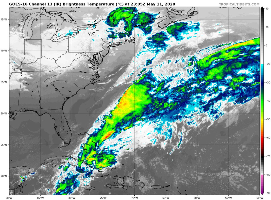
Forum rules

The posts in this forum are NOT official forecasts and should not be used as such. They are just the opinion of the poster and may or may not be backed by sound meteorological data. They are NOT endorsed by any professional institution or STORM2K. For official information, please refer to products from the National Hurricane Center and National Weather Service.

Help Support Storm2K
Message
Author
User avatar
cycloneye
Admin
Admin
Posts: 145307
Age: 68
Joined: Thu Oct 10, 2002 10:54 am
Location: San Juan, Puerto Rico

(Sub)Tropical development likely near the Bahamas: (Invest 90L thread is up)

#1 Postby cycloneye » Mon May 11, 2020 7:50 pm

Since it got mentioned in the WPC discussion I am making this thread for the area that the models are showing in different scenarios after the 15th. Let's see how this evolves.

Image

https://www.wpc.ncep.noaa.gov/discussio ... isc=pmdepd
0 likes   
Visit the Caribbean-Central America Weather Thread where you can find at first post web cams,radars
and observations from Caribbean basin members Click Here

User avatar
gatorcane
S2K Supporter
S2K Supporter
Posts: 23691
Age: 47
Joined: Sun Mar 13, 2005 3:54 pm
Location: Boca Raton, FL

Re: Possible Sub or Tropical development near the Bahamas?

#2 Postby gatorcane » Mon May 11, 2020 8:35 pm

Definitely looks like a possibility and climo suggests it is possible as well. This is a reminder the hurricane season is almost here.

We can see the frontal system that eventually contributes to possible genesis:

Image
1 likes   

USTropics
Professional-Met
Professional-Met
Posts: 2651
Joined: Sun Aug 12, 2007 3:45 am
Location: Florida State University

Re: Possible Sub or Tropical development near the Bahamas?

#3 Postby USTropics » Tue May 12, 2020 4:03 am

Chances have increased some with tonight's model runs, with the 00z ECMWF operational showing moderate strengthening now:
Image
Image

00z GFS has more of a stretched out axis with various areas of low pressure:
Image

You can see in the loop of ECMWF, GFS, UKMET, and ICON 850mb vort for Saturday evening, the closer the consolidation of vorticity to the Gulf Stream (such as the ECMWF), the better chance this has of developing:
Image

00z UKMET track with SST overlay:
Image

NCEP ensembles have slightly increased, up to a 60% chance of some type of development:
Image
1 likes   

User avatar
GCANE
S2K Supporter
S2K Supporter
Posts: 11496
Joined: Mon Oct 22, 2007 8:03 am

Re: Possible Sub or Tropical development near the Bahamas?

#4 Postby GCANE » Tue May 12, 2020 4:49 am

Latest GFS shows it a solid warm core up to about 30N

Image
0 likes   

User avatar
GCANE
S2K Supporter
S2K Supporter
Posts: 11496
Joined: Mon Oct 22, 2007 8:03 am

Re: Possible Sub or Tropical development near the Bahamas?

#5 Postby GCANE » Tue May 12, 2020 5:31 am

GFS Run-to-Run

Improving chances for development in terms of less inhibition of 355K PV and the negative-tilted shortwave strengthening along the stalled TPW front.

Image

Image

Image
0 likes   

User avatar
GCANE
S2K Supporter
S2K Supporter
Posts: 11496
Joined: Mon Oct 22, 2007 8:03 am

Re: Possible Sub or Tropical development near the Bahamas?

#6 Postby GCANE » Tue May 12, 2020 5:41 am

TPW is just starting to settle in now.
Front will beging to stall out in the Bahamas over the next few days.

Image
0 likes   

User avatar
aspen
Category 5
Category 5
Posts: 8818
Joined: Sat Oct 12, 2019 7:10 pm
Location: Connecticut, USA

Re: Possible Sub or Tropical development near the Bahamas

#7 Postby aspen » Tue May 12, 2020 7:27 am

The most recent GFS, Euro, CMC, NAVGEM, and ICON runs have all come to a consensus on a TC or STC forming around the Bahamas on Saturday or early Sunday. Surprisingly, the Euro seems the most aggressive, and has it meander around for longer than the other models do.
1 likes   
Irene '11 Sandy '12 Hermine '16 5/15/2018 Derecho Fay '20 Isaias '20 Elsa '21 Henri '21 Ida '21

I am only a meteorology enthusiast who knows a decent amount about tropical cyclones. Look to the professional mets, the NHC, or your local weather office for the best information.

User avatar
Kazmit
Category 5
Category 5
Posts: 2124
Age: 22
Joined: Mon Jul 25, 2016 8:49 am
Location: Williamsburg, VA / Bermuda

Re: Possible Sub or Tropical development near the Bahamas

#8 Postby Kazmit » Tue May 12, 2020 8:12 am

Euro is stronger and takes it on a Humberto-esque track.

Image
1 likes   
Igor 2010, Sandy 2012, Fay 2014, Gonzalo 2014, Joaquin 2015, Nicole 2016, Humberto 2019

I am only a tropical weather enthusiast. My predictions are not official and may or may not be backed by sound meteorological data. For official information, please refer to the NHC and NWS products.

User avatar
cycloneye
Admin
Admin
Posts: 145307
Age: 68
Joined: Thu Oct 10, 2002 10:54 am
Location: San Juan, Puerto Rico

Re: Possible Sub or Tropical development near the Bahamas

#9 Postby cycloneye » Tue May 12, 2020 8:44 am

2 likes   
Visit the Caribbean-Central America Weather Thread where you can find at first post web cams,radars
and observations from Caribbean basin members Click Here

Shell Mound
Category 5
Category 5
Posts: 2434
Age: 32
Joined: Thu Sep 07, 2017 3:39 pm
Location: St. Petersburg, FL → Scandinavia

Re: Possible Sub or Tropical development near the Bahamas

#10 Postby Shell Mound » Tue May 12, 2020 8:45 am

0 likes   
CVW / MiamiensisWx / Shell Mound
The posts in this forum are NOT official forecasts and should not be used as such. They are just the opinion of the poster and may or may not be backed by sound meteorological data. They are NOT endorsed by any professional institution or STORM2K. For official information, please refer to products from the NHC and NWS.

User avatar
cycloneye
Admin
Admin
Posts: 145307
Age: 68
Joined: Thu Oct 10, 2002 10:54 am
Location: San Juan, Puerto Rico

Re: Possible Sub or Tropical development near the Bahamas

#11 Postby cycloneye » Tue May 12, 2020 9:09 am

Special Tropical Weather Outlook
NWS National Hurricane Center Miami FL
1005 AM EDT Tue May 12 2020

For the North Atlantic...Caribbean Sea and the Gulf of Mexico:

Special Tropical Weather Outlook issued to discuss the potential
for subtropical development this weekend northeast of the Bahamas.

1. An area of low pressure is expected to develop this weekend
a couple hundred miles northeast of the Bahamas. Environmental
conditions appear conducive for this system to acquire some
subtropical characteristics as it moves northeastward through
Sunday. The next Special Tropical Weather Outlook on this system
will be issued by 9 PM EDT Tuesday, or earlier, if necessary.
* Formation chance through 48 hours...low...near 0 percent.
* Formation chance through 5 days...medium...50 percent.

$$
Forecaster Latto
3 likes   
Visit the Caribbean-Central America Weather Thread where you can find at first post web cams,radars
and observations from Caribbean basin members Click Here

User avatar
DioBrando
Category 4
Category 4
Posts: 904
Age: 28
Joined: Sun Aug 12, 2018 12:45 pm

Re: Possible Sub or Tropical development near the Bahamas

#12 Postby DioBrando » Tue May 12, 2020 9:21 am

Kazmit wrote:Euro is stronger and takes it on a Humberto-esque track.

https://i.imgur.com/2xPsiUn.png


what if it blows up into a category 3
0 likes   
blonde stacey (xe/xem/xir)

User avatar
NDG
S2K Supporter
S2K Supporter
Posts: 15446
Joined: Sun Jul 09, 2006 10:14 pm
Location: Orlando, FL

Re: Possible Sub or Tropical development near the Bahamas: STWO= 0%/50%

#13 Postby NDG » Tue May 12, 2020 9:22 am

Ladies and gents start your engines.
This will be the 6th year in a row to get a named system in the Atlantic before June 1st if indeed models are correct :eek:
7 likes   

User avatar
DioBrando
Category 4
Category 4
Posts: 904
Age: 28
Joined: Sun Aug 12, 2018 12:45 pm

Re: Possible Sub or Tropical development near the Bahamas: STWO= 0%/50%

#14 Postby DioBrando » Tue May 12, 2020 9:24 am

NDG wrote:Ladies and gents start your engines.
This will be the 6th year in a row to get a named system in the Atlantic before June 1st if indeed models are correct :eek:

i wonder what the analog systems are
0 likes   
blonde stacey (xe/xem/xir)

User avatar
GCANE
S2K Supporter
S2K Supporter
Posts: 11496
Joined: Mon Oct 22, 2007 8:03 am

Re: Possible Sub or Tropical development near the Bahamas: STWO= 0%/50%

#15 Postby GCANE » Tue May 12, 2020 9:27 am

0 likes   

User avatar
Dylan
Professional-Met
Professional-Met
Posts: 338
Age: 30
Joined: Mon May 31, 2010 9:50 am
Location: New Orleans, LA

Re: Possible Sub or Tropical development near the Bahamas: STWO= 0%/50%

#16 Postby Dylan » Tue May 12, 2020 9:50 am

1 likes   
Georges('98), Allison('01), Isidore('02), Lili('02), Frances('04) Ivan('04), Cindy('05), Katrina('05), Rita('05), Gustav('08), Isaac('12), Matthew('16), Harvey('17), Irma('17), Nate ('17), Ida ('21).

TheStormExpert

Re: Possible Sub or Tropical development near the Bahamas: STWO= 0%/50%

#17 Postby TheStormExpert » Tue May 12, 2020 10:03 am

NDG wrote:Ladies and gents start your engines.
This will be the 6th year in a row to get a named system in the Atlantic before June 1st if indeed models are correct :eek:

Why doesn’t this surprise me at all? :lol:
6 likes   

plasticup

Re: Possible Sub or Tropical development near the Bahamas

#18 Postby plasticup » Tue May 12, 2020 11:02 am

Kazmit wrote:Euro is stronger and takes it on a Humberto-esque track.

https://i.imgur.com/2xPsiUn.png

Without the strength, thank god. We just finished repairs a couple of months ago :roll:
1 likes   

User avatar
DioBrando
Category 4
Category 4
Posts: 904
Age: 28
Joined: Sun Aug 12, 2018 12:45 pm

Re: Possible Sub or Tropical development near the Bahamas

#19 Postby DioBrando » Tue May 12, 2020 11:23 am

plasticup wrote:
Kazmit wrote:Euro is stronger and takes it on a Humberto-esque track.

https://i.imgur.com/2xPsiUn.png

Without the strength, thank god. We just finished repairs a couple of months ago :roll:

i was legit scared because i thought this thing might actually pull a humberto last night especially with the waters being roasty toasty and getting toastier...
how likely would this scenario play out?
0 likes   
blonde stacey (xe/xem/xir)

User avatar
CyclonicFury
Category 5
Category 5
Posts: 2025
Age: 26
Joined: Sun Jul 02, 2017 12:32 pm
Location: NC
Contact:

Re: Possible Sub or Tropical development near the Bahamas

#20 Postby CyclonicFury » Tue May 12, 2020 11:28 am

DioBrando wrote:
plasticup wrote:
Kazmit wrote:Euro is stronger and takes it on a Humberto-esque track.

https://i.imgur.com/2xPsiUn.png

Without the strength, thank god. We just finished repairs a couple of months ago :roll:

i was legit scared because i thought this thing might actually pull a humberto last night especially with the waters being roasty toasty and getting toastier...
how likely would this scenario play out?

Very unlikely. It's May, not September. The track may be similar, but the SSTs are much colder than they were for Humberto.
4 likes   
NCSU B.S. in Meteorology Class of 2021. Tropical weather blogger at http://www.cyclonicfury.com. My forecasts and thoughts are NOT official, for official forecasts please consult the National Hurricane Center.


Return to “Talkin' Tropics”

Who is online

Users browsing this forum: Google Adsense [Bot], KeysRedWine, Steve H. and 48 guests