2020 Indicators: SST's / SAL / MSLP / Steering / Shear / Instability / Sat Images
Moderator: S2k Moderators
Forum rules

The posts in this forum are NOT official forecasts and should not be used as such. They are just the opinion of the poster and may or may not be backed by sound meteorological data. They are NOT endorsed by any professional institution or STORM2K. For official information, please refer to products from the National Hurricane Center and National Weather Service.
-
BYG Jacob
Re: 2020 Indicators: SST's / SAL / MSLP / Steering / Shear / Instability / Sat Images
Gonna be another very dangerous year. Wonderful.
0 likes
-
HurricaneEnzo

- Category 2

- Posts: 744
- Joined: Wed Mar 14, 2018 12:18 pm
- Location: Newport, NC (Hurricane Alley)
Re: 2020 Indicators: SST's / SAL / MSLP / Steering / Shear / Instability / Sat Images
crownweather wrote:TheStormExpert wrote:cycloneye wrote:
Why the Nashville tornado?
Not sure how much (if any) correlation tornadoes have to a given hurricane season but I find it interesting that two of Crown Weathers analog seasons featured two other instances of a significant tornado tracking very similar to the recent EF-4 one a few days ago.
What's even more intriguing is that I picked both 1933 & 1998 as possible analog years at least a couple of weeks ago when I was doing my research and was based on the weather pattern of the winter as well as various records that have been tied or broken.
Both of those seasons had Hurricane landfalls in my neck of the woods. Eastern North Carolina.
1933 had the 'Chesapeake Bay Hurricane' and the 'Outer Banks Hurricane'. The latter is considered one of the worst strikes in the last 100 years in my small community and was comparable to Hurricane Isabel in effects.
1998 had Hurricane Bonnie a top-end Cat 2.
Last edited by HurricaneEnzo on Thu Mar 05, 2020 2:13 pm, edited 1 time in total.
0 likes
Bertha 96' - Fran 96' - Bonnie 98' - Dennis 99' - Floyd 99' - Isabel 03' - Alex 04' - Ophelia 05' - Irene 11' - Arthur 14' - Matthew 16' - Florence 18' - Dorian 19' - Isaias 20' (countless other tropical storms and Hurricane swipes)
I am not a Professional Met just an enthusiast. Get your weather forecasts from the Pros!
I am not a Professional Met just an enthusiast. Get your weather forecasts from the Pros!
-
cycloneye

- Admin

- Posts: 149730
- Age: 69
- Joined: Thu Oct 10, 2002 10:54 am
- Location: San Juan, Puerto Rico
Re: 2020 Indicators: SST's / SAL / MSLP / Steering / Shear / Instability / Sat Images
Something big going on in the ENSO thread 
2 likes
Visit the Caribbean-Central America Weather Thread where you can find at first post web cams,radars
and observations from Caribbean basin members Click Here
and observations from Caribbean basin members Click Here
-
Kingarabian

- S2K Supporter

- Posts: 16381
- Joined: Sat Aug 08, 2009 3:06 am
- Location: Honolulu, Hawaii
Re: 2020 Indicators: SST's / SAL / MSLP / Steering / Shear / Instability / Sat Images
cycloneye wrote:Something big going on in the ENSO thread
Also interesting is that it's hinting @ a -AMO setting up.

PC- Weathermodels.com
3 likes
RIP Kobe Bryant
-
CyclonicFury

- Category 5

- Posts: 2038
- Age: 27
- Joined: Sun Jul 02, 2017 12:32 pm
- Location: NC
- Contact:
Re: 2020 Indicators: SST's / SAL / MSLP / Steering / Shear / Instability / Sat Images
Anyone have the ECMWF precipitation anomaly graphic for the Atlantic for JAS? FWIW in February it showed a much more moist MDR for JJA than it had shown the past three years in its February forecast.
0 likes
NCSU B.S. in Meteorology Class of 2021. Tropical weather blogger at http://www.cyclonicfury.com. My forecasts and thoughts are NOT official, for official forecasts please consult the National Hurricane Center.
-
TheStormExpert
Re: 2020 Indicators: SST's / SAL / MSLP / Steering / Shear / Instability / Sat Images
Kingarabian wrote:cycloneye wrote:Something big going on in the ENSO thread
Also interesting is that it's hinting @ a -AMO setting up.
https://i.imgur.com/swXdv5m.png
PC- Weathermodels.com
Well we kind of already have that look right now.

0 likes
-
SFLcane

- S2K Supporter
- Posts: 10281
- Age: 48
- Joined: Sat Jun 05, 2010 1:44 pm
- Location: Lake Worth Florida
Re: 2020 Indicators: SST's / SAL / MSLP / Steering / Shear / Instability / Sat Images
TheStormExpert wrote:Kingarabian wrote:cycloneye wrote:Something big going on in the ENSO thread
Also interesting is that it's hinting @ a -AMO setting up.
https://i.imgur.com/swXdv5m.png
PC- Weathermodels.com
Well we kind of already have that look right now.
https://i.imgur.com/XaJIzvL.png[/quote
Again Looks like a -AMO kinda. Cool horseshoe with warmth in the subtropics. Not a hyperactive setup for the Atlantic by any means. See how you have the sst in the area near Greenland and the MDR? This is the look for a hyperactive season. we shall see

0 likes
-
Shell Mound
- Category 5
- Posts: 2432
- Age: 33
- Joined: Thu Sep 07, 2017 3:39 pm
- Location: St. Petersburg, FL → Scandinavia
Re: 2020 Indicators: SST's / SAL / MSLP / Steering / Shear / Instability / Sat Images
My early guess: déjà vu. Every Atlantic hurricane season since 2015 has been roughly the same in terms of the -AMO, excepting 2017. The ENSO has been roughly the same as well, weak +/-ENSO events being dominant, at least since the super Niño of 2015-16. I would expect yet another season with relatively few “high-quality” storms and a lot of weak systems, with significant weighting given to TC development in the subtropics. In other words, most storms won’t produce a lot of ACE, other than a few notable exceptions. I would also watch out for homegrown development in the Gulf and/or along the Eastern Seaboard, plus quick development over or near West Africa and Cabo Verde. Watch out for that one major hurricane that hits land or that wet tropical storm that slogs ashore somewhere. Overall activity should be near or slightly above average, give or take a few systems.
0 likes
CVW / MiamiensisWx / Shell Mound
The posts in this forum are NOT official forecasts and should not be used as such. They are just the opinion of the poster and may or may not be backed by sound meteorological data. They are NOT endorsed by any professional institution or STORM2K. For official information, please refer to products from the NHC and NWS.
-
CyclonicFury
- Category 5
- Posts: 2038
- Age: 27
- Joined: Sun Jul 02, 2017 12:32 pm
- Location: NC
- Contact:
Re: 2020 Indicators: SST's / SAL / MSLP / Steering / Shear / Instability / Sat Images
Remember 2018 had a VERY strong -AMO signature in spring and still went on to be above average, even with a few MDR hurricanes. It's certainly not a lock the AMO is negative at peak season. FWIW the ECMWF graphic Kingarabian posted shows near-slightly above normal MDR SSTs based on a 1993-2016 climo which was mostly during a +AMO period. I strongly believe we are NOT in a -AMO era.
2 likes
NCSU B.S. in Meteorology Class of 2021. Tropical weather blogger at http://www.cyclonicfury.com. My forecasts and thoughts are NOT official, for official forecasts please consult the National Hurricane Center.
-
TheStormExpert
Re: 2020 Indicators: SST's / SAL / MSLP / Steering / Shear / Instability / Sat Images
Also wouldn’t a -AMO suggest delayed developments similar to storms like Dorian, Harvey, etc.?
0 likes
-
DestinHurricane

- Category 4

- Posts: 935
- Joined: Tue May 01, 2018 8:05 am
- Location: New York, NY
Re: 2020 Indicators: SST's / SAL / MSLP / Steering / Shear / Instability / Sat Images
TheStormExpert wrote:Also wouldn’t a -AMO suggest delayed developments similar to storms like Dorian, Harvey, etc.?
Which would cause storms to spin up more west, thus more of a threat to the U.S., correct?
0 likes
Michael 2018
-
gatorcane

- S2K Supporter
- Posts: 23708
- Age: 48
- Joined: Sun Mar 13, 2005 3:54 pm
- Location: Boca Raton, FL
Re: 2020 Indicators: SST's / SAL / MSLP / Steering / Shear / Instability / Sat Images
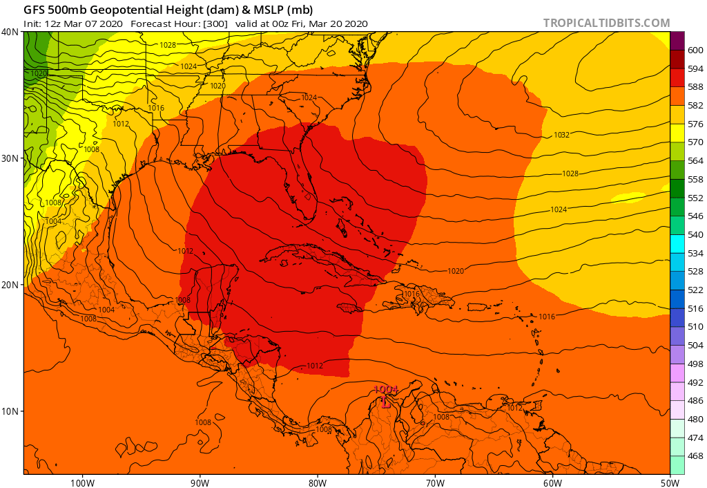
And the long-range GFS continues to go with a +NAO look which will further warm the Caribbean, Bahamas, Gulf, and waters around Florida. This pattern has pretty much dominated all winter and has kept the waters warmer than normal over this region.
2 likes
-
StruThiO

- Category 3

- Posts: 821
- Age: 26
- Joined: Fri Sep 15, 2017 5:51 am
- Location: Currently Portland, OR. Raised in Jax, FL.
Re: 2020 Indicators: SST's / SAL / MSLP / Steering / Shear / Instability / Sat Images
https://twitter.com/AndyHazelton/status/1236687661085196288
https://twitter.com/webberweather/status/1236688021623316480
https://twitter.com/AndyHazelton/status/1236688524843388928
https://twitter.com/webberweather/status/1236693170651570180
https://twitter.com/webberweather/status/1236688021623316480
https://twitter.com/AndyHazelton/status/1236688524843388928
https://twitter.com/webberweather/status/1236693170651570180
4 likes
-
Shell Mound
- Category 5
- Posts: 2432
- Age: 33
- Joined: Thu Sep 07, 2017 3:39 pm
- Location: St. Petersburg, FL → Scandinavia
Re: 2020 Indicators: SST's / SAL / MSLP / Steering / Shear / Instability / Sat Images
I would be more interested in seeing whether the SSTA configuration in the tropical Atlantic can take on a 2017-type look by ASO.
0 likes
CVW / MiamiensisWx / Shell Mound
The posts in this forum are NOT official forecasts and should not be used as such. They are just the opinion of the poster and may or may not be backed by sound meteorological data. They are NOT endorsed by any professional institution or STORM2K. For official information, please refer to products from the NHC and NWS.
-
CyclonicFury
- Category 5
- Posts: 2038
- Age: 27
- Joined: Sun Jul 02, 2017 12:32 pm
- Location: NC
- Contact:
Re: 2020 Indicators: SST's / SAL / MSLP / Steering / Shear / Instability / Sat Images
Shell Mound wrote::uarrow: That combination of La Niña, -PDO, and -AMO might lead to more subsidence over the MDR and Caribbean, counteracting the strong African monsoon.
I would be more interested in seeing whether the SSTA configuration in the tropical Atlantic can take on a 2017-type look by ASO.
I'm not convinced about that. Look what happened in 2018. 2018 had a near-textbook -AMO look for a large portion of the season, and the strong WAM was enough to boost the MDR to the point where four hurricanes formed, including the earliest hurricane to form so far east in the deep tropics on record (Beryl).
It seems like the Atlantic has had a -AMO look in just about every spring since 2014. Despite this, the Atlantic is coming off four straight above average seasons with 130+ ACE, including six hurricanes officially classified as Category 5. Only the Caribbean has really seen a significant decline in activity, while the subtropics have seen enhanced activity. It's going to be interesting to see if the current very warm anomalies over the southern MDR spread northward as the season gets closer.
2 likes
NCSU B.S. in Meteorology Class of 2021. Tropical weather blogger at http://www.cyclonicfury.com. My forecasts and thoughts are NOT official, for official forecasts please consult the National Hurricane Center.
-
SFLcane
- S2K Supporter
- Posts: 10281
- Age: 48
- Joined: Sat Jun 05, 2010 1:44 pm
- Location: Lake Worth Florida
Re: 2020 Indicators: SST's / SAL / MSLP / Steering / Shear / Instability / Sat Images
Time to get ready is now. Its going to be a busy one. 
https://twitter.com/BenNollWeather/status/1237385218329362433
https://twitter.com/BenNollWeather/status/1237385218329362433
2 likes
-
SFLcane
- S2K Supporter
- Posts: 10281
- Age: 48
- Joined: Sat Jun 05, 2010 1:44 pm
- Location: Lake Worth Florida
Re: 2020 Indicators: SST's / SAL / MSLP / Steering / Shear / Instability / Sat Images
Hmm... ECMWF has cool ENSO but notice the Atlantic MDR is average on this map below. Probably a 2016-type season. Lots to watch in the coming months

1 likes

Re: 2020 Indicators: SST's / SAL / MSLP / Steering / Shear / Instability / Sat Images
Salute!
I see different ENSO and such forecasts this year, with El Nino helping us in the Gulf states, and La Nina hurting. That's based on historical conditions and no models or such. Just past patterns.
A late season Nina would influence our September and October storms here in the Gulf, huh? And looking at history, the Nino seems to break up the upper level flows and we do not get a lotta storms here, and the ones we get hit the east coast.
Thots?
Gums sends...
P.S. Michael recovery is taking longer than I thot. My bride has a medical appointment over in PC every few months, and there's still a lotta roofs and weak structures needing repair. We are about 40 n.m. west from ground zero, and only had 20 - 25 mph winds. However, have been thru one Cat III on the "bad" side, and a good Cat II same oh same oh.
0 likes
-
ScottNAtlanta

- Category 5
- Posts: 2535
- Joined: Sat May 25, 2013 3:11 pm
- Location: Atlanta, GA
Re: 2020 Indicators: SST's / SAL / MSLP / Steering / Shear / Instability / Sat Images
This is not looking like a developing -AMO. If the area north of the islands continue to cool, you might get just the opposite. Warm over cool over warm. North Atlantic Tripole. That's also some really warm water off Africa. If there is a +WAM along with a stubborn +NAO you are going to see some long track storms this season

4 likes
The posts in this forum are NOT official forecast and should not be used as such. They are just the opinion of the poster and may or may not be backed by sound meteorological data. They are NOT endorsed by any professional institution or storm2k.org. For official information, please refer to the NHC and NWS products.
Who is online
Users browsing this forum: Hurricane2022, Kingarabian, Ulf and 154 guests