SFLcane wrote:NotSparta wrote:No surprise there, has been a very warm week here in Naples. Hopefully it fades between now and July though, don't want to risk it holding

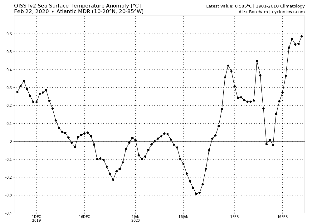
Problem is the entire basin is warm. The eastern atl mdr region is boiling if it holds these waves will have no problem developing. With a possible la nina or neutral i say things for now are setting up quite active in 2020.
Eh, wouldn't be so sure. Sure the basin is warm but it's been a huge roller coaster lately and wouldn't take much to cool right back down.
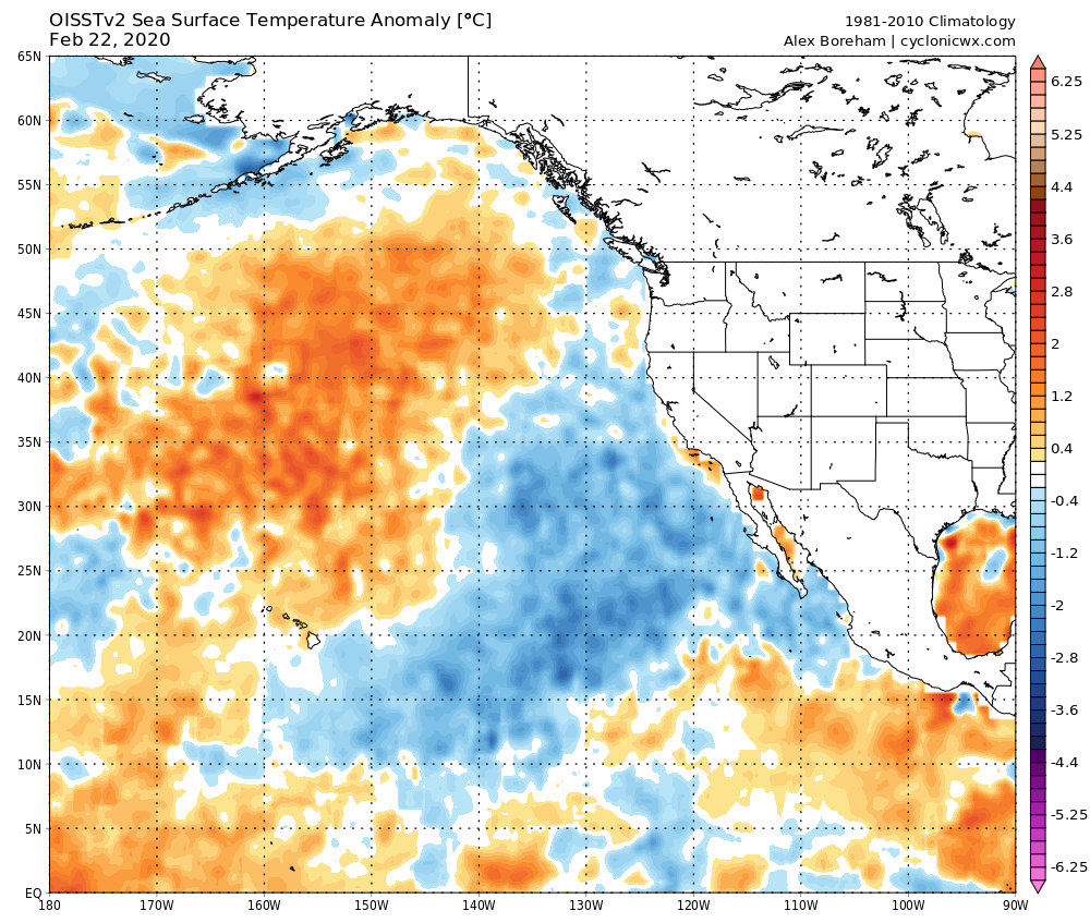
I wouldn't be confident calling for no El Niño in February especially given the look out west, almost looks like there's an El Niño waiting to happen, and there's a good amount of warmth under the ocean. In addition, there have been a lot of WWBs lately which can help promote El Niño.
However, given the large West Pacific MJO event failed to occur, it probably won't begin now (it still can, a huge one in March 2015 kicked off that El Niño event). Also, there's (so far) no real +PMM showing up which doesn't really help for an El Niño event.
This post was probably an opinion of mine, and
in no way is official. Please refer to
http://www.hurricanes.gov for official tropical analysis and advisories.
My website, with lots of tropical wx graphics, including satellite and recon:
http://cyclonicwx.com


 come july...If it holds.


