AL, 91, 2019100706, , BEST, 0, 312N, 450W, 35, 1012, DB, 34, NEQ, 150, 0, 0, 150, 0, 0, 0, 0, 0, , 0, , 0, 0, GENESIS031, , 0, , 0, 0, 0, 0, genesis-num, 031,
AL, 91, 2019100712, , BEST, 0, 312N, 450W, 40, 1012, EX, 34, NEQ, 180, 0, 0, 150, 0, 0, 0, 0, 0, , 0, , 0, 0, GENESIS031, , 0, , 0, 0, 0, 0, genesis-num, 031,
AL, 91, 2019100718, , BEST, 0, 312N, 452W, 40, 1009, EX, 34, NEQ, 180, 0, 0, 150, 1016, 240, 100, 0, 0, L, 0, , 0, 0, INVEST, M, 0, , 0, 0, 0, 0, genesis-num, 031, SPAWNINVEST, al722019 to al912019,
Thread at Talking Tropics forum that was the topic for this area.
viewtopic.php?f=31&t=120644&p=2786377#p2786377
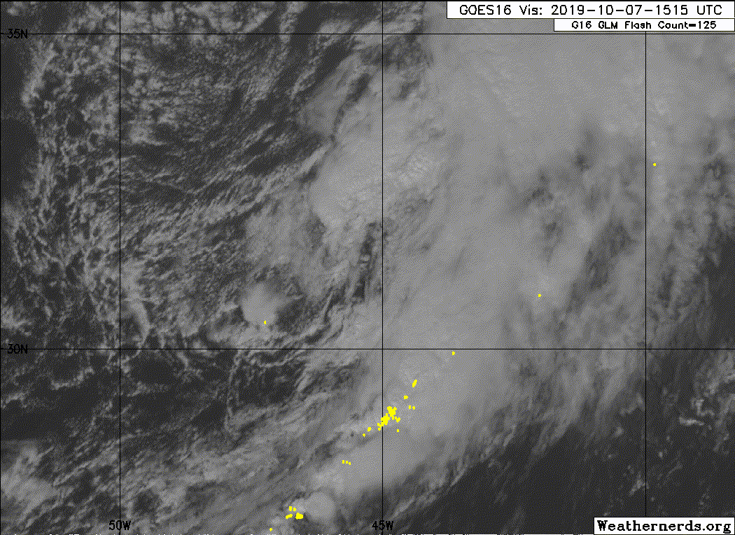
A non-tropical low pressure system located over the central Atlantic
Ocean between Bermuda and the Azores is producing gale-force winds
to the north of its center. Environmental conditions are forecast
to be generally conducive for the low to acquire some subtropical or
tropical characteristics during the next day or two, and this system
could become a tropical or subtropical storm on Tuesday or Wednesday
while it moves slowly westward. Upper-level winds are expected to
become unfavorable for further development by Wednesday night.
Additional information on this system can be found in High Seas
Forecasts issued by the National Weather Service.
* Formation chance through 48 hours...medium...50 percent.
* Formation chance through 5 days...medium...50 percent.
ATL: INVEST 91L - Discussion
Moderator: S2k Moderators
-
cycloneye

- Admin

- Posts: 149845
- Age: 69
- Joined: Thu Oct 10, 2002 10:54 am
- Location: San Juan, Puerto Rico
ATL: INVEST 91L - Discussion
0 likes
Visit the Caribbean-Central America Weather Thread where you can find at first post web cams,radars
and observations from Caribbean basin members Click Here
and observations from Caribbean basin members Click Here
-
Sciencerocks
- Category 5

- Posts: 10194
- Age: 40
- Joined: Thu Jul 06, 2017 1:51 am


Re: ATL: INVEST 91L - Discussion
Another girl storm not reaching hurricane intensity anyone? 
0 likes
blonde stacey (xe/xem/xir)
-
BadLarry95
- Tropical Depression

- Posts: 94
- Joined: Thu Apr 28, 2016 9:40 pm
Re: ATL: INVEST 91L - Discussion
DioBrando wrote:Another girl storm not reaching hurricane intensity anyone?
If that happens, I think Melissa will be one of only 3 names used atleast 3 times and never been a hurricane
(Andrea 3x)
(Ana 7x!!!)
2 likes
-
AnnularCane

- S2K Supporter

- Posts: 2965
- Joined: Thu Jun 08, 2006 9:18 am
- Location: Wytheville, VA
Re: ATL: INVEST 91L - Discussion
DioBrando wrote:Another girl storm not reaching hurricane intensity anyone?
I'd be happy with another Gabrielle at this point! She wasn't a cane, but at least she stuck around for a week and did not do too badly.
Last edited by AnnularCane on Mon Oct 07, 2019 8:52 pm, edited 1 time in total.
1 likes
-
Sciencerocks
- Category 5
- Posts: 10194
- Age: 40
- Joined: Thu Jul 06, 2017 1:51 am
Re: ATL: INVEST 91L - Discussion
Tropical Weather Outlook
NWS National Hurricane Center Miami FL
800 PM EDT Mon Oct 7 2019
For the North Atlantic...Caribbean Sea and the Gulf of Mexico:
A non-tropical low pressure system located over the central Atlantic
Ocean between Bermuda and the Azores is producing gale-force winds.
Environmental conditions are forecast to be generally conducive for
the low to acquire some subtropical or tropical characteristics
during the next day or two, and this system could become a tropical
or subtropical storm on Tuesday or Wednesday while it moves slowly
westward. Upper-level winds are expected to become unfavorable for
further development by Wednesday evening. Additional information on
this system can be found in High Seas Forecasts issued by the
National Weather Service.
* Formation chance through 48 hours...medium...50 percent.
* Formation chance through 5 days...medium...50 percent.
0 likes


Re: ATL: INVEST 91L - Discussion
this system seems like its in the right place, right time to drift west and interact with the big coastal low thats expected to intensify south of Cape Cod this week. Anyone recall the Halloween Storm of 1991? That was something to see along the mid - atlantic.
1 likes
-
Sciencerocks
- Category 5
- Posts: 10194
- Age: 40
- Joined: Thu Jul 06, 2017 1:51 am
Re: ATL: INVEST 91L - Discussion
BadLarry95 wrote:DioBrando wrote:Another girl storm not reaching hurricane intensity anyone?
If that happens, I think Melissa will be one of only 3 names used atleast 3 times and never been a hurricane
(Andrea 3x)
(Ana 7x!!!)
Continuing the weak streak while the likes of Humberto keep his strong streak.
0 likes
blonde stacey (xe/xem/xir)
-
cycloneye
- Admin
- Posts: 149845
- Age: 69
- Joined: Thu Oct 10, 2002 10:54 am
- Location: San Juan, Puerto Rico
Re: ATL: INVEST 91L - Discussion
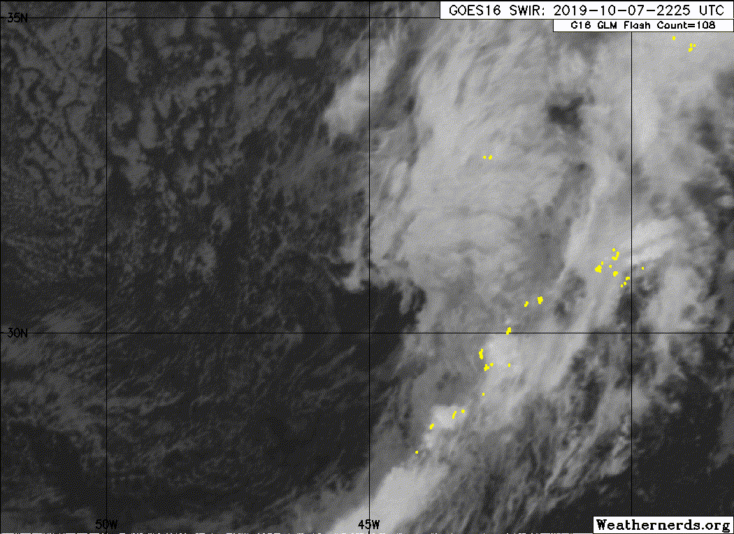
A non-tropical low pressure system located over the central Atlantic
between Bermuda and the Azores continues to produce gale-force winds
to the north of its center. Environmental conditions are somewhat
conducive for the low to acquire some subtropical or tropical
characteristics through early Wednesday, and this system could still
become a tropical or subtropical storm later today or early
Wednesday while it moves slowly westward. Upper-level winds are
expected to become unfavorable for further development by Wednesday
evening. Additional information on this system can be found in High
Seas Forecasts issued by the National Weather Service.
* Formation chance through 48 hours...medium...40 percent.
* Formation chance through 5 days...medium...40 percent.
0 likes
Visit the Caribbean-Central America Weather Thread where you can find at first post web cams,radars
and observations from Caribbean basin members Click Here
and observations from Caribbean basin members Click Here
-
Sciencerocks
- Category 5
- Posts: 10194
- Age: 40
- Joined: Thu Jul 06, 2017 1:51 am
-
cycloneye
- Admin
- Posts: 149845
- Age: 69
- Joined: Thu Oct 10, 2002 10:54 am
- Location: San Juan, Puerto Rico
Re: ATL: INVEST 91L - Discussion
1 likes
Visit the Caribbean-Central America Weather Thread where you can find at first post web cams,radars
and observations from Caribbean basin members Click Here
and observations from Caribbean basin members Click Here
-
cycloneye
- Admin
- Posts: 149845
- Age: 69
- Joined: Thu Oct 10, 2002 10:54 am
- Location: San Juan, Puerto Rico
Re: ATL: INVEST 91L - Discussion
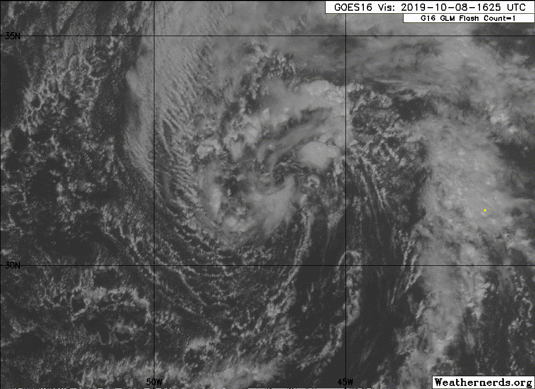
A non-tropical low pressure system located several hundred miles
east of Bermuda is producing limited shower and thunderstorm
activity. Although some limited development is still possible today,
upper-level winds are expected to become unfavorable for further
development by tonight, and the chance of this system becoming a
tropical or subtropical cyclone is decreasing.
* Formation chance through 48 hours...low...20 percent.
* Formation chance through 5 days...low...20 percent
0 likes
Visit the Caribbean-Central America Weather Thread where you can find at first post web cams,radars
and observations from Caribbean basin members Click Here
and observations from Caribbean basin members Click Here
Who is online
Users browsing this forum: No registered users and 9 guests