

Moderator: S2k Moderators


SFLcane wrote:European is complete opposite of the GFS with higher pressures.
https://i.imgur.com/poEENis.jpg
https://i.imgur.com/J2Msyx1.jpg


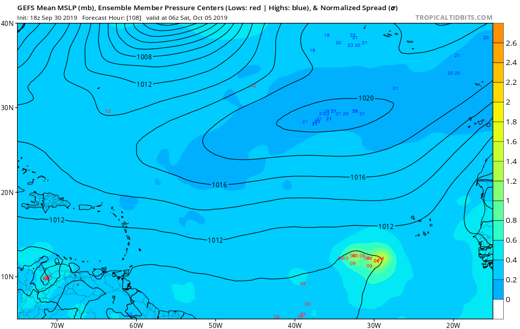
SFLcane wrote:EPS finally showing some members in the NW carib. EPS mean does look more like GFS with lower pressure in the Carib.
https://i.imgur.com/0lvOviG.jpg
Ubuntwo wrote:So far the 18z GFS develops the wave but keeps it pretty broad and weak through hour 300


toad strangler wrote:The end game has stayed in loonyville 384 hour territory but genesis has been creeping up. GFS all by itself is the story. For now. But WOW what a monster depicted...
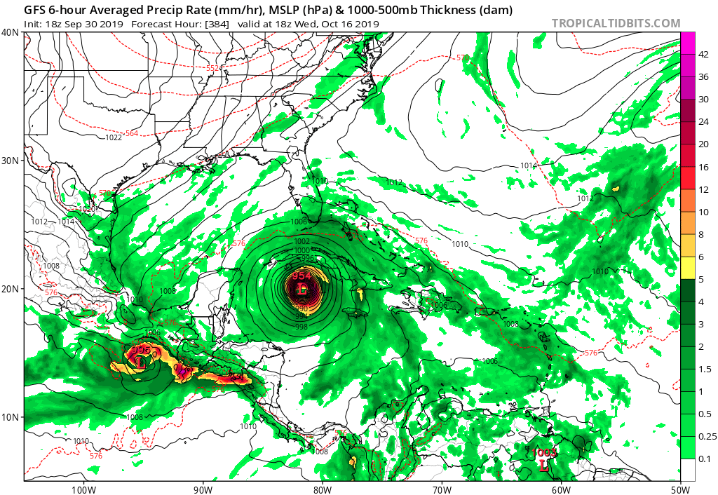


gatorcane wrote:Wave that could spark development in the Western Caribbean in 10+ days looks to be entering the scene. Gulp
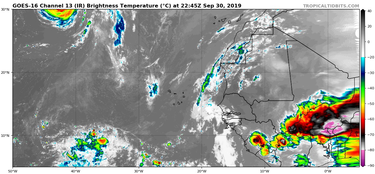
This wave is so vigorous that the Euro and some of the 18Z GFS ensembles show some development in the deep Atlantic MDR in October!
https://i.postimg.cc/cJ2HvQ8v/goes16-ir-eatl-201909302245.jpg
SFLcane wrote:gatorcane wrote:Wave that could spark development in the Western Caribbean in 10+ days looks to be entering the scene. Gulp
This wave is so vigorous that the Euro and some of the 18Z GFS ensembles show some development in the deep Atlantic MDR in October!
https://i.postimg.cc/cJ2HvQ8v/goes16-ir-eatl-201909302245.jpg
Seems like the euro could be right about it developing quick and slowing down or turning.
gatorcane wrote::uarrow: could be but the Euro also shows a strong 500MB ridge to the north of the islands which should drive it west. This wave is impressive. Loop:
https://www.tropicaltidbits.com/sat/sat ... product=ir
Users browsing this forum: Ulf, WaveBreaking and 218 guests


