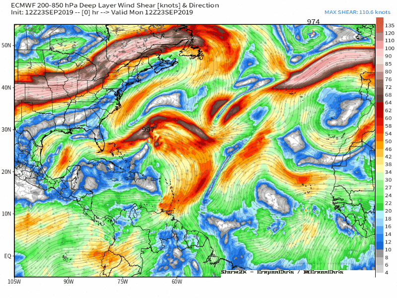
LarryWx wrote:18Z ICON lags Jerry more (consistent with his recent lack of motion) and this later results in a merge between Karen and Jerry!
Now this would be something, wouldn't it? If I see the Euro or GFS show this, it'll have my attention. Was Karen a wave in this run?