

Watch "Hurricane Hunters S1E01 - The Rookie and Irene" on YouTube
https://youtu.be/azGhIPnMgM8
ATL: DORIAN - Post-Tropical - Discussion
Moderator: S2k Moderators
-
Weather Watcher

- Tropical Storm

- Posts: 171
- Joined: Tue Aug 30, 2005 7:03 pm
- Location: Wisconsin
- Contact:
Re: ATL: DORIAN - Hurricane - Discussion
Bunkertor wrote:Weather Watcher wrote:Bunkertor wrote:We will need a new flag
I have never heard of the frying pan ocean cam. Is it a place to go to or is it a buoy?
It is kind of a platform for visitors, me thinks
Thank you too.
0 likes

Re: ATL: DORIAN - Hurricane - Discussion
tolakram wrote:Composite shows the motion a bit better. NE movement for now.
https://i.imgur.com/3tapiYp.gif
So maybe the wobble NE will be just enough to keep the core winds just offshore of Wilmington? there is an area of 55 mph winds in the outer eyewall that will no doubt have hurricane force gusts. Over 50,000 power outages being reported in NC so far.
0 likes
Re: ATL: DORIAN - Hurricane - Discussion
957.2 extrap on the AF plane’s first pass
FL ~85 kt, SMFR ~70 kt
FL ~85 kt, SMFR ~70 kt
1 likes

Re: ATL: DORIAN - Hurricane - Discussion
Looks like they didn’t sample the strongest winds or D is weakening steadily from earlier today. Looks good thou IMO.. prayers to you EC folks!!
2 likes

Re: ATL: DORIAN - Hurricane - Discussion
ROCK wrote:Looks like they didn’t sample the strongest winds or D is weakening steadily from earlier today. Looks good thou IMO.. prayers to you EC folks!!
He's not packing the same punch and the eye is expanding on radar.
There's still much damage potential but maybe Dorian is on his way down, finally.
0 likes
Personal Forecast Disclaimer:
The posts in this forum are NOT official forecast and should not be used as such. They are just the opinion of the poster and may or may not be backed by sound meteorological data. They are NOT endorsed by any professional institution or storm2k.org. For official information, please refer to the NHC and NWS products.
The posts in this forum are NOT official forecast and should not be used as such. They are just the opinion of the poster and may or may not be backed by sound meteorological data. They are NOT endorsed by any professional institution or storm2k.org. For official information, please refer to the NHC and NWS products.
Re: ATL: DORIAN - Hurricane - Discussion
Weather Watcher wrote:Bunkertor wrote:tolakram wrote:I'm still listening (it's dark) to the frying pan ocean cam, expecting the eye to move over it any time now.
We will need a new flag
I have never heard of the frying pan ocean cam. Is it a place to go to or is it a buoy?
For $25,000, you can own 1/32nd of the tower, it seems: https://www.fptower.com/ownership.html
1 likes
-
PavelGaborik10
- Category 1

- Posts: 472
- Joined: Tue Sep 04, 2018 3:23 pm
Re: ATL: DORIAN - Hurricane - Discussion
HDGator wrote:ROCK wrote:Looks like they didn’t sample the strongest winds or D is weakening steadily from earlier today. Looks good thou IMO.. prayers to you EC folks!!
He's not packing the same punch and the eye is expanding on radar.
There's still much damage potential but maybe Dorian is on his way down, finally.
As far as his tropical life goes it appears that is likely the case, however multiple models are showing Dorian undergoing some baroclinic strengthening as it merges with another system near Atlantic Canada. Could actually be even more dangerous at that point than he is now.
0 likes
-
1900hurricane

- Category 5

- Posts: 6063
- Age: 34
- Joined: Fri Feb 06, 2015 12:04 pm
- Location: Houston, TX
- Contact:
Re: ATL: DORIAN - Hurricane - Discussion
Core pressure gradient looks pretty blown out again. The RMW is rather broad but diffuse. Recon data doesn't even support the AH77 expected wind for the pressure the past few hours.
0 likes
Contract Meteorologist. TAMU & MSST. Fiercely authentic, one of a kind. We are all given free will, so choose a life meant to be lived. We are the Masters of our own Stories.
Opinions expressed are mine alone.
Follow me on Twitter at @1900hurricane : Read blogs at https://1900hurricane.wordpress.com/
Opinions expressed are mine alone.
Follow me on Twitter at @1900hurricane : Read blogs at https://1900hurricane.wordpress.com/
-
CrazyC83
- Professional-Met

- Posts: 34316
- Joined: Tue Mar 07, 2006 11:57 pm
- Location: Deep South, for the first time!
Re: ATL: DORIAN - Hurricane - Discussion
PavelGaborik10 wrote:HDGator wrote:ROCK wrote:Looks like they didn’t sample the strongest winds or D is weakening steadily from earlier today. Looks good thou IMO.. prayers to you EC folks!!
He's not packing the same punch and the eye is expanding on radar.
There's still much damage potential but maybe Dorian is on his way down, finally.
As far as his tropical life goes it appears that is likely the case, however multiple models are showing Dorian undergoing some baroclinic strengthening as it merges with another system near Atlantic Canada. Could actually be even more dangerous at that point than he is now.
Dorian will go back into the Gulf Stream tomorrow, so it is possible (I think) that it may have one more shot at intensification if shear isn't too much?
2 likes
Re: ATL: DORIAN - Hurricane - Discussion
CrazyC83 wrote:PavelGaborik10 wrote:HDGator wrote:He's not packing the same punch and the eye is expanding on radar.
There's still much damage potential but maybe Dorian is on his way down, finally.
As far as his tropical life goes it appears that is likely the case, however multiple models are showing Dorian undergoing some baroclinic strengthening as it merges with another system near Atlantic Canada. Could actually be even more dangerous at that point than he is now.
Dorian will go back into the Gulf Stream tomorrow, so it is possible (I think) that it may have one more shot at intensification if shear isn't too much?
Current eye appears to be expanding on radar but this beast has exceeded expectations time and time again.
0 likes
Personal Forecast Disclaimer:
The posts in this forum are NOT official forecast and should not be used as such. They are just the opinion of the poster and may or may not be backed by sound meteorological data. They are NOT endorsed by any professional institution or storm2k.org. For official information, please refer to the NHC and NWS products.
The posts in this forum are NOT official forecast and should not be used as such. They are just the opinion of the poster and may or may not be backed by sound meteorological data. They are NOT endorsed by any professional institution or storm2k.org. For official information, please refer to the NHC and NWS products.
Re: ATL: DORIAN - Hurricane - Discussion
Hoping NTB got lucky this time. The late push NE certainly was needed and timely. Having said that, the data seems fishy. I found many bouys in the area and local reports. No winds even close to what’s reported in the 2300 discussion, or several hours before. Am I right that the NHC is providing generous estimates to keep everyone interested?
Last edited by bcargile on Fri Sep 06, 2019 6:51 am, edited 1 time in total.
0 likes
Re: ATL: DORIAN - Hurricane - Discussion
CrazyC83 wrote:PavelGaborik10 wrote:HDGator wrote:He's not packing the same punch and the eye is expanding on radar.
There's still much damage potential but maybe Dorian is on his way down, finally.
As far as his tropical life goes it appears that is likely the case, however multiple models are showing Dorian undergoing some baroclinic strengthening as it merges with another system near Atlantic Canada. Could actually be even more dangerous at that point than he is now.
Dorian will go back into the Gulf Stream tomorrow, so it is possible (I think) that it may have one more shot at intensification if shear isn't too much?
I’ve noticed that usually when these things get into the mid-latitudes as large sprawled out hurricanes with very low pressures and winds in the strong Cat 1 to weak Cat 2 range, they never seem to actually strengthen as far as the winds go. Maybe they will temporarily, but usually when the pressure falls, the winds just keep spreading out and the winds don’t really go up at all (if they do they come right back down).
2 likes
Re: ATL: DORIAN - Hurricane - Discussion

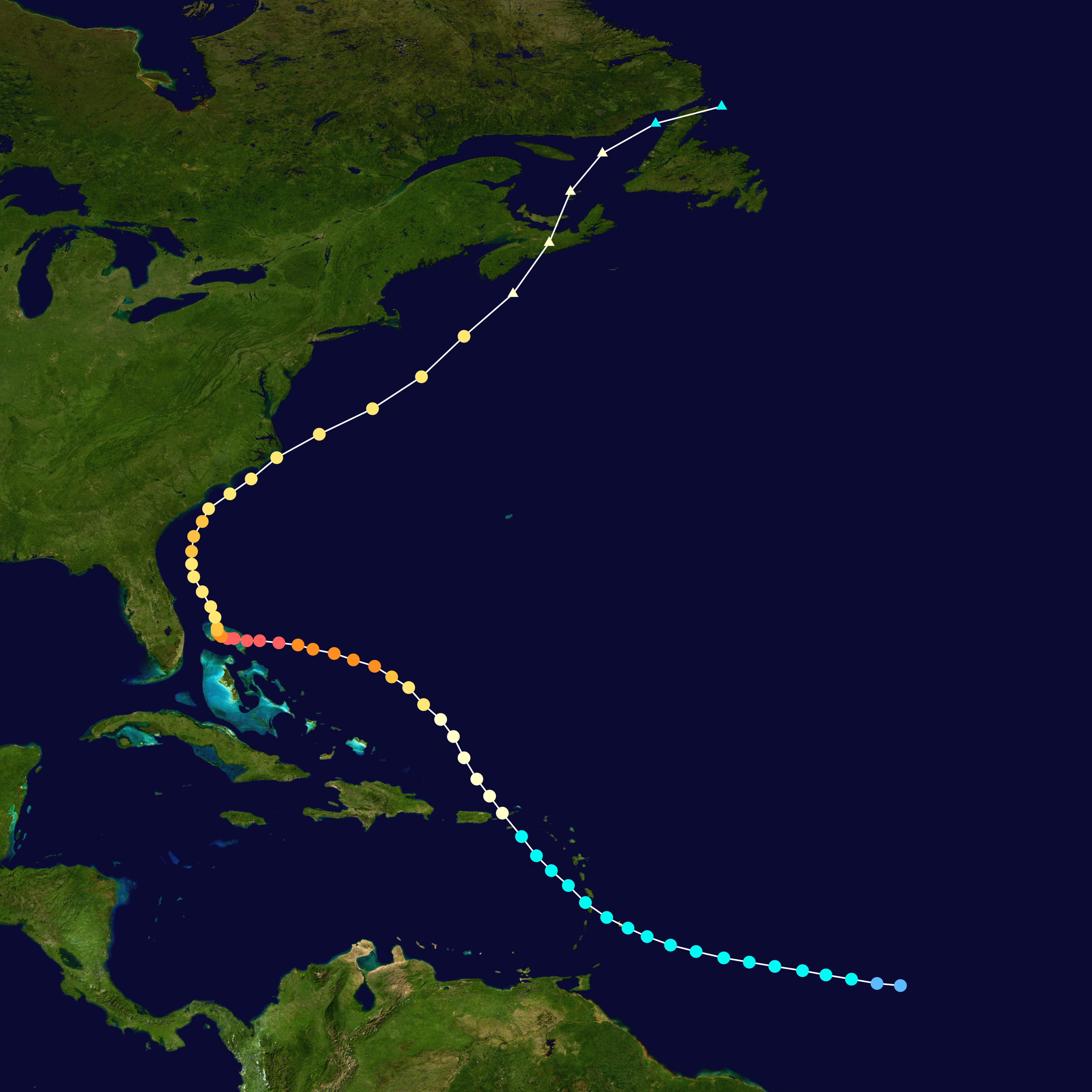
I didn't remember Dorian from 2013, but I knew there had to have been one since Dean was retired after being a landfalling Cat 5 in 2007. So I went back and looked at the 2013 Dorian, and it was certainly a much different storm, although it took a somewhat similar path. What stood out to me is that it passed just west and northwest of Freeport, Bahamas, as Tropical Depression Dorian, having recently regenerated from an open wave. It's like Dorian has been waiting 6 years to get another chance at the NW Bahamas.
11 likes
-
CrazyC83
- Professional-Met
- Posts: 34316
- Joined: Tue Mar 07, 2006 11:57 pm
- Location: Deep South, for the first time!
Re: ATL: DORIAN - Hurricane - Discussion
The posts in this forum are NOT official forecast and should not be used as such. They are just the opinion of the poster and may or may not be backed by sound meteorological data. They are NOT endorsed by any professional institution or STORM2K. For official information, please refer to products from the National Hurricane Center and National Weather Service.
I know we have quite a bit left of the story of Dorian to tell, but from what I have deciphered from the data, here is the best track I would have:
AL052019, DORIAN, 69
20190824, 0000, , LO, 10.0N, 45.4W, 25, 1011,
20190824, 0600, , TD, 10.3N, 46.7W, 30, 1010,
20190824, 1200, , TD, 10.5N, 47.7W, 30, 1009,
20190824, 1800, , TD, 10.7N, 48.8W, 30, 1009,
20190825, 0000, , TS, 10.9N, 49.9W, 35, 1008,
20190825, 0600, , TS, 11.0N, 51.0W, 40, 1007,
20190825, 1200, , TS, 11.2N, 52.2W, 40, 1006,
20190825, 1800, , TS, 11.4N, 53.5W, 50, 1003,
20190826, 0000, , TS, 11.6N, 54.7W, 50, 1002,
20190826, 0600, , TS, 11.8N, 56.0W, 50, 1001,
20190826, 1200, , TS, 12.1N, 57.2W, 45, 1003,
20190826, 1800, , TS, 12.5N, 58.4W, 45, 1004,
20190827, 0000, , TS, 13.1N, 59.3W, 40, 1004,
20190827, 0100, L, TS, 13.2N, 59.5W, 40, 1004,
20190827, 0600, , TS, 13.7N, 60.2W, 40, 1005,
20190827, 0930, L, TS, 14.1N, 60.9W, 40, 1005,
20190827, 1200, , TS, 14.4N, 61.2W, 40, 1005,
20190827, 1800, , TS, 15.0N, 62.0W, 40, 1005,
20190828, 0000, , TS, 15.7N, 62.7W, 45, 1004,
20190828, 0600, , TS, 16.4N, 63.5W, 50, 1002,
20190828, 1200, , TS, 17.2N, 64.2W, 60, 1000,
20190828, 1500, L, HU, 17.7N, 64.7W, 65, 998,
20190828, 1800, , HU, 18.3N, 65.1W, 65, 997,
20190829, 0000, , HU, 19.2N, 65.8W, 70, 992,
20190829, 0600, , HU, 20.0N, 66.4W, 75, 991,
20190829, 1200, , HU, 21.0N, 66.9W, 75, 988,
20190829, 1800, , HU, 22.0N, 67.4W, 75, 987,
20190830, 0000, , HU, 22.8N, 68.1W, 80, 979,
20190830, 0600, , HU, 23.5N, 68.8W, 85, 977,
20190830, 1200, , HU, 24.2N, 69.4W, 95, 972,
20190830, 1800, , HU, 24.8N, 70.3W, 105, 966,
20190831, 0000, , HU, 25.3N, 71.0W, 120, 950,
20190831, 0600, , HU, 25.7N, 72.1W, 125, 947,
20190831, 1200, , HU, 25.9N, 73.0W, 125, 945,
20190831, 1800, , HU, 26.1N, 74.0W, 130, 944,
20190901, 0000, , HU, 26.2N, 74.7W, 135, 941,
20190901, 0600, , HU, 26.4N, 75.6W, 135, 934,
20190901, 1200, , HU, 26.5N, 76.5W, 150, 924,
20190901, 1645, L, HU, 26.5N, 77.0W, 160, 911,
20190901, 1745, L, HU, 26.5N, 77.1W, 160, 908,
20190901, 1800, , HU, 26.5N, 77.1W, 160, 908,
20190902, 0000, , HU, 26.6N, 77.7W, 150, 914,
20190902, 0130, L, HU, 26.6N, 77.8W, 150, 915,
20190902, 0600, , HU, 26.6N, 78.1W, 140, 919,
20190902, 0900, L, HU, 26.6N, 78.2W, 135, 922,
20190902, 1200, , HU, 26.7N, 78.2W, 130, 928,
20190902, 1800, , HU, 26.8N, 78.4W, 115, 937,
20190903, 0000, , HU, 26.8N, 78.3W, 100, 943,
20190903, 0600, , HU, 26.9N, 78.3W, 95, 949,
20190903, 1200, , HU, 27.1N, 78.4W, 90, 955,
20190903, 1800, , HU, 27.5N, 78.7W, 85, 959,
20190904, 0000, , HU, 28.1N, 78.8W, 85, 960,
20190904, 0600, , HU, 28.8N, 79.2W, 80, 963,
20190904, 1200, , HU, 29.5N, 79.6W, 80, 963,
20190904, 1800, , HU, 30.1N, 79.7W, 90, 962,
20190905, 0000, , HU, 30.7N, 79.7W, 100, 957,
20190905, 0600, , HU, 31.4N, 79.6W, 95, 956,
20190905, 1200, , HU, 32.1N, 79.2W, 90, 957,
20190905, 1800, , HU, 32.7N, 78.9W, 80, 958,
20190906, 0000, , HU, 33.4N, 77.9W, 75, 956,
20190906, 0600, , HU, 34.1N, 76.9W, 75, 956,
20190906, 1200, , HU, 35.1N, 75.7W, 80, 955,
20190906, 1235, L, HU, 35.2N, 75.6W, 80, 955,
20190906, 1800, , HU, 36.3N, 73.7W, 90, 950,
20190907, 0000, , HU, 37.8N, 71.1W, 85, 953,
20190907, 0600, , HU, 38.9N, 69.1W, 85, 952,
20190907, 1200, , HU, 40.9N, 67.0W, 85, 951,
20190907, 1800, , HU, 42.8N, 64.9W, 90, 950,
20190907, 2100, S, EX, 43.8N, 64.0W, 85, 953,
20190907, 2215, L, EX, 44.5N, 63.6W, 80, 955,
20190908, 0000, , HU, 45.0N, 62.9W, 80, 958,
* I'd largely keep the operational data alone in the deep tropics, except for smoothing the center relocation.
* The peak intensity is going to get a lot of discussion. I left it at 160 kt, but you could argue higher or lower - the SFMR supported 175 kt but was highly questionable; flight-level winds supported about 150 kt. The pressures at landfall are based mostly on Jim Edds and Josh Morgerman's data, adjusted for the fact the true center was likely a touch south of them.
* Since the Bahamas, it's mostly lower than operational, but increased again as it departed. The landfall estimate at Hatteras is 80 kt.
Last edited by CrazyC83 on Sat Sep 07, 2019 6:50 pm, edited 12 times in total.
5 likes
-
storm_in_a_teacup

- Category 2

- Posts: 500
- Age: 33
- Joined: Wed Aug 16, 2017 5:01 pm
- Location: Huntsville, Alabama (originally from Houston)
- Contact:
Re: ATL: DORIAN - Hurricane - Discussion
Evenstar wrote:tolakram wrote:I'm still listening (it's dark) to the frying pan ocean cam, expecting the eye to move over it any time now.
Holy cow. I just listened and it sounds absolutely terrifying.
What did it sound like exactly to you? I just heard glitchy clipping from it overwhelming my speakers.
0 likes
I know I can't straddle the atmosphere...just a tiny storm in your teacup, girl.
-
supercane4867
- Category 5
- Posts: 4966
- Joined: Wed Nov 14, 2012 10:43 am
Re: ATL: DORIAN - Hurricane - Discussion
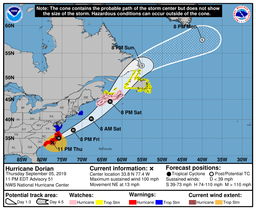
Hurricane watches are up for Nova Scotia and TS watches up for Newfoundland...Dorian is not done yet 
1 likes
-
CrazyC83
- Professional-Met
- Posts: 34316
- Joined: Tue Mar 07, 2006 11:57 pm
- Location: Deep South, for the first time!
Re: ATL: DORIAN - Hurricane - Discussion
supercane4867 wrote:Hurricane watches are up for Nova Scotia and TS watches up for Newfoundland...Dorian is not done yet
https://uploads.disquscdn.com/images/90ee583743434b1ef4b99e4840d120a04cfc7de192e8315a24f345522c2d51d6.png
Nope, not by a long shot. There's about 2.5 million people in Atlantic Canada.
4 likes
-
supercane4867
- Category 5
- Posts: 4966
- Joined: Wed Nov 14, 2012 10:43 am
Re: ATL: DORIAN - Hurricane - Discussion
CrazyC83 wrote:supercane4867 wrote:Hurricane watches are up for Nova Scotia and TS watches up for Newfoundland...Dorian is not done yet
https://uploads.disquscdn.com/images/90ee583743434b1ef4b99e4840d120a04cfc7de192e8315a24f345522c2d51d6.png
Nope, not by a long shot. There's about 2.5 million people in Atlantic Canada.
I remember the last hurricane to make landfall in the Atlantic Canada region tropically is Igor in 2010. Halifax got also hit pretty hard with Earl earlier in 2010
Last edited by supercane4867 on Thu Sep 05, 2019 11:02 pm, edited 1 time in total.
1 likes
-
Weather Watcher
- Tropical Storm
- Posts: 171
- Joined: Tue Aug 30, 2005 7:03 pm
- Location: Wisconsin
- Contact:
Re: ATL: DORIAN - Hurricane - Discussion
bjackrian wrote:Weather Watcher wrote:Bunkertor wrote:We will need a new flag
I have never heard of the frying pan ocean cam. Is it a place to go to or is it a buoy?
For $25,000, you can own 1/32nd of the tower, it seems: https://www.fptower.com/ownership.html
LOL!
 I don't have that kind of cash.
0 likes
Who is online
Users browsing this forum: No registered users and 48 guests