
gatorcane wrote:Blown Away wrote:DestinHurricane wrote:If it wobbles WSW anytime soon then it could bounce off the south coast of Grand Bahama and cause it to go into or get closer to Florida. Just a thought.
https://i.imgur.com/EYBSQRb.gif
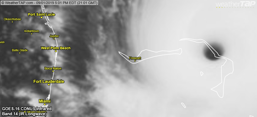
A hair S of due west motion is happening...
Indeed there are some hair south of west wobbles as some of the model guidance hinted at. Note the GFS moves this more W-WNW.
We talked about this yesterday:
John Hope wisdom: “Where the cirrus clouds go, the storm will go...”
I see them going wnw right now Turn coming?


