

Blown Away wrote:https://i.imgur.com/W6ln85f.jpg
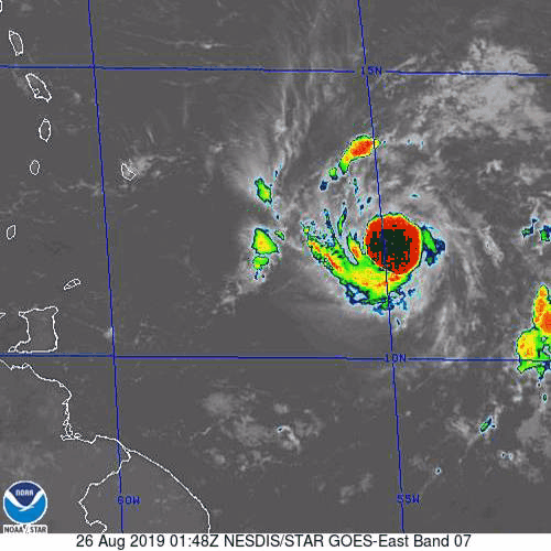
I attempted to draw the 00z TVCN Consensus line (NHC seems to follow this consensus line closely) compared to the 5pm NHC line... They flattened the line from 11am to 5pm, but didn't move it much north over Hispaniola, so I think at 11pm we will see a track inched N with less Hispaniola interaction and will that change intensity forecast???
Thanks for the overlay. If Dorian battles through the dry air, those two paths are the crux of the question we're facing. One takes it through a shredder and leaves next to nothing on the other side of the mountains of Hispaniola while the TVCN takes the 'magic route' that presents the worst danger for CONUS with those of us in South Florida in the crosshairs.
I can't see the NHC doing much to shift the forecast at 11pm until the GFS and ECMWF start to get on board with a survival scenario for Dorian in the Eastern Caribbean. At this point, I'm thinking it's still a small probability worst case scenario. I can hope, but you can tell from my post count and past posts that I'm only here when the bad scenario for South Florida is possibly in play.


