https://twitter.com/MichaelRLowry/status/1137028138158964736
2019 Indicators: SST'S / Sal / MSLP / Steering / Shear / Instability (See updated graphics at first post)
Moderator: S2k Moderators
Forum rules

The posts in this forum are NOT official forecasts and should not be used as such. They are just the opinion of the poster and may or may not be backed by sound meteorological data. They are NOT endorsed by any professional institution or STORM2K. For official information, please refer to products from the National Hurricane Center and National Weather Service.
-
NotSparta

- Professional-Met

- Posts: 1677
- Age: 24
- Joined: Fri Aug 18, 2017 8:24 am
- Location: Naples, FL
- Contact:
Re: 2019 Indicators: SST'S / Sal / MSLP / Steering / Shear / Instability (See updated graphics at first post)
TheStormExpert wrote:https://twitter.com/bennollweather/status/1137371704097792000
Wasn't July 2004 dead anyway?
1 likes
This post was probably an opinion of mine, and in no way is official. Please refer to http://www.hurricanes.gov for official tropical analysis and advisories.
My website, with lots of tropical wx graphics, including satellite and recon: http://cyclonicwx.com
My website, with lots of tropical wx graphics, including satellite and recon: http://cyclonicwx.com
-
crownweather

- S2K Supporter

- Posts: 602
- Age: 51
- Joined: Sat Aug 12, 2006 9:21 am
- Location: Sturbridge, Massachusetts
- Contact:
Re: 2019 Indicators: SST'S / Sal / MSLP / Steering / Shear / Instability (See updated graphics at first post)
NotSparta wrote:TheStormExpert wrote:https://twitter.com/bennollweather/status/1137371704097792000
Wasn't July 2004 dead anyway?
Yes, it was. Alex didn't form until July 31st. Kinda weird to see that tweet already proclaiming 2019 is nothing like 2004. Also, seeing references on SM declaring a dead season just due to MDR SSTs. Not sure that I agree with that.
7 likes
Rob Lightbown
Crown Weather Services
https://crownweather.com
Crown Weather Services
https://crownweather.com
-
CyclonicFury

- Category 5

- Posts: 2038
- Age: 27
- Joined: Sun Jul 02, 2017 12:32 pm
- Location: NC
- Contact:
Re: 2019 Indicators: SST'S / Sal / MSLP / Steering / Shear / Instability (See updated graphics at first post)
crownweather wrote:NotSparta wrote:TheStormExpert wrote:https://twitter.com/bennollweather/status/1137371704097792000
Wasn't July 2004 dead anyway?
Yes, it was. Alex didn't form until July 31st. Kinda weird to see that tweet already proclaiming 2019 is nothing like 2004. Also, seeing references on SM declaring a dead season just due to MDR SSTs. Not sure that I agree with that.
The convective pattern means a lot more when we get to August-October than July. Last year had sinking motion over the Atlantic for much of June-August before turning more favorable for convection in September.
I also disagree with calling for a dead season due to the MDR SSTs. Last year had four hurricanes in the MDR and it had a much cooler MDR at this time.
4 likes
NCSU B.S. in Meteorology Class of 2021. Tropical weather blogger at http://www.cyclonicfury.com. My forecasts and thoughts are NOT official, for official forecasts please consult the National Hurricane Center.


Re: 2019 Indicators: SST'S / Sal / MSLP / Steering / Shear / Instability (See updated graphics at first post)
crownweather wrote:NotSparta wrote:TheStormExpert wrote:https://twitter.com/bennollweather/status/1137371704097792000
Wasn't July 2004 dead anyway?
Yes, it was. Alex didn't form until July 31st. Kinda weird to see that tweet already proclaiming 2019 is nothing like 2004. Also, seeing references on SM declaring a dead season just due to MDR SSTs. Not sure that I agree with that.
I think Ben is noting that for the 2004 comparisons, they are not an exact match. He did not say it was going to be a dead season. Not every modoki El Nino is 2004 prerequisite.
1 likes
The above post and any post by Ntxw is NOT an official forecast and should not be used as such. It is just the opinion of the poster and may or may not be backed by sound meteorological data. It is NOT endorsed by any professional institution including Storm2k. For official information, please refer to NWS products.
Help support Storm2K!
Help support Storm2K!
-
NotSparta
- Professional-Met
- Posts: 1677
- Age: 24
- Joined: Fri Aug 18, 2017 8:24 am
- Location: Naples, FL
- Contact:
Re: 2019 Indicators: SST'S / Sal / MSLP / Steering / Shear / Instability (See updated graphics at first post)
crownweather wrote:NotSparta wrote:TheStormExpert wrote:https://twitter.com/bennollweather/status/1137371704097792000
Wasn't July 2004 dead anyway?
Yes, it was. Alex didn't form until July 31st. Kinda weird to see that tweet already proclaiming 2019 is nothing like 2004. Also, seeing references on SM declaring a dead season just due to MDR SSTs. Not sure that I agree with that.
The ironic thing is the MDR isn't actually that cool. It likely has cooled to slightly below normal but the anomalies shown on popular datasets are likely too low, as the increase in dust lately causes the aerosol SST bias to emerge
2 likes
This post was probably an opinion of mine, and in no way is official. Please refer to http://www.hurricanes.gov for official tropical analysis and advisories.
My website, with lots of tropical wx graphics, including satellite and recon: http://cyclonicwx.com
My website, with lots of tropical wx graphics, including satellite and recon: http://cyclonicwx.com
-
AnnularCane

- S2K Supporter
- Posts: 2964
- Joined: Thu Jun 08, 2006 9:18 am
- Location: Wytheville, VA
Re: 2019 Indicators: SST'S / Sal / MSLP / Steering / Shear / Instability (See updated graphics at first post)
So if July 2019 will be the opposite of July 2004, then I guess...look out? 
8 likes


-
WeatherEmperor
- S2K Supporter
- Posts: 4806
- Age: 42
- Joined: Thu Sep 04, 2003 2:54 pm
- Location: South Florida
Re: 2019 Indicators: SST'S / Sal / MSLP / Steering / Shear / Instability (See updated graphics at first post)

The NAO has been negative for almost 2 months now. Dont negative NAO’s usually lead to more troffing along the US east coast?
Also, in years past like 2010, 2011, 2012, etc. we had a lot of talk where the NAO was positive with strong ridging in the Spring but the pattern change made it go negative the remainder of the hurricane season. Now that the NAO has gone negative for almost 2 months, does that mean a patter change took place so that there is more troffing on the East Coast leading to more storms curving away from the US??
Sent from my iPhone using Tapatalk
1 likes

Re: 2019 Indicators: SST'S / Sal / MSLP / Steering / Shear / Instability (See updated graphics at first post)
Does a trough keep storms away from Florida?
1 likes
-
Kingarabian

- S2K Supporter
- Posts: 16381
- Joined: Sat Aug 08, 2009 3:06 am
- Location: Honolulu, Hawaii
Re: 2019 Indicators: SST'S / Sal / MSLP / Steering / Shear / Instability (See updated graphics at first post)
canes92 wrote:Does a trough keep storms away from Florida?
Generally takes storms OTS. But it depends on the respective storms position. If we have plenty of homebrew action near the GOM, a -NAO is not going to be very helpful in keeping systems away from land areas.
1 likes
RIP Kobe Bryant
-
TheStormExpert
Re: 2019 Indicators: SST'S / Sal / MSLP / Steering / Shear / Instability (See updated graphics at first post)
Kingarabian wrote:canes92 wrote:Does a trough keep storms away from Florida?
Generally takes storms OTS. But it depends on the respective storms position. If we have plenty of homebrew action near the GOM, a -NAO is not going to be very helpful in keeping systems away from land areas.
Lady I saw a -NAO allowed for more troughiness across the U.S. East Coast and the Western Atlantic preventing storms that are trying to affect the U.S.
1 likes
-
Kingarabian
- S2K Supporter
- Posts: 16381
- Joined: Sat Aug 08, 2009 3:06 am
- Location: Honolulu, Hawaii
Re: 2019 Indicators: SST'S / Sal / MSLP / Steering / Shear / Instability (See updated graphics at first post)
TheStormExpert wrote:Kingarabian wrote:canes92 wrote:Does a trough keep storms away from Florida?
Generally takes storms OTS. But it depends on the respective storms position. If we have plenty of homebrew action near the GOM, a -NAO is not going to be very helpful in keeping systems away from land areas.
Lady I saw a -NAO allowed for more troughiness across the U.S. East Coast and the Western Atlantic preventing storms that are trying to affect the U.S.
Yeah for storms that are developing over the tropical Atlantic and MDR, the -NAO increases their chances of heading OTS. However if something develops in the GOM or closer to the Caribbean then the risk of a landfall increases or remains the same. Basically what I'm trying to say is people shouldn't keep their guard down.
4 likes
RIP Kobe Bryant
-
cycloneye

- Admin

- Posts: 149734
- Age: 69
- Joined: Thu Oct 10, 2002 10:54 am
- Location: San Juan, Puerto Rico
Re: 2019 Indicators: SST'S / Sal / MSLP / Steering / Shear / Instability (See updated graphics at first post)
Don't like that dry thing in Caribbean as this area has been mainly rain free for the past few months.In PR we have been thru moderate drought for the central part of the island.
https://twitter.com/BenNollWeather/status/1137721007613984768
https://twitter.com/BenNollWeather/status/1137721007613984768
2 likes
Visit the Caribbean-Central America Weather Thread where you can find at first post web cams,radars
and observations from Caribbean basin members Click Here
and observations from Caribbean basin members Click Here
-
SFLcane

- S2K Supporter
- Posts: 10281
- Age: 48
- Joined: Sat Jun 05, 2010 1:44 pm
- Location: Lake Worth Florida
Re: 2019 Indicators: SST'S / Sal / MSLP / Steering / Shear / Instability (See updated graphics at first post)
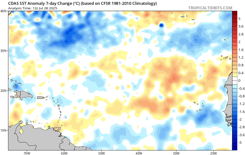
This is why any model or prediction can be made on fluctuations mdr warming again.
https://www.tropicaltidbits.com/analysi ... eatl_1.png
https://www.tropicaltidbits.com/analysi ... eatl_1.png
1 likes
-
weathaguyry

- Category 5
- Posts: 1273
- Age: 22
- Joined: Wed Jun 15, 2016 5:16 am
- Location: Long Island, NY
Re: 2019 Indicators: SST'S / Sal / MSLP / Steering / Shear / Instability (See updated graphics at first post)
IMO, SST anomalies in the MDR aren't going to make or break the season, 26C SSTs are closing in on 45W and 28C SSTs are plentiful in the deep tropics and GOM, which is perfectly normal for early June. Come August, these will be even warmer, and will easily support hurricanes, even if there are slightly negative anomalies present.

2 likes
My posts are only my opinions and NOT official forecasts. For official forecasts, consult the National Hurricane Center or the National Weather Service.
Irene 11', Sandy 12', Fay 20’, Isaias 20’, Elsa 21’, Henri 21’, Ida 21’
Irene 11', Sandy 12', Fay 20’, Isaias 20’, Elsa 21’, Henri 21’, Ida 21’
-
Shell Mound
- Category 5
- Posts: 2432
- Age: 33
- Joined: Thu Sep 07, 2017 3:39 pm
- Location: St. Petersburg, FL → Scandinavia
Re: 2019 Indicators: SST'S / Sal / MSLP / Steering / Shear / Instability (See updated graphics at first post)
As has been the case since 2016 (and arguably since 2012), seasonal forecasts, while always complicated, seem to have become ever more unreliable. Perhaps this is attributable, at least in part, to increased seasonal variability, which, in turn, owes to climate change, at least partially.
In other words, old seasonal indicators may no longer be as reliable as once assumed. Even if weak El Niño conditions were to persist through, or reemerge by the time of, the peak of the 2019 Atlantic hurricane season, the very strong African monsoon may not only serve to enhance low-level westerlies, thereby maintaining SSTs of at least slightly above average in the MDR, but also, owing to the very weak Saharan Air Layer (hence abundant moisture), combined with the strong African easterly jet, serve to weaken or even split the TUTT, a typical feature of El Niño (due to net rising air over the Pacific and sinking air over the Atlantic), near the Lesser Antilles, owing to abundant outflow from strong convection closer to Africa, which would warm up the atmospheric column and counteract upper-level breaking waves (sinking air) from the mid-latitudes.
Furthermore, if El Niño turns out to be central- or west-based, as seems increasingly plausible, the aforementioned factors could further reduce westerly shear over the western MDR and eastern Caribbean, at least to some degree.
Finally, El Niño, if present, tends to correlate with a suppressed (negative) NAO, hence reduced low-level easterlies over the MDR, owing to a weaker Bermuda High, which would promote net convergence off West Africa, reduce the advection of stable Saharan air from North Africa, and thus further contribute to both a warm MDR and early development off Africa.
However, unlike an east-based El Niño, a central- or west-based El Niño would tend to promote a mean trough over the central North Atlantic, with above-normal heights over the Great Lakes and parts of the Mid-Atlantic and/or Northeastern United States. An east-based event, conversely, would tend to promote a mean trough over the Eastern Seaboard, which would shield the East Coast from potential MDR-based impacts.
Therefore, lower-than-average vertical wind shear may exist over the eastern MDR, which, in conjunction with abundant instability and moisture, would, in light of all other considerations mention herein (as an aggregate), tend to foster rapid tropical cyclogenesis close to West Africa, i.e., in the eastern MDR, given the robustness of African easterly waves in recent seasons, especially 2019 so far.
Given a weaker Bermuda High and lower-than-average sea-level pressures off West Africa, storms that form early on may be able to grow in size, that is, become fairly expansive, owing to the relative lack of SAL and the abundance of strong convection.
As tropical cyclones gain strength and head westward, they may temporarily weaken, but not dissipate, as they encounter near-to-slightly-above-average shear over the western MDR and eastern Caribbean, thanks to the semi-permanent TUTT. However, the large size and initial strength of the storms may be able to weaken and/or split the TUTT.
Then, as the storms near the Bahamas and Southeastern U.S., they get "caught" beneath rebuilding ridging over the Eastern Seaboard, and encounter below-average shear near land, thereby re-strengthening as they turn westward toward the U.S. and/or eastern Gulf of Mexico, à la Betsy 1965, Andrew 1992, and Jeanne 2004.
Perhaps 2019 may not be as active as the most "bullish" estimates (including yours truly), but it may still be more active the most "bearish" estimates. Maybe fifteen to sixteen named storms, nine to ten hurricanes, and four to five majors (ACE: ~180-200) constitute a "reasonable" revised bet.
4 likes
CVW / MiamiensisWx / Shell Mound
The posts in this forum are NOT official forecasts and should not be used as such. They are just the opinion of the poster and may or may not be backed by sound meteorological data. They are NOT endorsed by any professional institution or STORM2K. For official information, please refer to products from the NHC and NWS.
Who is online
Users browsing this forum: No registered users and 175 guests