Texas Winter 2018-2019
Moderator: S2k Moderators
Forum rules
 The posts in this forum are NOT official forecast and should not be used as such. They are just the opinion of the poster and may or may not be backed by sound meteorological data. They are NOT endorsed by any professional institution or STORM2K.

The posts in this forum are NOT official forecast and should not be used as such. They are just the opinion of the poster and may or may not be backed by sound meteorological data. They are NOT endorsed by any professional institution or STORM2K.
-
ztshanklin
- Tropical Low

- Posts: 29
- Joined: Thu Dec 13, 2018 1:33 pm
-
South Texas Storms

- Professional-Met

- Posts: 4255
- Joined: Thu Jun 24, 2010 12:28 am
- Location: Houston, TX
Re: Texas Winter 2018-2019
ztshanklin wrote:End of year could really be interesting.
Yes, it's certainly looking interesting right now. Still plenty of time to watch, but I'm liking the trends!
By the way, welcome to Storm2K!
2 likes
-
orangeblood
- S2K Supporter

- Posts: 3895
- Joined: Tue Dec 15, 2009 6:14 pm
- Location: Fort Worth, TX
Re: Texas Winter 2018-2019
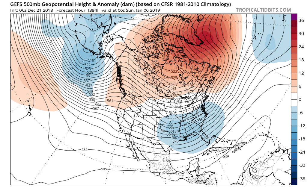
Ntxw wrote:EPS and GEFS rolling forward are now beginning to show the big -NAO/-AO over the polar regions and NATL. Also possible is the reflection of SSW, while I don't think we see severe cold with this SSW it will likely dislodge more cold air into the -NAO pattern. The Aleutian low also retrogrades from Alaska to form the snowier/colder weak-mod Nino look that we had a taste of late November and early December. Dec 28-31 will give a glimpse of colder air as the Pacific buckles some and less zonal, but the real fun likely happens the second week of January.
If you want to see a repeat of '78 then having the Hudson->Greenland west based NAO go crazy helps
https://images2.imgbox.com/8f/b7/Qh4Vl8io_o.jpg
Yep, and don't underestimate this SSW...there appears to now be consensus with all Models that this will become a Major SSW with a PV split around the 30th +/-. And it appears the weakened main portion of the Vortex might be coming to our side of the world, if that kind of block gets locked in and the PV is underneath, look out below - Jan 2019 is becoming really really interesting!!!
4 likes
-
Captmorg70
- Tropical Storm

- Posts: 206
- Age: 38
- Joined: Mon Dec 18, 2017 12:07 am
- Location: Highland Village Tx
Re: Texas Winter 2018-2019
Hey so maybe some advice from folks that know NM better:
My family has a ski trip planned to Angel Fire the 26-30. I know it’s still a week out but trend looks like it could snow some in Angel Fire. How are the roads up that way? I’m assuming better than here in NTX when we have winter weather
My family has a ski trip planned to Angel Fire the 26-30. I know it’s still a week out but trend looks like it could snow some in Angel Fire. How are the roads up that way? I’m assuming better than here in NTX when we have winter weather
1 likes
Location - Highland Village
Re: Texas Winter 2018-2019
Yukon Cornelius wrote:colder than forecasted this morning. The forecast was for a low of 35, it’s currently 29.
Seems like this has been happening a lot this year for our area.
1 likes


Re: Texas Winter 2018-2019
As for next weekend, there will be some colder air to work with. Once again timing is key. I think a faster solution like the 0z ECMWF gives us the best chance.
SE ridge favors cold to move more down the plains rather than to the east compared to early December.
SE ridge favors cold to move more down the plains rather than to the east compared to early December.
2 likes
The above post and any post by Ntxw is NOT an official forecast and should not be used as such. It is just the opinion of the poster and may or may not be backed by sound meteorological data. It is NOT endorsed by any professional institution including Storm2k. For official information, please refer to NWS products.
Help support Storm2K!

Re: Texas Winter 2018-2019
12z GFS arctic blast coming January 1st. 1047 mb high in southern Canada.
0 likes
-
orangeblood
- S2K Supporter
- Posts: 3895
- Joined: Tue Dec 15, 2009 6:14 pm
- Location: Fort Worth, TX
Re: Texas Winter 2018-2019
Captmorg70 wrote:Hey so maybe some advice from folks that know NM better:
My family has a ski trip planned to Angel Fire the 26-30. I know it’s still a week out but trend looks like it could snow some in Angel Fire. How are the roads up that way? I’m assuming better than here in NTX when we have winter weather
In that particular area, it appears the snow might be measured in feet during that time frame...drive safe!!
2 likes
-
South Texas Storms
- Professional-Met
- Posts: 4255
- Joined: Thu Jun 24, 2010 12:28 am
- Location: Houston, TX
Re: Texas Winter 2018-2019
Cpv17 wrote:12z GFS arctic blast coming January 1st. 1047 mb high in southern Canada.
Along with several chances for frozen precipitation across central TX during the first few days of 2019.
2 likes
Re: Texas Winter 2018-2019
Beyond truncation 12z GFS has a -EPO cold dump around the New Year. That's too far out to even seriously consider right now, but I do see merits in the pattern with lower EPO and the turn from +PNA to -PNA and SE ridge. CMC doesn't go out as far but does show source region loading up for something to move.
So at least there is a chance!
So at least there is a chance!
2 likes
The above post and any post by Ntxw is NOT an official forecast and should not be used as such. It is just the opinion of the poster and may or may not be backed by sound meteorological data. It is NOT endorsed by any professional institution including Storm2k. For official information, please refer to NWS products.
Help support Storm2K!
Help support Storm2K!
Re: Texas Winter 2018-2019
12z FV3 is probably the more extreme cold dome outcome for next weekend. It has the strongest HP of the models with plains oriented cold spill, and of course SE ridge. Conventional wisdom in a pattern like that with -PNA you'd think ice storm.
1 likes
The above post and any post by Ntxw is NOT an official forecast and should not be used as such. It is just the opinion of the poster and may or may not be backed by sound meteorological data. It is NOT endorsed by any professional institution including Storm2k. For official information, please refer to NWS products.
Help support Storm2K!
Help support Storm2K!
Re: Texas Winter 2018-2019
orangeblood wrote:Captmorg70 wrote:Hey so maybe some advice from folks that know NM better:
My family has a ski trip planned to Angel Fire the 26-30. I know it’s still a week out but trend looks like it could snow some in Angel Fire. How are the roads up that way? I’m assuming better than here in NTX when we have winter weather
In that particular area, it appears the snow might be measured in feet during that time frame...drive safe!!
Yeah the big SW trough pattern is treacherous weather in the high elevations of Northern New Mexico. Likely a lot of snow.
0 likes
The above post and any post by Ntxw is NOT an official forecast and should not be used as such. It is just the opinion of the poster and may or may not be backed by sound meteorological data. It is NOT endorsed by any professional institution including Storm2k. For official information, please refer to NWS products.
Help support Storm2K!
Help support Storm2K!
-
weatherdude1108
- Category 5

- Posts: 4228
- Joined: Tue Dec 13, 2011 1:04 pm
- Location: Northwest Austin/Cedar Park, TX
Re: Texas Winter 2018-2019
South Texas Storms wrote:Cpv17 wrote:12z GFS arctic blast coming January 1st. 1047 mb high in southern Canada.
Along with several chances for frozen precipitation across central TX during the first few days of 2019.
I just saw these 12Z GFS slides. Granted they are 288-234 hours out.


1 likes
The preceding post is NOT an official forecast, and should not be used as such. It is only the opinion of the poster and may or may not be backed by sound meteorological data. It is NOT endorsed by any professional institution including storm2k.org. For Official Information please refer to the NHC and NWS products.
-
Captmorg70
- Tropical Storm
- Posts: 206
- Age: 38
- Joined: Mon Dec 18, 2017 12:07 am
- Location: Highland Village Tx
Re: Texas Winter 2018-2019
orangeblood wrote:Captmorg70 wrote:Hey so maybe some advice from folks that know NM better:
My family has a ski trip planned to Angel Fire the 26-30. I know it’s still a week out but trend looks like it could snow some in Angel Fire. How are the roads up that way? I’m assuming better than here in NTX when we have winter weather
In that particular area, it appears the snow might be measured in feet during that time frame...drive safe!!
Sorta what I’m afraid of...
0 likes
Location - Highland Village
-
Captmorg70
- Tropical Storm
- Posts: 206
- Age: 38
- Joined: Mon Dec 18, 2017 12:07 am
- Location: Highland Village Tx
Re: Texas Winter 2018-2019
Ntxw wrote:orangeblood wrote:Captmorg70 wrote:Hey so maybe some advice from folks that know NM better:
My family has a ski trip planned to Angel Fire the 26-30. I know it’s still a week out but trend looks like it could snow some in Angel Fire. How are the roads up that way? I’m assuming better than here in NTX when we have winter weather
In that particular area, it appears the snow might be measured in feet during that time frame...drive safe!!
Yeah the big SW trough pattern is treacherous weather in the high elevations of Northern New Mexico. Likely a lot of snow.
If I make make it. I’ll take some pics and we can pretend it’s NTX
1 likes
Location - Highland Village
-
bubba hotep

- S2K Supporter
- Posts: 6012
- Joined: Wed Dec 28, 2016 1:00 am
- Location: Collin County Texas
Re: Texas Winter 2018-2019
orangeblood wrote:Ntxw wrote:EPS and GEFS rolling forward are now beginning to show the big -NAO/-AO over the polar regions and NATL. Also possible is the reflection of SSW, while I don't think we see severe cold with this SSW it will likely dislodge more cold air into the -NAO pattern. The Aleutian low also retrogrades from Alaska to form the snowier/colder weak-mod Nino look that we had a taste of late November and early December. Dec 28-31 will give a glimpse of colder air as the Pacific buckles some and less zonal, but the real fun likely happens the second week of January.
If you want to see a repeat of '78 then having the Hudson->Greenland west based NAO go crazy helps
https://images2.imgbox.com/8f/b7/Qh4Vl8io_o.jpg
Yep, and don't underestimate this SSW...there appears to now be consensus with all Models that this will become a Major SSW with a PV split around the 30th +/-. And it appears the weakened main portion of the Vortex might be coming to our side of the world, if that kind of block gets locked in and the PV is underneath, look out below - Jan 2019 is becoming really really interesting!!!
Dr. Amy Butler reminds us via Twitter today that not all SSW events work out good for us. She highlighted the Dec 2001 event that had a similar setup to now but ended up not delivering the cold.

However, typically SSW events do deliver the cold.

Dr. Butler is very informative and tweets a lot of her research at @DrAHButler
0 likes
Winter time post are almost exclusively focused on the DFW area.
-
bubba hotep
- S2K Supporter
- Posts: 6012
- Joined: Wed Dec 28, 2016 1:00 am
- Location: Collin County Texas
Re: Texas Winter 2018-2019
The anticipated active pattern is fast approaching and looks to match up pretty well with what the long range ENSO analogs were showing. There are still a lot of kinks to workout given that the after Christmas system looks to be sourced from multiple pieces of energy and the following system is still out over the NPAC. The ejection of the 1st system out over the Plains will draw down a decent slug of cold air for the next system to work with. As many others have pointed out over the last couple of days, "Time to buckle up!"

1 likes
Winter time post are almost exclusively focused on the DFW area.
-
Haris

- Category 5
- Posts: 1814
- Joined: Mon Nov 27, 2017 8:19 pm
- Location: ( Bee Cave) West Austin, Texas
Re: Texas Winter 2018-2019
the euro is showing over 3.5" of rain here mid week in Austin with cape near 3,000
The gfs is 1/2" . Fun
The gfs is 1/2" . Fun
1 likes
Weather geek and a storm spotter in West Austin. Not a degreed meteorologist. Big snow fan. Love rain and cold! Despise heat!
-
Ralph's Weather
- S2K Supporter
- Posts: 3371
- Age: 38
- Joined: Fri Dec 13, 2013 11:55 am
- Location: Lindale, TX
- Contact:
Re: Texas Winter 2018-2019
Captmorg70 wrote:Hey so maybe some advice from folks that know NM better:
My family has a ski trip planned to Angel Fire the 26-30. I know it’s still a week out but trend looks like it could snow some in Angel Fire. How are the roads up that way? I’m assuming better than here in NTX when we have winter weather
My family has a place on the other side of the mountain, near Sipapu, they do an awesome job with he roads up there, but at some point no amount of plowing can keep up. If rates are reasonable and temps are in the 20s the roads should not be terrible especially if there are breaks in the snow showers. It is so unpredictable up there, I have seen a foot on a day with 10% chance of snow showers. For your sake Angel Fire does tend to have lower totals than some of the other resorts in northern NM, though as always in the mountains snow totals are very dependant on the wind direction. Prepare for your car to be red from the chemicals they put down on the roads. Enjoy I hope to get up there later this winter.
2 likes
Follow on Facebook at Ralph's Weather.
Re: Texas Winter 2018-2019
Man, the models are really pounding the southeast with a ton of rain. I’m jealous.
0 likes
Who is online
Users browsing this forum: No registered users and 26 guests