#209 Postby SoupBone » Sat Sep 08, 2018 10:48 pm
shiny-pebble wrote:stormlover2013 wrote:And harvey was done until it got into the gulf
Why do people try to compare anything that might get in the Gulf to Harvey? I understand SSTs are very high there, but that doesnt mean Harvey 2.0.
Sent from my LG-H700 using Tapatalk
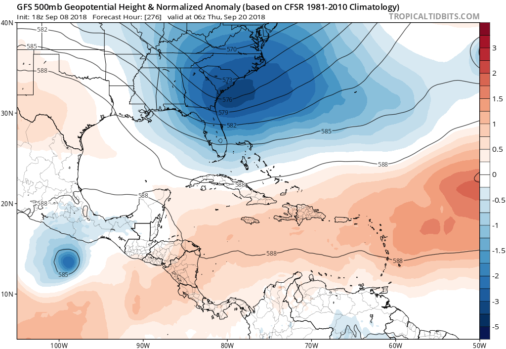
A key difference, at least for these last several of model runs, is that both the Euro and GFS show a high pressure system parked over Cuba, Haiti, and the DR, forcing it west, at least for a few days beyond the islands.
0 likes
Personal Forecast Disclaimer:
The posts in this forum are NOT official forecast and should not be used as such. They are just the opinion of the poster and may or may not be backed by sound meteorological data. They are NOT endorsed by any professional institution or storm2k.org. For official information, please refer to the NHC and NWS products.