cycloneye wrote:
Marine Weather Discussion
NWS National Hurricane Center Miami FL
300 PM EDT Wed May 23 2018
...GULF OF MEXICO...
Currently, light to moderate east-southeast winds are across the
basin with locally fresh winds near the Yucatan Channel
associated with an elongated area of low pressure extending from
the eastern Yucatan Peninsula to inland western Honduras. Seas
are generally 2 to 3 ft in the western half of the basin while
altimeter data show seas in the range of 4 to 7 ft in the eastern
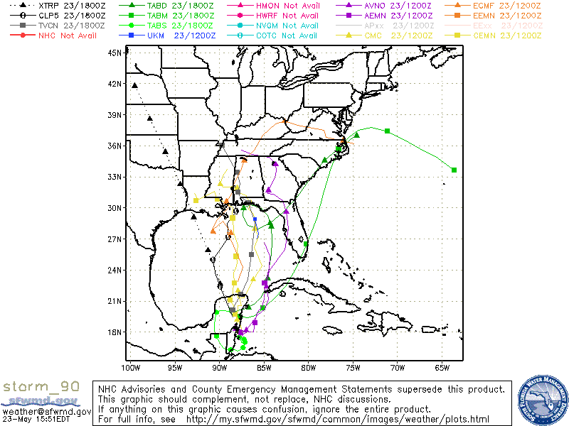
Gulf. The area of low pressure is expected to further develop
off the northern coast of the Yucatan Peninsula Fri morning. The
tropical low will move slowly northward in the eastern Gulf over
the weekend with up to near gale force winds and associated seas
east of the low. The global models consensus indicate the low
will reach the offshore waters of SE Louisiana Sunday morning,
then briefly stall in that region through Monday morning when the
low moves inland SE Louisiana. Regardless of development,
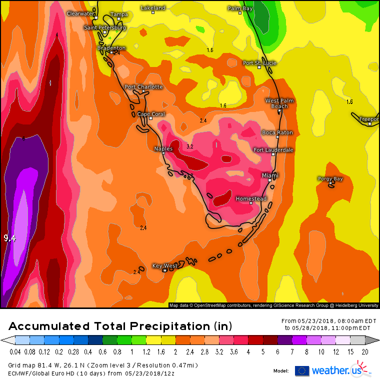
locally heavy rainfall and isolated tstms are possible over much
of Floria, the Yucatan Channel and the northeast Gulf.
https://www.nhc.noaa.gov/text/MIAMIMATS.shtml
I am confused. It says the low will move in the eastern gulf. But then mentions the low in or near louisiana which is the central gulf.