ATL: ALBERTO - Post-Tropical
Moderator: S2k Moderators
-
Aric Dunn
- Category 5

- Posts: 21238
- Age: 43
- Joined: Sun Sep 19, 2004 9:58 pm
- Location: Ready for the Chase.
- Contact:
Re: ATL: INVEST 90L - Models
CMC is now stalling it just off shore for about a day before moving inland around the mouth of Mississippi. majority of models are now showing it being left behind in some form or fashion... not counting the silly operational GFS
0 likes
Note: If I make a post that is brief. Please refer back to previous posts for the analysis or reasoning. I do not re-write/qoute what my initial post said each time.
If there is nothing before... then just ask
Space & Atmospheric Physicist, Embry-Riddle Aeronautical University,
I believe the sky is falling...
If there is nothing before... then just ask
Space & Atmospheric Physicist, Embry-Riddle Aeronautical University,
I believe the sky is falling...
-
Dylan

- Professional-Met

- Posts: 338
- Age: 31
- Joined: Mon May 31, 2010 9:50 am
- Location: New Orleans, LA
Re: ATL: INVEST 90L - Models
I’m really worried about this stalling/meandering just before or after landfall, and dumping catastrophic amounts of rain on somebody. There isn’t any evidence of a weakness that will pick it up around the time of landfall on any of the guidance. Very concerning.
1 likes
Georges('98), Allison('01), Isidore('02), Lili('02), Frances('04) Ivan('04), Cindy('05), Katrina('05), Rita('05), Gustav('08), Isaac('12), Matthew('16), Harvey('17), Irma('17), Nate ('17), Ida ('21).
-
Aric Dunn
- Category 5
- Posts: 21238
- Age: 43
- Joined: Sun Sep 19, 2004 9:58 pm
- Location: Ready for the Chase.
- Contact:
Re: ATL: INVEST 90L - Models
Dylan wrote:I’m really worried about this stalling/meandering just before or after landfall, and dumping catastrophic amounts of rain on somebody. There isn’t any evidence of a weakness that will pick it up around the time of landfall on any of the guidance. Very concerning.
yeah, and it will cover multiple states.. no long wave trough at all. if it does not reform centers as often while moving north than its forward progress will be limited those center jumps are what is producing the fast motion with the models. and if that is the case then could remain offshore for awhile and do similar stuff to earlier Euro runs and now ICON .. have to wait for the upper trough to position itself and see where that shear axis sets up and its orientation. and.... well see how well defined a center we get before into moves into the gulf.
1 likes
Note: If I make a post that is brief. Please refer back to previous posts for the analysis or reasoning. I do not re-write/qoute what my initial post said each time.
If there is nothing before... then just ask
Space & Atmospheric Physicist, Embry-Riddle Aeronautical University,
I believe the sky is falling...
If there is nothing before... then just ask
Space & Atmospheric Physicist, Embry-Riddle Aeronautical University,
I believe the sky is falling...
-
galaxy401

- Category 5
- Posts: 2446
- Age: 30
- Joined: Sat Aug 25, 2012 9:04 pm
- Location: Casa Grande, Arizona
Re: ATL: INVEST 90L - Models
Ugh, hearing the word stalling right at landfall sends a chill to myself after the madness with Harvey. Hope that's not the case here.
1 likes
Got my eyes on moving right into Hurricane Alley: Florida.
-
Dylan
- Professional-Met
- Posts: 338
- Age: 31
- Joined: Mon May 31, 2010 9:50 am
- Location: New Orleans, LA
Re: ATL: INVEST 90L - Models
Aric Dunn wrote:Dylan wrote:I’m really worried about this stalling/meandering just before or after landfall, and dumping catastrophic amounts of rain on somebody. There isn’t any evidence of a weakness that will pick it up around the time of landfall on any of the guidance. Very concerning.
yeah, and it will cover multiple states.. no long wave trough at all. if it does not reform centers as often while moving north than its forward progress will be limited those center jumps are what is producing the fast motion with the models. and if that is the case then could remain offshore for awhile and do similar stuff to earlier Euro runs and now ICON .. have to wait for the upper trough to position itself and see where that shear axis sets up and its orientation. and.... well see how well defined a center we get before into moves into the gulf.
It’s plain as day when you look at a 500mb chart of North America heading into Sunday and beyond. People way smarter than I am are pointing this out as well.
1 likes
Georges('98), Allison('01), Isidore('02), Lili('02), Frances('04) Ivan('04), Cindy('05), Katrina('05), Rita('05), Gustav('08), Isaac('12), Matthew('16), Harvey('17), Irma('17), Nate ('17), Ida ('21).
-
USTropics
- Professional-Met
- Posts: 2738
- Joined: Sun Aug 12, 2007 3:45 am
- Location: Florida State University
Re: ATL: INVEST 90L - Models
UKMET plots, looks like a weaker system but a noticeable turn towards the NW at the end:

Code: Select all
             GLOBAL MODEL DATA TIME 00UTC 23.05.2018

             NEW TROPICAL STORM FORECAST TO DEVELOP AFTER 114 HOURS
                   FORECAST POSITION AT T+114 : 24.5N  84.1W

  VERIFYING TIME     POSITION     STRENGTH        TENDENCY
  --------------     --------     --------        --------
 00UTC 28.05.2018  26.0N  84.0W     WEAK      WEAKENING RAPIDLY
 12UTC 28.05.2018  27.8N  85.1W   MODERATE      LITTLE CHANGE
 00UTC 29.05.2018  28.3N  85.8W   MODERATE      LITTLE CHANGE
1 likes
-
SouthFloridawx

- S2K Supporter

- Posts: 8346
- Age: 47
- Joined: Tue Jul 26, 2005 1:16 am
- Location: Sarasota, FL
- Contact:
Re: RE: Re: ATL: INVEST 90L - Discussion
That was very interesting, thank you.
Sent from my SM-G930P using Tapatalk
TheStormExpert wrote:Interesting Twitter discussion by Philippe Papin on Invest 90L and its CAG (Central American Gyre) origin and key aspects of this kind of originating TC potential.
Sent from my SM-G930P using Tapatalk
0 likes
-
CyclonicFury

- Category 5
- Posts: 2035
- Age: 27
- Joined: Sun Jul 02, 2017 12:32 pm
- Location: NC
- Contact:
Re: ATL: INVEST 90L - Models
00z GEFS clustered near the Panhandle/Big Bend

1 likes
NCSU B.S. in Meteorology Class of 2021. Tropical weather blogger at http://www.cyclonicfury.com. My forecasts and thoughts are NOT official, for official forecasts please consult the National Hurricane Center.
-
USTropics
- Professional-Met
- Posts: 2738
- Joined: Sun Aug 12, 2007 3:45 am
- Location: Florida State University
Re: ATL: INVEST 90L - Models
Not much change in the 00z ECMWF, time frame has slowed down by a day in terms of landfall with a slightly weaker vort signature, but looks to be a slow moving, heavy rain producing event once again in the NGOM/SE US:

1 likes
-
Dylan
- Professional-Met
- Posts: 338
- Age: 31
- Joined: Mon May 31, 2010 9:50 am
- Location: New Orleans, LA
Re: ATL: INVEST 90L - Models
0z EURO to NOLA. It’s been no further west than south-central Louisiana and no further east than Gulfport, MS over the past 3 days. Very consistent. Only a matter of time until the GFS caves into the European, which is its anthem.
0 likes
Georges('98), Allison('01), Isidore('02), Lili('02), Frances('04) Ivan('04), Cindy('05), Katrina('05), Rita('05), Gustav('08), Isaac('12), Matthew('16), Harvey('17), Irma('17), Nate ('17), Ida ('21).
-
Wx_Warrior
- Category 5
- Posts: 2718
- Joined: Thu Aug 03, 2006 3:58 pm
- Location: Beaumont, TX
-
AtlanticWind

- S2K Supporter
- Posts: 1898
- Age: 67
- Joined: Sun Aug 08, 2004 9:57 pm
- Location: Plantation,Fla
Re: ATL: INVEST 90L - Models
Dylan wrote:0z EURO to NOLA. It’s been no further west than south-central Louisiana and no further east than Gulfport, MS over the past 3 days. Very consistent. Only a matter of time until the GFS caves into the European, which is its anthem.
The broad center will likely come ashore near NOLA, but the stronger bands will likely be much further
east over florida.
This should be a sheared right handed storm I would guess.
0 likes
-
stormreader
Re: ATL: INVEST 90L - Models
Yeah...posted that Euro solution last night delivered through local met here in La. Beginning to look like very severe impacts (rainfall) for NOLA in particular. The forecasted stall by Euro also shows precip expanding westward (as you might imagine with weak steering) into SW La too. Could be very serious situation from Pensacola to La/Tex birder. I know that’s significantly further west than what was supposed a day or two ago. But becoming a very real possibility now.
0 likes
-
Twisted-core
Re: ATL: INVEST 90L - Models
Just as well its a sheared environment in GOMEX this modelled storm should encounter,
well hoping it stays tamed by excessive shear.


https://imgur.com/quvymtq
Ukmet 00z thinks a stronger system may play out..Clearing the shear within the gyre.
well hoping it stays tamed by excessive shear.
https://imgur.com/quvymtq
Ukmet 00z thinks a stronger system may play out..Clearing the shear within the gyre.
0 likes
-
Sciencerocks
- Category 5
- Posts: 10186
- Age: 40
- Joined: Thu Jul 06, 2017 1:51 am
Re: ATL: INVEST 90L - Discussion
I am putting a satellite loop once or twice per day as people in the future will want to know how the system looked at this point. It would add to the pleasure of looking back at the cyclone!
2 likes
-
northjaxpro

- S2K Supporter
- Posts: 8900
- Joined: Mon Sep 27, 2010 11:21 am
- Location: Jacksonville, FL
Re: ATL: INVEST 90L - Models
Well, no change with the 06Z GFS. This run continues to show the boatload of rain moving over Florida. GFS still maintains Invest 90L has a weak, sloppy and sheared system. getting no stronger than 1002 mb as it moves over Florida during the weekend, then north into South Carolina on 12Z Monday. morning
0 likes
NEVER, EVER SAY NEVER in the tropics and weather in general, and most importantly, with life itself!!
________________________________________________________________________________________
Fay 2008 Beryl 2012 Debby 2012 Colin 2016 Hermine 2016 Julia 2016 Matthew 2016 Irma 2017 Dorian 2019
________________________________________________________________________________________
Fay 2008 Beryl 2012 Debby 2012 Colin 2016 Hermine 2016 Julia 2016 Matthew 2016 Irma 2017 Dorian 2019
-
cycloneye

- Admin

- Posts: 149497
- Age: 69
- Joined: Thu Oct 10, 2002 10:54 am
- Location: San Juan, Puerto Rico
Re: ATL: INVEST 90L - Models
JB goes with Euro.
@BigJoeBastardi
GFS continues to look like the feedback fairy has got it, Euro track toward central gulf coast of east side weighted feature looks much better to me
https://twitter.com/BigJoeBastardi/status/999233832183320576
@BigJoeBastardi
GFS continues to look like the feedback fairy has got it, Euro track toward central gulf coast of east side weighted feature looks much better to me
https://twitter.com/BigJoeBastardi/status/999233832183320576
2 likes
Visit the Caribbean-Central America Weather Thread where you can find at first post web cams,radars
and observations from Caribbean basin members Click Here
and observations from Caribbean basin members Click Here
-
stormreader
Re: ATL: INVEST 90L - Discussion
Aric Dunn wrote:tailgater wrote:Aric Dunn wrote:MId and upper levels are becoming less dry around the system. Could see more convection build overnight.
yep, and the southern GOM showing up pretty on Mimic TPW
http://tropic.ssec.wisc.edu/real-time/m ... t72hrs.gif
Very nice....The gyre appears very distinctly in those images.
just in case anyone missed it. there is a new and improved TPW> >> http://tropic.ssec.wisc.edu/real-time/m ... anim=html5
you can check multiple layers. its is very helpful
0 likes
-
TheStormExpert
Re: ATL: INVEST 90L - Discussion
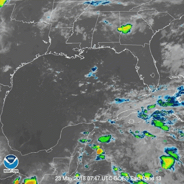
90L looks like total dried up crap this morning. The models showing a drier than normal MDR and Caribbean weren’t kidding!
1 likes
-
NotSparta

- Professional-Met
- Posts: 1677
- Age: 24
- Joined: Fri Aug 18, 2017 8:24 am
- Location: Naples, FL
- Contact:
Re: ATL: INVEST 90L - Discussion
The 2 day chances of formation are 0% for a reason, aren't they?
0 likes
This post was probably an opinion of mine, and in no way is official. Please refer to http://www.hurricanes.gov for official tropical analysis and advisories.
My website, with lots of tropical wx graphics, including satellite and recon: http://cyclonicwx.com
My website, with lots of tropical wx graphics, including satellite and recon: http://cyclonicwx.com
Who is online
Users browsing this forum: No registered users and 76 guests