Texas Summer 2017

U.S. & Caribbean Weather Discussions and Severe Weather Events

Moderator: S2k Moderators

Forum rules

The posts in this forum are NOT official forecast and should not be used as such. They are just the opinion of the poster and may or may not be backed by sound meteorological data. They are NOT endorsed by any professional institution or STORM2K.

Help Support Storm2K
Message
Author
User avatar
Texas Snowman
Storm2k Moderator
Storm2k Moderator
Posts: 6179
Joined: Fri Jan 25, 2008 11:29 am
Location: Denison, Texas

Re: Texas Summer 2017

#1061 Postby Texas Snowman » Mon Aug 07, 2017 9:28 am

I totally understand the frustration in the Metroplex.

Just a reminder I guess that even with multiple meteorologists, high powered computers and several models, it's still a forecast and not a guarantee.

Sometimes Charley doesn't want to go to Tampa. :D
0 likes   
The above post and any post by Texas Snowman is NOT an official forecast and should not be used as such. It is just the opinion of the poster and may or may not be backed by sound meteorological data. It is NOT endorsed by any professional institution including storm2k.org. For official information, please refer to NWS products.

User avatar
Ntxw
Storm2k Moderator
Storm2k Moderator
Posts: 22785
Joined: Wed Oct 21, 2009 6:34 pm
Location: DFW, Texas

Re: Texas Summer 2017

#1062 Postby Ntxw » Mon Aug 07, 2017 9:38 am

Texas Snowman wrote:I totally understand the frustration in the Metroplex.

Just a reminder I guess that even with multiple meteorologists, high powered computers and several models, it's still a forecast and not a guarantee.

Sometimes Charley doesn't want to go to Tampa. :D


Our central Texas friends got plenty overnight, it was worthwhile sacrifice since DFW is ahead for the year anyway. Hopefully we can get a few more chances, in August even 1" of rain is more than good. Cooler temps still on track
3 likes   
The above post and any post by Ntxw is NOT an official forecast and should not be used as such. It is just the opinion of the poster and may or may not be backed by sound meteorological data. It is NOT endorsed by any professional institution including Storm2k. For official information, please refer to NWS products.

  Help support Storm2K!
Help Support Storm2K

weatherdude1108
Category 5
Category 5
Posts: 4228
Joined: Tue Dec 13, 2011 1:04 pm
Location: Northwest Austin/Cedar Park, TX

Re: Texas Summer 2017

#1063 Postby weatherdude1108 » Mon Aug 07, 2017 9:40 am

I saw a reference to the DFW discussion and how this complex was not in any of the models, producing low confidence in the forecast. EWX also alluded to that.

000
FXUS64 KEWX 071114
AFDEWX

Area Forecast Discussion
National Weather Service Austin/San Antonio TX
614 AM CDT Mon Aug 7 2017

.AVIATION...
Complex of showers and storms continue to push east and will affect
the Austin and San Antonio TAF sites this morning. Should see periods
of thunderstorms through the late morning hours before the system
weakens with the loss of the low-level jet. The forecast beyond this
morning is low-confidence as models do not have any sort of handle on
this event.
Think the atmosphere will be pretty worked over and there
is a chance not much more will happen today. Will only mention VCSH
this afternoon and overnight due to the low confidence forecast.
1 likes   
The preceding post is NOT an official forecast, and should not be used as such. It is only the opinion of the poster and may or may not be backed by sound meteorological data. It is NOT endorsed by any professional institution including storm2k.org. For Official Information please refer to the NHC and NWS products.

User avatar
Portastorm
Storm2k Moderator
Storm2k Moderator
Posts: 9914
Age: 63
Joined: Fri Jul 11, 2003 9:16 am
Location: Round Rock, TX
Contact:

Re: Texas Summer 2017

#1064 Postby Portastorm » Mon Aug 07, 2017 10:10 am

weatherdude1108 wrote:I saw a reference to the DFW discussion and how this complex was not in any of the models, producing low confidence in the forecast. EWX also alluded to that.

000
FXUS64 KEWX 071114
AFDEWX

Area Forecast Discussion
National Weather Service Austin/San Antonio TX
614 AM CDT Mon Aug 7 2017

.AVIATION...
Complex of showers and storms continue to push east and will affect
the Austin and San Antonio TAF sites this morning. Should see periods
of thunderstorms through the late morning hours before the system
weakens with the loss of the low-level jet. The forecast beyond this
morning is low-confidence as models do not have any sort of handle on
this event.
Think the atmosphere will be pretty worked over and there
is a chance not much more will happen today. Will only mention VCSH
this afternoon and overnight due to the low confidence forecast.


It should stop raining here around lunchtime and I doubt we see any more rain today. The atmosphere is worked over pretty good and it would take a great deal of forcing to re-initiate convection. And that is fine with me. Not just me but I know so many people I have already run into today who are THRILLED about the rain and cooler temperatures.
3 likes   
Any forecasts under my name are to be taken with a grain of salt. Get your best forecasts from the National Weather Service and National Hurricane Center.

Shoshana
Category 5
Category 5
Posts: 1414
Joined: Thu Sep 09, 2004 7:50 pm
Location: NE Austin

Re: Texas Summer 2017

#1065 Postby Shoshana » Mon Aug 07, 2017 10:28 am

I also woke up sometime before 3 am. I didn't hear the thunder at first, but the dog did and pawed at me until I got up and got her Thundershirt and put it on her.

I did get to watch the storm later.

We've had a bit more than 3 inches as of 9:15 when I emptied the rain gauge and it's still raining.

Edited to add: I'm hearing thunder again
1 likes   

weatherguy425
Tropical Storm
Tropical Storm
Posts: 180
Joined: Sun Aug 16, 2009 1:06 pm
Location: Houston, TX > Lubbock, TX > Savannah, GA
Contact:

Re: Texas Summer 2017

#1066 Postby weatherguy425 » Mon Aug 07, 2017 10:34 am

Not to jump the gun, but most guidance suggests a similar setup late this weekend, into next week; 8/11 - 8/15. That 'chance' to score in the rain department may come sooner rather than later. :wink:
2 likes   

weatherdude1108
Category 5
Category 5
Posts: 4228
Joined: Tue Dec 13, 2011 1:04 pm
Location: Northwest Austin/Cedar Park, TX

Re: Texas Summer 2017

#1067 Postby weatherdude1108 » Mon Aug 07, 2017 10:39 am

Portastorm wrote:
weatherdude1108 wrote:I saw a reference to the DFW discussion and how this complex was not in any of the models, producing low confidence in the forecast. EWX also alluded to that.

000
FXUS64 KEWX 071114
AFDEWX

Area Forecast Discussion
National Weather Service Austin/San Antonio TX
614 AM CDT Mon Aug 7 2017

.AVIATION...
Complex of showers and storms continue to push east and will affect
the Austin and San Antonio TAF sites this morning. Should see periods
of thunderstorms through the late morning hours before the system
weakens with the loss of the low-level jet. The forecast beyond this
morning is low-confidence as models do not have any sort of handle on
this event.
Think the atmosphere will be pretty worked over and there
is a chance not much more will happen today. Will only mention VCSH
this afternoon and overnight due to the low confidence forecast.


It should stop raining here around lunchtime and I doubt we see any more rain today. The atmosphere is worked over pretty good and it would take a great deal of forcing to re-initiate convection. And that is fine with me. Not just me but I know so many people I have already run into today who are THRILLED about the rain and cooler temperatures.


I'm ecstatic too! This is normally the hottest part of year (last week in July through the first two weeks of August). Although this year, starting with this past insanely warm Winter, it has been FAR from "normal".

Why not cap it off with a cool and wet August?
:cheesy: :wink:
I love this cooler and wet time!!
2 likes   
The preceding post is NOT an official forecast, and should not be used as such. It is only the opinion of the poster and may or may not be backed by sound meteorological data. It is NOT endorsed by any professional institution including storm2k.org. For Official Information please refer to the NHC and NWS products.

aggiecutter
Category 5
Category 5
Posts: 1753
Joined: Thu Oct 14, 2004 9:22 pm
Location: Texarkana

Re: Texas Summer 2017

#1068 Postby aggiecutter » Mon Aug 07, 2017 12:27 pm

4.75" of rain in Texarkana the past 24 hours. That brings the 5 week total to 12.40".
0 likes   

User avatar
CaptinCrunch
S2K Supporter
S2K Supporter
Posts: 8728
Age: 57
Joined: Mon Nov 03, 2003 4:33 pm
Location: Kennedale, TX (Tarrant Co.)

Re: Texas Summer 2017

#1069 Postby CaptinCrunch » Mon Aug 07, 2017 12:36 pm

If you didn't live in Montague, Wise, Parker counties then you saw little if any measurable rainfall. I did however make a trip to Bowie yesterday evening and drove right through the middle of that strong cell. Lightening was intense with heavy rainfall, even saw a few storm chasers along 287 just south of Decatur watching the cell as it pushed in.
0 likes   

User avatar
JDawg512
Category 5
Category 5
Posts: 1077
Age: 45
Joined: Mon Aug 26, 2013 8:56 pm
Location: Austin
Contact:

Re: Texas Summer 2017

#1070 Postby JDawg512 » Mon Aug 07, 2017 1:16 pm

weatherdude1108 wrote:
Portastorm wrote:
weatherdude1108 wrote:I saw a reference to the DFW discussion and how this complex was not in any of the models, producing low confidence in the forecast. EWX also alluded to that.

000
FXUS64 KEWX 071114
AFDEWX

Area Forecast Discussion
National Weather Service Austin/San Antonio TX
614 AM CDT Mon Aug 7 2017

.AVIATION...
Complex of showers and storms continue to push east and will affect
the Austin and San Antonio TAF sites this morning. Should see periods
of thunderstorms through the late morning hours before the system
weakens with the loss of the low-level jet. The forecast beyond this
morning is low-confidence as models do not have any sort of handle on
this event.
Think the atmosphere will be pretty worked over and there
is a chance not much more will happen today. Will only mention VCSH
this afternoon and overnight due to the low confidence forecast.


It should stop raining here around lunchtime and I doubt we see any more rain today. The atmosphere is worked over pretty good and it would take a great deal of forcing to re-initiate convection. And that is fine with me. Not just me but I know so many people I have already run into today who are THRILLED about the rain and cooler temperatures.


I'm ecstatic too! This is normally the hottest part of year (last week in July through the first two weeks of August). Although this year, starting with this past insanely warm Winter, it has been FAR from "normal".

Why not cap it off with a cool and wet August?
:cheesy: :wink:
I love this cooler and wet time!!


Interesting enough, last year was similar in that we almost saw nothing in July but then several inches in August, 10 inches in my yard. I even said a few days ago that it would be awesome if this August ends up the same way lol. Maybe not 10 inches but definitely way more rain just overnight than we saw in all of July.


Over 2 and a half inches here. Other than some light sprinkles, the rain is done.

Some areas across Llano and Burnet counties saw 6-8 inches. If that much rain is gonna fall in our area, that is the most ideal location since the runoff goes into not only the Colorado but the Llano River and Sandy Creek which both flow into the Colorado River.
1 likes   
Resident Rain Miser

I am a weather hobbyist living 3.5 miles south of Downtown Austin and in no way or fashion should anything I say concerning forecasts be taken seriously. Please check your local NWS for accurate weather forecasting and conditions.

User avatar
Portastorm
Storm2k Moderator
Storm2k Moderator
Posts: 9914
Age: 63
Joined: Fri Jul 11, 2003 9:16 am
Location: Round Rock, TX
Contact:

Re: Texas Summer 2017

#1071 Postby Portastorm » Mon Aug 07, 2017 1:19 pm

It was 74 degrees at 1 pm at Camp Mabry. 74 degrees!!!! :D :D :D

Yeah, this is glorious weather. The Portastorm Weather Center has recorded 2.28" of rain since midnight.

It also has been great to see ample rains today in areas along and to the SE of I-35 which have been suffering from the worst drought.
2 likes   
Any forecasts under my name are to be taken with a grain of salt. Get your best forecasts from the National Weather Service and National Hurricane Center.

User avatar
South Texas Storms
Professional-Met
Professional-Met
Posts: 4226
Joined: Thu Jun 24, 2010 12:28 am
Location: Houston, TX

Re: Texas Summer 2017

#1072 Postby South Texas Storms » Mon Aug 07, 2017 1:43 pm

What a great day it's been! I'm very happy to report that SA received about 3.00 inches of beneficial rain today! Very thankful :D
2 likes   

weatherdude1108
Category 5
Category 5
Posts: 4228
Joined: Tue Dec 13, 2011 1:04 pm
Location: Northwest Austin/Cedar Park, TX

Re: Texas Summer 2017

#1073 Postby weatherdude1108 » Mon Aug 07, 2017 2:10 pm

South Texas Storms wrote:What a great day it's been! I'm very happy to report that SA received about 3.00 inches of beneficial rain today! Very thankful :D

One of my brothers in north SA near the airport reported 3.25 inches of rain just after 12 noon, and counting (at the time). :)
I'm sure he got slightly more than that.
1 likes   
The preceding post is NOT an official forecast, and should not be used as such. It is only the opinion of the poster and may or may not be backed by sound meteorological data. It is NOT endorsed by any professional institution including storm2k.org. For Official Information please refer to the NHC and NWS products.

gpsnowman
S2K Supporter
S2K Supporter
Posts: 3185
Joined: Fri Jan 07, 2011 10:35 am
Location: Grand Prairie Tx

Re: Texas Summer 2017

#1074 Postby gpsnowman » Mon Aug 07, 2017 2:14 pm

Very happy for the south cental folks. You definitely deserved this go around. But man, what a colossal bust for DFW. Barely saw some sprinkles last night. The humidity is still high but the temp is tolerable. 86 at last check. Looks like another system next weekend will be our next shot at some rain. Keep em comin.
2 likes   

weatherdude1108
Category 5
Category 5
Posts: 4228
Joined: Tue Dec 13, 2011 1:04 pm
Location: Northwest Austin/Cedar Park, TX

Re: Texas Summer 2017

#1075 Postby weatherdude1108 » Mon Aug 07, 2017 2:17 pm

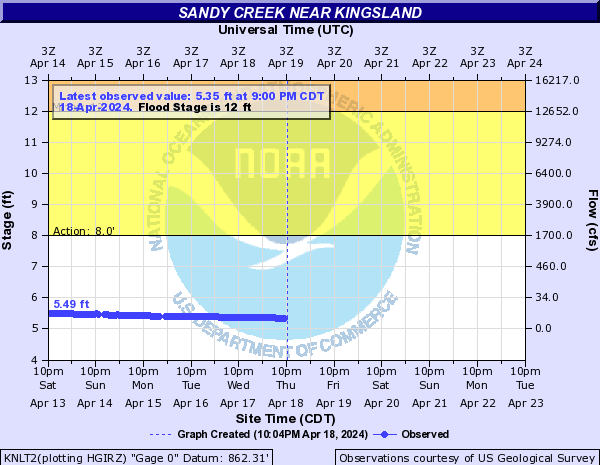
Looks like Sandy Creek, which feeds into Lake Marble Falls (and eventually downstream into Lake Travis) is just over "Bank Full Stage". That is the only gauge in the highland lakes chain network of gauges that is higher than normal.

Image
1 likes   
The preceding post is NOT an official forecast, and should not be used as such. It is only the opinion of the poster and may or may not be backed by sound meteorological data. It is NOT endorsed by any professional institution including storm2k.org. For Official Information please refer to the NHC and NWS products.

User avatar
Texas Snowman
Storm2k Moderator
Storm2k Moderator
Posts: 6179
Joined: Fri Jan 25, 2008 11:29 am
Location: Denison, Texas

Re: Texas Summer 2017

#1076 Postby Texas Snowman » Mon Aug 07, 2017 2:21 pm

We only had about 0.75 of an inch in Denison last night. But as alluded to earlier, 6-8 inches to our northeast and 2-3 inches about 20 miles to our north on the other side of Lake Texoma.

Also rained very hard in southern Grayson County. A friend of mine in Luella (southeast of Sherman and about 34 miles from McKinney) reported 4.21 inches overnight. Said his 3-acre pond was flowing over its spillway this morning.

That doesn't happen in August very often. :D
2 likes   
The above post and any post by Texas Snowman is NOT an official forecast and should not be used as such. It is just the opinion of the poster and may or may not be backed by sound meteorological data. It is NOT endorsed by any professional institution including storm2k.org. For official information, please refer to NWS products.

weatherdude1108
Category 5
Category 5
Posts: 4228
Joined: Tue Dec 13, 2011 1:04 pm
Location: Northwest Austin/Cedar Park, TX

Re: Texas Summer 2017

#1077 Postby weatherdude1108 » Mon Aug 07, 2017 4:11 pm

Well, most of us here in south and central Texas benefitted from the early August gift. It looks like a slow and steady return of heat and dryness doldrums after Wednesday - to be expected climatologically, but boooo.
:grrr: :roll:

I'm thankful for the abundant, beneficial rain today. Lasted long and steady enough, and temperatures are cool enough (70s with high dewpoints) to get down into the soil before the ridge sets back in.

However, I'm pulling for the GFS front-related outflow boundaries late this weekend/early next week, rather than the ECMWF's hot and dry doldrums.
:wink:

Area Forecast Discussion
National Weather Service Austin/San Antonio TX
351 PM CDT Mon Aug 7 2017

.SHORT TERM (Tonight through Tuesday Night)...
Showers and thunderstorms are continuing to dissipate across most of
South Central Texas except in the Rio Grande Plains in Maverick
County where some weak instability is helping maintain storms. An MCV
left behind by today`s widespread showers and thunderstorms is
currently pushing into Lee County with an outflow boundary or weak
front along the Gulf Coast near Corpus Christi. Cloud cover has
persisted over most of the region to keep temperatures in the upper
70s to mid 80s, but we are beginning to see some breaks in the clouds
in the Hill Country. SPC Mesoanalysis and aircraft soundings into
SAT and AUS show the atmosphere is fairly stable, but daytime
heating may still allow isolated to scattered showers and a few
thunderstorms to redevelop in the Hill Country and possibly our far
eastern counties. Otherwise, storms are generally not expected into
the early evening hours, with the lowest rain chances along the I-35
corridor from Austin to San Antonio where we have 20 POPs in place.

We are expecting that there will be some redevelopment of showers and
thunderstorms late in the evening and overnight hours. Most hi-res
models and the current position of the MCV suggest that this will be
in the Coastal Plains well east of the San Antonio metro and I-35
corridor. This makes sense considering the midlevel circulation is
rather deep and will likely cause some large-scale subsidence and
negative vorticity advection on the west side of this MCV. Based on
the confidence in convective redevelopment occurring over the Coastal
Plains counties which have generally only received 1-2 inches of rain
or less (even zero in parts of Karnes County), a Flash Flood Watch is
not necessary at this time. We will only need to consider a watch if
the MCV stalls and a more S-SE LLJ is predicted with model guidance
trending further west with convective redevelopment. However, that
scenario seems unlikely at this time with most areas outside of the
Coastal Plains only seeing isolated showers and thunderstorms
with
lows in the 70s.

Models are continuing to trend towards lower convective coverage
tomorrow due to the strength and progression of the MCV and outflow
boundary/front associated with this morning`s storms.
Nevertheless,
we still are forecasting isolated to scattered showers and
thunderstorms as the front potentially tries to lift north as it
dissipates with abundant moisture over the region. Temperatures
warming up into the upper 80s to mid 90s should also increase
instability over the region to allow for less organized convection to
develop. Widespread showers and thunderstorms are not expected since
large scale subsidence is expected to due isentropic descent and NVA
west of the midlevel circulation
that will likely be located over
far southeast Texas tomorrow. We will still have to watch for any
shortwave that triggers storms over west Texas tonight leaving
behind an MCV that could move into our area as well, but at this
point it seems more likely that the 30-40 POPs will be decreased in
future forecast cycles
than increased.

&&

.LONG TERM (Wednesday through Monday)...
Isolated showers and thunderstorms may continue into Wednesday as the
front dissipates further and the subtropical ridge begins to build
back over the region.
Slight rain chances will be limited to only
the Coastal Plains for Thursday and Friday with the entire region
remaining dry on Saturday. High temperatures will also increase back
to near or slightly above normal values in the upper 90s and lower
100s. This subtropical ridge should also keep Tropical Storm Franklin
well south of Texas in the Bay of Campeche as it pushes west through
Mexico and into the East Pacific late Friday into Saturday.
The GFS
suggests that slight rain chances may return to our northern counties
on Sunday or Monday as another weak front triggers storms over north
Texas that may push outflow boundaries into our region. However, the
ECMWF generally keeps the region hot and dry which would be the more
likely scenario climatologically for mid-August.
1 likes   
The preceding post is NOT an official forecast, and should not be used as such. It is only the opinion of the poster and may or may not be backed by sound meteorological data. It is NOT endorsed by any professional institution including storm2k.org. For Official Information please refer to the NHC and NWS products.

aggiecutter
Category 5
Category 5
Posts: 1753
Joined: Thu Oct 14, 2004 9:22 pm
Location: Texarkana

Re: Texas Summer 2017

#1078 Postby aggiecutter » Mon Aug 07, 2017 7:33 pm

The rain just wont stop north of I-20 and east of a Sulphur Springs to Paris line:

Image
0 likes   

User avatar
1900hurricane
Category 5
Category 5
Posts: 6059
Age: 34
Joined: Fri Feb 06, 2015 12:04 pm
Location: Houston, TX
Contact:

Re: Texas Summer 2017

#1079 Postby 1900hurricane » Mon Aug 07, 2017 8:09 pm

1 likes   
Contract Meteorologist. TAMU & MSST. Fiercely authentic, one of a kind. We are all given free will, so choose a life meant to be lived. We are the Masters of our own Stories.
Opinions expressed are mine alone.

Follow me on Twitter at @1900hurricane : Read blogs at https://1900hurricane.wordpress.com/

User avatar
Cpv17
Category 5
Category 5
Posts: 4979
Joined: Wed Dec 07, 2016 2:24 pm
Location: Wharton/El Campo, TX

Re: Texas Summer 2017

#1080 Postby Cpv17 » Mon Aug 07, 2017 10:22 pm

Might be an interesting night tonight over SETX with that MCV around. Radar really beginning to light up.
1 likes   


Return to “USA & Caribbean Weather”

Who is online

Users browsing this forum: No registered users and 31 guests