
ATL: FRANKLIN - Remnants - Discussion
Moderator: S2k Moderators
-
stormreader
Re: ATL: INVEST 90L - Discussion
I don't know, but this looks like a tropical cyclone has formed.
0 likes
-
txwatcher91
- Category 5

- Posts: 1498
- Joined: Tue Aug 02, 2005 2:29 pm
Re: ATL: INVEST 90L - Discussion
It spit out a few outflow boundaries on the NW side. Still a vigorous MLC it looks like but weak at the surface. I expect that will quickly change tonight with DMAX.
0 likes


Re: ATL: INVEST 90L - Models
Euro continues to trend stronger in the near term, 998mb before landfall early Tuesday morning.
1 likes
-
wxman57

- Moderator-Pro Met

- Posts: 23177
- Age: 68
- Joined: Sat Jun 21, 2003 8:06 pm
- Location: Houston, TX (southwest)
Re: ATL: INVEST 90L - Discussion
Tireman4 wrote:wxman57 wrote:No big surprise. Should have been 90% 3 days ago. Meets the PTC criteria now. NHC should initiate advisories shortly.
So just to be clear..no to Texas at this time....sir?
Nope, still looks like Tampico area.
0 likes


Re: ATL: INVEST 90L - Discussion
Exalt wrote:This has to be at least a TD, this is kinda ridiculous.
no LLC yet. None expected until tomorrow morning. once it forms though, rapid intensification is expected
0 likes
-
stormreader
Re: ATL: INVEST 90L - Discussion
Exalt wrote:This has to be at least a TD, this is kinda ridiculous.
That relatively small and compact white ball spinning on the south side sure looks lower level to my untrained eyes. Maybe someone can give some facts and figures to say why its not so. I am obviously an untrained observer.
0 likes
-
cycloneye

- Admin

- Posts: 149840
- Age: 69
- Joined: Thu Oct 10, 2002 10:54 am
- Location: San Juan, Puerto Rico
Re: ATL: INVEST 90L - Models
985 mbs on second landfall in Mexico near Veracruz.
1 likes
Visit the Caribbean-Central America Weather Thread where you can find at first post web cams,radars
and observations from Caribbean basin members Click Here
and observations from Caribbean basin members Click Here
-
Aric Dunn
- Category 5
- Posts: 21238
- Age: 43
- Joined: Sun Sep 19, 2004 9:58 pm
- Location: Ready for the Chase.
- Contact:
Re: ATL: INVEST 90L - Discussion
stormreader wrote:Exalt wrote:This has to be at least a TD, this is kinda ridiculous.
That relatively small and compact white ball spinning on the south side sure looks lower level to my untrained eyes. Maybe someone can give some facts and figures to say why its not so. I am obviously an untrained observer.
Yeah plnety of evidence to make the case for closed surface circ. two fairly well definded circ are quite easy to see. surface obs also point to it being closed. if that vort develops convection over the next few hours. then its very highly likely that a TD/TS
0 likes
Note: If I make a post that is brief. Please refer back to previous posts for the analysis or reasoning. I do not re-write/qoute what my initial post said each time.
If there is nothing before... then just ask
Space & Atmospheric Physicist, Embry-Riddle Aeronautical University,
I believe the sky is falling...
If there is nothing before... then just ask
Space & Atmospheric Physicist, Embry-Riddle Aeronautical University,
I believe the sky is falling...
Re: ATL: INVEST 90L - Discussion
This is NOT a TD or a TS. The convective blowup from this morning is now mainly cirrus. The next one, which should occur overnight, will form the cyclone.
Just need some patience. This could end up as a 3 in the Gulf. Some many similarities to Karl, expect toward Tampico instead of Veracruz
Just need some patience. This could end up as a 3 in the Gulf. Some many similarities to Karl, expect toward Tampico instead of Veracruz
1 likes
-
AxaltaRacing24
- Category 5
- Posts: 1774
- Age: 25
- Joined: Wed Jul 27, 2016 11:14 am
- Location: Jupiter, FL
Re: ATL: INVEST 90L - Discussion
You can see it slowly tightening up but still has a little ways to go.
http://rammb-slider.cira.colostate.edu/ ... mmb-slider
http://rammb-slider.cira.colostate.edu/ ... mmb-slider
1 likes
-
stormreader
Re: ATL: INVEST 90L - Discussion
Perhaps not as much red as you would like to see, but it does look like there is rotation in the precip. Will be patient.

0 likes
-
TheAustinMan

- Category 5
- Posts: 1060
- Joined: Mon Jul 08, 2013 4:26 pm
- Location: Central TX / United States
Re: ATL: INVEST 90L - Discussion
Expecting a PTC now that the best track has been updated to indicate disturbance 07L.
Code: Select all
AL, 07, 2017080618, , BEST, 0, 152N, 815W, 30, 1008, DB, 34, NEQ, 0, 0, 0, 0, 1011, 120, 90, 0, 0, L, 0, , 0, 0, SEVEN, M, 0, , 0, 0, 0, 0, genesis-num, 017, TRANSITIONED, alB02017 to al072017,
3 likes
Treat my opinions with a grain of salt. For official information see your local weather service.
“It's tough to make predictions, especially about the future.”
“It's tough to make predictions, especially about the future.”
-
TheStormExpert
Re: ATL: INVEST 90L - Discussion
Future Franklin will likely make a run at major hurricane status, no surprise since the BoC and Western Caribbean seem to be the only favorable spots in town right now in the Atlantic.
1 likes
-
Aric Dunn
- Category 5
- Posts: 21238
- Age: 43
- Joined: Sun Sep 19, 2004 9:58 pm
- Location: Ready for the Chase.
- Contact:
Re: ATL: INVEST 90L - Discussion
If a plane was out there it would very likely find a closed circ. bu as we know the NHC like to be on schedule.
1 likes
Note: If I make a post that is brief. Please refer back to previous posts for the analysis or reasoning. I do not re-write/qoute what my initial post said each time.
If there is nothing before... then just ask
Space & Atmospheric Physicist, Embry-Riddle Aeronautical University,
I believe the sky is falling...
If there is nothing before... then just ask
Space & Atmospheric Physicist, Embry-Riddle Aeronautical University,
I believe the sky is falling...
-
gatorcane

- S2K Supporter

- Posts: 23708
- Age: 48
- Joined: Sun Mar 13, 2005 3:54 pm
- Location: Boca Raton, FL
Re: ATL: INVEST 90L - Discussion" 18z Best Track transitions to Tropical Disturbance SEVEN
looks well on its way. Assuming this goes into the BOC->Mexico this would make yet another BOC->Mexico system 7 out of the last 8 seasons.
1 likes
-
stormreader
Re: ATL: INVEST 90L - Discussion" 18z Best Track transitions to Tropical Disturbance SEVEN
gatorcane wrote:looks well on its way. Assuming this goes into the BOC->Mexico this would make yet another BOC->Mexico system 7 out of the last 8 seasons.
And those have been quiet seasons for the US mainland. A pattern....will this year break the mold (US mainland)?? Just coincidence, probably...not indicative of any larger meaning.
0 likes
-
Aric Dunn
- Category 5
- Posts: 21238
- Age: 43
- Joined: Sun Sep 19, 2004 9:58 pm
- Location: Ready for the Chase.
- Contact:
Re: ATL: INVEST 90L - Discussion" 18z Best Track transitions to Tropical Disturbance SEVEN
Looks plenty closed. and defined enough. storms have been declared for way less than this..
0 likes
Note: If I make a post that is brief. Please refer back to previous posts for the analysis or reasoning. I do not re-write/qoute what my initial post said each time.
If there is nothing before... then just ask
Space & Atmospheric Physicist, Embry-Riddle Aeronautical University,
I believe the sky is falling...
If there is nothing before... then just ask
Space & Atmospheric Physicist, Embry-Riddle Aeronautical University,
I believe the sky is falling...

Re: ATL: INVEST 90L - Discussion" 18z Best Track transitions to Tropical Disturbance SEVEN
The Yucatan peninsula will take some steam out of TD7 and it would take at least 48 hours in the BOC to reach major hurricane status. Definitely looks like Franklin though.
0 likes
-
1900hurricane

- Category 5
- Posts: 6063
- Age: 34
- Joined: Fri Feb 06, 2015 12:04 pm
- Location: Houston, TX
- Contact:
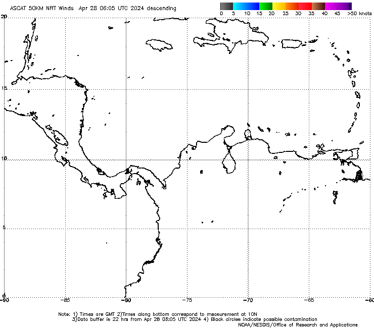
Re: ATL: INVEST 90L - Discussion" 18z Best Track transitions to POTENTIAL TROPICAL CYCLONE 07L
Ehh, I wouldn't call it closed when using the 25 km ASCAT data from METOP-A.

2 likes
Contract Meteorologist. TAMU & MSST. Fiercely authentic, one of a kind. We are all given free will, so choose a life meant to be lived. We are the Masters of our own Stories.
Opinions expressed are mine alone.
Follow me on Twitter at @1900hurricane : Read blogs at https://1900hurricane.wordpress.com/
Opinions expressed are mine alone.
Follow me on Twitter at @1900hurricane : Read blogs at https://1900hurricane.wordpress.com/
Who is online
Users browsing this forum: No registered users and 91 guests