ATL: Ex INVEST 96L - Discussion
Moderator: S2k Moderators
-
AxaltaRacing24
- Category 5

- Posts: 1774
- Age: 25
- Joined: Wed Jul 27, 2016 11:14 am
- Location: Jupiter, FL
Re: ATL: INVEST 96L - Discussion
Very tough to tell (it's night) but there appears to be some type of circulation near or under the NE side of the convection. Definitely on its way IMO
0 likes
-
AutoPenalti
- Category 5
- Posts: 4091
- Age: 29
- Joined: Mon Aug 17, 2015 4:16 pm
- Location: Ft. Lauderdale, Florida
Re: ATL: INVEST 96L - Discussion
AtlanticWind wrote:The hostile conditions that the NHC mentions,is that just the sale or is shear also forecast to increase?
It's forecast to increase during the next 24-36 hours.
0 likes
The posts in this forum are NOT official forecasts and should not be used as such. They are just the opinion of the poster and may or may not be backed by sound meteorological data. They are NOT endorsed by any professional institution or STORM2K. For official information, please refer to products from the NHC and NWS.
Model Runs Cheat Sheet:
GFS (5:30 AM/PM, 11:30 AM/PM)
HWRF, GFDL, UKMET, NAVGEM (6:30-8:00 AM/PM, 12:30-2:00 AM/PM)
ECMWF (1:45 AM/PM)
TCVN is a weighted averaged
-
northjaxpro

- S2K Supporter

- Posts: 8900
- Joined: Mon Sep 27, 2010 11:21 am
- Location: Jacksonville, FL
Re: ATL: INVEST 96L - Discussion
Wow, look at the impressive explosion of convection in this early pre-dawn this morning as 96L really looks good now. This is by far the most impressive convection I have seen yet with this system. It appears that the system obviously has found much better conditions and at the moment, looks as if it has insulated itself quite well against any impacts from SAL..
Looking at the current trends, this is well on its way to become Emily, although I think it may already be Emily as of right now! Also, the system is beginning to look more and more symmetric as the anticyclone it is under is really showing its influence currently. We shall see, but as of now, this system has really flexed its muscle now!
Looking at the current trends, this is well on its way to become Emily, although I think it may already be Emily as of right now! Also, the system is beginning to look more and more symmetric as the anticyclone it is under is really showing its influence currently. We shall see, but as of now, this system has really flexed its muscle now!
2 likes
NEVER, EVER SAY NEVER in the tropics and weather in general, and most importantly, with life itself!!
________________________________________________________________________________________
Fay 2008 Beryl 2012 Debby 2012 Colin 2016 Hermine 2016 Julia 2016 Matthew 2016 Irma 2017 Dorian 2019
________________________________________________________________________________________
Fay 2008 Beryl 2012 Debby 2012 Colin 2016 Hermine 2016 Julia 2016 Matthew 2016 Irma 2017 Dorian 2019
-
Sciencerocks
- Category 5
- Posts: 10194
- Age: 40
- Joined: Thu Jul 06, 2017 1:51 am
Re: ATL: INVEST 96L - Discussion
northjaxpro wrote:Wow, look at the impressive explosion of convection in this early pre-dawn this morning as 96L really looks good now. This is by far the most impressive convection I have seen yet with this system. It appears that the system obviously has found much better conditions and at the moment, looks as if it has insulated itself quite well against any impacts from SAL..
Looking at the current trends, this is well on its way to become Emily, although I think it may already be Emily as of right now! Also, the system is beginning to look more and more symmetric as the anticyclone it is under is really showing its influence currently. We shall see, but as of now, this system has really flexed its muscle now!
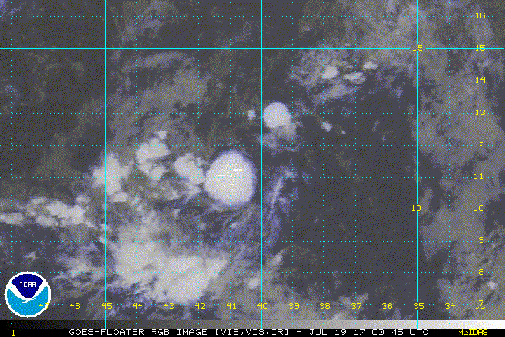
Looking at night time visible I'd estimate the broad LLC near 12.2/40.8
0 likes
-
northjaxpro
- S2K Supporter
- Posts: 8900
- Joined: Mon Sep 27, 2010 11:21 am
- Location: Jacksonville, FL
Re: ATL: INVEST 96L - Discussion
1 likes
NEVER, EVER SAY NEVER in the tropics and weather in general, and most importantly, with life itself!!
________________________________________________________________________________________
Fay 2008 Beryl 2012 Debby 2012 Colin 2016 Hermine 2016 Julia 2016 Matthew 2016 Irma 2017 Dorian 2019
________________________________________________________________________________________
Fay 2008 Beryl 2012 Debby 2012 Colin 2016 Hermine 2016 Julia 2016 Matthew 2016 Irma 2017 Dorian 2019
-
Aric Dunn
- Category 5
- Posts: 21238
- Age: 43
- Joined: Sun Sep 19, 2004 9:58 pm
- Location: Ready for the Chase.
- Contact:
Re: ATL: INVEST 96L - Discussion
Sciencerocks wrote:northjaxpro wrote:Wow, look at the impressive explosion of convection in this early pre-dawn this morning as 96L really looks good now. This is by far the most impressive convection I have seen yet with this system. It appears that the system obviously has found much better conditions and at the moment, looks as if it has insulated itself quite well against any impacts from SAL..
Looking at the current trends, this is well on its way to become Emily, although I think it may already be Emily as of right now! Also, the system is beginning to look more and more symmetric as the anticyclone it is under is really showing its influence currently. We shall see, but as of now, this system has really flexed its muscle now!
Looking at night time visible I'd estimate the broad LLC near 12.2/40.8
Agreed though there is nothing broad about it. A well defined llc has been tracked and is not an issue.. the convection needs to persist.
0 likes
Note: If I make a post that is brief. Please refer back to previous posts for the analysis or reasoning. I do not re-write/qoute what my initial post said each time.
If there is nothing before... then just ask
Space & Atmospheric Physicist, Embry-Riddle Aeronautical University,
I believe the sky is falling...
If there is nothing before... then just ask
Space & Atmospheric Physicist, Embry-Riddle Aeronautical University,
I believe the sky is falling...
-
northjaxpro
- S2K Supporter
- Posts: 8900
- Joined: Mon Sep 27, 2010 11:21 am
- Location: Jacksonville, FL
Re: ATL: INVEST 96L - Discussion
I agree Aric. I also think this is a well established circulation.
0 likes
NEVER, EVER SAY NEVER in the tropics and weather in general, and most importantly, with life itself!!
________________________________________________________________________________________
Fay 2008 Beryl 2012 Debby 2012 Colin 2016 Hermine 2016 Julia 2016 Matthew 2016 Irma 2017 Dorian 2019
________________________________________________________________________________________
Fay 2008 Beryl 2012 Debby 2012 Colin 2016 Hermine 2016 Julia 2016 Matthew 2016 Irma 2017 Dorian 2019

Re: ATL: INVEST 96L - Discussion

I was thinking this might develop a few days ago but I think it's running out of time given the dry air surrounding it. Convection looks quite disorganized at this point, and latest ASCAT shows the circulation actually becoming elongated SW-NE.
3 likes
The above post is not official and should not be used as such. It is the opinion of the poster and may or may not be backed by sound meteorological data. It is not endorsed by any professional institution or storm2k.org. For official information, please refer to the NHC and NWS products.

Re: ATL: INVEST 96L - Discussion
This has a lot of potential.
1) Already, a well established warm core.
2) Tons of organizining LL Moisture
3) Ahead of it, decent moist air with good lapse rate to mid level. Some dry air above that. Little to no directional shear.


1) Already, a well established warm core.
2) Tons of organizining LL Moisture
3) Ahead of it, decent moist air with good lapse rate to mid level. Some dry air above that. Little to no directional shear.
0 likes
-
northjaxpro
- S2K Supporter
- Posts: 8900
- Joined: Mon Sep 27, 2010 11:21 am
- Location: Jacksonville, FL
Re: ATL: INVEST 96L - Discussion
Good analysis. I would have to believe NHC will have Recon fly out to 96L soon if the trends you and I have pointed out in earlier posts on this page continues.
Also, latest satellite imagery is beginning to show banding and solid inflow into the well defined LLC, so this cyclone is definitely in the process of getting its act together this morning.
2 likes
NEVER, EVER SAY NEVER in the tropics and weather in general, and most importantly, with life itself!!
________________________________________________________________________________________
Fay 2008 Beryl 2012 Debby 2012 Colin 2016 Hermine 2016 Julia 2016 Matthew 2016 Irma 2017 Dorian 2019
________________________________________________________________________________________
Fay 2008 Beryl 2012 Debby 2012 Colin 2016 Hermine 2016 Julia 2016 Matthew 2016 Irma 2017 Dorian 2019
-
weathaguyry

- Category 5
- Posts: 1273
- Age: 22
- Joined: Wed Jun 15, 2016 5:16 am
- Location: Long Island, NY
Re: ATL: INVEST 96L - Discussion
The NHC must be picking up on something we aren't, because they give this a 30/30
0 likes
My posts are only my opinions and NOT official forecasts. For official forecasts, consult the National Hurricane Center or the National Weather Service.
Irene 11', Sandy 12', Fay 20’, Isaias 20’, Elsa 21’, Henri 21’, Ida 21’
Irene 11', Sandy 12', Fay 20’, Isaias 20’, Elsa 21’, Henri 21’, Ida 21’
-
cycloneye

- Admin

- Posts: 149817
- Age: 69
- Joined: Thu Oct 10, 2002 10:54 am
- Location: San Juan, Puerto Rico
Re: ATL: INVEST 96L - Discussion
Tropical Weather Outlook
NWS National Hurricane Center Miami FL
800 AM EDT Wed Jul 19 2017
For the North Atlantic...Caribbean Sea and the Gulf of Mexico:
An elongated low pressure area located about midway between the
Cabo Verde Islands and the Lesser Antilles is producing a large
area of disorganized showers and thunderstorms. Some gradual
development of this system is possible during the next day or
two while it moves toward the west-northwest or northwest at
10 to 15 mph. After that time, environmental conditions are
forecast to become unfavorable for development.
* Formation chance through 48 hours...low...30 percent.
* Formation chance through 5 days...low...30 percent.
Forecaster Brown
0 likes
Visit the Caribbean-Central America Weather Thread where you can find at first post web cams,radars
and observations from Caribbean basin members Click Here
and observations from Caribbean basin members Click Here
Re: ATL: INVEST 96L - Discussion
northjaxpro wrote::uarrow:
Good analysis. I would have to believe NHC will have Recon fly out to 96L soon if the trends you and I have pointed out in earlier posts on this page continues.
Also, latest satellite imagery is beginning to show banding and solid inflow into the well defined LLC, so this cyclone is definitely in the process of getting its act together this morning.
Much thanks!
Another hot-tower fired off at dawn with a good cirrus canopy spreading out afterwards.
0 likes

Re: ATL: INVEST 96L - Discussion
northjaxpro wrote::uarrow:
Good analysis. I would have to believe NHC will have Recon fly out to 96L soon if the trends you and I have pointed out in earlier posts on this page continues.
Also, latest satellite imagery is beginning to show banding and solid inflow into the well defined LLC, so this cyclone is definitely in the process of getting its act together this morning.
Don't they fly recon only after systems pass 50W? Or do they fly a drone (the Global Hawk) farther out?
0 likes
-
TheStormExpert
Re: ATL: INVEST 96L - Discussion
I don't know what some of you are seeing, all I'm seeing is a struggling invest producing disorganized storms trying to stay alive.

There is plentiful of SAL to it's North, East, and West which should eventually sooner rather than later get entrained into 96L killing it off completely.

If that wasn't enough for it there is wind shear which should be on the increase over the next few days. For now though it is under or near an anti-cyclone.


There is plentiful of SAL to it's North, East, and West which should eventually sooner rather than later get entrained into 96L killing it off completely.
If that wasn't enough for it there is wind shear which should be on the increase over the next few days. For now though it is under or near an anti-cyclone.
2 likes
-
Blown Away

- S2K Supporter
- Posts: 10253
- Joined: Wed May 26, 2004 6:17 am
Re: ATL: INVEST 96L - Discussion
Has 96L been deactivated?
0 likes
Hurricane Eye Experience: David 79, Irene 99, Frances 04, Jeanne 04, Wilma 05… Hurricane Brush Experience: Andrew 92, Erin 95, Floyd 99, Matthew 16, Irma 17, Ian 22, Nicole 22…
-
Aric Dunn
- Category 5
- Posts: 21238
- Age: 43
- Joined: Sun Sep 19, 2004 9:58 pm
- Location: Ready for the Chase.
- Contact:
Re: ATL: INVEST 96L - Discussion
Nice large well defined Circ. Convection has collapse around the center again but it still needs to be watched and has a decent shot if it can keep producing the pulses of convection to keep the circ going.
1 likes
Note: If I make a post that is brief. Please refer back to previous posts for the analysis or reasoning. I do not re-write/qoute what my initial post said each time.
If there is nothing before... then just ask
Space & Atmospheric Physicist, Embry-Riddle Aeronautical University,
I believe the sky is falling...
If there is nothing before... then just ask
Space & Atmospheric Physicist, Embry-Riddle Aeronautical University,
I believe the sky is falling...
Re: ATL: INVEST 96L - Discussion
Aric Dunn wrote:Nice large well defined Circ. Convection has collapse around the center again but it still needs to be watched and has a decent shot if it can keep producing the pulses of convection to keep the circ going.
11.9N 45.5W
Seems to be firing back up.
Based on tracking the previous tower this morning, its running due west.
http://www.ssd.noaa.gov/PS/TROP/floater ... -long.html
0 likes
-
Aric Dunn
- Category 5
- Posts: 21238
- Age: 43
- Joined: Sun Sep 19, 2004 9:58 pm
- Location: Ready for the Chase.
- Contact:
Re: ATL: INVEST 96L - Discussion
GCANE wrote:Aric Dunn wrote:Nice large well defined Circ. Convection has collapse around the center again but it still needs to be watched and has a decent shot if it can keep producing the pulses of convection to keep the circ going.
11.9N 45.5W
Seems to be firing back up.
Based on tracking the previous tower this morning, its running due west.
http://www.ssd.noaa.gov/PS/TROP/floater ... -long.html
yeah a little blob is there, unfortunately, its associated with the vigorous mid level circ the low leve circ is well to the NE of that. Have to wait and see if convection builds north around the center again
0 likes
Note: If I make a post that is brief. Please refer back to previous posts for the analysis or reasoning. I do not re-write/qoute what my initial post said each time.
If there is nothing before... then just ask
Space & Atmospheric Physicist, Embry-Riddle Aeronautical University,
I believe the sky is falling...
If there is nothing before... then just ask
Space & Atmospheric Physicist, Embry-Riddle Aeronautical University,
I believe the sky is falling...

Re: ATL: INVEST 96L - Discussion
These waves all developed persistent convection near -50W so another TD/ minimal storm is likely.
Doesn't bother me if they fizzle and head for the Pacific after that.
Doesn't bother me if they fizzle and head for the Pacific after that.
1 likes
Who is online
Users browsing this forum: No registered users and 59 guests