
EPAC: INVEST 94E
Moderator: S2k Moderators
-
Kingarabian

- S2K Supporter

- Posts: 16321
- Joined: Sat Aug 08, 2009 3:06 am
- Location: Honolulu, Hawaii
Re: EPAC: INVEST 94E
Has potential to be a TD very soon if it can maintain convection near the center:
0 likes
RIP Kobe Bryant
-
Kingarabian
- S2K Supporter
- Posts: 16321
- Joined: Sat Aug 08, 2009 3:06 am
- Location: Honolulu, Hawaii
Re: EPAC: INVEST 94E
TXPZ27 KNES 041818
TCSENP
A. TROPICAL DISTURBANCE (94E)
B. 04/1800Z
C. 16.7N
D. 113.4W
E. FIVE/GOES-W
F. T1.0/1.0/S0.0/24HRS
G. IR/EIR/VIS
H. REMARKS...SYSTEM IS CHARACTERIZED BY SPIRAL, LOOSELY DEFINED CLOUD
LINES AND A CENTER NEAR A SMALL COLD OVERCAST RESULTING IN A DT OF 1.5
USING THE SHEAR PATTERN. MET AND PT ARE 1.0. FT IS BASED ON MET BECAUSE
CONVECTION NEAR THE ESTIMATED CENTER IS NEWLY DEVELOPED AND HAS NOT
BEEN PERSISTENT.
I. ADDL POSITIONS
NIL
...TURK
Looks like SAB will give it a 1.5 as long as it maintains convection.
0 likes
RIP Kobe Bryant
-
Kingarabian
- S2K Supporter
- Posts: 16321
- Joined: Sat Aug 08, 2009 3:06 am
- Location: Honolulu, Hawaii
Re: EPAC: INVEST 94E
Shear appears to be relaxing as we're seeing outflow becoming persistent to the N and NW of the system. Also the low seems to be consolidating further.

0 likes
RIP Kobe Bryant
-
cycloneye

- Admin

- Posts: 148832
- Age: 69
- Joined: Thu Oct 10, 2002 10:54 am
- Location: San Juan, Puerto Rico
Re: EPAC: INVEST 94E
It has to hurry before time runs out very soon.
Shower and thunderstorm activity associated with a low pressure
area located about 550 miles southwest of the southern tip of the
Baja California peninsula has become a little better organized
during the afternoon, but satellite data indicates that a
well-defined circulation does not yet exist. This system still has
the potential to become a tropical depression during the next day or
two before it moves westward into a less favorable environment.
* Formation chance through 48 hours...high...80 percent.
* Formation chance through 5 days...high...80 percent.
0 likes
Visit the Caribbean-Central America Weather Thread where you can find at first post web cams,radars
and observations from Caribbean basin members Click Here
and observations from Caribbean basin members Click Here
-
Kingarabian
- S2K Supporter
- Posts: 16321
- Joined: Sat Aug 08, 2009 3:06 am
- Location: Honolulu, Hawaii

Re: EPAC: INVEST 94E
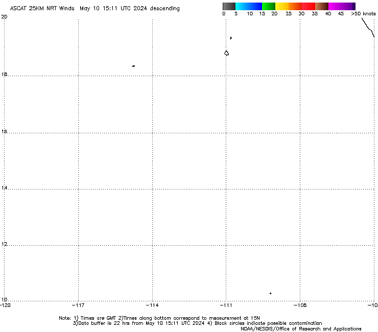
Kingarabian wrote:1.5/1.5 from SAB. I would say it's ready to go.
Last hr visible sat loop before sunset and ASCAT from earlier today still indicates that the COC still is elongated and weak.
1 likes
-
Kingarabian
- S2K Supporter
- Posts: 16321
- Joined: Sat Aug 08, 2009 3:06 am
- Location: Honolulu, Hawaii
Re: EPAC: INVEST 94E
Moving away from 30kts of shear towards lesser 20kts of shear. May have a chance of developing in 12hrs. Then runs into a great wall of 40kt shear which should shred it.
0 likes
RIP Kobe Bryant
-
cycloneye
- Admin
- Posts: 148832
- Age: 69
- Joined: Thu Oct 10, 2002 10:54 am
- Location: San Juan, Puerto Rico
Re: EPAC: INVEST 94E
Satellite data suggests that a low pressure system located about
550 miles southwest of the southern tip of the Baja California
peninsula has become a little better defined this morning. However,
the associated showers and thunderstorms remain displaced well to
the south of the center. This system still has the potential to
become a tropical depression later today or tonight before it moves
westward into a less favorable environment.
* Formation chance through 48 hours...high...80 percent.
* Formation chance through 5 days...high...80 percent.
0 likes
Visit the Caribbean-Central America Weather Thread where you can find at first post web cams,radars
and observations from Caribbean basin members Click Here
and observations from Caribbean basin members Click Here
-
hurricanes1234
- Category 5

- Posts: 2908
- Joined: Sat Jul 28, 2012 6:19 pm
- Location: Trinidad and Tobago
Re: EPAC: INVEST 94E
Look at how badly exposed the centre is. Convection has also decreased. Personally I have my doubts as to whether this develops at all.

1 likes
PLEASE NOTE: With the exception of information from weather agencies that I may copy and paste here, my posts will NEVER be official, since I am NOT a meteorologist. They are solely my amateur opinion, and may or may not be accurate. Therefore, please DO NOT use them as official details, particularly when making important decisions. Thank you.
Re: EPAC: INVEST 94E
0 likes
-
cycloneye
- Admin
- Posts: 148832
- Age: 69
- Joined: Thu Oct 10, 2002 10:54 am
- Location: San Juan, Puerto Rico
Re: EPAC: INVEST 94E
Is over.
Showers and thunderstorms have decreased during the past several
hours in association with a low pressure system located about 600
miles southwest of the Baja California peninsula. This low is
beginning to move into less favorable environmental conditions, and
the chances of this system becoming a tropical depression are
decreasing. The low is expected to move westward at 10 to 15 mph
during the next few days.
* Formation chance through 48 hours...medium...60 percent.
* Formation chance through 5 days...medium...60 percent.
1 likes
Visit the Caribbean-Central America Weather Thread where you can find at first post web cams,radars
and observations from Caribbean basin members Click Here
and observations from Caribbean basin members Click Here
-
Kingarabian
- S2K Supporter
- Posts: 16321
- Joined: Sat Aug 08, 2009 3:06 am
- Location: Honolulu, Hawaii
Re: EPAC: INVEST 94E
Took too long to develop and did not develop a CDO in time or any sustained convection to help fend off shear. Surprised it didn't make it. On to the next.
1 likes
RIP Kobe Bryant
-
cycloneye
- Admin
- Posts: 148832
- Age: 69
- Joined: Thu Oct 10, 2002 10:54 am
- Location: San Juan, Puerto Rico
Re: EPAC: INVEST 94E
Showers and thunderstorms associated with a low pressure area
located about 675 miles west-southwest of the southern tip of the
Baja California peninsula have continued to decrease this
afternoon. The low is moving westward at 10 to 15 mph into less
favorable environment conditions, and the chances of this system
becoming a tropical depressions are decreasing.
* Formation chance through 48 hours...low...30 percent.
* Formation chance through 5 days...low...30 percent.
0 likes
Visit the Caribbean-Central America Weather Thread where you can find at first post web cams,radars
and observations from Caribbean basin members Click Here
and observations from Caribbean basin members Click Here
-
hurricanes1234
- Category 5
- Posts: 2908
- Joined: Sat Jul 28, 2012 6:19 pm
- Location: Trinidad and Tobago
Re: EPAC: INVEST 94E
Well, it's dead. 
0 likes
PLEASE NOTE: With the exception of information from weather agencies that I may copy and paste here, my posts will NEVER be official, since I am NOT a meteorologist. They are solely my amateur opinion, and may or may not be accurate. Therefore, please DO NOT use them as official details, particularly when making important decisions. Thank you.
Who is online
Users browsing this forum: No registered users and 63 guests