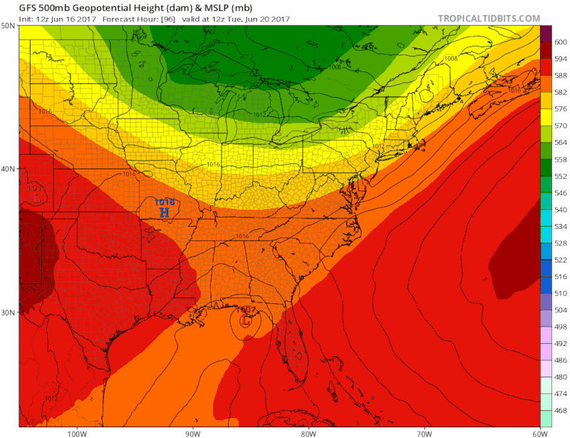
Note that every single model got "Bret" right. A system trapped in the tradewinds moving at 20+ mph is easy to forecast. Heck, I'd even trust the NOGAPS for such a setup. Nowhere else it could go. Doesn't mean the GFS is right with this system.

Moderator: S2k Moderators


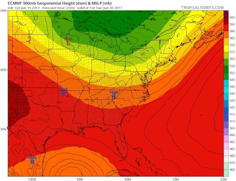
NDG wrote:Not too often that you see a system pull moisture from both the EPAC and Atlantic Basin.


ronyan wrote:I'm thinking that with AI advancing at the speed it is we will probably see dramatic improvement in the models over the next 10 years.
Wx_Warrior wrote:2 local mets hinting at "west shift" this evening....
hriverajr wrote:Using Goes 16 Band 7 "Shortwave Window" You can still see the primary eddies(looks like 2) moving west.. quite interesting.
Blinhart wrote:NDG wrote:Not too often that you see a system pull moisture from both the EPAC and Atlantic Basin.
So if this system can wrap itself around, it can become a pretty big storm pretty quickly. I'm not saying a powerful system, but large in size.
tarheelprogrammer wrote:NAM coming in weaker, and joining us here in the real world.
Was 993 last run at hour 22. At 998 at hour 16 now.


Users browsing this forum: No registered users and 3 guests


