ATL: CINDY - Post-Tropical - Discussion
Moderator: S2k Moderators

Re: ATL: INVEST 93L - Models
18z NAM stays off the LA Coast and heads toward Central TX Coast by 84 hours when the run ends.
2 likes
-
South Texas Storms

- Professional-Met

- Posts: 4263
- Joined: Thu Jun 24, 2010 12:28 am
- Location: Houston, TX
Re: ATL: INVEST 93L - Models
Steve wrote:18z NAM stays off the LA Coast and heads toward Central TX Coast by 84 hours when the run ends.
It's been one of the more consistent models with this system Steve. I'm starting to buy into it more and more.
2 likes
-
Emmett_Brown

- Category 5

- Posts: 1433
- Joined: Wed Aug 24, 2005 9:10 pm
- Location: Sarasota FL
Re: ATL: INVEST 93L - Discussion
gatorcane wrote:We have popcorn over the NW Carib...i think we are seeing some gradual organization. Any chance a low forms closer to the MLC or more NE of the broad Yucatán low?
http://rammb.cira.colostate.edu/ramsdis ... display=12
Yes, it does seem like the MLC to the NE of the LLC is refiring convection, so it isn't dissipating as quickly as I thought it would. We have certainly witnessed center reformations in the past, especially during early stages of organization, perhaps the already elongated center will will consolidate further to the NE somewhat?
Either way, it clearly is not well organized.... yet....
1 likes
-
tarheelprogrammer

- S2K Supporter

- Posts: 1793
- Joined: Mon Mar 28, 2016 9:25 pm
- Location: Raleigh, NC area (Garner, NC)
Re: ATL: INVEST 93L - Models
South Texas Storms wrote:Steve wrote:18z NAM stays off the LA Coast and heads toward Central TX Coast by 84 hours when the run ends.
It's been one of the more consistent models with this system Steve. I'm starting to buy into it more and more.
It has also been gradually running stronger, and stronger each run. Peaks at 987 I believe this run.
1 likes
My posts are not official forecasts. They are just my opinion and may or may not be backed by sound meteorological data. They are NOT endorsed by any professional institution or storm2k.org. For official information, please refer to the NHC and NWS products.
Re: ATL: INVEST 93L - Models
Yeah I hear you man. Sometimes it's good. I don't usually like it South of 25N, but it's always been useful on the continent even the old ETA forerunner. But it seems like it's been pretty reasonable the last 2 days of runs. I don't know about the simulated radar as that seems sparse. But I think general track direction for the next 4 days will be close. It ends up off of Brownsville looking to stall or loop before probably heading toward Kings Ranch or Corpus. Looks like if it gets close enough to the coast that you guys would see the longest time near the center of circulation (obviously based on the NAM).
1 likes

Re: ATL: INVEST 93L - Discussion
http://climate.cod.edu/hanis/satellite/ ... c-vis-0-24
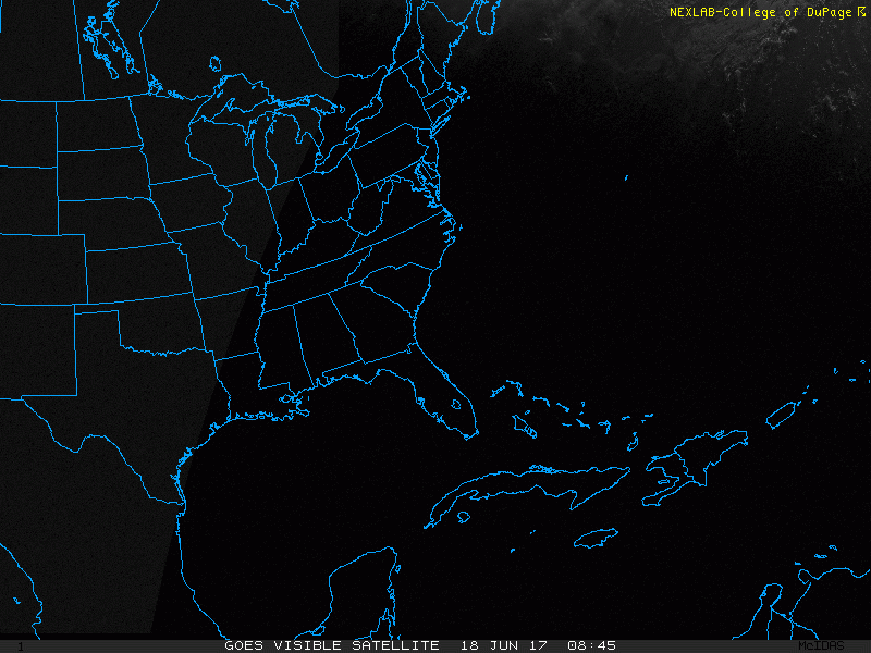
you can feel it falling into place on this loop
the COD MET images rock!!
you can feel it falling into place on this loop
the COD MET images rock!!
1 likes
-
bamajammer4eva
- Category 4

- Posts: 907
- Joined: Sun Apr 18, 2010 3:21 am
- Location: Ozark, AL
Re: ATL: INVEST 93L - Discussion
Wondering if maybe they think the chances for 93L are going down since at 2pm the chance was 70% in 48 hrs which is the same as the chances in the first advisory for 92L/Two . We might see the chances reduced to Medium in the next 48 hrs outlook.
0 likes
-
tarheelprogrammer
- S2K Supporter
- Posts: 1793
- Joined: Mon Mar 28, 2016 9:25 pm
- Location: Raleigh, NC area (Garner, NC)
Re: ATL: INVEST 93L - Discussion
bamajammer4eva wrote:Wondering if maybe they think the chances for 93L are going down since at 2pm the chance was 70% in 48 hrs which is the same as the chances in the first advisory for 92L/Two . We might see the chances reduced to Medium in the next 48 hrs outlook.
Huh?

1 likes
My posts are not official forecasts. They are just my opinion and may or may not be backed by sound meteorological data. They are NOT endorsed by any professional institution or storm2k.org. For official information, please refer to the NHC and NWS products.
-
ldelatorre
- Tropical Low

- Posts: 16
- Joined: Tue Aug 31, 2004 8:11 pm
- Location: Seminole, FL
- Contact:

-
Hurricaneman

- Category 5
- Posts: 7404
- Age: 45
- Joined: Tue Aug 31, 2004 3:24 pm
- Location: central florida
Re: ATL: INVEST 93L - Discussion
bamajammer4eva wrote:Wondering if maybe they think the chances for 93L are going down since at 2pm the chance was 70% in 48 hrs which is the same as the chances in the first advisory for 92L/Two . We might see the chances reduced to Medium in the next 48 hrs outlook.
Don't see that happening, if anything the numbers should go up
1 likes
-
bamajammer4eva
- Category 4
- Posts: 907
- Joined: Sun Apr 18, 2010 3:21 am
- Location: Ozark, AL
Re: ATL: INVEST 93L - Discussion
Hurricaneman wrote:bamajammer4eva wrote:Wondering if maybe they think the chances for 93L are going down since at 2pm the chance was 70% in 48 hrs which is the same as the chances in the first advisory for 92L/Two . We might see the chances reduced to Medium in the next 48 hrs outlook.
Don't see that happening, if anything the numbers should go up
I agree it looks that way but the situation is the same as with 92L where its close to land and has a high chance of development within 48 hrs yet they began advisories for 92L but not 93L so 93L must be missing something.
0 likes

Re: ATL: INVEST 93L - Discussion
bamajammer4eva wrote:Wondering if maybe they think the chances for 93L are going down since at 2pm the chance was 70% in 48 hrs which is the same as the chances in the first advisory for 92L/Two . We might see the chances reduced to Medium in the next 48 hrs outlook.
The most likely reason that advisories have not been started on this invest is that it's not as likely to bring TS conditions to Cuba/Mexico (as a tropical storm) compared to PTC Two. The odds haven't decreased and will most likely increase at the next TWO.
2 likes
Re: ATL: INVEST 93L - Discussion
On the highres you can see sort of a bend in the overall envelope (flow) toward the Gulf.
0 likes
Re: ATL: INVEST 93L - Discussion
To expand on that. The point of the new product is not to issue warnings for areas that could get TS force winds from the invest/wave/disturbance. It's to issue watch/warnings for areas that will likely get TS force winds FROM A TROPICAL STORM (not an invest/disturbance) within 48 hours. With 93L, it's not yet clear that parts of Cuba and/or Mexico will get TS force winds from a named tropical storm. They may get TS force winds from the invest/disturbance, but that's not enough to issue an advisory package and warnings.
1 likes
-
Frank P
- S2K Supporter
- Posts: 2779
- Joined: Fri Aug 29, 2003 10:52 am
- Location: Biloxi Beach, Ms
- Contact:
Re: ATL: INVEST 93L - Discussion
Looking a the sat loops overall system sure looks to be heading of the the NNW to NW.... somebody gonna get biblical rain fall with this system!
Last edited by Frank P on Sun Jun 18, 2017 4:40 pm, edited 1 time in total.
1 likes
Re: ATL: INVEST 93L - Discussion
http://weather.cod.edu/satrad/exper/?parms=gulf-10-12-1
goes 16 low level water vapor -look in-
it will become operational in november
goes 16 low level water vapor -look in-
it will become operational in november
1 likes
-
Frank P
- S2K Supporter
- Posts: 2779
- Joined: Fri Aug 29, 2003 10:52 am
- Location: Biloxi Beach, Ms
- Contact:
Re: ATL: INVEST 93L - Models
Steve wrote:Yeah I hear you man. Sometimes it's good. I don't usually like it South of 25N, but it's always been useful on the continent even the old ETA forerunner. But it seems like it's been pretty reasonable the last 2 days of runs. I don't know about the simulated radar as that seems sparse. But I think general track direction for the next 4 days will be close. It ends up off of Brownsville looking to stall or loop before probably heading toward Kings Ranch or Corpus. Looks like if it gets close enough to the coast that you guys would see the longest time near the center of circulation (obviously based on the NAM).
I'm not sold on any significant weather even near the center, we get that typical sheared June center and you can bet that points well east of the center will get copious amounts of rain and squally weather... unless it can really get iis act together.... which climatologically is usually not the case for most early season storms... fun to track regardless, and what a great early season start we have!
1 likes
-
CrazyC83
- Professional-Met
- Posts: 34316
- Joined: Tue Mar 07, 2006 11:57 pm
- Location: Deep South, for the first time!
Re: ATL: INVEST 93L - Discussion
Re: the PTC consideration, there are a few differences I can see:
* 92L is likely closer to becoming a TC, and given its small size, may already have TS-force winds that we don't know about.
* 93L is much larger and more lopsided. For that reason, winds are likely lower. Even if a circulation closes, most likely it would only be a TD through 48 hours. Hence, no more than a low-end Tropical Storm Watch would be warranted, which is probably too low confidence to issue. I wouldn't issue PTC alerts on systems which are only in watch range with intensity likely below 50 kt (although I would for anything in warning range, or watch range with rapid intensification likely).
0 likes
-
Aric Dunn
- Category 5
- Posts: 21238
- Age: 43
- Joined: Sun Sep 19, 2004 9:58 pm
- Location: Ready for the Chase.
- Contact:
Re: ATL: INVEST 93L - Discussion
It is extremely apparent this later afternoon that the wave axis has sharpened quite drastically. The upper or northern part of the trough is the most likely area to see something tighten up especially with the increased convergence and convection building there now. over night will likely help its as the land heating/ sea breezes wont have as much effect on the low level winds

1 likes
Note: If I make a post that is brief. Please refer back to previous posts for the analysis or reasoning. I do not re-write/qoute what my initial post said each time.
If there is nothing before... then just ask
Space & Atmospheric Physicist, Embry-Riddle Aeronautical University,
I believe the sky is falling...
If there is nothing before... then just ask
Space & Atmospheric Physicist, Embry-Riddle Aeronautical University,
I believe the sky is falling...
-
TheStormExpert
Who is online
Users browsing this forum: No registered users and 6 guests