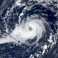
ATL: BRET - Remnants - Discussion

Moderator: S2k Moderators

Message
Author
Dougiefresh
Tropical Depression
Tropical Depression
Posts: 55
Age: 35
Joined: Thu Jun 08, 2017 8:07 am
Location: Barbados

Re: ATL: INVEST 92L - Discussion

#101 Postby Dougiefresh » Fri Jun 16, 2017 8:48 pm

cycloneye wrote:
floridasun78 wrote:are you surrise no plane plane go to 92l?


Not mentioned in Fridays TCPOD.Let's see if the Saturdays one has a mention.


Its still 2500 km away from the leeward islands that's alot of flying. Maybe on Sunday if it has shown more development.
1 likes   

User avatar
Yellow Evan
Professional-Met
Professional-Met
Posts: 16143
Age: 27
Joined: Fri Jul 15, 2011 12:48 pm
Location: Henderson, Nevada/Honolulu, HI
Contact:

Re: ATL: INVEST 92L - Discussion

#102 Postby Yellow Evan » Fri Jun 16, 2017 8:58 pm

SAB at 1.0

16/2345 UTC 6.1N 35.7W T1.0/1.0 92L -- Atlantic
0 likes   

User avatar
Hammy
Category 5
Category 5
Posts: 5849
Age: 41
Joined: Fri May 25, 2012 5:25 pm
Contact:

Re: ATL: INVEST 92L - Models

#103 Postby Hammy » Fri Jun 16, 2017 9:23 pm

HWRF ironically doesn't seem to make this into much (keeping it open more often than not), even as most other models develop it.
1 likes   
The above post is not official and should not be used as such. It is the opinion of the poster and may or may not be backed by sound meteorological data. It is not endorsed by any professional institution or storm2k.org. For official information, please refer to the NHC and NWS products.

CrazyC83
Professional-Met
Professional-Met
Posts: 34002
Joined: Tue Mar 07, 2006 11:57 pm
Location: Deep South, for the first time!

Re: ATL: INVEST 92L - Discussion

#104 Postby CrazyC83 » Fri Jun 16, 2017 9:24 pm

Hypercane_Kyle wrote:
hurricanes1234 wrote:Even in peak season, a system this far south is very rare, let alone in June when tropical waves themselves rarely organise and consolidate in any part of the open Atlantic.

So the result is that 92L is double rare. :eek:


92L's low latitude is the only reason it's alive. It's far enough south that it's able to avoid significant dry air and shear.


Also being June the MDR is not conducive so something has to go below it. Reminds me in a way of some December and January WPAC storms that form at below 5 degrees latitude.
0 likes   

User avatar
Dylan
Professional-Met
Professional-Met
Posts: 338
Age: 30
Joined: Mon May 31, 2010 9:50 am
Location: New Orleans, LA

Re: ATL: INVEST 92L - Discussion

#105 Postby Dylan » Fri Jun 16, 2017 9:26 pm

I wonder if the monster tropical wave behind 92L is robbing energy from the disturbance.

Image
0 likes   
Georges('98), Allison('01), Isidore('02), Lili('02), Frances('04) Ivan('04), Cindy('05), Katrina('05), Rita('05), Gustav('08), Isaac('12), Matthew('16), Harvey('17), Irma('17), Nate ('17), Ida ('21).

dexterlabio
Category 5
Category 5
Posts: 3468
Joined: Sat Oct 24, 2009 11:50 pm

Re: ATL: INVEST 92L - Discussion

#106 Postby dexterlabio » Fri Jun 16, 2017 9:28 pm

Looks like we're gonna see Bret very soon. Though is it rare for potential cyclones in the Atlantic to develop this far south? I remember Matthew last year also being a low rider, brushing the coast as far south as South America.
0 likes   
Personal Forecast Disclaimer:
The posts in this forum are NOT official forecast and should not be used as such. They are just the opinion of the poster and may or may not be backed by sound meteorological data. They are NOT endorsed by any professional institution or storm2k.org. For official information, please refer to the NHC and NWS products.

User avatar
cycloneye
Admin
Admin
Posts: 145270
Age: 68
Joined: Thu Oct 10, 2002 10:54 am
Location: San Juan, Puerto Rico

Re: ATL: INVEST 92L - Models

#107 Postby cycloneye » Fri Jun 16, 2017 10:52 pm

00z operational GFS has it down to 1000mbs in 54 hours.

Image
0 likes   
Visit the Caribbean-Central America Weather Thread where you can find at first post web cams,radars
and observations from Caribbean basin members Click Here

User avatar
cycloneye
Admin
Admin
Posts: 145270
Age: 68
Joined: Thu Oct 10, 2002 10:54 am
Location: San Juan, Puerto Rico

Re: ATL: INVEST 92L - Models

#108 Postby cycloneye » Fri Jun 16, 2017 10:58 pm

998 mbs in 72 hours.

Image

995mbs over TT.

Image
0 likes   
Visit the Caribbean-Central America Weather Thread where you can find at first post web cams,radars
and observations from Caribbean basin members Click Here

User avatar
Hurricaneman
Category 5
Category 5
Posts: 7350
Age: 45
Joined: Tue Aug 31, 2004 3:24 pm
Location: central florida

Re: ATL: INVEST 92L - Discussion

#109 Postby Hurricaneman » Fri Jun 16, 2017 11:05 pm

Seems the wave behind could be a detriment to this system for the time being
1 likes   

User avatar
Hurricaneman
Category 5
Category 5
Posts: 7350
Age: 45
Joined: Tue Aug 31, 2004 3:24 pm
Location: central florida

Re: ATL: INVEST 92L - Models

#110 Postby Hurricaneman » Fri Jun 16, 2017 11:09 pm

Looks as though the 0zGfs wants to make a run at being a hurricane but think this is going to take a bit of time because the wave behind is robing this system of moisture
1 likes   

Alyono
Professional-Met
Professional-Met
Posts: 6961
Joined: Fri Apr 26, 2013 3:52 pm
Location: Texas Coast

Re: ATL: INVEST 92L - Models

#111 Postby Alyono » Fri Jun 16, 2017 11:15 pm

There's no wave behind this invest. That is merely convection at the base of the trough.

Not all convection is due to a tropical wave
2 likes   

Alyono
Professional-Met
Professional-Met
Posts: 6961
Joined: Fri Apr 26, 2013 3:52 pm
Location: Texas Coast

Re: ATL: INVEST 92L - Discussion

#112 Postby Alyono » Fri Jun 16, 2017 11:17 pm

Hurricaneman wrote:Seems the wave behind could be a detriment to this system for the time being


that's not a wave behind it. Merely convection at the base of the trough
0 likes   

djones65
Category 1
Category 1
Posts: 264
Age: 59
Joined: Mon Jun 20, 2005 12:05 am
Location: Ocean Springs, MS

Re: ATL: INVEST 92L - Discussion

#113 Postby djones65 » Sat Jun 17, 2017 12:58 am

What? That is NOT a tropical wave east of 92L?
What is it then? NHC is tracking a wave along 23W. What trough are you seeing instead of that wave?
0 likes   

Alyono
Professional-Met
Professional-Met
Posts: 6961
Joined: Fri Apr 26, 2013 3:52 pm
Location: Texas Coast

Re: ATL: INVEST 92L - Discussion

#114 Postby Alyono » Sat Jun 17, 2017 1:06 am

great way to track waves is to look at the TPW loops. Waves are usually associated with a TPW maximum

http://tropic.ssec.wisc.edu/real-time/m ... /main.html

there may be a very low amplitude wave near 23W. However, that is EAST of the convection. The convection is at the base of the trough. The wave at 45W may be more of a detriment to this developing than the convection we see between 25 and 30W
1 likes   

AutoPenalti
Category 5
Category 5
Posts: 4030
Age: 29
Joined: Mon Aug 17, 2015 4:16 pm
Location: Ft. Lauderdale, Florida

Re: ATL: INVEST 92L - Models

#115 Postby AutoPenalti » Sat Jun 17, 2017 2:20 am

cycloneye wrote:998 mbs in 72 hours.

Image

995mbs over TT.

Image

Look how far south that is. Anything that can move this up? The Bermuda Ridge seems stout where it's at right now and I don't see any trough that can pick this up.
0 likes   
The posts in this forum are NOT official forecasts and should not be used as such. They are just the opinion of the poster and may or may not be backed by sound meteorological data. They are NOT endorsed by any professional institution or STORM2K. For official information, please refer to products from the NHC and NWS.


Model Runs Cheat Sheet:
GFS (5:30 AM/PM, 11:30 AM/PM)
HWRF, GFDL, UKMET, NAVGEM (6:30-8:00 AM/PM, 12:30-2:00 AM/PM)
ECMWF (1:45 AM/PM)

TCVN
is a weighted averaged

User avatar
Vince_and_Grace_fan
Category 1
Category 1
Posts: 317
Joined: Thu Nov 03, 2016 9:25 am
Location: Szombathely (Hungary)

Re: ATL: INVEST 92L - Models

#116 Postby Vince_and_Grace_fan » Sat Jun 17, 2017 2:58 am

Hammy wrote:HWRF ironically doesn't seem to make this into much (keeping it open more often than not), even as most other models develop it.


Now develops it into a moderate TS and shows landfall in Venezuela.

Image
0 likes   

Digital-TC-Chaser

Re: ATL: INVEST 92L - Models

#117 Postby Digital-TC-Chaser » Sat Jun 17, 2017 3:42 am

Alyono wrote:There's no wave behind this invest. That is merely convection at the base of the trough.

Not all convection is due to a tropical wave


What are you thinking on this Alyono. I tend to think will start coming together from this point of time.
0 likes   

Alyono
Professional-Met
Professional-Met
Posts: 6961
Joined: Fri Apr 26, 2013 3:52 pm
Location: Texas Coast

Re: ATL: INVEST 92L - Models

#118 Postby Alyono » Sat Jun 17, 2017 3:46 am

Digital-TC-Chaser wrote:
Alyono wrote:There's no wave behind this invest. That is merely convection at the base of the trough.

Not all convection is due to a tropical wave


What are you thinking on this Alyono. I tend to think will start coming together from this point of time.


convection could produce a little bit of easterly shear if it gets too close, though this invest is moving quite quickly itself
0 likes   

Alyono
Professional-Met
Professional-Met
Posts: 6961
Joined: Fri Apr 26, 2013 3:52 pm
Location: Texas Coast

Re: ATL: INVEST 92L - Models

#119 Postby Alyono » Sat Jun 17, 2017 3:47 am

Vince_and_Grace_fan wrote:
Hammy wrote:HWRF ironically doesn't seem to make this into much (keeping it open more often than not), even as most other models develop it.


Now develops it into a moderate TS and shows landfall in Venezuela.

Image


Looks like this possible Bret wants to do what Bret did 24 years ago. Hopefully, this one is not as deadly
0 likes   

User avatar
Hammy
Category 5
Category 5
Posts: 5849
Age: 41
Joined: Fri May 25, 2012 5:25 pm
Contact:

Re: ATL: INVEST 92L - Discussion

#120 Postby Hammy » Sat Jun 17, 2017 4:42 am

Looks like it's getting stretched out within the monsoon trough.
0 likes   
The above post is not official and should not be used as such. It is the opinion of the poster and may or may not be backed by sound meteorological data. It is not endorsed by any professional institution or storm2k.org. For official information, please refer to the NHC and NWS products.


Return to “2017”

Who is online

Users browsing this forum: No registered users and 13 guests