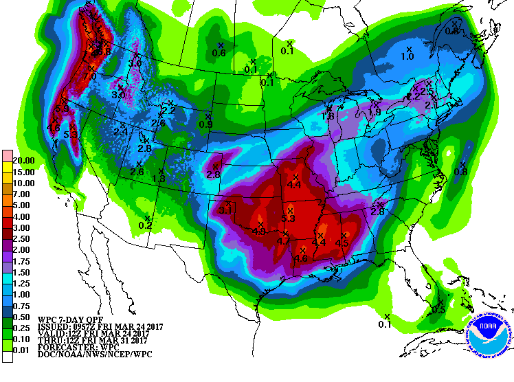
Pacific tropics for Thursday night/Friday morning. But the fast cell movement and limited training will keep rain low. Seems like a slight dwindling in rain chances to me. Nothing new.
Area Forecast Discussion
National Weather Service Austin/San Antonio TX
316 PM CDT Wed Mar 22 2017
.SHORT TERM (Tonight through Thursday Night)...
More warm and humid conditions will continue tonight through
Thursday. An upper ridge axis centered over West TX today will shift
east with an upstream trough likely to increase southerly winds for
Thursday. Winds of 20 to 30 mph are possible over western counties by
Thursday afternoon. The trough is expected to deepen into a Central
Plains low through Friday morning, which is a slight northward shift
over the tracks forecast from yesterday's forecast models. This
shift could lower precipitation/t-storm potential over our northern
counties as chances were already low for the rest of the forecast
area for Thursday night. A moisture tap to an unstable region in the
Pacific tropics could increase the chances for elevated convection,
so will continue with the model consensus on PoPs Thursday night.
&&
.LONG TERM (Friday through Wednesday)...
By daybreak Friday morning most of the storms and precipitation
should have shifted into the Hwy 281 corridor and eastward. The
aforementioned tropical tap could limit the impacts of a dry-slot
given our location with respect to the track of the large upper low.
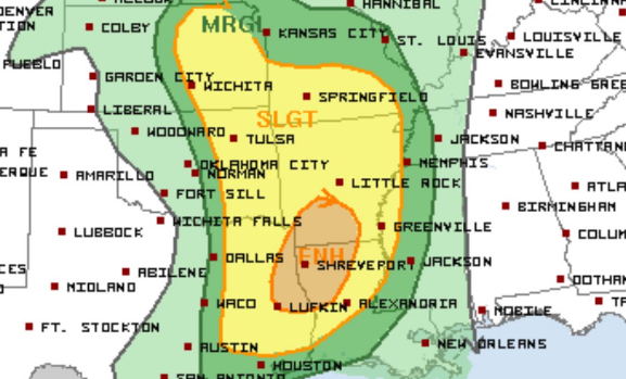
A moderate wind shear/low CAPE environment looks to be well
represented in the morning SPC day 3 outlook. Fast cell movement and
limited training potential should mean most of the larger rainfall
totals with this system should be on the order of an inch or less.
Areas SW of Rocksprings to Jourdanton could wind up with no rain, and
an elevated fire weather condition environment is expected to set up
over the Southern Edwards Plateau. The Pacific style front to follow
should bring partial drying with some low level moisture expected to
hang up over the Coastal Prairies for Saturday. Moisutre return
should remain too shallow as another progressive, but smaller
disturbance passes well north of the area Sunday night into Monday.
Low PoPs are offered based on uncertainties of the moisture pooling
left behind from the Friday storm/front, but the pattern looks to be
trending drier versus yesterday's model projections. The lack of an
immediate upstream disturbance behind the Sunday/Monday disturbance
leaves a better frontal push to follow.
While model agreement in handling the first two disturbances were
fair to good, a third disturbance expected late Tue/Wed has more
variance. With a more pronounced post-frontal environment Tuesday in
advance of this next larger disturbance, the best rain chances of the
week look to be with this system for next Wednesday.


