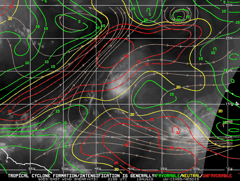
NDG wrote:Kingarabian wrote:It has 25kts-30kts of shear waiting for it to the southwest...
Is all easterly UL winds, if the TW picks up significant forward speed towards the west, which the GFS shows it approaching the windward Island by Wednesday morning, traveling west at an average speed of 15 mph, it cancels out a lot of that UL easterly shear.
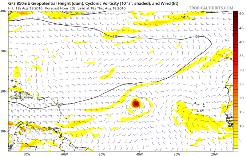
18Z SHIPS shows shear to be well under 15 knots over the next 5 days as it travels westward.Code: Select all
SHEAR (KT) 14 8 8 11 12 7 9 6 9 12 5 9 8
Gang, either there is 25-30kt of shear or there isn't.
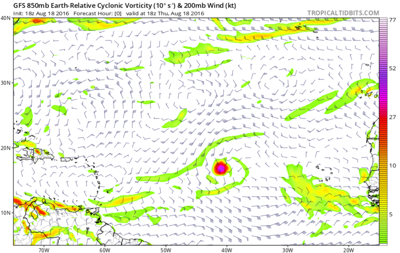
Shear is a vector difference, which already takes into account a lower level wind vector. The 850 wind vector in the deep tropics, is usually (but not always) a decent proxy for speed of forward motion. The only way that a shear calculation will be significantly off is if the storm motion vector is markedly different from the low level wind vector used in the shear calculation. If the OP was talking about an upper tropospheric wind vector, then, and only then, will the direction of that wind vector, relative to the direction of the storm motion vector play a role in the total magnitude of the shear.
I.e. if a model is advertising 25-30kt of easterly shear in the MDR, that means the upper level easterlies are that much stronger than the lower level easterlies, which are generally 15-20kt. This means the upper tropospheric easterlies used in the shear calculation would be over 40kt. Shear is shear.
OK, now that my mini-rant is over, here's a little two-question true or false quiz to see if you were listening...
True or false: In the MDR, 25-30kt of upper level westerly shear over a system moving westward at 15kt is "worse" than 25kt of upper level easterly shear.
True or false: In the MDR, 25-30kt of upper level westerly wind over a system moving westward at 15kt is "worse" than 25kt of upper level easterly wind.
Carry on.