ATL: EARL - Remnants - Discussion

Moderator: S2k Moderators

Message
Author
znel52

Re: ATL: INVEST 97L - Discussion

#341 Postby znel52 » Sun Jul 31, 2016 10:47 am

CaliforniaResident wrote:
znel52 wrote:Even if it can't be classified yet it almost feels weird seeing something semi-organized holding together in the Caribbean. Seems like it's been so long!


If the timing is right, it could literally explode from almost nothing to a MH in a very short time when it hits that "sweet spot." Could this also be the start of a conveyor belt in the Atlantic for the month of the August?


Yeah if it can slow its forward speed and stay in good upper level conditions we have seen what the Caribbean is capable of in the past. I don't want to speculate on how strong this storm will end up but I have a feeling it could be one of those 'over-achievers'. (meaning it outdoes model predictions)
0 likes   

User avatar
tarheelprogrammer
S2K Supporter
S2K Supporter
Posts: 1793
Joined: Mon Mar 28, 2016 9:25 pm
Location: Raleigh, NC area (Garner, NC)

Re: ATL: INVEST 97L - Models

#342 Postby tarheelprogrammer » Sun Jul 31, 2016 11:08 am

12z GFS buried into Central America. Probably going to continue the lucky streak for the US and Gulf of Mexico. A lot could change but it is trending that way right in the nick of time.
0 likes   
My posts are not official forecasts. They are just my opinion and may or may not be backed by sound meteorological data. They are NOT endorsed by any professional institution or storm2k.org. For official information, please refer to the NHC and NWS products.

hurrtracker79
Tropical Depression
Tropical Depression
Posts: 94
Joined: Sun Jul 28, 2013 1:32 pm

Re: ATL: INVEST 97L - Models

#343 Postby hurrtracker79 » Sun Jul 31, 2016 11:11 am

tarheelprogrammer wrote:12z GFS buried into Central America. Probably going to continue the lucky streak for the US and Gulf of Mexico. A lot could change but it is trending that way right in the nick of time.


Yep, appears any threat to the U.S (not that there was much to begin with) is lowering as most models now bury it into Central America. Still lots of time to watch...
1 likes   

User avatar
perk
Category 3
Category 3
Posts: 825
Joined: Mon Aug 09, 2004 9:35 am
Location: Richmond Texas

Re: ATL: INVEST 97L - Models

#344 Postby perk » Sun Jul 31, 2016 11:17 am

Alyono wrote:of course watch it. However, given the questions regarding this moving into the Gulf, I just think it's too soon to panic.

of course, given that we are entering the heart of the season, one should be reviewing any cane prep plans that they may have. Know what to do in case this does come to Texas


i have seen no evidence of panic over 97L.
0 likes   

User avatar
Nimbus
Category 5
Category 5
Posts: 5300
Joined: Mon Jul 19, 2004 10:54 am

Re: ATL: INVEST 97L - Discussion

#345 Postby Nimbus » Sun Jul 31, 2016 11:25 am

There is light shear from the south that will inhibit development short term.
Not much change in forecast yet, IF the TUTT fills in by the time 97L reaches the western Caribbean then we could see development and a track change.
0 likes   

Alyono
Professional-Met
Professional-Met
Posts: 6961
Joined: Fri Apr 26, 2013 3:52 pm
Location: Texas Coast

Re: ATL: INVEST 97L - Discussion

#346 Postby Alyono » Sun Jul 31, 2016 11:26 am

NHC has no recon scheduled until Tuesday. That is a clue as to when they think this will be classified.

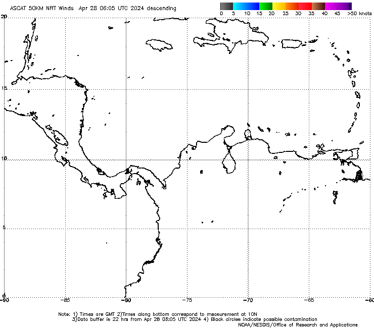
It should take quite a bit of time for a circulation to develop. The ASCAT from the past couple of days showed a very weak wave at best
Last edited by Alyono on Sun Jul 31, 2016 11:33 am, edited 1 time in total.
0 likes   

User avatar
Hurricaneman
Category 5
Category 5
Posts: 7351
Age: 45
Joined: Tue Aug 31, 2004 3:24 pm
Location: central florida

Re: ATL: INVEST 97L - Discussion

#347 Postby Hurricaneman » Sun Jul 31, 2016 11:27 am

The convergence seems to be happening at 63W 15N

The posts in this forum are NOT official forecast and should not be used as such. They are just the opinion of the poster and may or may not be backed by sound meteorological data. They are NOT endorsed by any professional institution or STORM2K. For official information, please refer to products from the National Hurricane Center and National Weather Service
1 likes   

User avatar
Agua
Category 5
Category 5
Posts: 1138
Joined: Thu Jul 31, 2003 4:54 pm
Location: Biloxi, Mississippi

Re: ATL: INVEST 97L - Models

#348 Postby Agua » Sun Jul 31, 2016 11:27 am

northjaxpro wrote:Who is saying we are in a state of panic? All I am saying is to watch it carefully. As we always do anyway. We do not even have a fully mature system yet. I guess some folks just look for anything to exploit you on this forum for Pete's sake

I don't think there's any worry the people here won't "watch it carefully" when they keep an eye on every thunderstorm in the Sahara. :ggreen:
2 likes   

Javlin
Category 5
Category 5
Posts: 1620
Age: 64
Joined: Fri Jul 09, 2004 7:58 pm
Location: ms gulf coast

Re: ATL: INVEST 97L - Discussion

#349 Postby Javlin » Sun Jul 31, 2016 11:31 am

Hurricaneman wrote:The convergence seems to be happening at 63W 15N

The posts in this forum are NOT official forecast and should not be used as such. They are just the opinion of the poster and may or may not be backed by sound meteorological data. They are NOT endorsed by any professional institution or STORM2K. For official information, please refer to products from the National Hurricane Center and National Weather Service


That was my thought's looking at the sat I would almost think we could have a depression later today looks like maybe some SW inflow on the RGB
Last edited by Javlin on Sun Jul 31, 2016 11:32 am, edited 1 time in total.
0 likes   

User avatar
tarheelprogrammer
S2K Supporter
S2K Supporter
Posts: 1793
Joined: Mon Mar 28, 2016 9:25 pm
Location: Raleigh, NC area (Garner, NC)

Re: ATL: INVEST 97L - Discussion

#350 Postby tarheelprogrammer » Sun Jul 31, 2016 11:32 am

Hurricaneman wrote:The convergence seems to be happening at 63W 15N

The posts in this forum are NOT official forecast and should not be used as such. They are just the opinion of the poster and may or may not be backed by sound meteorological data. They are NOT endorsed by any professional institution or STORM2K. For official information, please refer to products from the National Hurricane Center and National Weather Service


To me it looks like an LLC is forming right now within the system. 8-)
0 likes   
My posts are not official forecasts. They are just my opinion and may or may not be backed by sound meteorological data. They are NOT endorsed by any professional institution or storm2k.org. For official information, please refer to the NHC and NWS products.

User avatar
Hurricaneman
Category 5
Category 5
Posts: 7351
Age: 45
Joined: Tue Aug 31, 2004 3:24 pm
Location: central florida

Re: ATL: INVEST 97L - Discussion

#351 Postby Hurricaneman » Sun Jul 31, 2016 11:35 am

I have this feeling if this can somehow gain and keep a LLC this may become a hurricane before central America but that is me sticking my neck out there and pushing it as I think at peak this is 60MPH into Belize-Mexico border

The posts in this forum are NOT official forecast and should not be used as such. They are just the opinion of the poster and may or may not be backed by sound meteorological data. They are NOT endorsed by any professional institution or STORM2K. For official information, please refer to products from the National Hurricane Center and National Weather Service
1 likes   

User avatar
Nimbus
Category 5
Category 5
Posts: 5300
Joined: Mon Jul 19, 2004 10:54 am

Re: ATL: INVEST 97L - Discussion

#352 Postby Nimbus » Sun Jul 31, 2016 11:38 am

tarheelprogrammer wrote:
Hurricaneman wrote:The convergence seems to be happening at 63W 15N

The posts in this forum are NOT official forecast and should not be used as such. They are just the opinion of the poster and may or may not be backed by sound meteorological data. They are NOT endorsed by any professional institution or STORM2K. For official information, please refer to products from the National Hurricane Center and National Weather Service


To me it looks like an LLC is forming right now within the system. 8-)


I'm looking at the west side of the storm.
Upper level clouds are being sheared away.
Low level clouds should be moving in with the inflow if the storm is developing?

YMMV

http://weather.msfc.nasa.gov/cgi-bin/ge ... olor=black
0 likes   

User avatar
AJC3
Admin
Admin
Posts: 3999
Age: 61
Joined: Tue Aug 31, 2004 7:04 pm
Location: Ballston Spa, New York
Contact:

Re: ATL: INVEST 97L - Discussion

#353 Postby AJC3 » Sun Jul 31, 2016 11:42 am

For folks that might not be aware, over the last decade plus, The CMO's Caribbean Regional Weather Radar Project was developed to install and maintain weather surveillance radars at strategic sites throughout the Caribbean.

http://www.cmo.org.tt/radar.html

This is a challenging undertaking, primarily due to fiscal/monetary constraints. The construction/installation part is hard enough, and the cost associated with maintenance and repair results in frequent, and, as you've no doubt noticed, often significant down time for many of the sites, some moreso than others.

One of the important goals of the project was to create a Caribbean radar mosaic of all available radars, plus some adjoining CONUS and SOAM sites (perhaps one day, sites from Cuba, Mexico CENTAM, and the Bahamas will be included as well).

Image

You've no doubt seen the U.S. mosaic (animation)...
http://radar.weather.gov/Conus/full_loop.php

But have you seen that the Barbados Weather Service now has the Caribbean Mosaic up and running?
http://barbadosweather.org/BMS_radar_Composite.php
http://barbadosweather.org/Composite/ki ... site=Sabre

IMO, this is huge, that this has gotten to the point where it's online. We can only hope the sites that are up stay up as much as possible, some other sites (such as Punta Cana, DR and Nassau,BHM that have been down for a while get repaired.

Note: I posted this in the 97L discussion thread since the current radar mosaic covers the area it's in.
5 likes   

Alyono
Professional-Met
Professional-Met
Posts: 6961
Joined: Fri Apr 26, 2013 3:52 pm
Location: Texas Coast

Re: ATL: INVEST 97L - Discussion

#354 Postby Alyono » Sun Jul 31, 2016 11:45 am

thinking Debby from 1988 may be an agalog for this
0 likes   

User avatar
NDG
S2K Supporter
S2K Supporter
Posts: 15446
Joined: Sun Jul 09, 2006 10:14 pm
Location: Orlando, FL

Re: ATL: INVEST 97L - Discussion

#355 Postby NDG » Sun Jul 31, 2016 12:21 pm

It sure is trying to close a circulation but not much model support for doing so in the short term.

Image
0 likes   

Javlin
Category 5
Category 5
Posts: 1620
Age: 64
Joined: Fri Jul 09, 2004 7:58 pm
Location: ms gulf coast

Re: ATL: INVEST 97L - Discussion

#356 Postby Javlin » Sun Jul 31, 2016 12:22 pm

Nimbus wrote:
tarheelprogrammer wrote:
Hurricaneman wrote:The convergence seems to be happening at 63W 15N

The posts in this forum are NOT official forecast and should not be used as such. They are just the opinion of the poster and may or may not be backed by sound meteorological data. They are NOT endorsed by any professional institution or STORM2K. For official information, please refer to products from the National Hurricane Center and National Weather Service


To me it looks like an LLC is forming right now within the system. 8-)


I'm looking at the west side of the storm.
Upper level clouds are being sheared away.
Low level clouds should be moving in with the inflow if the storm is developing?

YMMV

http://weather.msfc.nasa.gov/cgi-bin/ge ... olor=black

I am thinking 14.5'N and 64'ishW ATTM the cloud shear out to the W looks to be from the retrograding UL and few hundred miles from the 64W mark.
0 likes   

BobHarlem
Category 5
Category 5
Posts: 2108
Joined: Thu Oct 20, 2005 6:11 pm

Re: ATL: INVEST 97L - Models

#357 Postby BobHarlem » Sun Jul 31, 2016 12:25 pm

The 12Z GFS is going with the idea of it just having a hard time getting together in the central Caribbean, and then tilting toward the south around Honduras (almost bouncing off) and not really getting itself together then because of land interaction. With this run, shear isn't the problem with this one, but it just looks like a bunch of cuts from other things the fast forward motion mainly. If this manages to organize sooner rather than later I think it may change, but it's really only the HWRF showing it.
0 likes   

User avatar
msbee
S2K Supporter
S2K Supporter
Posts: 3027
Joined: Wed Jun 11, 2003 10:11 am
Location: St. Maarten

Re: ATL: INVEST 97L - Discussion

#358 Postby msbee » Sun Jul 31, 2016 12:35 pm

AJC3 wrote:For folks that might not be aware, over the last decade plus, The CMO's Caribbean Regional Weather Radar Project was developed to install and maintain weather surveillance radars at strategic sites throughout the Caribbean.

http://www.cmo.org.tt/radar.html

This is a challenging undertaking, primarily due to fiscal/monetary constraints. The construction/installation part is hard enough, and the cost associated with maintenance and repair results in frequent, and, as you've no doubt noticed, often significant down time for many of the sites, some moreso than others.

One of the important goals of the project was to create a Caribbean radar mosaic of all available radars, plus some adjoining CONUS and SOAM sites (perhaps one day, sites from Cuba, Mexico CENTAM, and the Bahamas will be included as well).

Image

You've no doubt seen the U.S. mosaic (animation)...
http://radar.weather.gov/Conus/full_loop.php

But have you seen that the Barbados Weather Service now has the Caribbean Mosaic up and running?
http://barbadosweather.org/BMS_radar_Composite.php
http://barbadosweather.org/Composite/ki ... site=Sabre

IMO, this is huge, that this has gotten to the point where it's online. We can only hope the sites that are up stay up as much as possible, some other sites (such as Punta Cana, DR and Nassau,BHM that have been down for a while get repaired.

Note: I posted this in the 97L discussion thread since the current radar mosaic covers the area it's in.


That is very cool and VERY helpful to those of us in the Caribbean!
0 likes   
Too many hurricanes to remember

User avatar
cycloneye
Admin
Admin
Posts: 145307
Age: 68
Joined: Thu Oct 10, 2002 10:54 am
Location: San Juan, Puerto Rico

Re: ATL: INVEST 97L - Discussion

#359 Postby cycloneye » Sun Jul 31, 2016 12:44 pm

TROPICAL WEATHER OUTLOOK
NWS NATIONAL HURRICANE CENTER MIAMI FL
200 PM EDT SUN JUL 31 2016

For the North Atlantic...Caribbean Sea and the Gulf of Mexico:

Showers and thunderstorms associated with a strong and fast-moving
tropical wave over the eastern Caribbean Sea have changed little in
organization this morning, and there are still no signs of a closed
surface circulation. Although some gradual development of this
system is possible during the next day or so, the chance for
tropical cyclone formation should increase after the wave reaches
the western Caribbean Sea in a couple of days. This disturbance is
expected to cause locally heavy rains and gusty winds over portions
of the Lesser Antilles, the Virgin Islands, and Puerto Rico today
and tonight. These conditions should spread westward across the
central Caribbean Sea and reach Hispaniola by Monday and Jamaica and
Cuba by Tuesday. Interests in these areas and elsewhere in the
Caribbean Sea should continue to monitor the progress of this
system. For additional information on this system, see High Seas
Forecasts issued by the National Weather Service.
* Formation chance through 48 hours...medium...40 percent
* Formation chance through 5 days...high...70 percent

&&

High Seas Forecasts issued by the National Weather Service can be
found under AWIPS header NFDHSFAT1, WMO header FZNT01 KWBC, and on
the Web at http://www.opc.ncep.noaa.gov/shtml/NFDHSFAT1.shtml.

$$
Forecaster Kimberlain
0 likes   
Visit the Caribbean-Central America Weather Thread where you can find at first post web cams,radars
and observations from Caribbean basin members Click Here

tolakram
Admin
Admin
Posts: 20009
Age: 62
Joined: Sun Aug 27, 2006 8:23 pm
Location: Florence, KY (name is Mark)

Re: ATL: INVEST 97L - Discussion

#360 Postby tolakram » Sun Jul 31, 2016 1:05 pm

1 likes   
M a r k
- - - - -
Join us in chat: Storm2K Chatroom Invite. Android and IOS apps also available.

The posts in this forum are NOT official forecasts and should not be used as such. Posts are NOT endorsed by any professional institution or STORM2K.org. For official information and forecasts, please refer to NHC and NWS products.


Return to “2016”

Who is online

Users browsing this forum: No registered users and 5 guests