Medtronic15 wrote:He we go #Invest97L
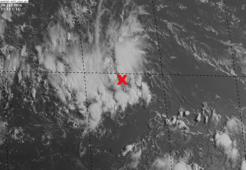
Very interresting graphic. Any link my friend? We will appreciate
Moderator: S2k Moderators


Medtronic15 wrote:He we go #Invest97L


Gustywind wrote:Medtronic15 wrote:He we go #Invest97L
Very interresting graphic. Any link my friend? We will appreciateThanks


Code: Select all
* ATLANTIC     SHIPS INTENSITY FORECAST          *
                    * IR SAT DATA AVAILABLE,       OHC AVAILABLE     *
                    *  INVEST      AL972016  07/30/16  12 UTC        *

TIME (HR)          0     6    12    18    24    36    48    60    72    84    96   108   120
V (KT) NO LAND    25    27    30    33    37    46    52    59    65    76    85    94    99
V (KT) LAND       25    27    30    33    37    46    44    48    56    68    76    52    35
V (KT) LGEM       25    26    28    31    33    39    37    44    46    54    62    46    33
Storm Type      TROP  TROP  TROP  TROP  TROP  TROP  TROP  TROP  TROP  TROP  TROP  TROP  TROP

SHEAR (KT)         1     2     4     8    13    11    12    11    11     2     5     9    13
SHEAR ADJ (KT)     1     0    -4    -3    -1    -1    -2     0     0     1     0    -6    -5
SHEAR DIR         48    59   232   274   315   293   282   271   292   199    53    67    50
SST (C)         27.6  27.9  28.3  28.4  28.7  28.8  28.8  29.5  29.5  29.6  29.7  30.1  30.2
POT. INT. (KT)   137   141   146   147   152   153   153   164   163   164   165   170   170
ADJ. POT. INT.   147   151   157   157   163   163   161   171   168   164   162   164   163
200 MB T (C)   -54.1 -53.6 -53.4 -53.6 -53.6 -53.1 -53.2 -52.7 -52.9 -52.0 -52.5 -51.8 -52.5
200 MB VXT (C)   0.0  -0.1   0.0   0.0   0.0   0.0   0.1   0.0   0.1   0.2   0.4   0.3   0.3
TH_E DEV (C)       9    10    10    11    11    12    12    13    12    11     8    10     7
700-500 MB RH     57    56    55    55    57    60    60    64    64    74    74    80    81
MODEL VTX (KT)     8     8     8     8    10    10     7     6     6    10    10    10     9
850 MB ENV VOR    70    68    64    53    47    60    60    71    60    91    69    81    61
200 MB DIV        32    39    17    22     6    38     8    31     4    52    27    72    64
700-850 TADV       8     4     5     4     1    -5    -4    -3   -12    -3    -4     0    -2
LAND (KM)       1021   884   714   616   488    48     0    -2   257   146    29   -39  -118
LAT (DEG N)     14.5  14.9  15.5  16.0  16.5  17.5  18.1  18.2  17.8  17.1  16.0  15.3  15.1
LONG(DEG W)     51.3  54.0  56.5  59.0  61.5  66.6  71.8  76.5  80.7  84.0  86.6  88.4  89.6
STM SPEED (KT)    26    26    25    25    25    25    24    21    19    15    11     7     6
HEAT CONTENT      36    55    33    43    11    88    21    28    81    42    30    89    79

  FORECAST TRACK FROM TABM      INITIAL HEADING/SPEED (DEG/KT):275/ 25      CX,CY: -24/  2
  T-12 MAX WIND:  25            PRESSURE OF STEERING LEVEL (MB):  494  (MEAN=618)
  GOES IR BRIGHTNESS TEMP. STD DEV.  50-200 KM RAD:  27.3 (MEAN=14.5)
  % GOES IR PIXELS WITH T < -20 C    50-200 KM RAD:  45.0 (MEAN=65.0)
  PRELIM RI PROB (DV .GE. 30 KT IN 24 HR):            6.3
Medtronic15 wrote:Gustywind wrote:Medtronic15 wrote:He we go #Invest97L
Very interresting graphic. Any link my friend? We will appreciate
Link!

http://www.ndbc.noaa.gov/show_plot.php? ... _label=ADT


Dean4Storms wrote:From what I saw a week or so ago, some of the highest TCHP resides in the NW Carib. Sea just South of Cuba, if this is a TC by that time and UL winds are favorable there is little doubt in my mind we could see some rapid intensification if it tracks there. From there if it does indeed deepen rapidly you have to begin to wonder about the track and if this doesn't gain more latitude compared to the current models which show a weak TW or weak TC steered mostly in the lower level flow. Something to keep an eye on for sure!

NDG wrote:97L has everything working for it, very warm SSTs, an UL anticyclone on top of it, good UL divergence and surface convergence but like mentioned by the NHC it is moving too fast. It has to slow down some for it to develop a closed circulation and it may do so as it reaches the western Caribbean in a few days.
Models keep a very strong ridge to the north of it so at this time it looks like it is no threat to the US except for south TX still has to keep an eye on it, IMO.The posts in this forum are NOT official forecasts and should not be used as such. They are just the opinion of the poster and may or may not be backed by sound meteorological data. They are NOT endorsed by any professional institution or STORM2K. For official information, please refer to products from the NHC and NWS.
JaxGator wrote:And recon is not going in today. For now anyway.
WEATHER RECONNAISSANCE FLIGHTS
CARCAH, NATIONAL HURRICANE CENTER, MIAMI, FL.
1015 AM EDT SAT 30 JULY 2016
SUBJECT: TROPICAL CYCLONE PLAN OF THE DAY (TCPOD)
VALID 31/1100Z TO 01/1100Z AUGUST 2016
TCPOD NUMBER.....16-065
I. ATLANTIC REQUIREMENTS
1. NEGATIVE RECONNAISSANCE REQUIREMENTS.
2. OUTLOOK FOR SUCCEEDING DAY.....NEGATIVE.
Users browsing this forum: No registered users and 37 guests


