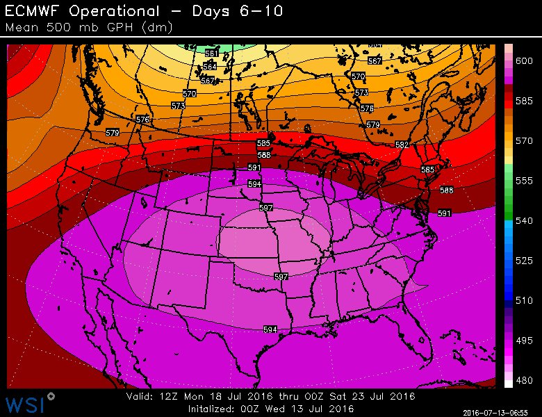
Ntxw wrote:I was driving home and it hit me it is mid summer and amazing how green the majority of the land still was. Everybody's lawn is green, parks are green, side of the road was green. DFW hasn't hit 100 yet and if you think the green landscape has nothing to do with it you'd be wrong. I pulled up images from 2011 posted by some and it is night and day.
2011
2016 is complete 180


Makes a big difference it seems. What exactly is it though?
I remember one time i saw a picture from the NWS soon after a major tornado passed through. Where the storm passed the ground was torn up and yellow and the next day, there was a string of clouds DIRECTLY over the path of the tornado and the ground that was yellow. Same effect?