I rarely comment on atlantic storms but i'm kinda interested in this one because it's very slow over there and GFS almost makes this a Category 5 which we love tracking over in the WPAC.
Good thing it misses land for now...
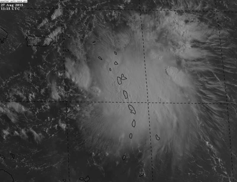
ATL: ERIKA - Remnants - Discussion
Moderator: S2k Moderators
-
euro6208
Re: ATL: ERIKA - Tropical Storm - Discussion
Last edited by euro6208 on Thu Aug 27, 2015 5:53 am, edited 1 time in total.
0 likes

Re: ATL: ERIKA - Tropical Storm - Discussion
NOAA just found center S of 16N...
000
URNT15 KWBC 271046
NOAA3 0505A ERIKA HDOB 35 20150827
103630 1558N 06134W 6938 03209 0041 +119 +053 072037 037 /// /// 03
103700 1556N 06133W 6945 03201 0034 +124 +046 075039 040 /// /// 03
103730 1555N 06132W 6958 03185 0038 +121 +053 077039 040 /// /// 03
103800 1553N 06131W 6979 03162 0039 +121 +059 071038 038 /// /// 03
103830 1551N 06131W 6988 03152 0044 +118 +064 058037 038 /// /// 03
103900 1549N 06130W 6953 03195 0050 +113 +063 058036 037 /// /// 03
103930 1547N 06129W 6946 03200 0045 +117 +059 054035 036 /// /// 03
104000 1545N 06128W 6931 03222 0041 +119 +060 056033 033 /// /// 03
104030 1543N 06127W 6943 03207 0045 +116 +063 060038 039 /// /// 03
104100 1541N 06126W 6927 03223 0044 +111 +077 068038 042 /// /// 03
104130 1539N 06125W 6951 03185 0051 +097 //// 057016 026 /// /// 05
104200 1537N 06123W 6964 03170 0057 +090 //// 288010 017 /// /// 05
104230 1536N 06122W 6999 03133 0058 +098 //// 248016 027 /// /// 05
104300 1535N 06120W 6975 03157 0069 +086 //// 208020 023 /// /// 05
104330 1534N 06118W 6951 03192 0067 +089 //// 204016 019 /// /// 05
104400 1533N 06116W 6936 03220 0069 +095 //// 182020 023 /// /// 05
104430 1533N 06114W 6929 03225 0076 +090 //// 178020 024 /// /// 05
104500 1533N 06112W 6926 03234 0095 +079 //// 130028 031 031 014 05
104530 1533N 06110W 6956 03197 0083 +090 +089 107019 026 035 012 00
104600 1534N 06108W 6946 03210 0077 +097 +080 081018 019 033 010 00
0 likes
-
eastcoastFL

- Category 5

- Posts: 3996
- Age: 44
- Joined: Thu Apr 12, 2007 12:29 pm
- Location: Palm City, FL
Re: Re:
jlauderdal wrote:eastcoastFL wrote:who is forecating ts winds for palm city?
http://kamala.cod.edu/fl/latest.fpus52.KMLB.html
My local noaa sun-mon
http://forecast.weather.gov/MapClick.ph ... d7kqsvD8wg[/quote]
tropical storm winds possible....stay tuned, check your hurricane supplies today and tomorrow, follow nhc and mlb weather office, media is ok but be wary as there can be misinformation out there believe it or not...we could have a whole thread about what we hear and see in the media as it approaches that will be factually incorrect but that is another story...if you are on this board you are way ahead of the game as far as having info well in advance but again use your filter accordingly just like with the media[/quote]
Thanks man. Ive been here for a while and use it as my main source for tropics info. Lets be prepared but hopefully not need it.
0 likes
Personal Forecast Disclaimer:
The posts in this forum are NOT official forecast and should not be used as such. They are just the opinion of the poster and may or may not be backed by sound meteorological data. They are NOT endorsed by any professional institution or storm2k.org. For official information, please refer to the NHC and NWS products.
The posts in this forum are NOT official forecast and should not be used as such. They are just the opinion of the poster and may or may not be backed by sound meteorological data. They are NOT endorsed by any professional institution or storm2k.org. For official information, please refer to the NHC and NWS products.
-
CourierPR

- Category 5
- Posts: 1336
- Age: 72
- Joined: Tue Aug 31, 2004 7:53 pm
- Location: Pompano Beach, Florida
Re: ATL: ERIKA - Tropical Storm - Discussion
drezee posted that NOAA just located the center south of 16 degrees north. Will this alter track guidance?
0 likes
Re: ATL: ERIKA - Tropical Storm - Discussion
CourierPR wrote:drezee posted that NOAA just located the center south of 16 degrees north. Will this alter track guidance?
They are flying high and just may mean it is very tilted, but the lowest pressure was Still S of 16N
0 likes
-
CourierPR
- Category 5
- Posts: 1336
- Age: 72
- Joined: Tue Aug 31, 2004 7:53 pm
- Location: Pompano Beach, Florida
Re: ATL: ERIKA - Tropical Storm - Discussion
drezee wrote:CourierPR wrote:drezee posted that NOAA just located the center south of 16 degrees north. Will this alter track guidance?
They are flying high and just may mean it is very tilted, but the lowest pressure was Still S of 16N
Does Erika's movement currently have less of a northerly component than previously forecasted?
0 likes
-
TheProfessor

- Professional-Met

- Posts: 3506
- Age: 29
- Joined: Tue Dec 03, 2013 10:56 am
- Location: Wichita, Kansas
Well since any predictions I make on storm2k become the opposite I will make this one to help you Floridans out. (remember I'm not a pro met lol) Erika will turn in to a cat 5 storm make landfall in Miami then get carried out to the Northeast but then get trapped and making a 2nd landfall in North Carolina as a cat 5.
Now that I've made this prediction there's about a .0000001% of this happening.
Now that I've made this prediction there's about a .0000001% of this happening.
0 likes
An alumnus of The Ohio State University.
Your local National Weather Service office is your best source for weather information.
Your local National Weather Service office is your best source for weather information.

Re: ATL: ERIKA - Tropical Storm - Discussion
Erika is struggling now with strong westerly shear despite the blowup in convection. The storm is not vertically aligned between the low and mid levels.
0 likes
Re:
TheProfessor wrote:Well since any predictions I make on storm2k become the opposite I will make this one to help you Floridans out. (remember I'm not a pro met lol) Erika will turn in to a cat 5 storm make landfall in Miami then get carried out to the Northeast but then get trapped and making a 2nd landfall in North Carolina as a cat 5.
Now that I've made this prediction there's about a .0000001% of this happening.
But did you stay at a holiday inn express last night? Lol.
0 likes
-
CourierPR
- Category 5
- Posts: 1336
- Age: 72
- Joined: Tue Aug 31, 2004 7:53 pm
- Location: Pompano Beach, Florida
Re: ATL: ERIKA - Tropical Storm - Discussion
ronjon wrote:Erika is struggling now with strong westerly shear despite the blowup in convection. The storm is not vertically aligned between the low and mid levels.
It seems to have been this way for awhile now but it is looking decent this morning in the face of that shear.
0 likes
-
TheProfessor
- Professional-Met
- Posts: 3506
- Age: 29
- Joined: Tue Dec 03, 2013 10:56 am
- Location: Wichita, Kansas
Re: Re:
ronjon wrote: But did you stay at a holiday inn express last night? Lol.
Sorry, I'm young, I don't get the reference lol, I did stay in a college dorm room though if that helps.
0 likes
An alumnus of The Ohio State University.
Your local National Weather Service office is your best source for weather information.
Your local National Weather Service office is your best source for weather information.
-
eastcoastFL
- Category 5
- Posts: 3996
- Age: 44
- Joined: Thu Apr 12, 2007 12:29 pm
- Location: Palm City, FL
Re: Re:
TheProfessor wrote:ronjon wrote: But did you stay at a holiday inn express last night? Lol.
Sorry, I'm young, I don't get the reference lol, I did stay in a college dorm room though if that helps.
Its in reference to a commercial on tv. You have probably seen it but didnt even notice.
0 likes
Personal Forecast Disclaimer:
The posts in this forum are NOT official forecast and should not be used as such. They are just the opinion of the poster and may or may not be backed by sound meteorological data. They are NOT endorsed by any professional institution or storm2k.org. For official information, please refer to the NHC and NWS products.
The posts in this forum are NOT official forecast and should not be used as such. They are just the opinion of the poster and may or may not be backed by sound meteorological data. They are NOT endorsed by any professional institution or storm2k.org. For official information, please refer to the NHC and NWS products.

With the 12z HWRF now forecasting a Danny to make landfall along in Brevard County FL I would expect they will move the track a little westward at the 11 AM advisory.
The roller coaster continues lol.
Edit: Erika
The roller coaster continues lol.
Edit: Erika
Last edited by NDG on Thu Aug 27, 2015 7:06 am, edited 1 time in total.
0 likes
-
wzrgirl1

- S2K Supporter

- Posts: 1360
- Joined: Sat Sep 04, 2004 6:44 am
- Location: Pembroke Pines, Florida
Re:
NDG wrote:With the 12z HWRF now forecasting a Danny to make landfall along in Brevard County FL I would expect they will move the track a little westward at the 11 AM advisory.
The roller coaster continues lol.
You mean Erika.
0 likes

Re: Re:
wzrgirl1 wrote:NDG wrote:With the 12z HWRF now forecasting a Danny to make landfall along in Brevard County FL I would expect they will move the track a little westward at the 11 AM advisory.
The roller coaster continues lol.
You mean Erika.
Sorry, 5 hours of sleep take a toll on me eventually, and it has just begun.
0 likes
Who is online
Users browsing this forum: No registered users and 45 guests