
Radar loop out of Tallahassee, make sure you speed up the loop.
http://weather.rap.ucar.edu/radar/displ ... duration=3
Weak low in NE Gulf of Mexico: (Is Invest 95L)
Moderator: S2k Moderators
Forum rules

The posts in this forum are NOT official forecasts and should not be used as such. They are just the opinion of the poster and may or may not be backed by sound meteorological data. They are NOT endorsed by any professional institution or STORM2K. For official information, please refer to products from the National Hurricane Center and National Weather Service.
-
cycloneye

- Admin

- Posts: 149789
- Age: 69
- Joined: Thu Oct 10, 2002 10:54 am
- Location: San Juan, Puerto Rico
Re: Weak low in NE Gulf of Mexico
Interesting tweet by Levi.
Levi Cowan @TropicalTidbits · 8m8 minutes ago
System in NE gulf might end up closer to a TD than one might have expected before shifting inland.
Levi Cowan @TropicalTidbits · 8m8 minutes ago
System in NE gulf might end up closer to a TD than one might have expected before shifting inland.
0 likes
Visit the Caribbean-Central America Weather Thread where you can find at first post web cams,radars
and observations from Caribbean basin members Click Here
and observations from Caribbean basin members Click Here
-
northjaxpro

- S2K Supporter

- Posts: 8900
- Joined: Mon Sep 27, 2010 11:21 am
- Location: Jacksonville, FL
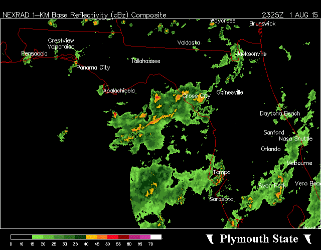
Yeah, there is clearly a decent rotation right at the Bend area south of Tallahassee in the Apalachee Bay region NDG. The Low Pressure is still broad though. That Low is just meandering, almost stationary .
0 likes
NEVER, EVER SAY NEVER in the tropics and weather in general, and most importantly, with life itself!!
________________________________________________________________________________________
Fay 2008 Beryl 2012 Debby 2012 Colin 2016 Hermine 2016 Julia 2016 Matthew 2016 Irma 2017 Dorian 2019
________________________________________________________________________________________
Fay 2008 Beryl 2012 Debby 2012 Colin 2016 Hermine 2016 Julia 2016 Matthew 2016 Irma 2017 Dorian 2019
-
TheStormExpert
-
TheStormExpert
Re: Weak low in NE Gulf of Mexico
cycloneye wrote:Interesting tweet by Levi.
Levi Cowan @TropicalTidbits · 8m8 minutes ago
System in NE gulf might end up closer to a TD than one might have expected before shifting inland.
When will the NHC bite?
0 likes
-
northjaxpro
- S2K Supporter
- Posts: 8900
- Joined: Mon Sep 27, 2010 11:21 am
- Location: Jacksonville, FL
As indicated earlier today, we have two distinctive areas of interest in the NE GOM. The Low Pressure area near the Big Bend coast just south of Tallahassee, and the apparent development of another wave of Low Pressure to the south/southeast of the MS River Delta area.
I have to agree with NDG in that the Low near the Big Bend region is definitely looking the best it has all day long with very impressive convective tops and motion appears stationary. Interesting to see Cowan thinking that something out of either of these areas may form into a TD before coming ashore in the short term.
I have to agree with NDG in that the Low near the Big Bend region is definitely looking the best it has all day long with very impressive convective tops and motion appears stationary. Interesting to see Cowan thinking that something out of either of these areas may form into a TD before coming ashore in the short term.
0 likes
NEVER, EVER SAY NEVER in the tropics and weather in general, and most importantly, with life itself!!
________________________________________________________________________________________
Fay 2008 Beryl 2012 Debby 2012 Colin 2016 Hermine 2016 Julia 2016 Matthew 2016 Irma 2017 Dorian 2019
________________________________________________________________________________________
Fay 2008 Beryl 2012 Debby 2012 Colin 2016 Hermine 2016 Julia 2016 Matthew 2016 Irma 2017 Dorian 2019
-
Stormcenter
- S2K Supporter
- Posts: 6689
- Joined: Wed Sep 03, 2003 11:27 am
- Location: Houston, TX
Area southeast of the MS. Delta looking more interesting. IMO
http://www.ssd.noaa.gov/goes/east/gmex/flash-vis.html
http://www.ssd.noaa.gov/goes/east/gmex/flash-vis.html
0 likes
-
TheStormExpert
Re:
northjaxpro wrote:As indicated earlier today, we have two distinctive areas of interest in the NE GOM. The Low Pressure area near the Big Bend coast just south of Tallahassee, and the apparent development of another wave of Low Pressure to the south/southeast of the MS River Delta area.
I have to agree with NDG in that the Low near the Big Bend region is definitely looking the best it has all day long with very impressive convective tops and motion appears stationary. Interesting to see Cowan thinking that something out of either of these areas may form into a TD before coming ashore in the short term.
What are the odds of a minimal TS in your opinion? Just curious.
0 likes
-
northjaxpro
- S2K Supporter
- Posts: 8900
- Joined: Mon Sep 27, 2010 11:21 am
- Location: Jacksonville, FL
That is a good question. Shear reduced considerably today as we can all see with these two areas of interest I have been following all day. Although the Low Pressure area near the Big Bend of Florida currently looks the best, it's proximity to land will hinder any further development chances, unless it drifts and stalls in Apalachee Bay before coming ashore.
I think the developing Low pressure wave south/southeast of the MS River Delta region has the best potential to develop in my view. That disturbed area is farther back in a more conducive area where shear is even lighter. Convection is still building over this particular area and if this trend continues, all attention I think should focus to that area.
I think the developing Low pressure wave south/southeast of the MS River Delta region has the best potential to develop in my view. That disturbed area is farther back in a more conducive area where shear is even lighter. Convection is still building over this particular area and if this trend continues, all attention I think should focus to that area.
0 likes
NEVER, EVER SAY NEVER in the tropics and weather in general, and most importantly, with life itself!!
________________________________________________________________________________________
Fay 2008 Beryl 2012 Debby 2012 Colin 2016 Hermine 2016 Julia 2016 Matthew 2016 Irma 2017 Dorian 2019
________________________________________________________________________________________
Fay 2008 Beryl 2012 Debby 2012 Colin 2016 Hermine 2016 Julia 2016 Matthew 2016 Irma 2017 Dorian 2019
-
USTropics
- Professional-Met

- Posts: 2742
- Joined: Sun Aug 12, 2007 3:45 am
- Location: Florida State University
Re: Weak low in NE Gulf of Mexico
8PM TWD from NHC is out:
AN UPPER TROUGH OVER THE NE US
SUPPORTS A FRONTAL SYSTEM WITH A 1011 MB LOW CENTERED NEAR
30N85W AND STATIONARY FRONT FROM THIS LOW ACROSS THE NORTHERN
GULF...TO A DISSIPATING 1013 MB LOW NEAR 28N94W. A COLD FRONT
EXTENDS FROM THE 1013 MB LOW TO NEAR THE TX/MEXICO BORDER NEAR
26N97W. THE COMBINATION OF FORCING FROM THE EASTERNMOST LOW AND
THE FRONT...AND UPPER LEVEL DIFFLUENCE...SUPPORTS SCATTERED
MODERATE TO ISOLATED STRONG CONVECTION FROM 26N TO 31N BETWEEN
THE FL W COAST AND 91W. SCATTERED SHOWERS AND THUNDERSTORMS ARE
ELSEWHERE WITHIN 50 NM OF THE FRONTAL BOUNDARIES. E TO NE WINDS
OF 10 TO 15 KT ARE N OF THE FRONTS. SW WINDS OF 15 TO 20 KT ARE
WITHIN 125 NM S OF THE FRONTS. SE TO SW WINDS OF 10 TO 15 KT ARE
S OF 24 N ACROSS THE REMAINDER OF THE GULF. THE SURFACE LOWS
WILL DISSIPATE OVER THE NEXT 24 HOURS.
0 likes
-
northjaxpro
- S2K Supporter
- Posts: 8900
- Joined: Mon Sep 27, 2010 11:21 am
- Location: Jacksonville, FL
Still, we have two Low Pressure areas at the current time. Both are pulsating convection in a slightly better enviroment in which we have not seen all week. Definitely need to keep monitoring until we see trends indicating that these Low Pressure areas are dissipating.
0 likes
NEVER, EVER SAY NEVER in the tropics and weather in general, and most importantly, with life itself!!
________________________________________________________________________________________
Fay 2008 Beryl 2012 Debby 2012 Colin 2016 Hermine 2016 Julia 2016 Matthew 2016 Irma 2017 Dorian 2019
________________________________________________________________________________________
Fay 2008 Beryl 2012 Debby 2012 Colin 2016 Hermine 2016 Julia 2016 Matthew 2016 Irma 2017 Dorian 2019
Re: Weak low in NE Gulf of Mexico
I just don't anything south of the MS River delta, nothing but westerly winds at the surface in this area with pressures not as low as closer to FL, broad surface circulation is in the NE GOM. There still some windshear in the area, convection keeps being pushed to the south.
Saved radar loop:
Saved radar loop:
0 likes
-
gatorcane

- S2K Supporter
- Posts: 23708
- Age: 48
- Joined: Sun Mar 13, 2005 3:54 pm
- Location: Boca Raton, FL
The problem for this area continues to be the shear. Check out the map below. You have an upper-level low just east of the Bahamas and an upper-high over the NW Gulf and you get a strong north wind gradient between the two (20K to 30K winds in the upper atmosphere) through the northern Gulf area which should prevent any development.

0 likes


Re: Weak low in NE Gulf of Mexico
A lot of the times we see convection it is due to the shear causing lift over the warm SST's.
Once the shear ends no more lift and the surface pressures rise.
That is what the NHC thinks is going on so those hot towers that keep blowing up must be just from shear.
There really hasn't been any persistent vorticity evident once the cloud tops get blown off.
Once the shear ends no more lift and the surface pressures rise.
That is what the NHC thinks is going on so those hot towers that keep blowing up must be just from shear.
There really hasn't been any persistent vorticity evident once the cloud tops get blown off.
0 likes
Re: Weak low in NE Gulf of Mexico
SSE of Tallahassee is where the surface vorticity, clearly seen on radar and from surface observations.
0z NAM brings it onshore by tomorrow morning.
0z NAM brings it onshore by tomorrow morning.
0 likes
-
northjaxpro
- S2K Supporter
- Posts: 8900
- Joined: Mon Sep 27, 2010 11:21 am
- Location: Jacksonville, FL
1010 mb Low on WPC surface analysis at 4Z analyzed in Apalachee Bay about 40 miles west of Cedar Key.
0 likes
NEVER, EVER SAY NEVER in the tropics and weather in general, and most importantly, with life itself!!
________________________________________________________________________________________
Fay 2008 Beryl 2012 Debby 2012 Colin 2016 Hermine 2016 Julia 2016 Matthew 2016 Irma 2017 Dorian 2019
________________________________________________________________________________________
Fay 2008 Beryl 2012 Debby 2012 Colin 2016 Hermine 2016 Julia 2016 Matthew 2016 Irma 2017 Dorian 2019
Who is online
Users browsing this forum: Kingarabian and 196 guests