Weak low in NE Gulf of Mexico: (Is Invest 95L)
Moderator: S2k Moderators
Forum rules

The posts in this forum are NOT official forecasts and should not be used as such. They are just the opinion of the poster and may or may not be backed by sound meteorological data. They are NOT endorsed by any professional institution or STORM2K. For official information, please refer to products from the National Hurricane Center and National Weather Service.
-
northjaxpro

- S2K Supporter

- Posts: 8900
- Joined: Mon Sep 27, 2010 11:21 am
- Location: Jacksonville, FL
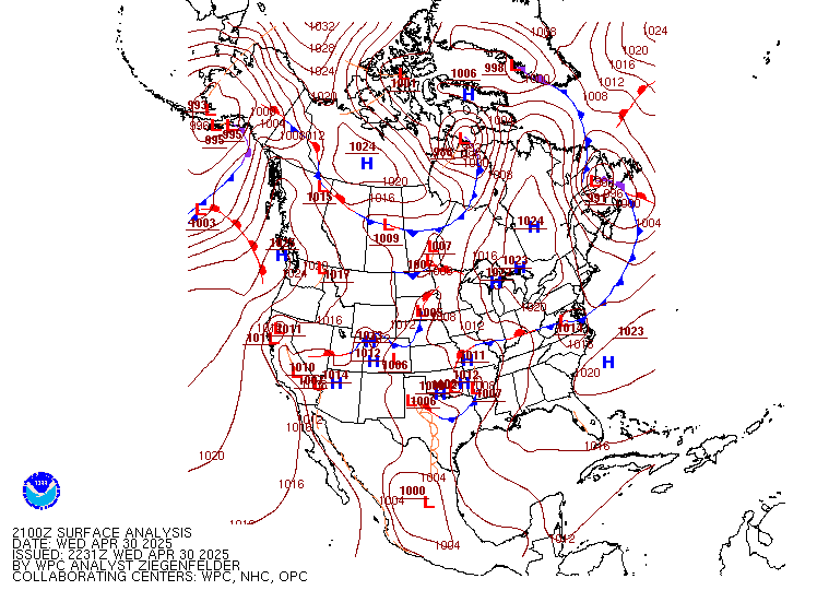
Looking at the satellite and radar composites, and the analysis of the WPC/ NHC 18Z surface plot, the Low pressure wave is centered very near Apalachicola.
0 likes
NEVER, EVER SAY NEVER in the tropics and weather in general, and most importantly, with life itself!!
________________________________________________________________________________________
Fay 2008 Beryl 2012 Debby 2012 Colin 2016 Hermine 2016 Julia 2016 Matthew 2016 Irma 2017 Dorian 2019
________________________________________________________________________________________
Fay 2008 Beryl 2012 Debby 2012 Colin 2016 Hermine 2016 Julia 2016 Matthew 2016 Irma 2017 Dorian 2019
-
NCSTORMMAN
Re:
northjaxpro wrote:Looking at the satellite and radar composites, and the analysis of the WPC/ NHC 18Z surface plot, the Low pressure wave is centered very near Apalachicola.
The spot to the southeast of Louisiana is really starting to fire up. Some of the most concentrated convection I have seen all week long.
0 likes
-
northjaxpro
- S2K Supporter
- Posts: 8900
- Joined: Mon Sep 27, 2010 11:21 am
- Location: Jacksonville, FL
Yeah, I have been observing that area south of the MS coast this afternoon. That area is in a better environment relating to the shear. Shear is much more lighter today from the MS River Delta region west to the TX coast, which I have already pointed out and the latest shear analysis shows us.
The Apalachicola Low Pressure wave looks to be dissolving as it moves inland. However, if convection can sustain on that area back a bit farther to the southwest, and with the shear relaxing in that direction, it is possible a Low pressure wave/area could form down south/southeast of the MS River Delta region. Just a possibility though.
The Apalachicola Low Pressure wave looks to be dissolving as it moves inland. However, if convection can sustain on that area back a bit farther to the southwest, and with the shear relaxing in that direction, it is possible a Low pressure wave/area could form down south/southeast of the MS River Delta region. Just a possibility though.
0 likes
NEVER, EVER SAY NEVER in the tropics and weather in general, and most importantly, with life itself!!
________________________________________________________________________________________
Fay 2008 Beryl 2012 Debby 2012 Colin 2016 Hermine 2016 Julia 2016 Matthew 2016 Irma 2017 Dorian 2019
________________________________________________________________________________________
Fay 2008 Beryl 2012 Debby 2012 Colin 2016 Hermine 2016 Julia 2016 Matthew 2016 Irma 2017 Dorian 2019
-
NCSTORMMAN
Re:
northjaxpro wrote:Yeah, I have been observing that area south of the MS coast this afternoon. That area is in a better environment relating to the shear. Shear is much more lighter today from the MS River Delta region west to the TX coast, which I have already pointed out and the latest shear analysis shows us.
The Apalachicola Low Pressure wave looks to be dissolving as it moves inland. However, if convection can sustain on that area back a bit farther to the southwest, and with the shear relaxing in that direction, it is possible a Low pressure wave/area could form down south/southeast of the MS River Delta region. Just a possibility though.
Surprised no one is talking about it but it must be because they doubt it could happen. I believe it is looking pretty TD like to me right now.
0 likes
-
northjaxpro
- S2K Supporter
- Posts: 8900
- Joined: Mon Sep 27, 2010 11:21 am
- Location: Jacksonville, FL
Re: Re:
NCSTORMMAN wrote:northjaxpro wrote:Yeah, I have been observing that area south of the MS coast this afternoon. That area is in a better environment relating to the shear. Shear is much more lighter today from the MS River Delta region west to the TX coast, which I have already pointed out and the latest shear analysis shows us.
The Apalachicola Low Pressure wave looks to be dissolving as it moves inland. However, if convection can sustain on that area back a bit farther to the southwest, and with the shear relaxing in that direction, it is possible a Low pressure wave/area could form down south/southeast of the MS River Delta region. Just a possibility though.
Surprised no one is talking about it but it must be because they doubt it could happen. I believe it is looking pretty TD like to me right now.
I would not state that much yet about a TD like situation. It is firing convection, and have to take a few minutes to check bouys out off the MS coast to see what is going on. But, if convection can sustain and with shear slackening off over towards that area, another Low pressure wave could possibly form. If, and only if another Low pressure wave develops anyway, it would drift similarly as to what the Apalachicola Low did today, a very slow north-northeastward motion. it is just a very weak steering flow across the Northern Gulf region.
Last edited by northjaxpro on Sat Aug 01, 2015 4:39 pm, edited 1 time in total.
0 likes
NEVER, EVER SAY NEVER in the tropics and weather in general, and most importantly, with life itself!!
________________________________________________________________________________________
Fay 2008 Beryl 2012 Debby 2012 Colin 2016 Hermine 2016 Julia 2016 Matthew 2016 Irma 2017 Dorian 2019
________________________________________________________________________________________
Fay 2008 Beryl 2012 Debby 2012 Colin 2016 Hermine 2016 Julia 2016 Matthew 2016 Irma 2017 Dorian 2019
-
NCSTORMMAN
Re: Re:
northjaxpro wrote:NCSTORMMAN wrote:northjaxpro wrote:Yeah, I have been observing that area south of the MS coast this afternoon. That area is in a better environment relating to the shear. Shear is much more lighter today from the MS River Delta region west to the TX coast, which I have already pointed out and the latest shear analysis shows us.
The Apalachicola Low Pressure wave looks to be dissolving as it moves inland. However, if convection can sustain on that area back a bit farther to the southwest, and with the shear relaxing in that direction, it is possible a Low pressure wave/area could form down south/southeast of the MS River Delta region. Just a possibility though.
Surprised no one is talking about it but it must be because they doubt it could happen. I believe it is looking pretty TD like to me right now.
I would not state that much yet about a TD. It is firing convection, and have to take a few minutes to check bouys out off the MS coast to see what is going on. But, if convection can sustain and with shear slackening off over towards that area, another Low pressure wave could possibly form. If, and only if another Low pressure wave develops anyway, it would drift similarly as to what the Apalachicola Low did today, a very slow north-northeastward motion. it is just a very weak steering flow across the Northern Gulf region.
I still see circulation to the south of Apalachicola. All storms are wrapping around a circulation there and that could be where a new low forms.
0 likes
-
northjaxpro
- S2K Supporter
- Posts: 8900
- Joined: Mon Sep 27, 2010 11:21 am
- Location: Jacksonville, FL
Remember, the Low pressure wave is very elongated and broad NCSTORMAN. The Low Pressure wave by plots and WPC/NHC surface analysis at 18Z (3 hours ago), and AFD from NWS Tallahassee WFO from this afternoon showed the wave had moved just inland, with the NWS TLH mets indicating that the wave was on top of the Tallahassee region.
The wave is meandering and causing extremely heavy rains across that region, already a foot of rain in parts of Dixie county in the Eastern Big Bend region.
The wave is meandering and causing extremely heavy rains across that region, already a foot of rain in parts of Dixie county in the Eastern Big Bend region.
Last edited by northjaxpro on Sat Aug 01, 2015 4:46 pm, edited 2 times in total.
0 likes
NEVER, EVER SAY NEVER in the tropics and weather in general, and most importantly, with life itself!!
________________________________________________________________________________________
Fay 2008 Beryl 2012 Debby 2012 Colin 2016 Hermine 2016 Julia 2016 Matthew 2016 Irma 2017 Dorian 2019
________________________________________________________________________________________
Fay 2008 Beryl 2012 Debby 2012 Colin 2016 Hermine 2016 Julia 2016 Matthew 2016 Irma 2017 Dorian 2019
-
NCSTORMMAN
Re:
northjaxpro wrote:Remember, the Low pressure wave is very elongated and broad NCSTORMAN. The Low Pressure wave by plots and surface analysis at 18Z (3 hours ago), and AFD from NWS Tallahassee WFO from this afternoon showed the wave had moved just inland, with the NWS TLH mets indicating that the wave was on top of the Tallahassee region.
The wave is meandering and causing extremely heavy rains across that region.
Well they are the experts and I am not so what they say goes.
0 likes
-
fwbbreeze

- S2K Supporter
- Posts: 897
- Joined: Sun Mar 21, 2004 10:09 pm
- Location: Fort Walton Beach, FL
Re: Weak low in NE Gulf of Mexico
It's got that feel here in the western panhandle this afternoon. Storms firing inland and moving rather quickly S/SW. I agree the axis is rather elongated....but shear appears to be improving a tad. Could get interesting.
0 likes
-
Frank P
- S2K Supporter
- Posts: 2779
- Joined: Fri Aug 29, 2003 10:52 am
- Location: Biloxi Beach, Ms
- Contact:
Re: Weak low in NE Gulf of Mexico
Bouys in that area of the GOM not showing much attm .. Pressures ~29.81 to 29.85, all are falling but usually do at this time... No really significant winds noted, average around 10 mph...
0 likes
-
northjaxpro
- S2K Supporter
- Posts: 8900
- Joined: Mon Sep 27, 2010 11:21 am
- Location: Jacksonville, FL
Re: Weak low in NE Gulf of Mexico
Frank P wrote:Bouys in that area of the GOM not showing much attm .. Pressures ~29.81 to 29.85, all are falling but usually do at this time... No really significant winds noted, average around 10 mph...
Yeah, thanks Frank. You beat me to that. The overall pressures you stated are actually for now uniform to just off the Mississippi coast. But, still worth monitoring in the short term if the convection down to the southeast of the MS River Delta region sustains itself. Remember, shear is letting up back that way.
0 likes
NEVER, EVER SAY NEVER in the tropics and weather in general, and most importantly, with life itself!!
________________________________________________________________________________________
Fay 2008 Beryl 2012 Debby 2012 Colin 2016 Hermine 2016 Julia 2016 Matthew 2016 Irma 2017 Dorian 2019
________________________________________________________________________________________
Fay 2008 Beryl 2012 Debby 2012 Colin 2016 Hermine 2016 Julia 2016 Matthew 2016 Irma 2017 Dorian 2019
-
Frank P
- S2K Supporter
- Posts: 2779
- Joined: Fri Aug 29, 2003 10:52 am
- Location: Biloxi Beach, Ms
- Contact:
Re: Weak low in NE Gulf of Mexico
northjaxpro wrote:Frank P wrote:Bouys in that area of the GOM not showing much attm .. Pressures ~29.81 to 29.85, all are falling but usually do at this time... No really significant winds noted, average around 10 mph...
Yeah, thanks Frank. You beat me to that. The overall pressures you stated are actually for now uniform to just off the Mississippi coast. But, still worth monitoring in the short term if the convection down to the southeast of the MS River Delta region sustains itself. Remember, shear is letting up back that way.
Shears continues to let up then things might get a little interesting northjaxpro, at least from the latest sat pixs the convection continues to build in the NGOM south of the MS/AL line!
0 likes

-
NCSTORMMAN
-
Frank P
- S2K Supporter
- Posts: 2779
- Joined: Fri Aug 29, 2003 10:52 am
- Location: Biloxi Beach, Ms
- Contact:
Re:
NCSTORMMAN wrote:I have a feeling I might of been right all along about something forming. This thing is wrapping convection and unlike a few of you I personally believe the area south of Panama City is the CoC or at least where it is wrapping convection into. Wish some pro mets would chime in.
Only feeling I have is from a few glasses of Pinot... Have absolutely no feeling that the GOM will develop anything significant as of now... But that is why we watch it closely at this time of year!
0 likes
-
northjaxpro
- S2K Supporter
- Posts: 8900
- Joined: Mon Sep 27, 2010 11:21 am
- Location: Jacksonville, FL
Exactly Frank. We already knew going into the season that we would have unfavorable conditions in the basin and it has played out that way for the most part. However, we still monitor for any subtle changes. Today, shear has reduced considerably west from about 87 degrees Longitude and points westward scross the Northern Gulf coastal region. We are now watching the area of convection firing south/southeast of the MS River Delta. Monitoring closely is what we should do anytime we have a stagnant trough across the GOM.
0 likes
NEVER, EVER SAY NEVER in the tropics and weather in general, and most importantly, with life itself!!
________________________________________________________________________________________
Fay 2008 Beryl 2012 Debby 2012 Colin 2016 Hermine 2016 Julia 2016 Matthew 2016 Irma 2017 Dorian 2019
________________________________________________________________________________________
Fay 2008 Beryl 2012 Debby 2012 Colin 2016 Hermine 2016 Julia 2016 Matthew 2016 Irma 2017 Dorian 2019

Re: Weak low in NE Gulf of Mexico
The upper level high is setting up over the gulf centered SSE of NOLA.
The previous high shear will now be an outflow channel for that area near the center of the dome.
Since the buoy data is showing a broad low surface pressure it would make sense that the area with the least shear would have the highest probability of system formation.
Maybe something for Monday.
Lowest surface pressure seems to be migrating southwest a little from Tyndall to buoy 42039.
http://www.ndbc.noaa.gov/show_plot.php? ... _label=CDT
May be the diurnal min at 8pm we'll see.
Last edited by Nimbus on Sat Aug 01, 2015 6:20 pm, edited 1 time in total.
0 likes
-
northjaxpro
- S2K Supporter
- Posts: 8900
- Joined: Mon Sep 27, 2010 11:21 am
- Location: Jacksonville, FL
Re: Weak low in NE Gulf of Mexico
Nimbus wrote:The upper level high is setting up over the gulf centered SSE of NOLA.
The previous high shear will now be an outflow channel for that area near the center of the dome.
Since the buoy data is showing a broad low surface pressure it would make sense that the area with the least shear would have the highest probability of system formation.
Maybe something for Monday.
Maybe Nimbus. We wait and see how the next 12-24 hours will fare .
0 likes
NEVER, EVER SAY NEVER in the tropics and weather in general, and most importantly, with life itself!!
________________________________________________________________________________________
Fay 2008 Beryl 2012 Debby 2012 Colin 2016 Hermine 2016 Julia 2016 Matthew 2016 Irma 2017 Dorian 2019
________________________________________________________________________________________
Fay 2008 Beryl 2012 Debby 2012 Colin 2016 Hermine 2016 Julia 2016 Matthew 2016 Irma 2017 Dorian 2019

Re: Weak low in NE Gulf of Mexico
The area I am watching is south of Tallahassee very close to the coast, this is where the lowest surface pressures are found, models show a narrow upper level ridge building in through the next 24-48 hrs before upper level conditions go downhill again. So if the broad low pressure can stay just offshore we may see something develop here but surface low pressure circulation is still very broad.
0 likes
-
northjaxpro
- S2K Supporter
- Posts: 8900
- Joined: Mon Sep 27, 2010 11:21 am
- Location: Jacksonville, FL
Yeah NDG, that is the Low Pressure elongated wave which moved inland earlier this afternoon across the Eastern Big Bend region to near Tallahassee. But, that wave is meandering about. Good convective tops are showing in that region at this hour.
0 likes
NEVER, EVER SAY NEVER in the tropics and weather in general, and most importantly, with life itself!!
________________________________________________________________________________________
Fay 2008 Beryl 2012 Debby 2012 Colin 2016 Hermine 2016 Julia 2016 Matthew 2016 Irma 2017 Dorian 2019
________________________________________________________________________________________
Fay 2008 Beryl 2012 Debby 2012 Colin 2016 Hermine 2016 Julia 2016 Matthew 2016 Irma 2017 Dorian 2019
Who is online
Users browsing this forum: Google Adsense [Bot] and 66 guests